Rare old maps of the whole world. Secret knowledge, ancient worlds, ancient maps - discover the ancient world
![[Untitled Map of the Northern Hemisphere]](/map/small/18651.jpg)
Rare early map of the Northern Hemisphere, one of the earliest maps engraved by Walch, who would go on to have a successful career of more than 30 years as a mapmaker in Augsburg. Nice post-Cook detail, a very early use of information from Cook's...
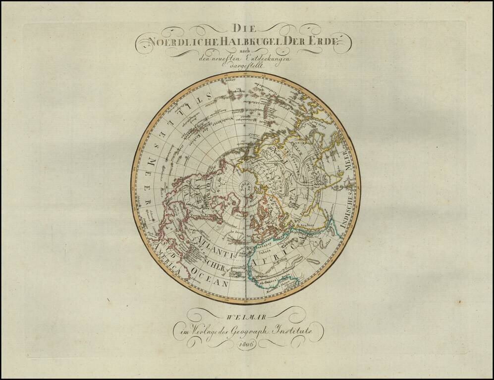
Rare map of the Northern Hemisphere, published in 1806. The map shows the incomplete understanding of the Northwest Passage, as well as still speculative details on the northwest coast of America and the interior parts of North America.
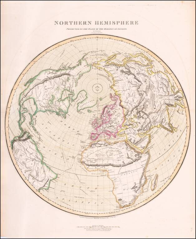
Interesting and highly detailed map of the Northern Hemisphere, published by John Thomson. Includes an unusual orientation such that all of Asia, Europe, Africa and North America are shown. Includes the tracks from Cook's voyages, along with dates...
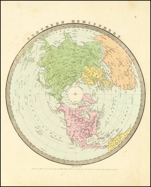
Interesting map of the Northern Hemisphere by David Burr, one of 4 hemispheric map projections in his New Universal Atlas. The map provides a nice depiction of the known extent of the North Polar regions and the coastlines of Northwestern America and...
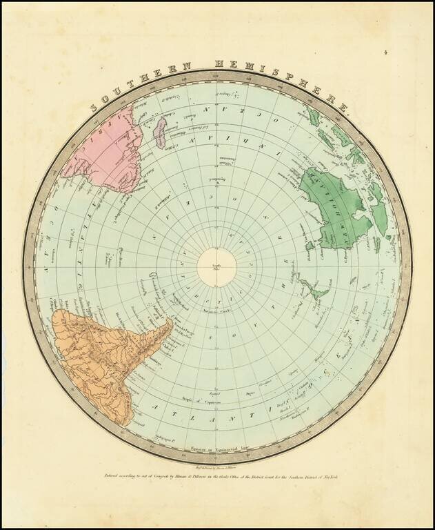
Interesting map of the Southern Hemisphere by David Burr, one of 4 hemispheric map projections in his New Universal Atlas. The map provides a nice depiction of the known extent of the South Polar regions.
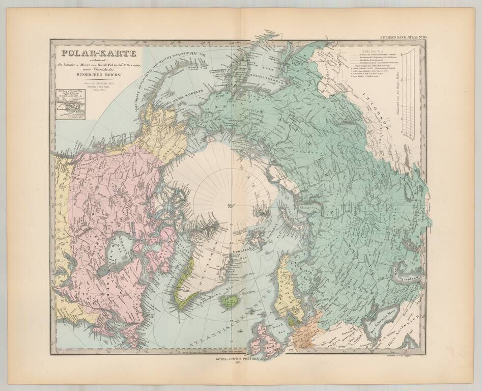
Striking map of the polar region, extending south to 50 degrees. Nice detail in Alaska and Canada, including forts, several routes and other interesting details.
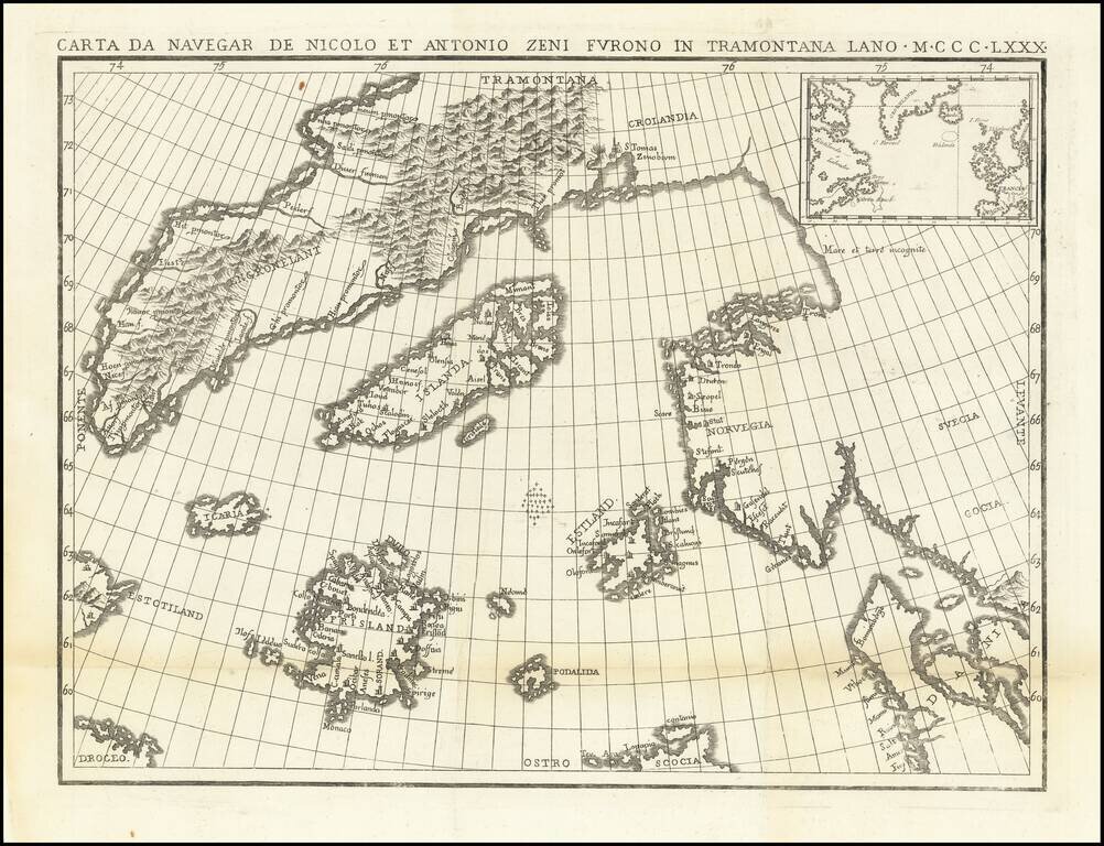
The Zeno Brothers Discoveries in the North Atlantic in the 14th Century Fine dark impression of this fine large format example of Nicolo Zeno's map of the North Atlantic, based upon the legend of a 14th Century Venetian family and their reported...
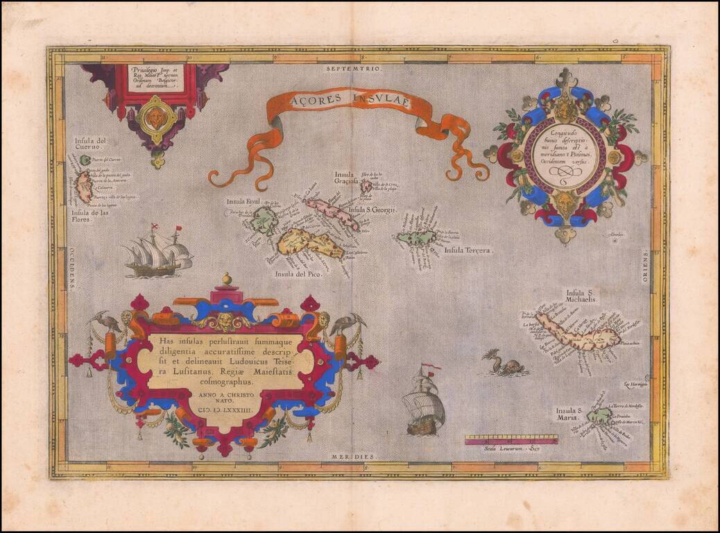
Old color example of Ortelius' map of the Azores, one of the most important destinations of explorers and early commercial mariners in the 16th Century. The size and detail of the map reflects the strategic importance of the Azores during the 16th...

Fine old color example of Ortelius' map of the Azores, one of the most important destinations of explorers and early commercial mariners in the 16th Century. The size and detail of the map reflects the strategic importance of the Azores during the 16th...

Ortelius' Map of the North Atlantic Old color example of Abraham Ortelius's important early map of the North Atlantic, extending from Scandinavia and the Polar regions in the East, to the mythical Islands of the North Atlantic, Greenland, Iceland and...
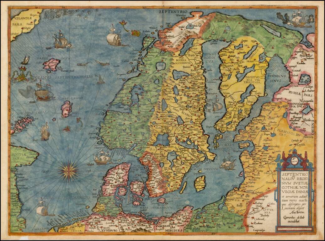
Colored example of De Jode's map of Scandinavia, the Baltic and Gulf of Finland, extending from Iceland and the Coast of Scotland to Novograd, St. Petersburg and the Norwegian Sea. The map is richly engraved by Joannes and Lucas van Deutecum's,...
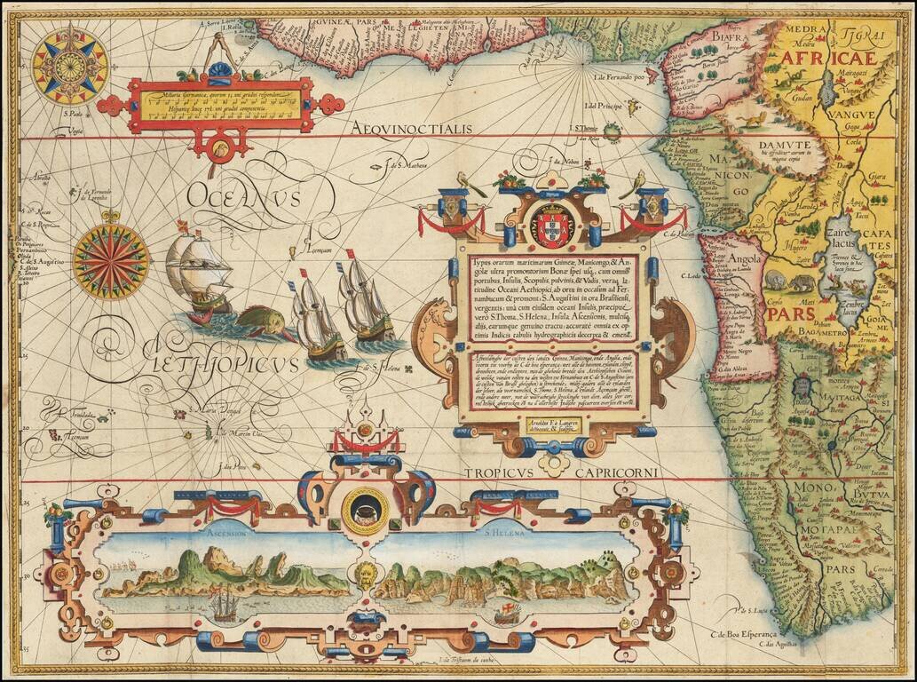
Fine Sixteenth-Century Decorative Map of South and West Africa from Linschoten's Influential Itinerario Striking map of South Africa, West Africa and contiguous parts of the Atlantic. This is one of the most richly ornamented maps of the era,...
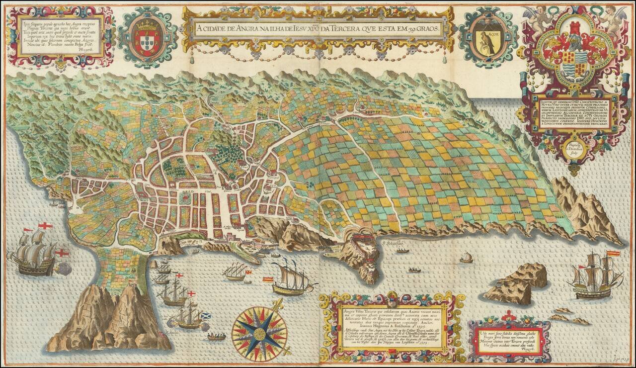
Spectacular birds-eye view of the island of Terceira and the town of Angra. Engraved by Baptista van Deutecum in Amsterdam, for LInschoten's Itinerario. Linschoten's view of Terceira in the Azores is one of the most decorative and recognizable...
![[Ascension Island] The True Description of the Island of Ascention lyeing under 8 degrees on ye South syde of ye Equinoctiall lyne.](/map/small/69468.jpg)
Antique engraved view of the Island of Ascension (St. Helena), which appeared in the rare English edition of Linschoten's Itinerario, Iohn Huighen van Linschoten. His discours of voyages . . . , published in London in 1598, and engraved by Englishman...
![[Angra - Madera - Porto Santo - Sao Miguel] Pascaarte vande Eijlanden van Madera en Port Sancto, vertoonende degelegentheijt vande Reede aldaer en hoese van malcanderen zijn gheleghen . . .](/map/small/62128.jpg)
Early Sailing Chart of the Madeira, Angra and Sao Miguel. Rare sea chart showing the islands of Madeira and Porto Santo, with smaller maps showing Angra and a portion of Sao Miguel. The chart appeared in J Blaeu's Het Licht der Zee-vaert , first...

Henry Hudson's Final Sea Chart, One of the First Maps to Show Hudson Bay This remarkable chart illustrates the track of the fourth and final voyage of Henry Hudson in his hunt for a Northwest Passage. It was a landmark map in the exploration of the...