
![[Manuscript Civil War Map signed by G.K. Warren] Map of Field Occupation of Army of the Potomac. Prepared by order of Gen. Hooker from reconnaisances made under Capt. R.S. Williamson, Lt. N. Bowen, Gen. D.P. Woodbury and others. Sent from Top'l Eng'rs o](/map/small/42063.jpg)
Hand Drawn Field Map of the Theater of War in Virginia Signed By One of America's Most Important Government Surveyors For The Explorations of the West The second known example of Governor Kemble Warren's magnificent large-scale manuscript map of the...
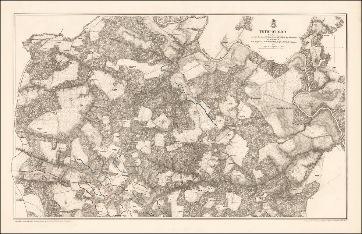
Highly detailed map of the area around Totopotomoy, Virginia, highlighting the battles fought in the area during the Civil War. The Battle of Totopotomoy Creek, also called the Battle of Bethesda Church, Crumps Creek, Shady Grove Road, and...
![[Four Untitled Globe Gores of North America]](/map/small/69801.jpg)
John Smith's Lost First Map of Virginia. An exceptional set of four globe gores depicting North America, prepared by Jodocus Hondius II and Johannes Janssonius, and engraved by Abraham Goos, for their 17.5-inch (44-cm.) terrestrial globe published in...
![[Governor of Virginia] The Right Honble William Anne, Keppel, Earl of Albermarle, Viscount Bury, Baron of Ashford, Groom of the Stole, Governour & Captn General of Virginia, Colonel of the Coldstream Regiment of Fort, Lt. General of His Majesty's Forces,](/map/small/60432.jpg)
William Anne, Governor of Virginia Rare mezzotint portrait of William Anne Keppel, Second Earl of Albermarle and Governor of Virginia. Lieutenant-General Willem Anne van Keppel, 2nd Earl of Albemarle KG KB PC (1702 – 1754) was a British diplomat...
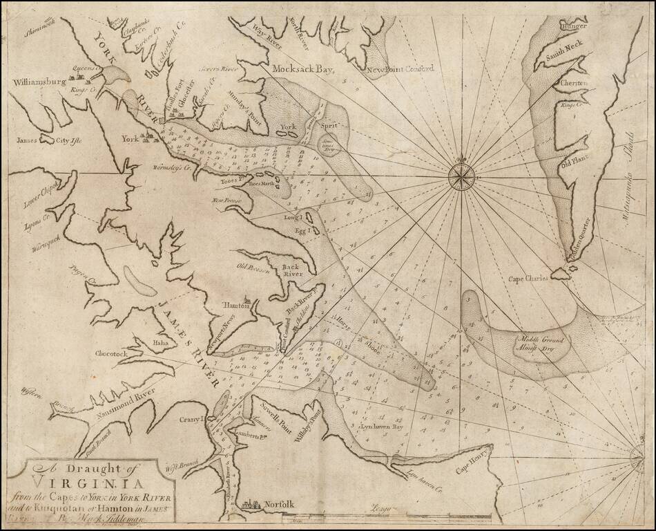
Rare Dublin Edition! Rare Dublin edition of Mark Tidemann's sea char of the region bounded by the York River , Williamsburg, James City Isle, Nansimond River, Elizabeth River, Norfolk, Cape Henry, Cape Charles, and the southern portion of Delaware,...
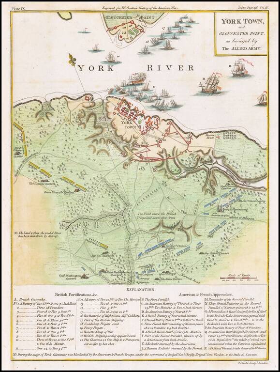
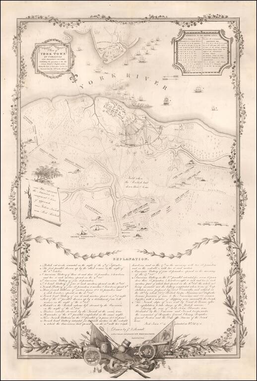
Marvelous detailed map of the Battle at York Town. Includes dozens of ships at anchor, extensive battle notes and troop movements with an explanatory key, the positions of the various armies, General Washington's Quarters, Rochambeaus Quarter's,...
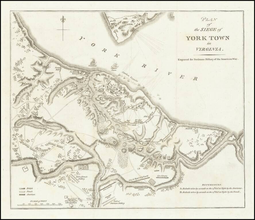
Important battle plan of the Siege of Yorktown This is the second appearance of this plan of Yorktown, which first appeared in Banastre Tarleton's A History of the Campaigns of 1780 & 1781 .... This is the second issue of the map, re-engraved for...
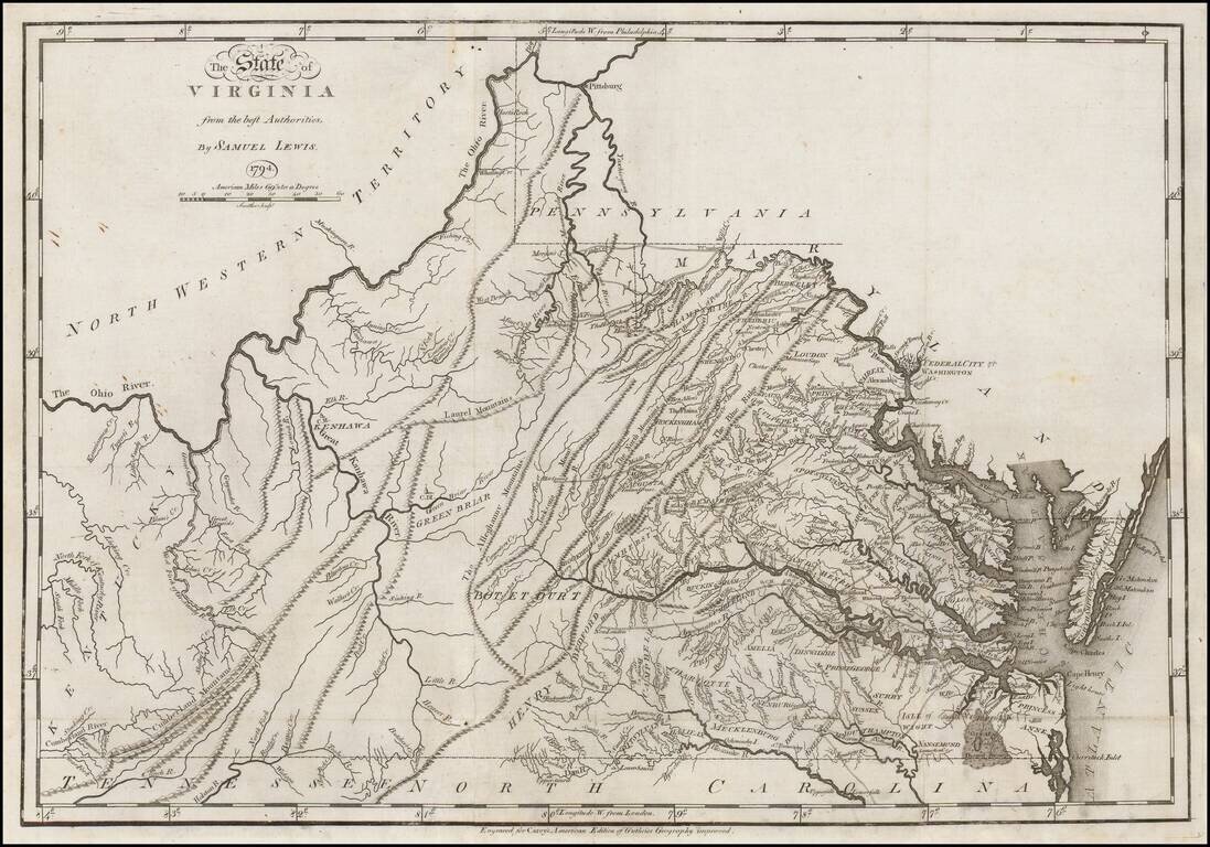
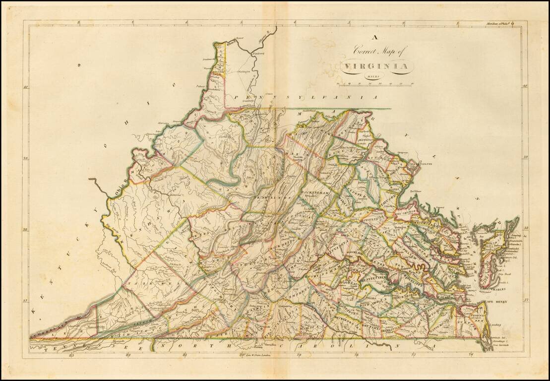
First edition of Carey's map of Virginia, one of the earliest obtainable maps of Virginia published in the U.S. Wheat & Brun note: This is a topographical map showing much detail. Many towns and court houses are indicated; county names are given...
Fine early map of Virginia, published by Jedidiah Morse for his New American Universal Geography, first published in 1796. The map focuses on the topographical features of Virginia, along with naming its major towns. One of the earliest maps of...
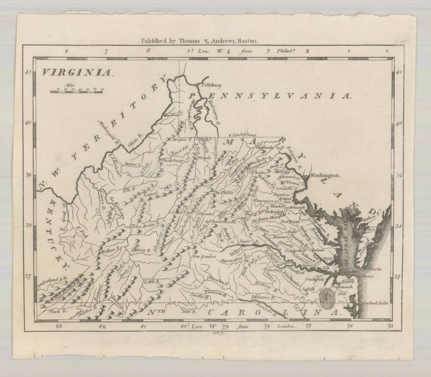
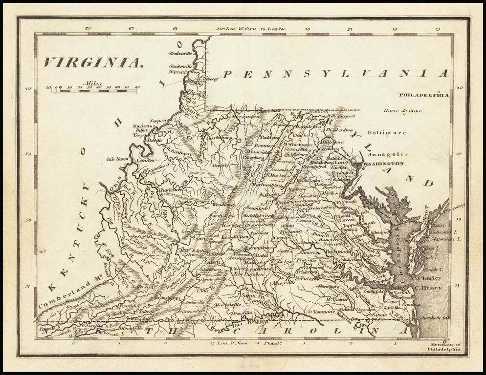
Early engraved map of Virginia, published in Philadelphia in 1804. The map shows towns, early roads and distances, early counties, mountains, rivers and other details.
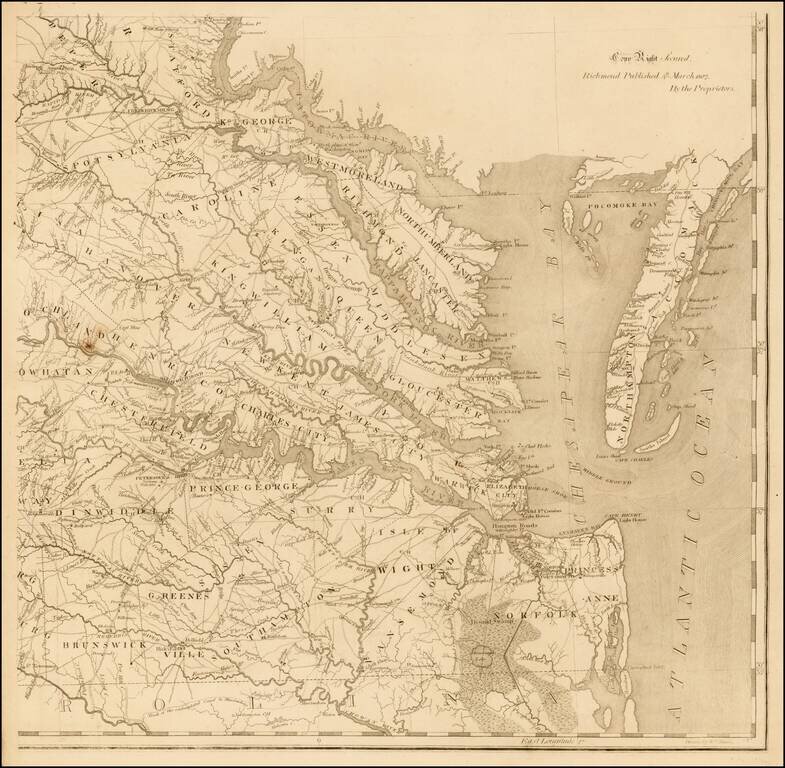
The Tidewater sheet of Bishop James Madison's A Map of Virginia Formed from Actual Surveys, and the Latest as well as the most accurate observations (1807), the first accurate general map of the Old Dominion State, and one of the most important and...
Nice example of the 1814 edition of Carey's map of Virginia, one of the best large format maps of the state to appear in a Commercial Atlas. The map is attractively hand colored by counties and shows, towns, roads, mountains, rivers, lakes, islands,...
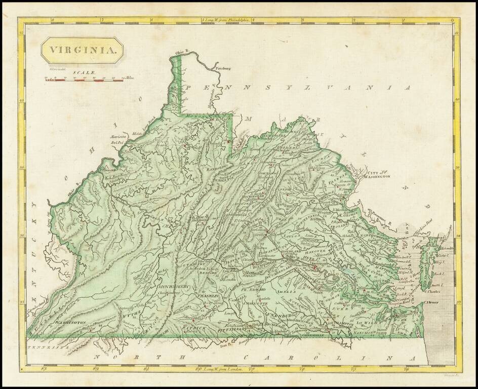
Nice example of Carey's map of Virginia. A highly detailed map, which includes towns, roads, rivers, mountains, and many other details.
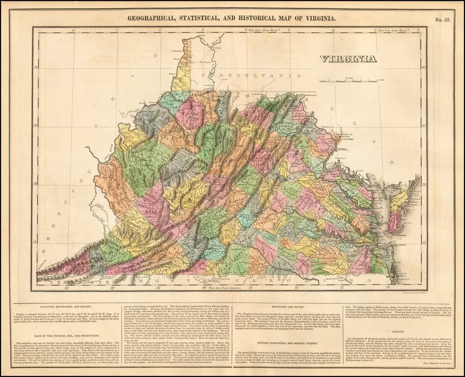
Striking example of this finely executed map of Virginia, from the first edition of Carey & Lea's Atlas. The map includes contemporary details concerning the topography, indigenous lands, rivers, climate, towns, manufacturing, commerce, and other...
Revolutionary War Battle Plan Published to Commemorate the Marquis De Lafayette's Return To America in 1825 Rare plan of the siege of Yorktown, issued on the occasion of Lafayette's triumphal 1825 visit to America. Drawn by John Francis Renault, a...
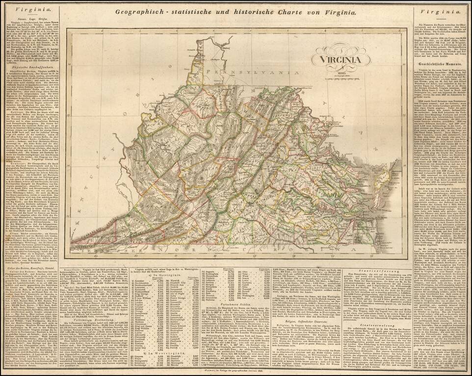
Rare German map of Virginia, mimicking the style popularized by Carey & Lea. The map shows early towns, roads, rivers, lakes, and other geographical features. The early road detail is noteworthy. Many court houses and post offices also shown....