
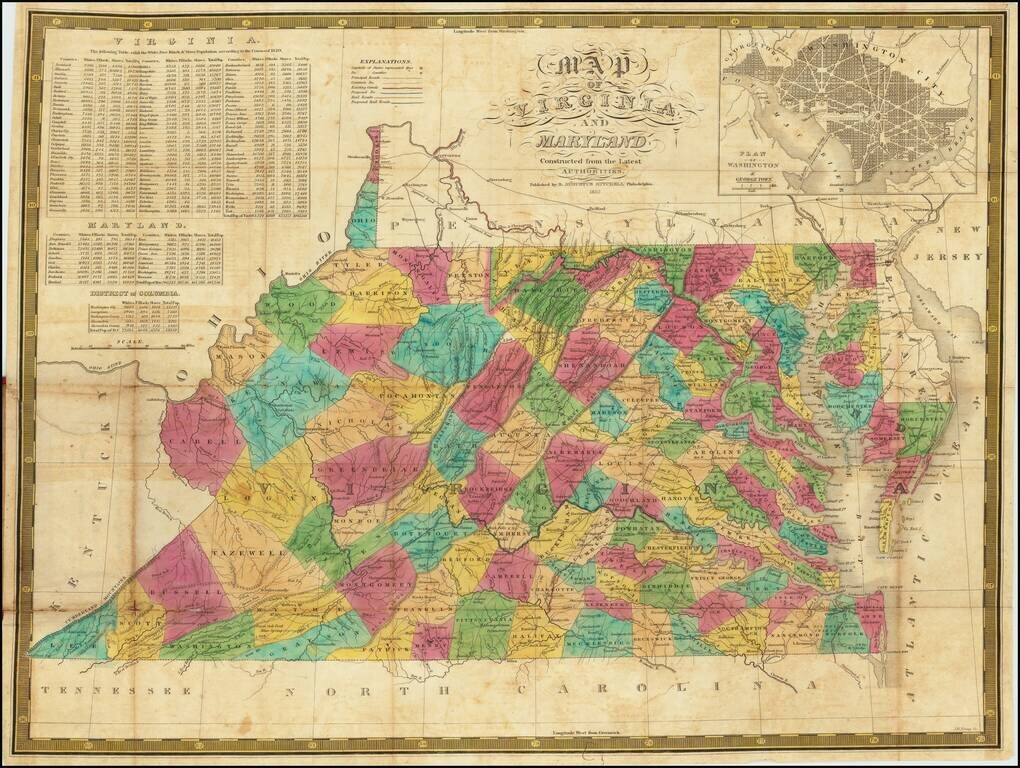
An Early American Map of Virginia & Maryland - Includes White, Free Black & Slave Population Table Second edition of Samuel Augustus Mitchell's separately published map of Virginia and Maryland (with a large inset of Washington DC). The map...
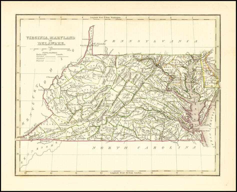
Scarce full original color map of Virginia, Maryland and Delaware from Bradford's Comprehensive Atlas. Shows counties, towns, rivers, and other details. Bradford's Comprehensive Atlas was one of the most successful commercial atlases of the 1830s, at...
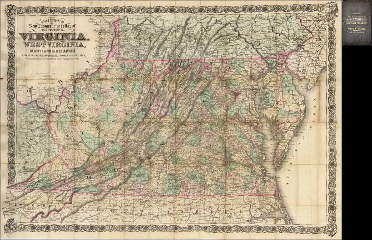
Fine large scale map of Virginia, West Virginia, Maryland and Delaware, published by Colton. This is the second edition of a map originally published in 1866 to supply a detailed representation of the area of the civil war. The geographical data was...

Fine large map illustrating the route of the Richmond & Louisville Railroad. Exceptionally detailed Railroad map of portions of Virginia, West Virginia, Kentucky and Tennessee, on a scale of 12 miles per inch. Timber and coal regions are noted,...
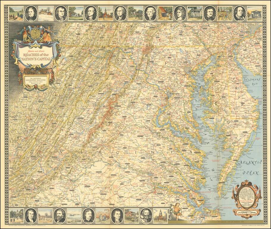
Entertaining map of the the Chesapeake Region, topped with portraits of 8 of the founding fathers and vignettes of important places in American history.
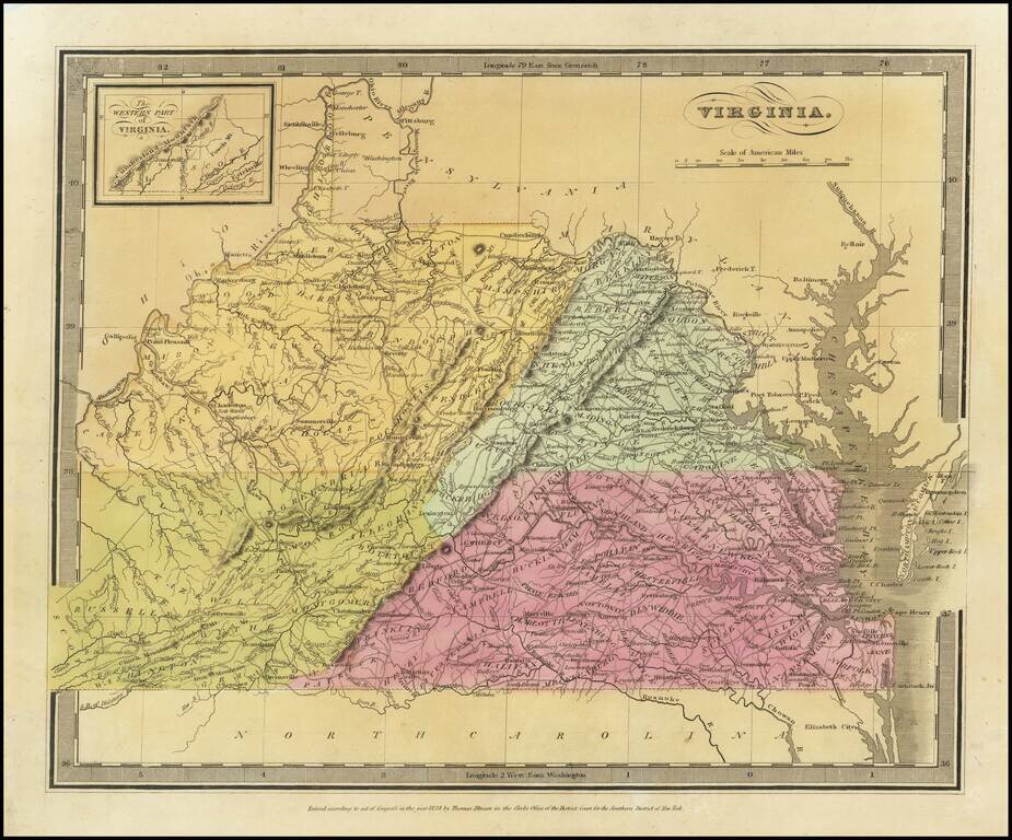
Striking full color map of Virginia, which first appeared in David Burr's Universal Atlas, in 1836. Burr is widely regarded as one of the most important names in American Cartographic history. Burr's Atlas was perhaps the most elegant American...
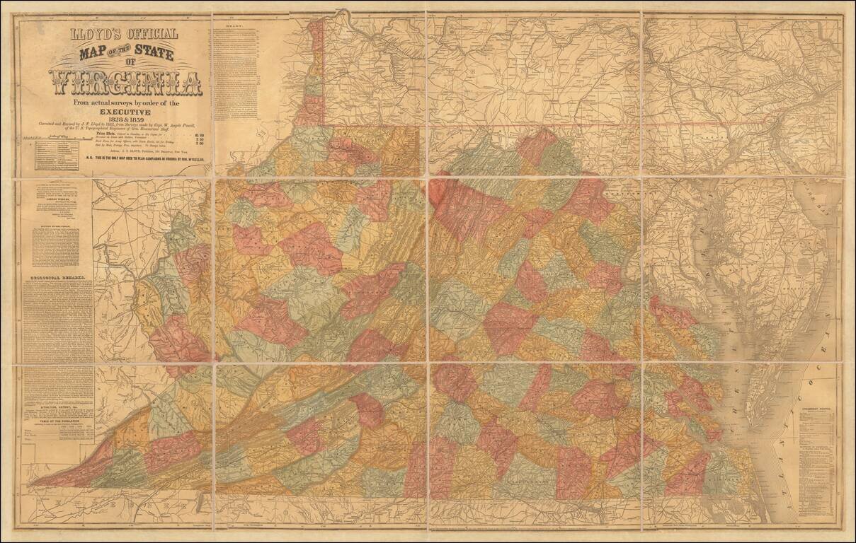
Important Large Map of Virginia With A Vitriolic Testimonial Added Nice example of the 1862 edition of JT Lloyd's large map of Virginia, the most widely distributed and influential map of Virginia during the Civil War period. Lloyd's map of Virginia...
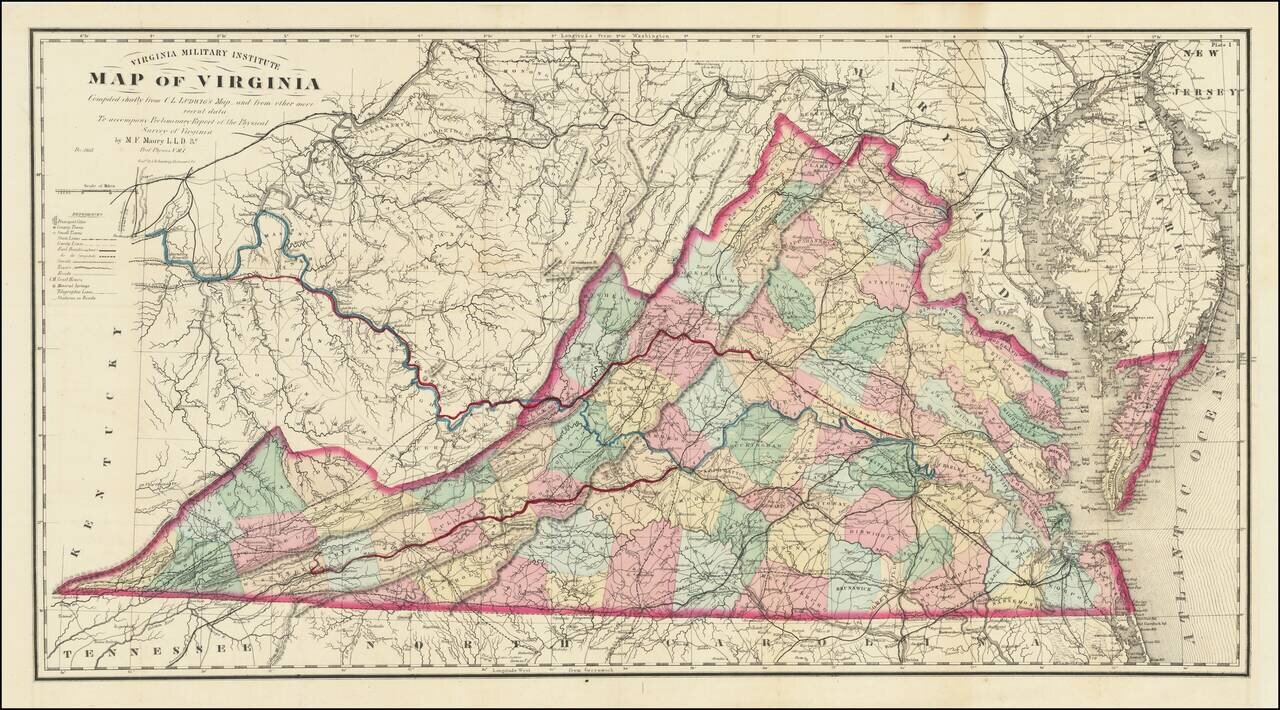
A Mathew Fontaine Maury - VMI - Rarity Nice example of the extremely rare third edition of the so-called Bucholtz-Ludwig map of Virginia. The Bucholtz-Ludwig map was originally based upon work done by Ludwig von Bucholtz, in connection with his...
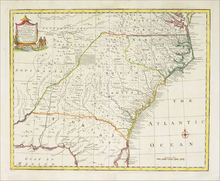
Striking example of Bowen's detailed map of the Carolinas, Georgia and most of Florida, extending west to the Country of the Cherokees and French Louisiana. The map is highly detailed and show many towns, forts, Indian Tribes, mountains, rivers,...
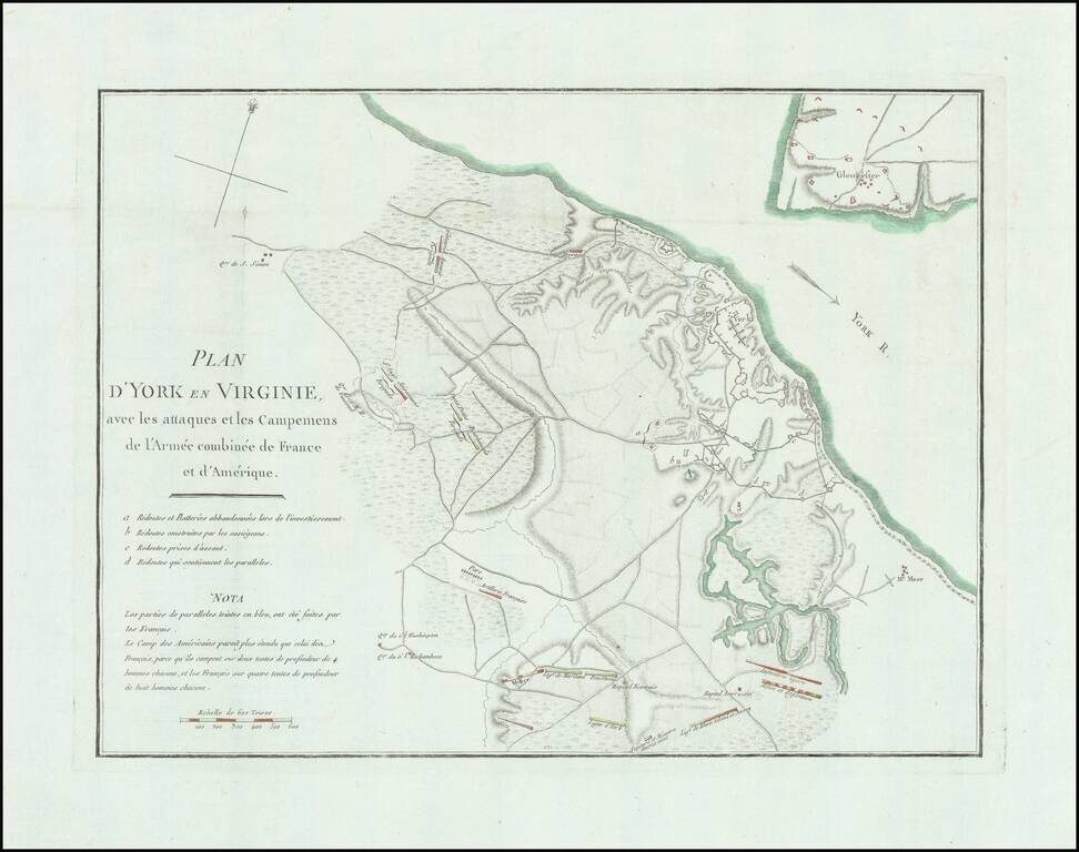
Detailed battle plan of the Battle of Yorktown, the final battle of the American Revolution. The map provides a detailed look at the battle of Yorktown, based upon French sources. The positions of the American, French and English forces and artillery...
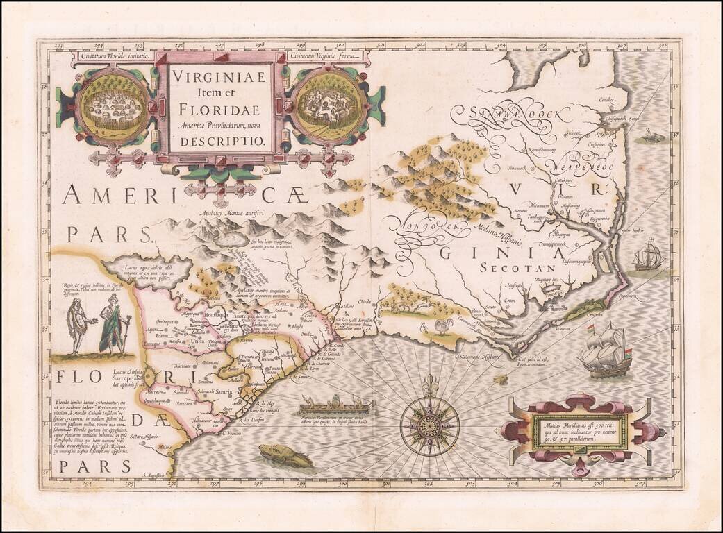
Early Seventeenth Century Map of Carolina and Virginia Fine old color example of Jodocus Hondius's important map of Virginia and the Carolinas, from the Mercator-Hondius A tlas Sive Cosmographie . . . Hondius utilized John White's map of Virginia and...
Nice example of Jansson's map of the Southeast. Jansson's map of the Carolinas and Blaeu's map of the Carolinas are virtually indistinguishable cartographically, although there are a number of minor differences in the embellishments. Both maps are on...
![[Carolinas, Georgia, etc] Virginiae Partis australis, et Floridae partis orientalis, interjacentiumqus regionum Nova Descriptio](/map/small/51779.jpg)
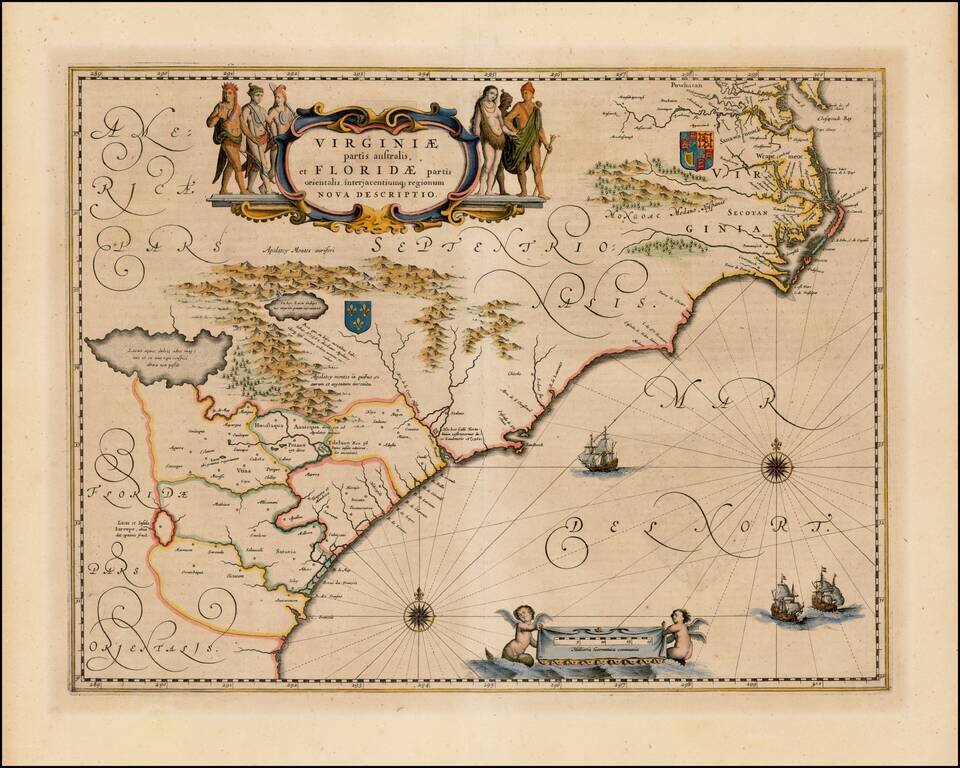
The Second Earliest Dutch Map of the Carolinas, Southern Virginia & Georgia. Fine old color example of Blaeu's map of the Southeast. This map is based on the 1606 Mercator-Hondius map, but with significant improvements. The map covers an area...
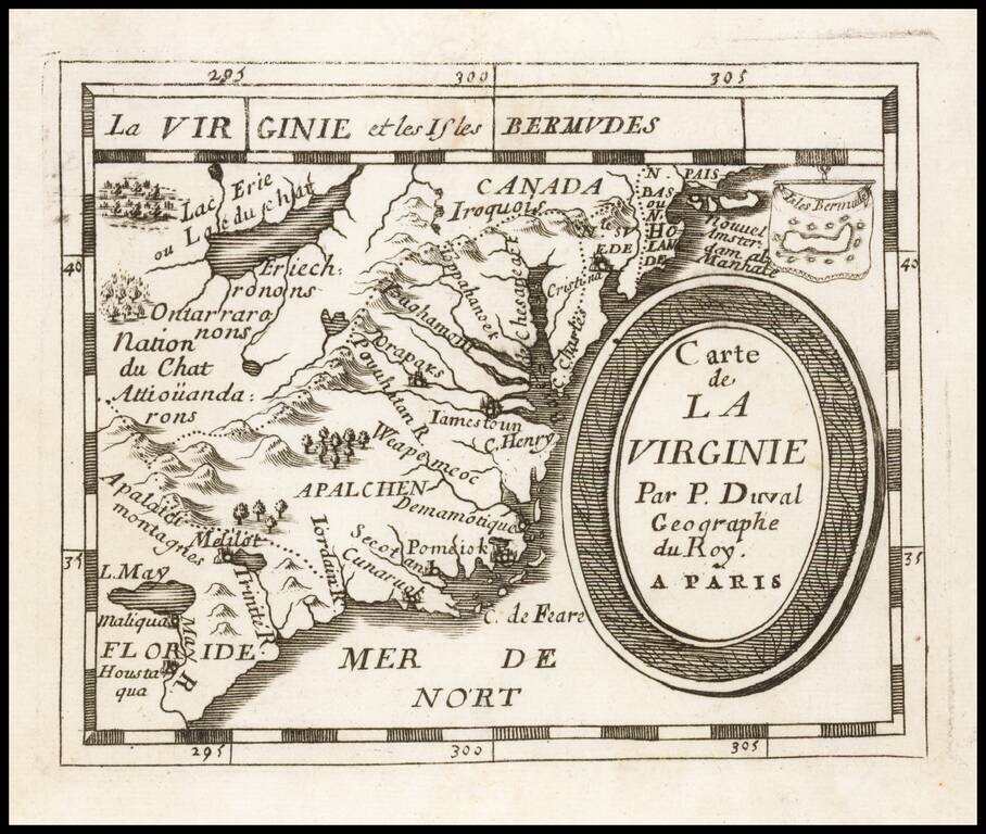
Early regional map from Duval's Le Monde Terrestre, first published in 1659, although no copy located pre-dates 1660. Includes an early depiction of the Chesapeake region, the mythical Lake May above Floride, Jamestown, Cape Henry, Secot, Pomeiok, an...

Nice example of this scarce late 17th Century map of the Southeast. Valk & Schenk's map is a rare re-issue and reworking of Jan Jansson's map of the region. Jansson's map of the Carolinas and Blaeu's map of the Carolinas are virtually...
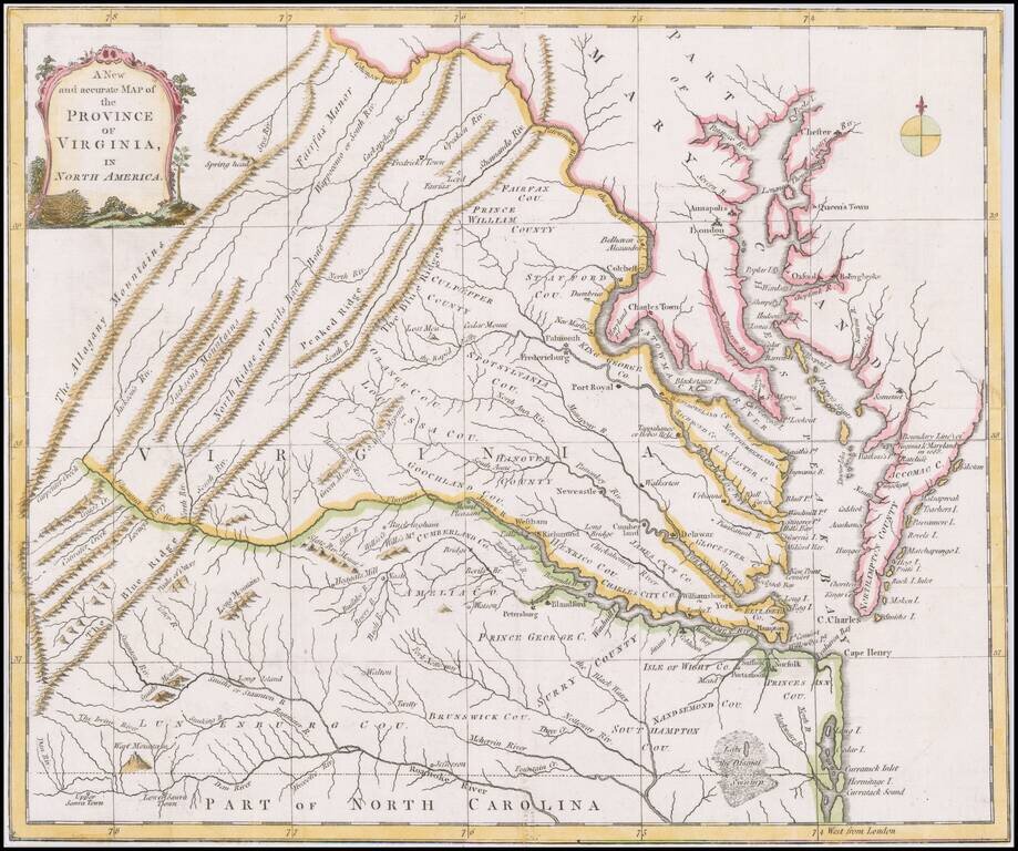
Scarce map of Virginia based largely on the Fry Jefferson map, as revised in 1775. The map is one of the first large format maps of Virginia to have appeared in a British serial publication ( Universal Magazine). It provides an excellent depiction of...