
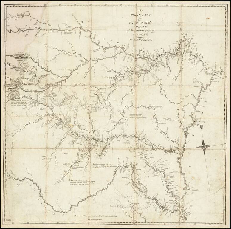
A Foundational American Map An exceptional Trans-Mississippi West map, showing the first portion of Zebulon Pike's exploration of the American Southwest. The map shows Pike's route through the region from the west of the Mississippi, from the...
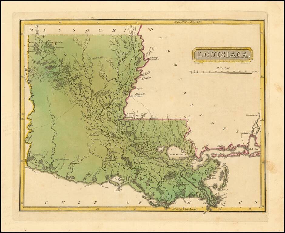
Louisiana on the Eve of the Battle of New Orleans A fine example of Mathew Carey's map of Louisiana, one of the earliest large format maps of the state to appear in a commercial atlas. Includes roads, towns, rivers, lakes, and a host of other...
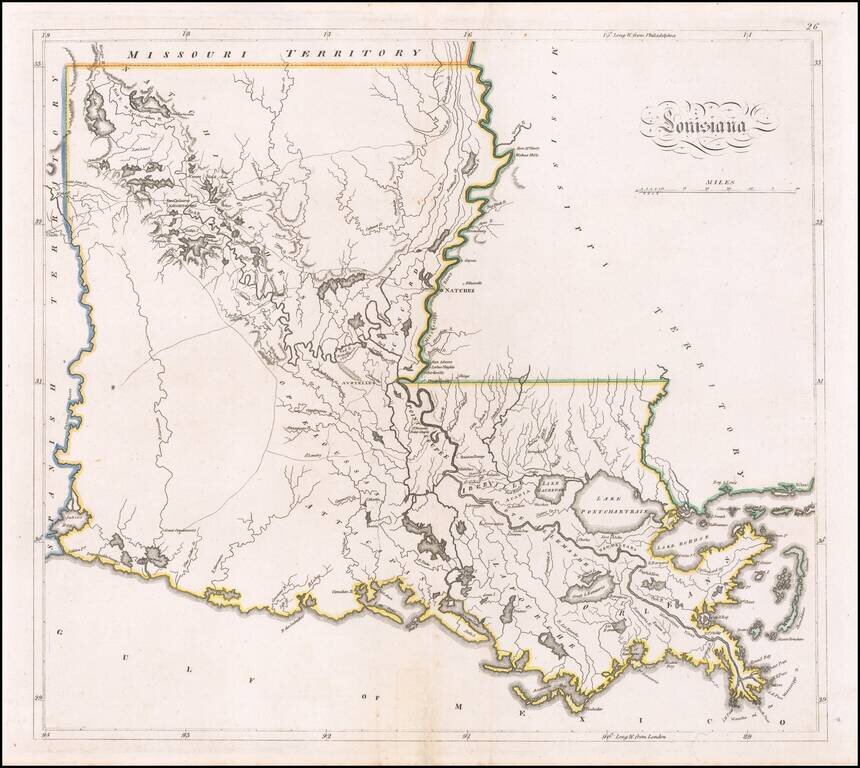
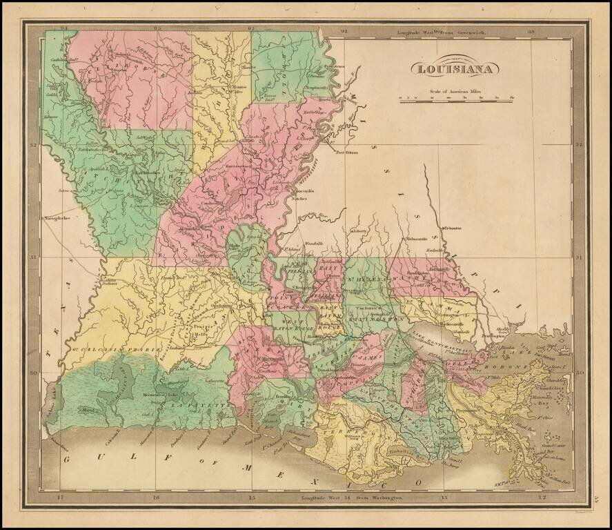
One of the earliest obtainable maps of the State of Louisiana A rare early map of Louisiana, published by Fielding Lucas Jr. in Baltimore, from his New & Elegant General Atlas of the United States . . . Includes a number of early roads, towns,...
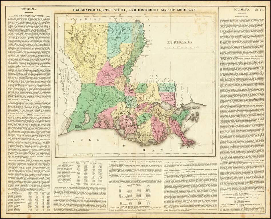
Fine early map of Louisiana, from Carey & Lea's Geographical, Statistical and Historical Atlas. Many parishes still not formed. Size includes text below the map, which includes wonderful contemporary details concerning the topography, indigenous...
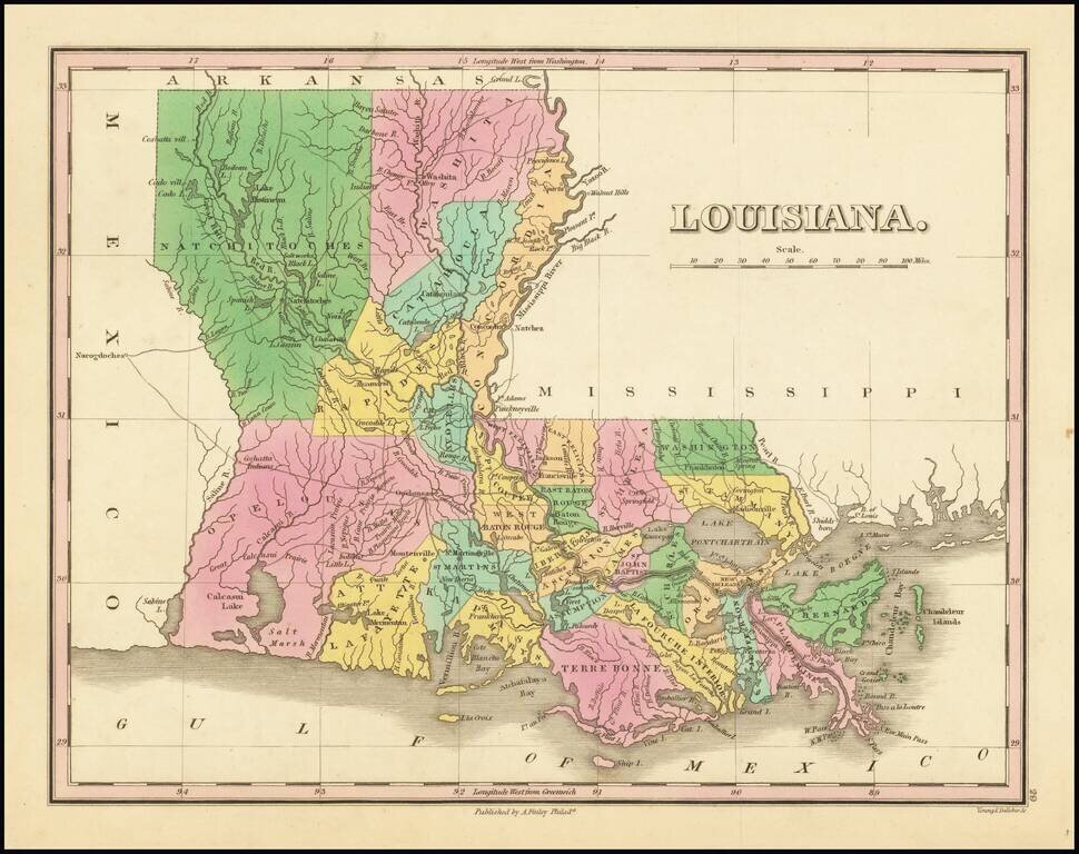
A striking example of Finley's map of Louisiana, colored by parish and showing towns, roads, rivers, and other geographical features. The map is attractively colored in bright colors. Some detail is shown in adjoining states, especially along the...
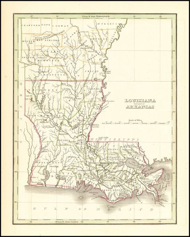
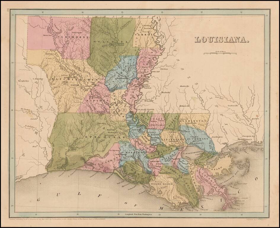
Rare full original color example of this map of Louisiana and the southeastern part of Arkansas, from an early edition of Bradford's first atlas. Early county configurations in Arkansas and parish configurations in Louisiana.
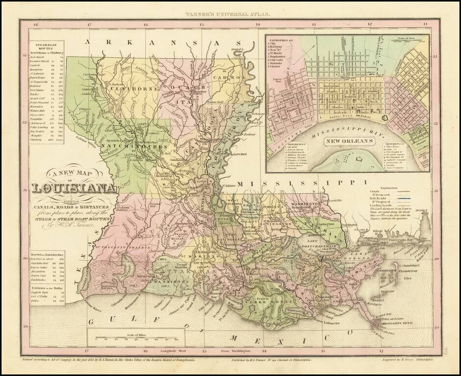
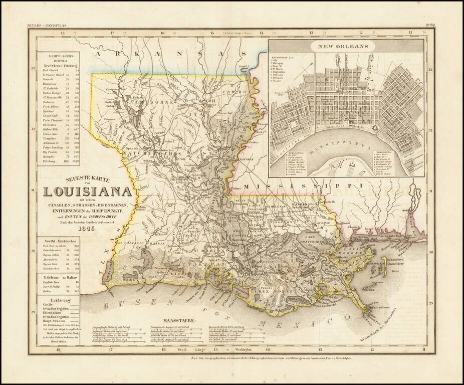
Gorgeous example of Tanner's map of Louisiana, with a large inset map of New Orleans. The map is hand colored by county and shows towns, rivers, canals, roads, railroads etc. A key lists steamship routes and distances. Tanner's maps are now quite...
Striking full color example of David Burr's scarce map of Louisiana. The Parish system is still quite primitive, especially in the north and west, where 7 parishes dominate the region. The early roads are shown, although few traverse the state from...
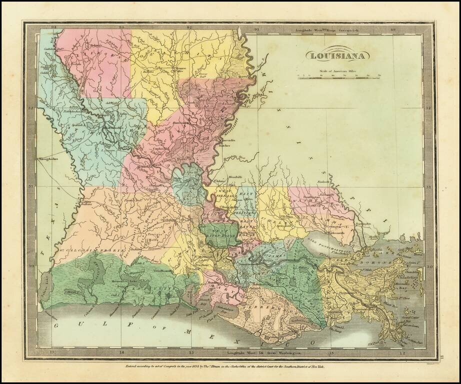
Bradford's large map of Louisiana. The map is hand colored by Parishes, and shows towns, forts, lakes, rivers, and some of the very earliest railroad lines in the South. Many of the early western and northern parishes have not yet been formed, and...
Striking full color example of Greenleaf's map of Louisiana, which appeared in his Universal Atlas, first issued in 1842. The Parish system is still quite primitive, especially in the North and West, where 7 parishes dominate the region. The early...
An elegantly engraved and highly detailed map of Louisiana, based upon Tanner's work in the early 1840s. Shows counties, towns, roads, canals, lakes, etc. Detailed inset town plan of New Orleans. While often referred to as the German Mitchell, this...
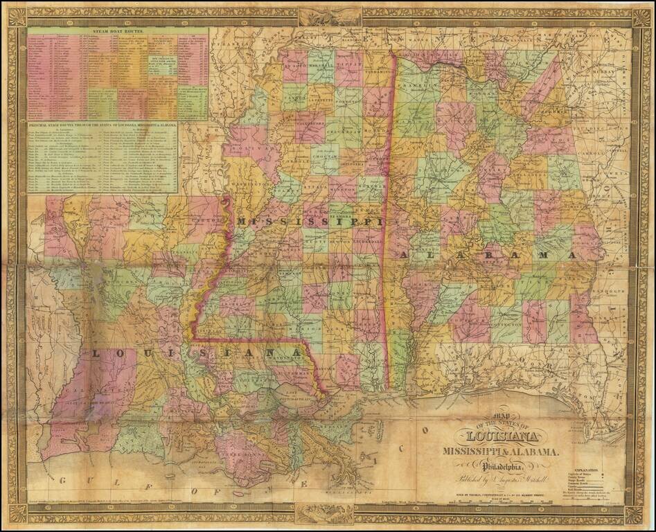
Late, updated edition of Finley's American Atlas map of three states, first issued in 1825. This edition was published by Samuel Augustus Mitchell after he took over the plates. Thomas, Cowperthwait & Co. are given as the mapsellers. Perhaps the...
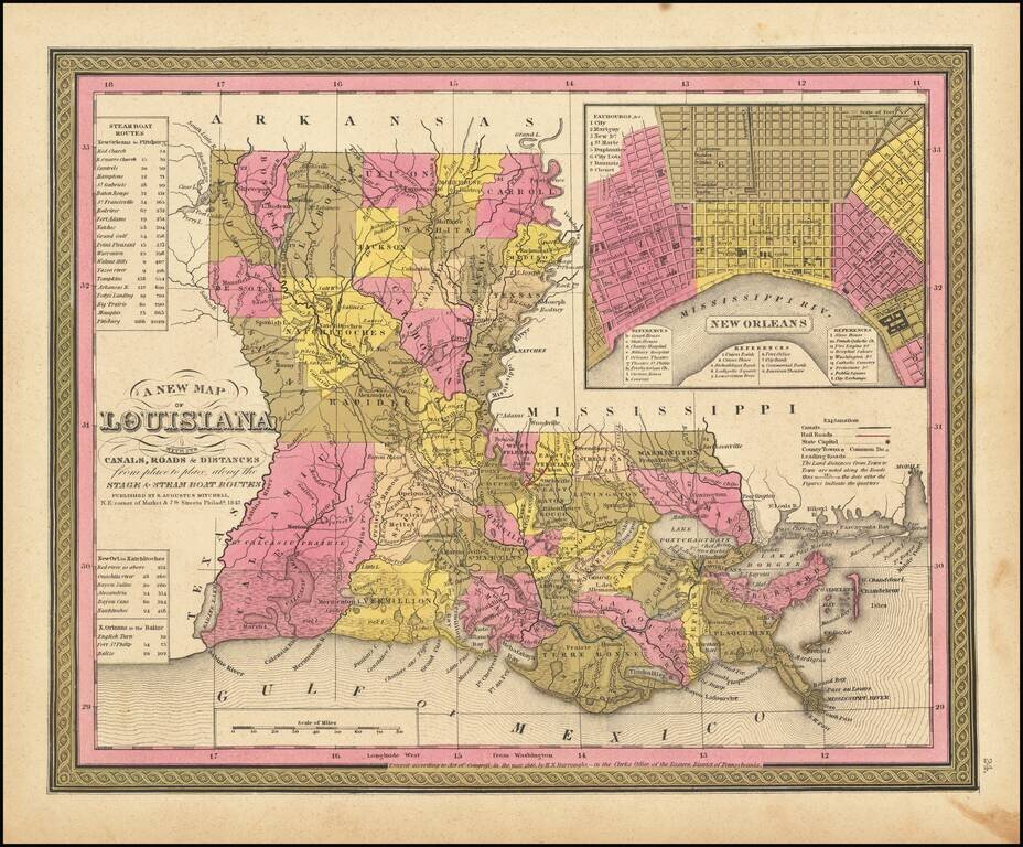
Detailed and interesting map of Louisiana, hand colored by parish, and showing towns, rivers, bays, lakes, railroads, swamps, etc. Includes a Table of Steam Boat routes and distances. Large inset map of New Orleans, colored by wards. An early map of...
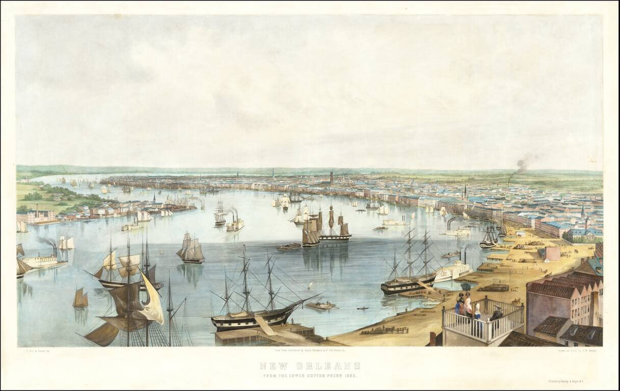
Stunning large view of New Orleans and the Mississippi River, based upon a drawing by Jonathan W. Hill. An exceptional large view of New Orleans, looking across the River from the Lower Cotton Press towards the French Quarter, with commerce and...
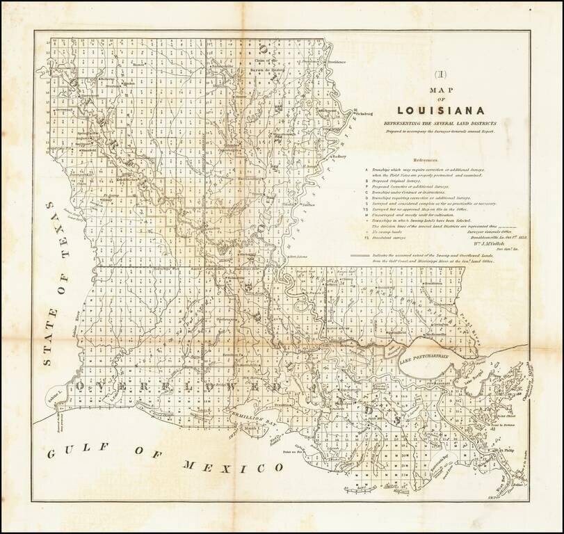
Early General Land Office Survey of Louisiana, prepared by the General Land Office. Includes a list of surveys and other sources, including a category (FS) for Fraudulent Surveys.
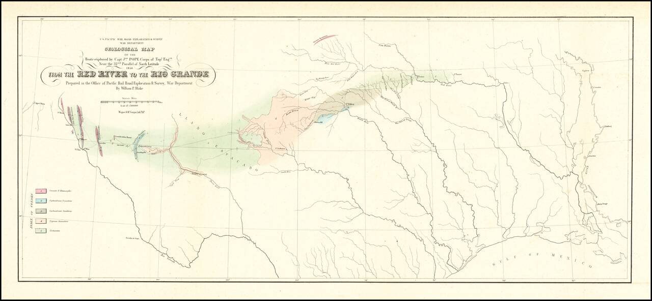
Finely executed Geological Map, centered on Texas and published in conjunction with search for the most practicable route for a railroad line to the Pacific Ocean. Nice example of William Phipps Blake's geological railroad survey of the region between...