Map size in jpg-format: 764071B
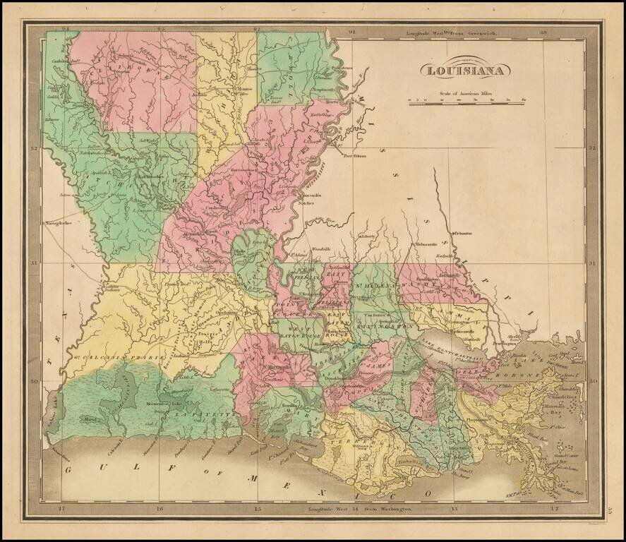
Striking full color example of Greenleaf's map of Louisiana, which appeared in his Universal Atlas, first issued in 1842.
The Parish system is still quite primitive, especially in the North and West, where 7 parishes dominate the region. The early roads are shown, although few traverse the state from north to south. The North and West are still dominated by Indian Lands and Prairie.
If you are a student, write to us in telegram: @antiquemaps and indicate what material you need and for what work you need a map in high detail. We are ready to provide material on special terms. For students only!
![The Coast of West Florida and Louisiana . . . [with] The Peninsula and Gulf of Florida or Channel of Bahama with the Bahama Islands . . .](/map/small/66344.jpg)