
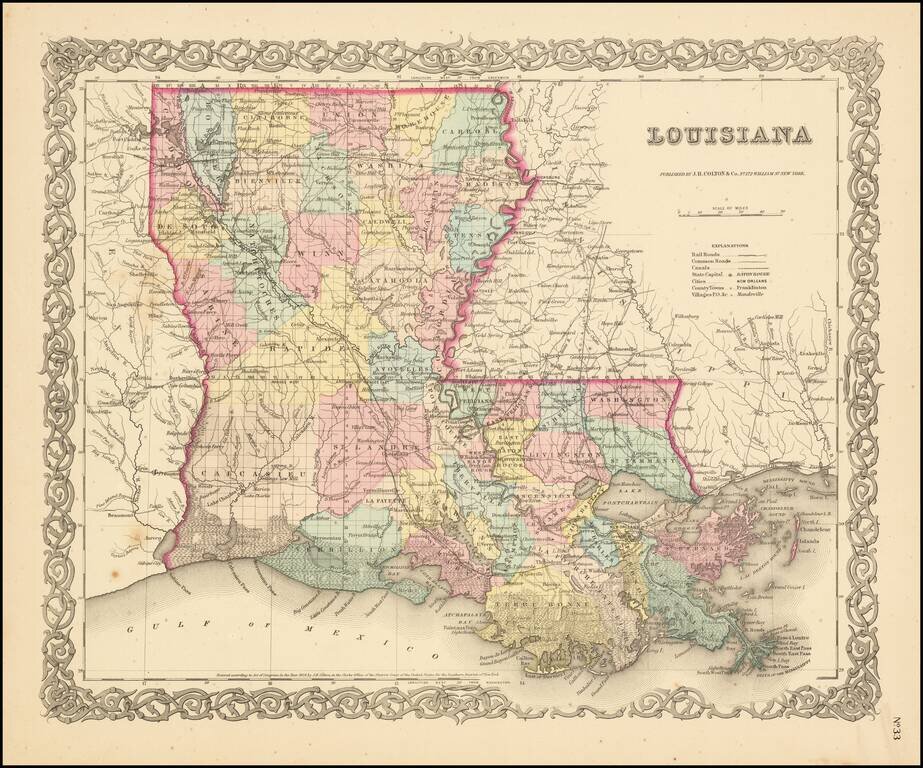
Detailed map of Louisiana, colored by parish and showing roads, railroads, post offices, township surveys, towns, rivers, lakes, stations and a host of other details. JH Colton was one of the pre-eminent American map publishing firms in the mid-19th...
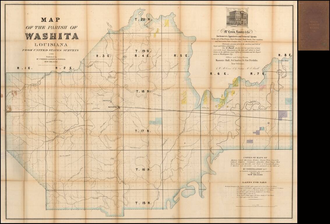
Rare Map of Ouachita Parish, Louisiana Nice example of this rare large format map of Ouachita Parish, Louisiana, published in New Orleans in 1860 by McCerren, Landry & Co., Auctioneers, Appraisers and General Agents for the sale of Real Estate,...
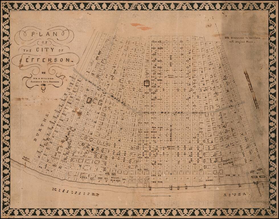
Jefferson City Before Its Annexation by the Big Easy -- Hand Drawn By A Prominent New Orleans Surveyor Fine hand drawn Antebellum plan of Jefferson City, Louisiana on the east bank of the Mississippi, prior to it annexation by New Orleans in 1870....
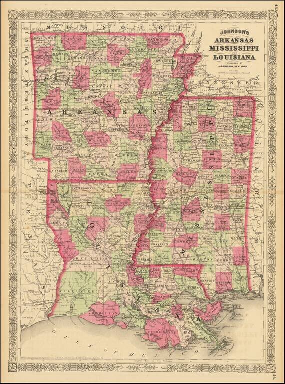
Highly detailed map of Louisiana, Mississippi and Arkansas, published by Johnson & Ward. The map is hand colored by counties and parishes and showing the extent of the state surveys to date. Includes towns, railroads, forts, post offices, roads,...
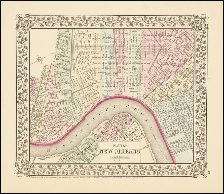
Attractive map of New Orleans, with decorative border showing Mississippi River to Algiers, parks and trolleys. The map is hand colored by wards. Shows streets, buildings, rail lines, etc. An attractive city plan from the pre-eminent commercial...
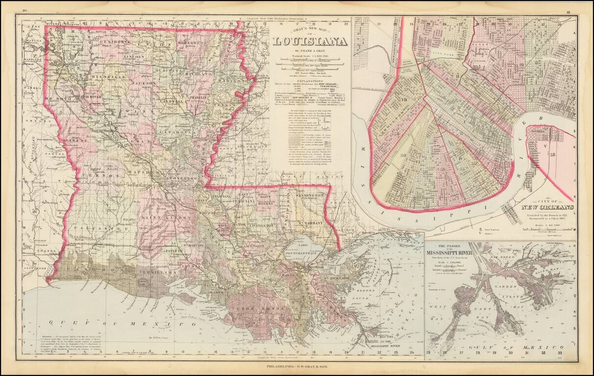
Highly detailed map of Louisiana, published by OW Gray & Son. The map is colored by parishes and showing towns, roads, railroads, swamps, Post Offices, islands, sand bars, soundings, shoals and a host of other details. Large insets of the City of...
![[Texas and Western Louisiana]](/map/small/66617.jpg)
Highly detailed map of a large part of Texas and Louisiana, prepared as part of the US Government's monumental work Atlas to accompany the official records of the Union and Confederate armies, published between 1891 and 1895. The map extends west to...
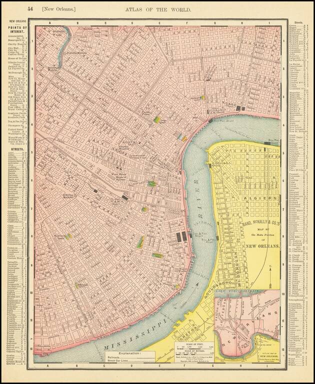
Detailed map of downtown New Orleans, from the late 19th century. The map includes an "Outline Map of New Orleans Portion Shown on Main Map in Solid Color."
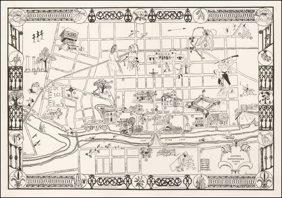
Decorative pictorial map of Natchitoches, Louisiana, by Thelma Z Kyser. Thelma Kyser was a life resident of Natchitoches, Louisiana, who seems to have been very active in Women's Physical Education and Health issues. We can find no information about...
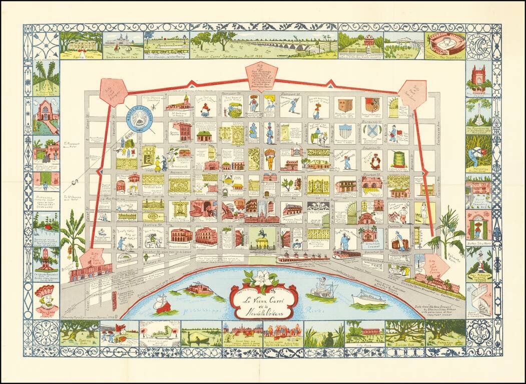
Scarce map of New Orleans, drawn by Myro Zimmerman Barnes in New Orleans in 1942. Includes a fabulous whimsical look at the city, with block by block vignettes of history, costumes and other clever caricatures.
Restricted World War II Aviation Map Detailed aeronautical map Eastern Texas, Southern Louisiana and Southern Mississippi, prepared by the US Department of Commerce. This is an early chart on a Lambert Conformal Conic Projection. The chart is a...
![[Restricted] New Orleans (0-6)](/map/small/68648.jpg)
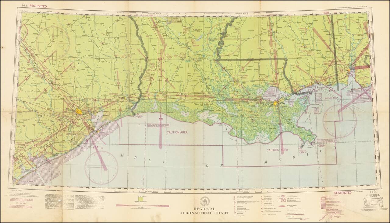
A great World War II [Restricted] map of the Gulf Coast spanning from Beaumont in Texas to Gulfport in Mississippi. The map focuses on aviation in the area, showing sensitive civilian and military corridors. Civilian flying is restricted along a large...
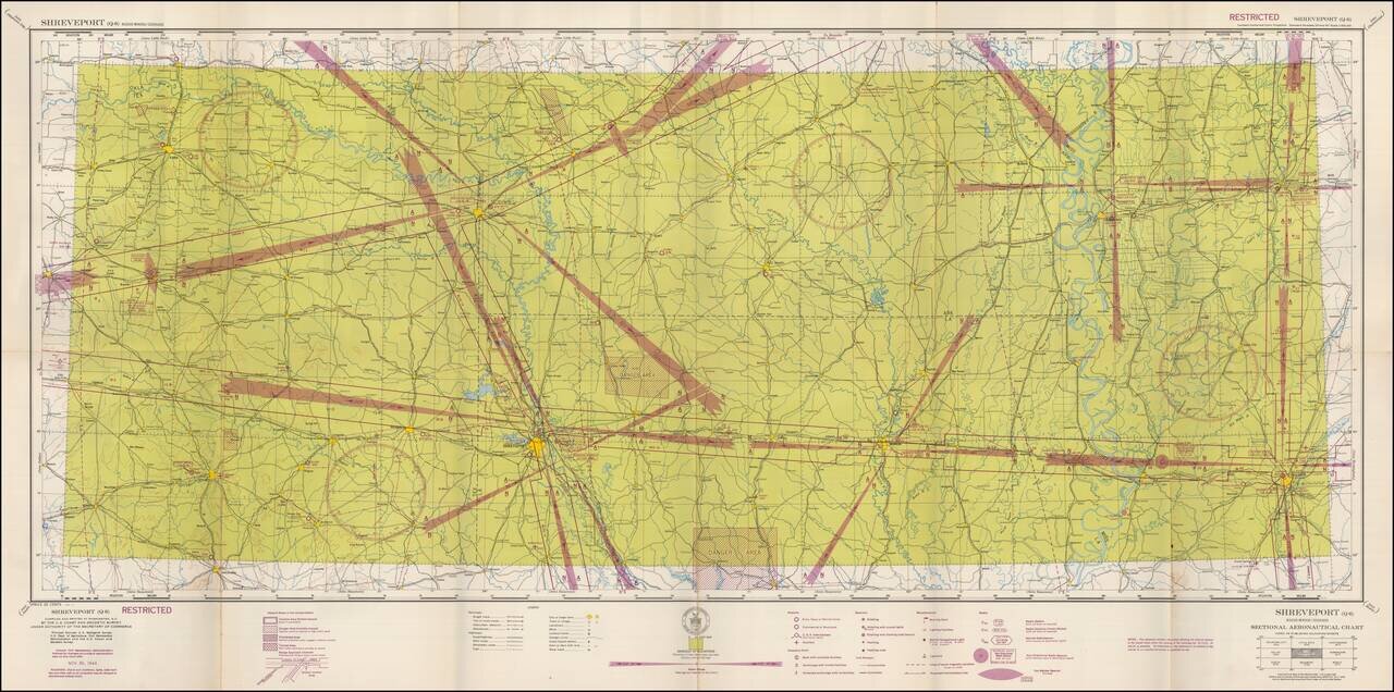
Restricted World War II Aviation Map Detailed aeronautical map of the Shreveport, Louisiana region. The chart is a font of information about civil and military aviation during WWII. It was intended for civil aviators flying by visual navigation and...