Map size in jpg-format: 10.5824MiB
Click to open in high resolution (open in new tab).
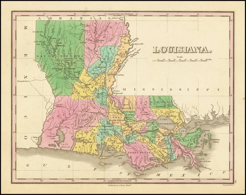
A striking example of Finley's map of Louisiana, colored by parish and showing towns, roads, rivers, and other geographical features. The map is attractively colored in bright colors. Some detail is shown in adjoining states, especially along the Mississippi coastline. Various short notes describe the areas, denoting American Indian villages, prairies, and more.
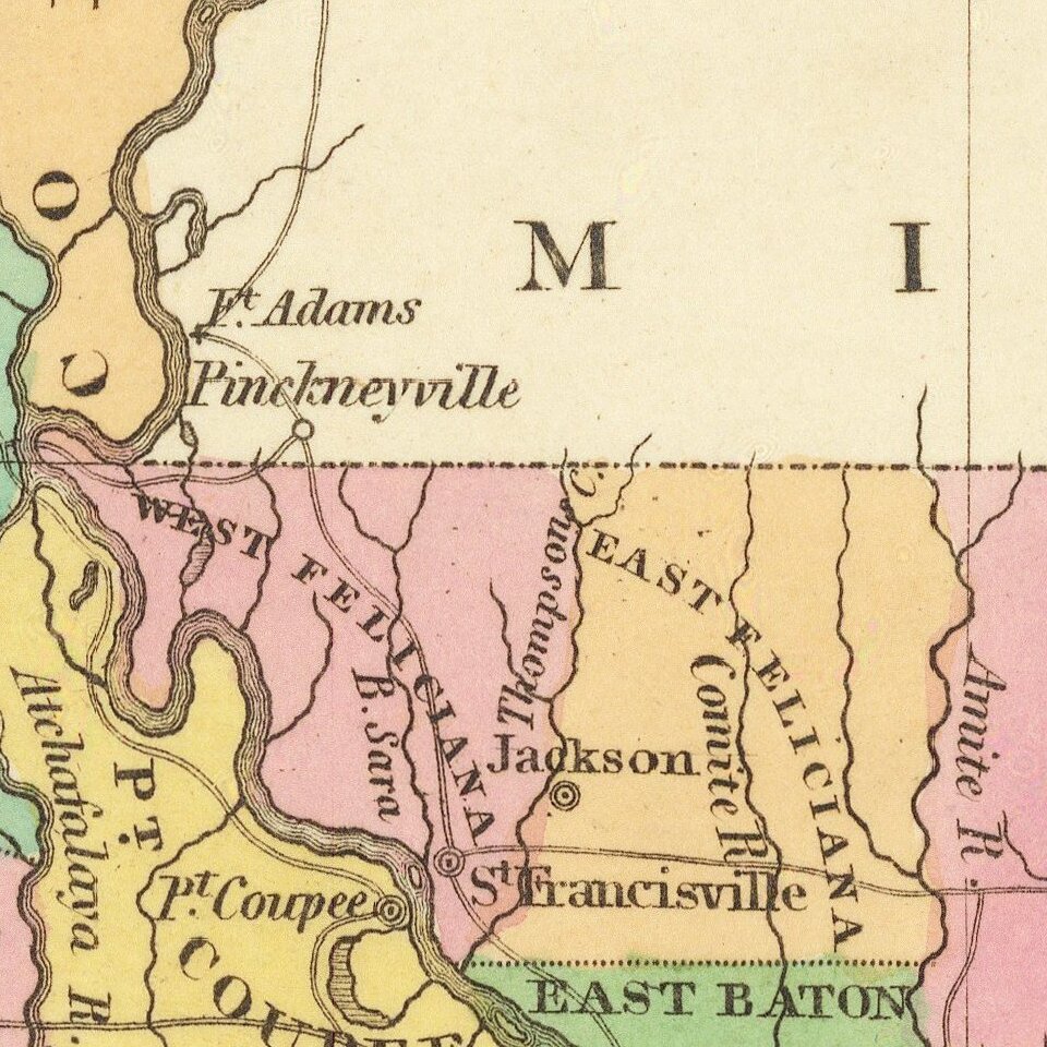
The map shows early parish configurations, with a number of northern and western parishes still not formed. Parishes are the Louisiana equivalent of counties, inherited from the French colonial paroisses. Modern Louisiana has 64 such parishes, while this map only shows a little over two dozen. East and West Feliciana are shown in this map as separate, which divided from Feliciana Parish in 1824, the same year as this map was published. Feliciana comprised the Louisiana portion of West Florida.
Anthony Finley (1784-1836) was an American map publisher. Little is known about his life. He is presumed to have been born in Philadelphia, where he also died. A publisher, Finley was also involved in several Philadelphia civic and professional societies such as the Philadelphia Apprentices’ Library. He may have been in business as early as 1809 and his first publication dates from ca. 1811.
His first maps also date from this year, with two maps in Daniel Edward Clarke’s Travels in Various Countries of Europe, Asia, and Africa. The first atlas published by Finley appeared in 1818, the Atlas classica, or, Select maps of ancient geography, both sacred and profane, for the use of colleges and schools in the United States. He is best known for his A New General Atlas Comprising a Complete Set of Maps (1824), which was a bestseller. There were two editions in 1824, with annual editions until 1834.
Finley was part of the first generation of American publishers who produced high quality, precise maps on American soil. He was in competition with other Philadelphia publishers, for example Henry S. Tanner. Finley’s A New American Atlas Designed Principally to Illustrate the Geography of the United States of America (1826) closely mirrors Tanner’s A New American Atlas Containing Maps of the Several States of the North American Union, with similar groupings of maps; the main difference is the smaller scale of Finley’s maps. Finley printed two editions of this atlas.
If you are a student, write to us in telegram: @antiquemaps and indicate what material you need and for what work you need a map in high detail. We are ready to provide material on special terms. For students only!
![The Coast of West Florida and Louisiana . . . [with] The Peninsula and Gulf of Florida or Channel of Bahama with the Bahama Islands . . .](/map/small/66344.jpg)