
Rare old maps of the United States.
![Various Plans and Draughts of Cities, Towns, Harbours &c . . . [New York, Boston, Charleston, Delaware River to Philadelphia & Havana]](/map/small/58898.jpg)
Detailed set of Revolutionary War era harbor plans, based upon larger maps of the period, including New York, Boston, Charleston and Philadelphia. Each of the plans in turn is based upon separately issued large format plans by Faden.
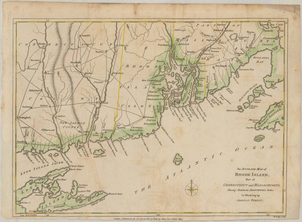
Scarce map of the Rhode Island and contiguous parts of Massachusetts, Connecticut, Long Island, Block Island, Martha's Vineyard, etc. The map illustrates Admiral Mariot Arbuthnot's blockade of Narrangasett, Rhode Island, shortly after the arrival of...
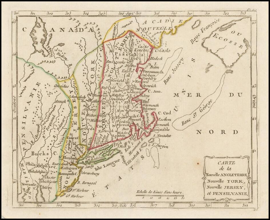
Highly detailed regional map of the Northern British Colonies, featuring numerous place names, forts, Native American tribes, rivers, coastal banks, and other details. Bucks County features prominently north of Philadelphia. Bucks County is one of...
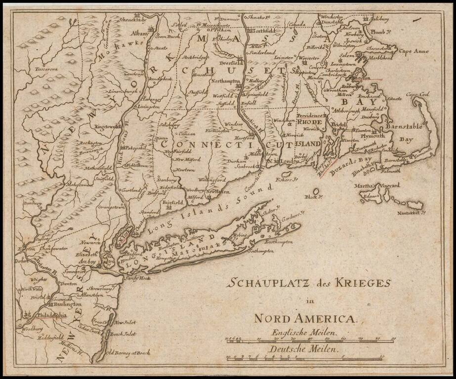
Unrecorded German map of the Theater of War in the northeast during the American Revolution. The towns of Boston, Providence, Newport, New York and Philadelphia are underlined in red. This is the first time we have ever seen the map and we can find...
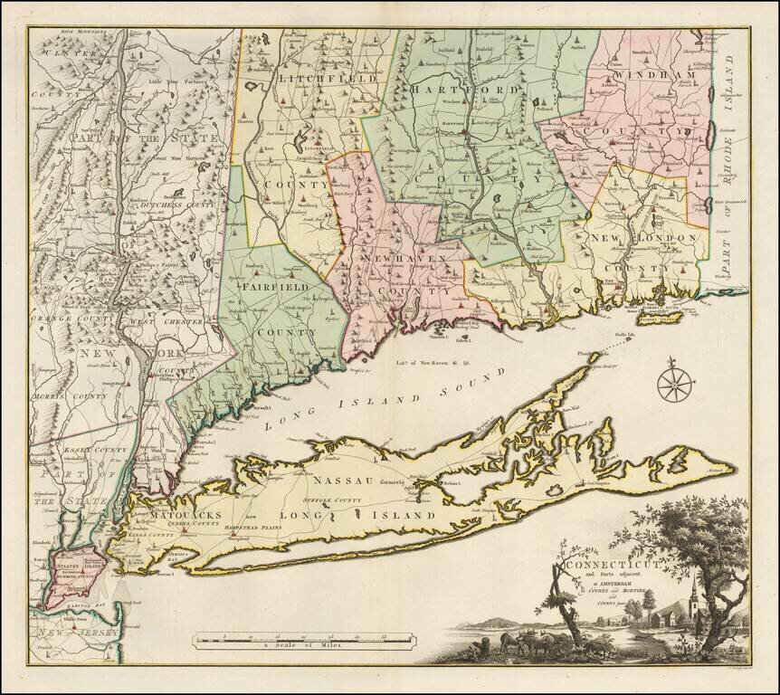
Bernard Romans' Map of Connectiuct -- A Revolutionary War Era Rarity Important early map of Connecticut and Long Island, originally published in New Haven by Bernard Romans and later in Amsterdam. This map was one of four Romans maps parts of the...
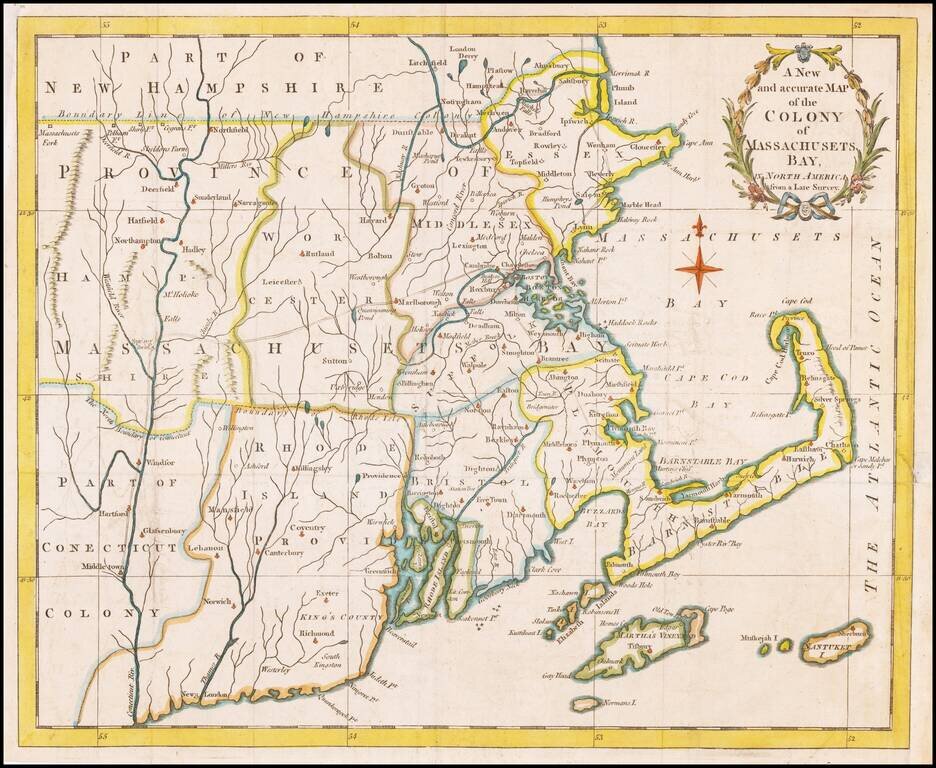
An early map of Massachusetts Bay Colony, which appeared in the Universal Magazine. Shows boundary line with New Hampshire Colony, Rhode Island Province, part of Connecticut Colony, boundary of Rhode Isle, early counties, etc. Nantucket, Martha's...
![[Manuscript Sea Chart of Cape Cod area / Nantucket / Martha's Vineyard / Boston Bay]](/map/small/69611.jpg)
Revolutionary War Era Sea Chart Interesting unsigned hand drawn sea chart, centered on Cape Cod and Martha's Vineyard. The chart tracks the coast of Massachusetts and Rhode Island, with Block Island and Nantucket in the south and Boston Harbor and...
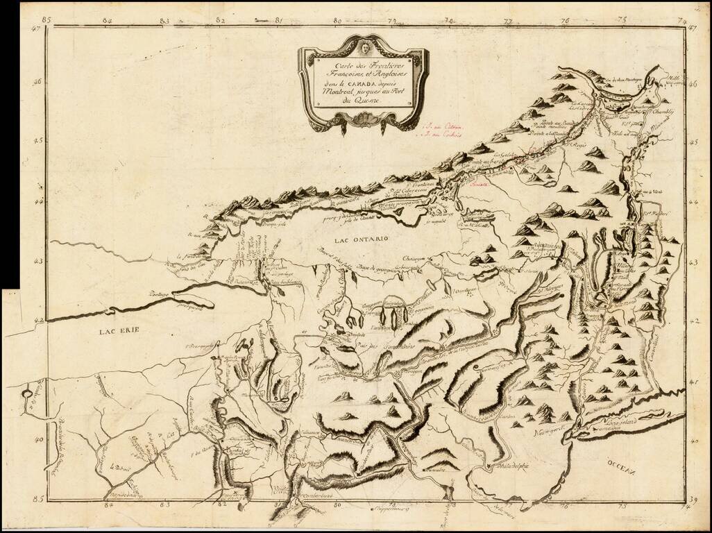
Rare French & Indian War era map of the region between Montreal and Fort Duquesne (Pittsburgh), including all of New York and New Jersey, and most of Pennsylvania. It exhibits a portion of the Theater of War, from Pierre Pouchot's Memoires sur le...
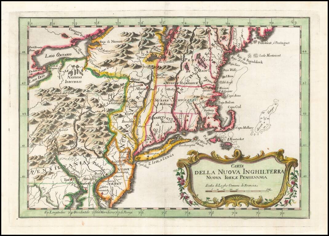
Rare Italian edition of Bellin's map of the Northeast and New England region, from his Teatro Della Guerre Marittima, published in Venice. The map covers the region from the Delaware River and New Jersey in the south to Maine and west to the...
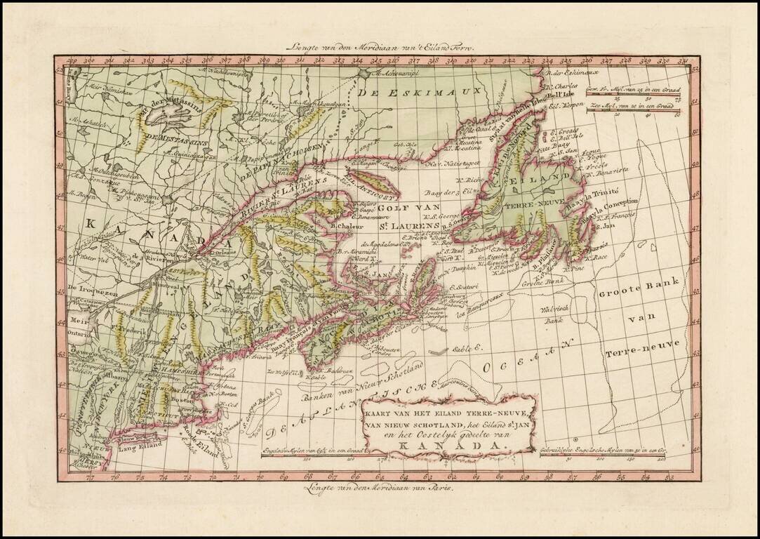
Rare map of Nova Scotia, Newfoundland, northeastern Canada and New England, published by Bachiene in Amsterdam. The map appeared in Bachiene's rare Atlas tot Opheldering der Hedendaagsche Historie ....
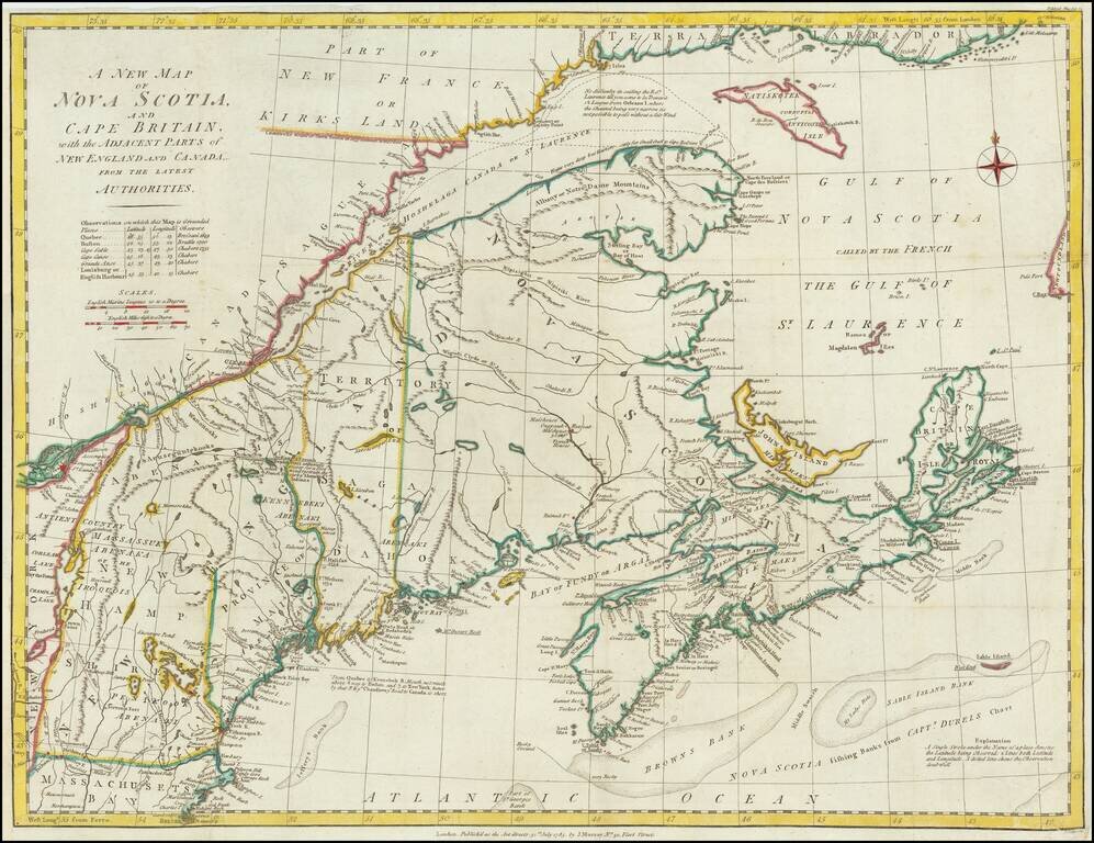
Scarce map of New England and Nova Scotia, published in London. The map is centered on the Provinces of Maine and provides a fine detailed treatment of the region at the conclusion of the American Revolution. The treatment of Lake Champlain is quite...
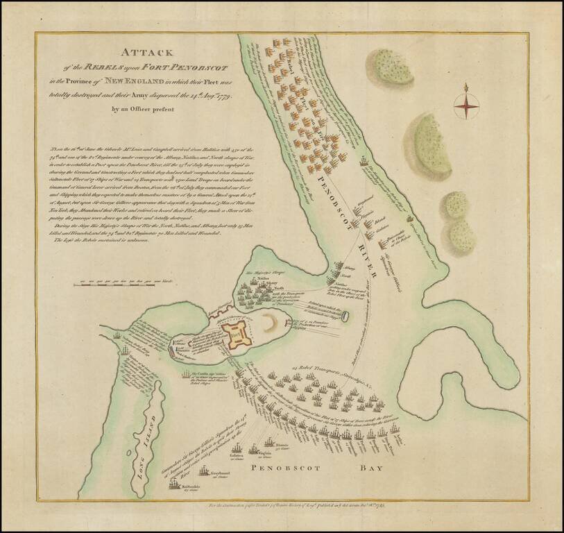
The Battle of Penobscot Bay, Maine -- Lt. Colonel Paul Revere Commanding An Artillery Detachment Interesting American battle plan, showing the action between the British and American Troops at the Battle of Penobscot, during the American Revolution....
![Plan Du Fort Carillon . . . 1758 [French & Indian War Battle Plan--Fort Carillon/Ticonderoga]](/map/small/58985.jpg)
Rare French & Indian War Battle Plan, showing the fortifications and battles fought at Fort Carillon between Lake Champlain and Lake George. The map shows the English Assault on Fort Carillon under the direction of General James Abercromby. The...
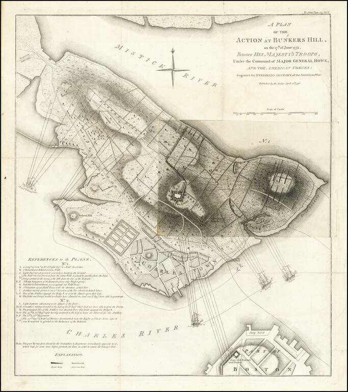
Fine Plan of the Battle of Bunker Hill—Illustrating Two Phases of the Action Nice example of William Faden's important Revolutionary War battle plan of the Battle of Bunker Hill, as issued by William Stedman. The present example has a single fold...
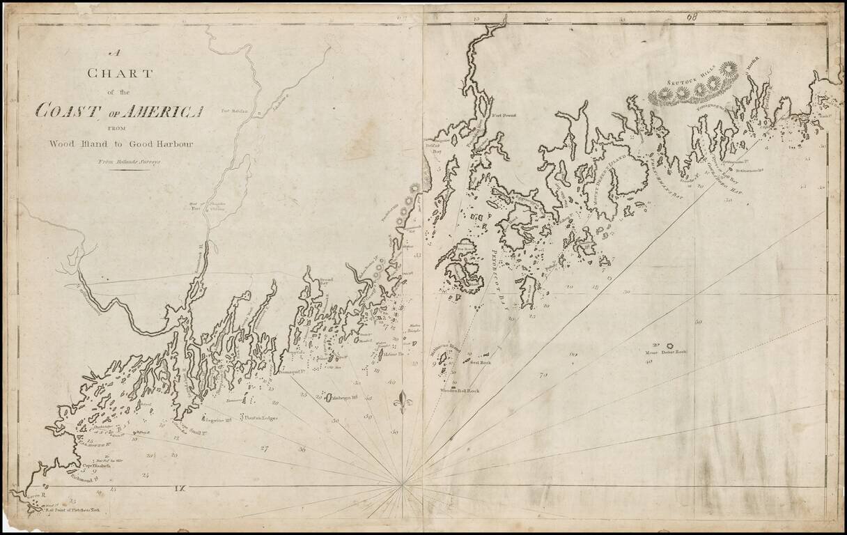
Important 2 sheet map of the coast of Maine, the second large format map of the region published in America. The map is exceptionally detailed for the period, with a wonderful primitive engraving style indicative of 18th Century American printing....
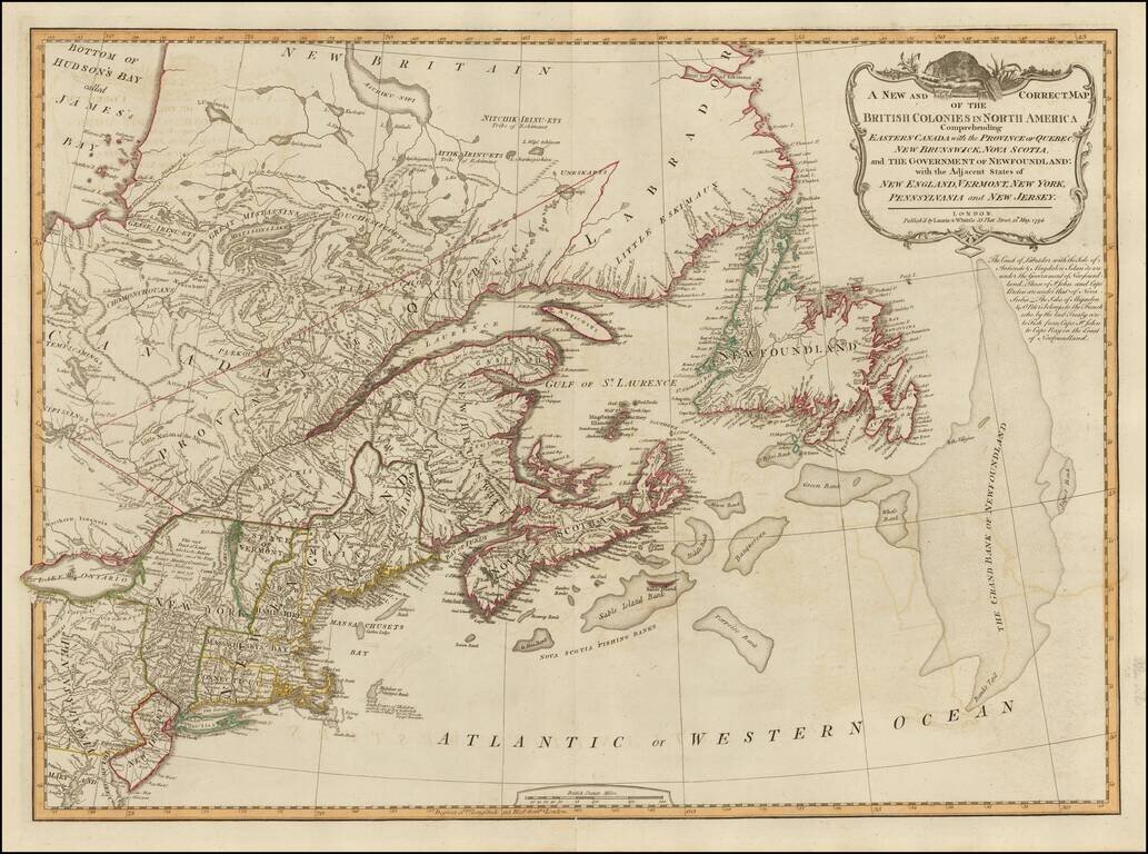
18th Century British Map of the Northern United States A nice example of Laurie & Whittle's map of Canada and the Northeastern United States, extending from Hudson and James Bays to Newfoundland and the Grand Bank, and to Delaware Bay, the Upper...