Map size in jpg-format: 412292B
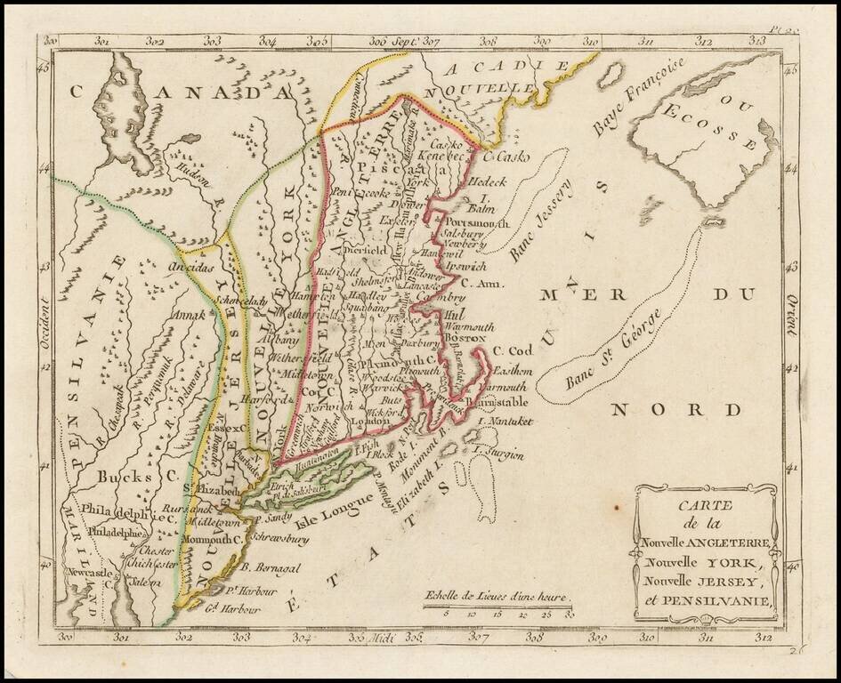
Highly detailed regional map of the Northern British Colonies, featuring numerous place names, forts, Native American tribes, rivers, coastal banks, and other details.
Bucks County features prominently north of Philadelphia. Bucks County is one of the three original counties created by colonial proprietor William Penn in 1682. Penn named the county after Buckinghamshire, the county where he lived in England. He built a country estate called Pennsbury Manor in Falls Township, Bucks County.
The map is based upon Herman Moll's map of the region, issued in the 1720s.
If you are a student, write to us in telegram: @antiquemaps and indicate what material you need and for what work you need a map in high detail. We are ready to provide material on special terms. For students only!
![[The First Maps in a la poupée Printed Color] Cartes en Couleur des Lieux Sujets aux tremblements de Terre Dans toutes les parties du Monde Selon le Sisteme de l’impulsion Solaire](/map/small/52293op.jpg)

