Map size in jpg-format: 1.25578MiB
Click to open in high resolution (open in new tab).
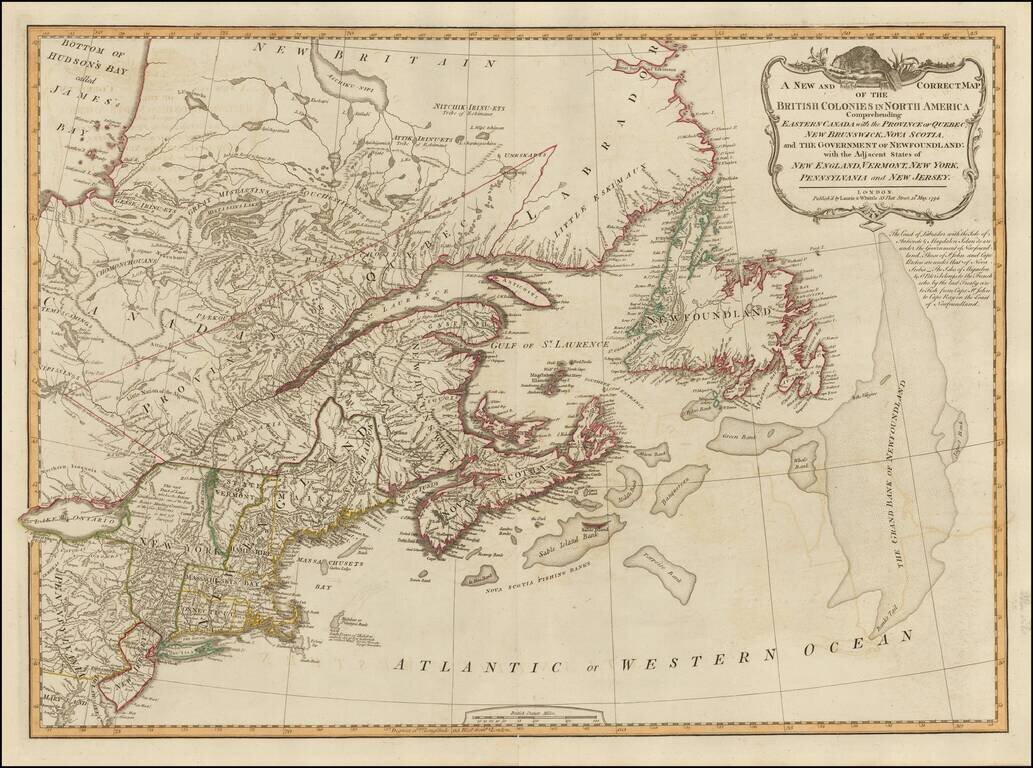
18th Century British Map of the Northern United States
A nice example of Laurie & Whittle's map of Canada and the Northeastern United States, extending from Hudson and James Bays to Newfoundland and the Grand Bank, and to Delaware Bay, the Upper Chesapeake, Pennsylvania and Lake Ontario.
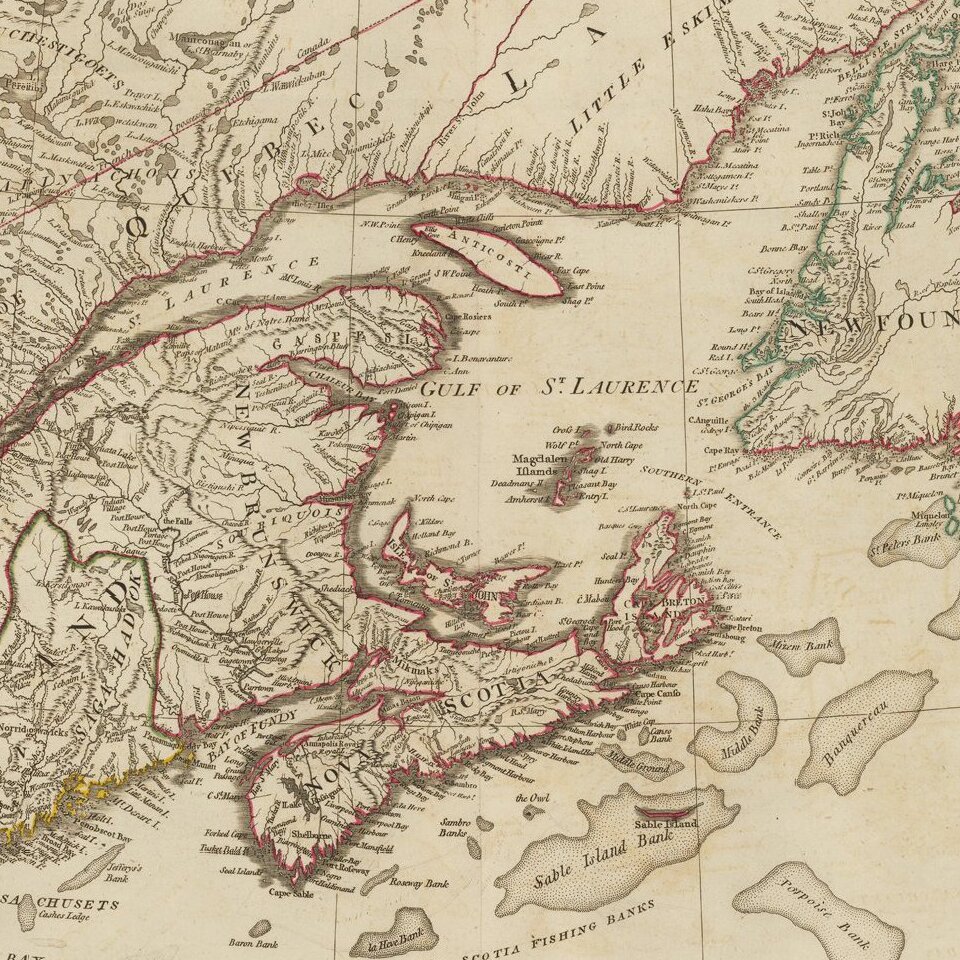
Interesting annotations in New York, immediately west of the early reference to the State of Vermont. Interesting US State boundaries and annotations. Rich with Indian details. The cartouche includes a Beaver at the top.
The note below the cartouche explains the control of various strategic fishing islands off the coast of Newfoundland, etc.
Laurie & Whittle refers to the partnership of Robert Laurie (1755?-1836) and James Whittle (1757-1818), engravers and map publishers. Both men were employed by Robert Sayer (ca. 1724-1794), one of the most prominent British publishers and map sellers of the eighteenth century. Sayer died in 1794 and his business was taken over by his assistants. The two worked together as Laurie & Whittle until 1812, when Laurie retired. They were especially known for publishing sea charts and maritime atlases. From 1812-1818, when he died, Whittle worked with Laurie’s son, Richard Holmes Laurie, as Whittle & Laurie. After 1818, the firm was known as R. H. Laurie, even though Richard died in 1858. Later, the firm was managed by Laurie’s draughtsman, Alexander George Findlay, and, later, Daniel and William Kettle.
If you are a student, write to us in telegram: @antiquemaps and indicate what material you need and for what work you need a map in high detail. We are ready to provide material on special terms. For students only!
![[The First Maps in a la poupée Printed Color] Cartes en Couleur des Lieux Sujets aux tremblements de Terre Dans toutes les parties du Monde Selon le Sisteme de l’impulsion Solaire](/map/small/52293op.jpg)

