
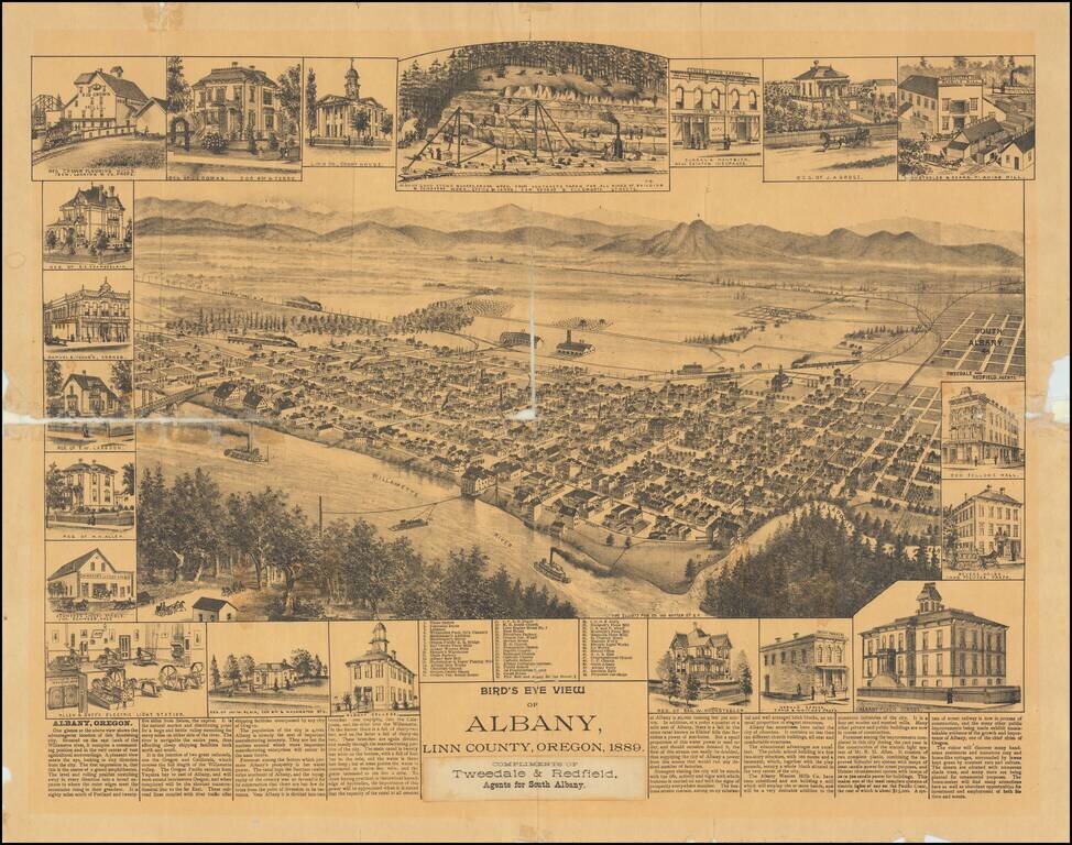
One of the Earliest Settlements in Oregon Rare separately published view of Albany, in Linn County, Oregon. Includes an interesting smaller view of the Albany Sand Stone Quarry and Allen & Goff's Electric Light Stations, along with the unusual...
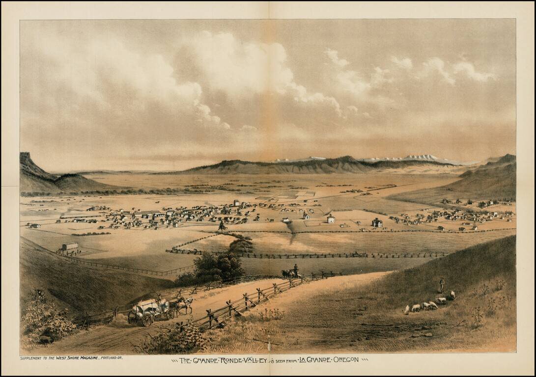
Fine early view of the Le Grande Ronde Valley, in Oregon, from West Shore Magazine. The Astor Expedition passed through the Le Grande Valley in 1811. Thereafter, it became a waypoint along the Oregon Trail. Since the 1840s, settlers headed toward the...
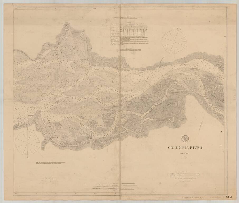
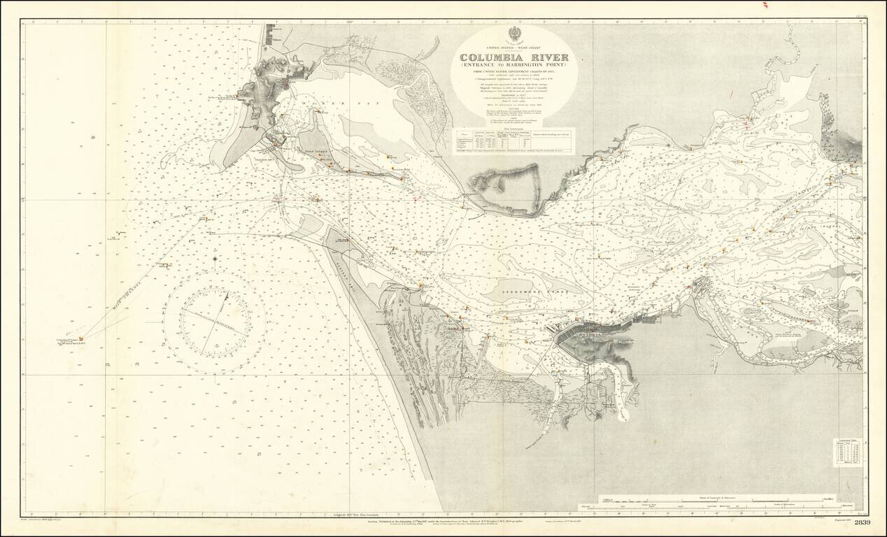
Detailed chart of the Columbia River, extending from the area near Astoria in the west to Skamokawa in the east. The chart is based upon Triangulation data compiled in 1852 and 1871, with topographical data compiled in 1868, 1870 and 1871 and...
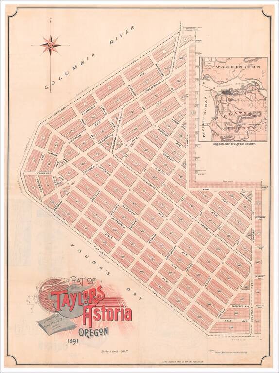
Rare promotional plan of Taylors Astoria subdivision, published in Portland in 1891. Taylors Astoria is situated on the Columbia River at Young's Bay, just east of Fort Stevens and the Astoria Lighthouse. The map inset shows that a proposed rail...
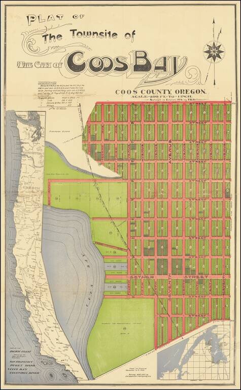
An Oregon Paper City Interesting four-stone color-lithographed real estate promotion map for the city of Coos Bay, Oregon, a proposed settlement on the east side of the bay. In this map, the City of Coos Bay is imagined as a counterpoint to the...
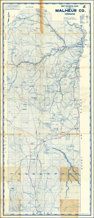
Highly Annotated With New Roads and Mining Details Detailed map of Malheur County in Southwestern Oregon. The map is extensively annotated several different colors. For example, near Owyhee Reservoir (built in 1927), a pencil annotations notes:...
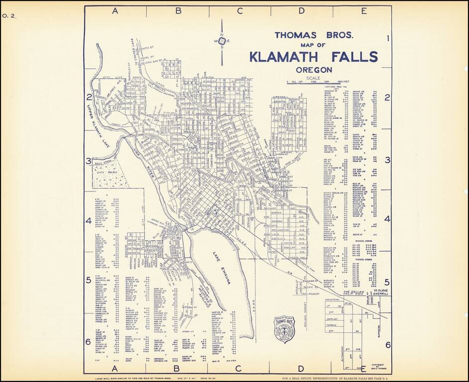
Early map of Klamath Falls, Oregon, with a map of State Highway system of Oregon on the verso. Nice pair of city plans including streets, major buildings, railroad lines, etc.
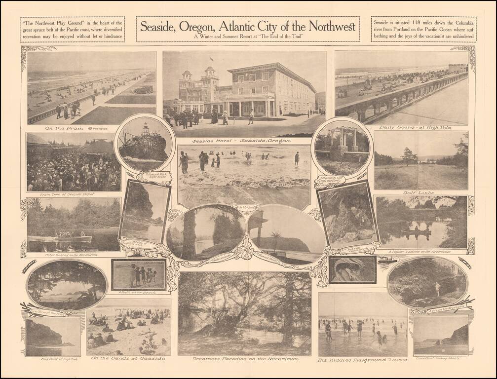
A Winter and Summer Resort at "The End of the Trail" Rare promotional pamphlet for Seaside, Oregon, including approximately 20 black and white photos of the town, beach and tourist features. Promotional text on the verso. Rarity OCLC locates 2...
Extremely detailed chart of the mouth of the Columbia River, between the states of Oregon and Washington. The map covers the north and south shore of the Columbia as it exits into the Pacific Ocean. On the north shore, the towns of Ilwaco, Holman, and...
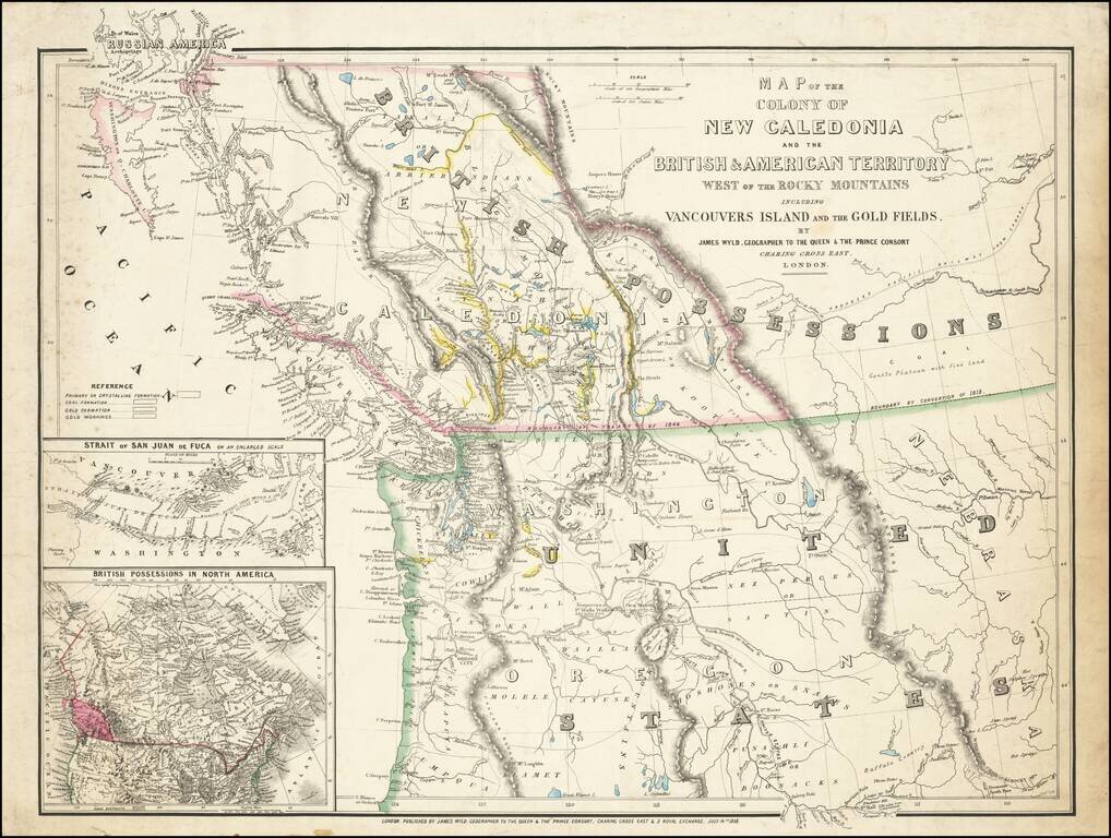
First State of this Exceptional Fraser Canyon Gold Rush Rarity One of the great early mappings of the Pacific Northwest, covering Oregon Territory, Washington Territory, and British Columbia (which was then still "New Caledonia") with information...
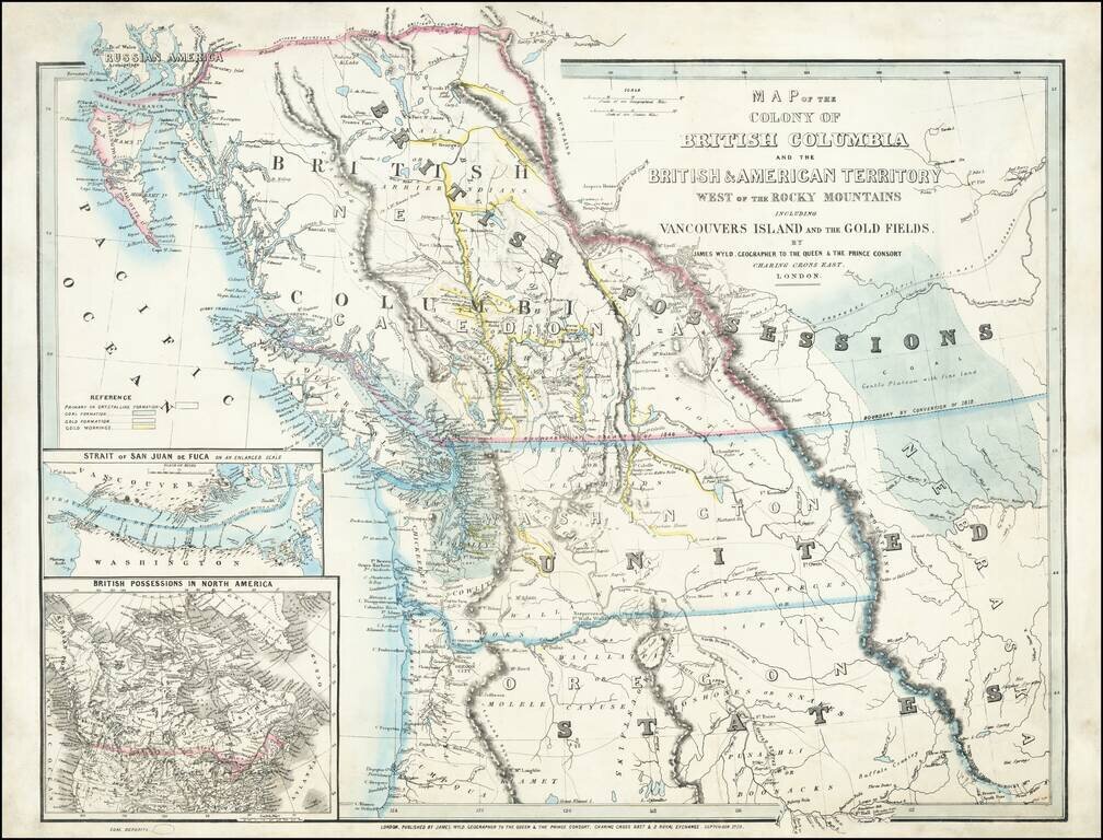
An Exceptional Fraser Canyon Gold Rush Rarity. One of the great early mappings of the Pacific Northwest, covering Oregon and Washington Territories, and British Columbia ("New Caledonia") with information derived from the Hudson Bay Company and Royal...