
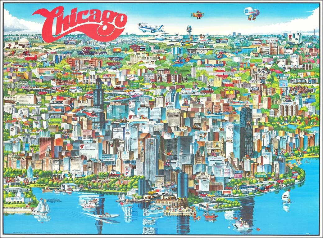
Richly embellished advertising oriented pictorial map / birdseye view of the Chicago area, published by Archar Inc. of Canada. Packed with advertising for local businesses, the images shows buildings, tourism and other landmarks, recreational...
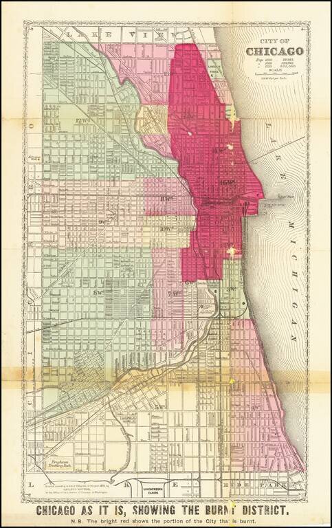
Detailed Plan of Chicago Showing the Area Ravaged by the Great Chicago Fire Scarce map showing the area affected by the Chicago Fire of 1871, with the "Burnt District" colored in red. The map has each street labeled, along with the rivers flowing...
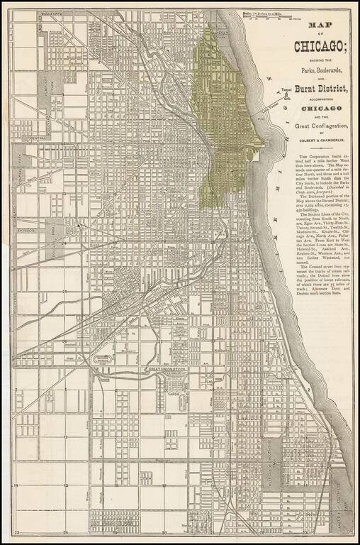
Early map of Chicago issued shortly after the 1871 Fire. The darkened portion of the map shows the Burned District consisting of 2,124 acres and containing 17,450 buildings. A scarce map -- this is the first example we have offered....
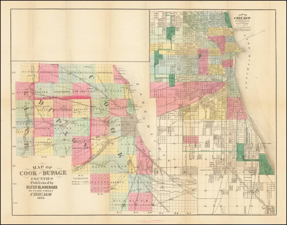
Rare Chicagoland Map Showing Extent of Great Fire. This is a rare separately issued folding map by Rufus Blanchard, creator of some of the earliest maps of Chicago. This 1872 edition of the map shows the extent of the Great Chicago Fire which had...