Map size in jpg-format: 12.7295MiB
Click to open in high resolution (open in new tab).
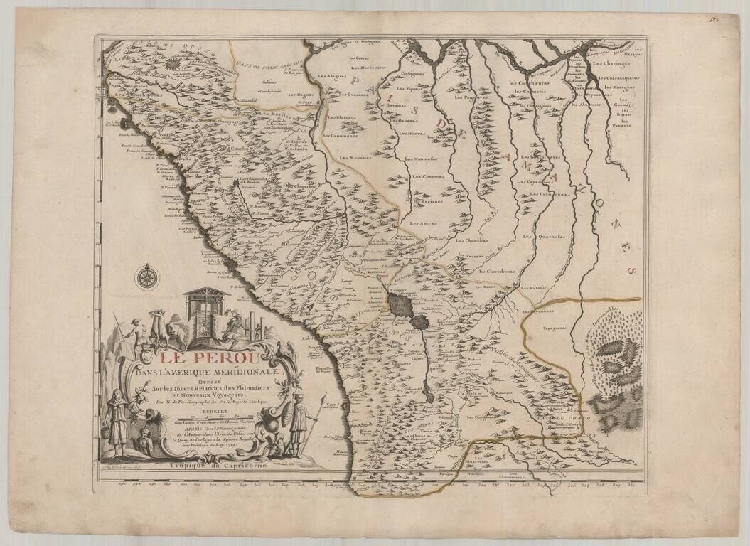
Fine example of De Fer's map of Peru and contiguous parts of the Andes and Upper Amazon River Basin.
The striking large format map is the result of some of the most up to date cartographic information coming back to Europe from the Jesuit Missionaries, who were then actively working to convert the indigenous peoples of South America to Christianity.
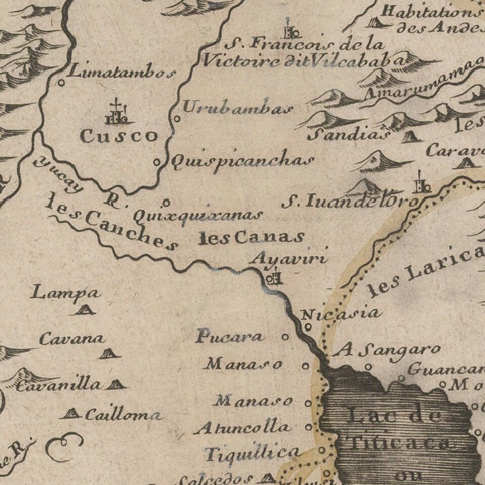
The map includes parts of present-day Ecuador, Bolivia, and Brazil. Cartographic elements include the location of native American settlements, rivers, lakes, and wetlands, some topographical details, compass rose, and degrees of latitude and longitude. Decorative cartouche includes llamas, scene of mining with miners carrying baskets on their backs, and climbing ladders. Also includes native American man and woman with spear, shield, and basket.
Nicholas de Fer (1646-1720) was the son of a map seller, Antoine de Fer, and grew to be one of the most well-known mapmakers in France in the seventeenth century. He was apprenticed at twelve years old to Louis Spirinx, an engraver. When his father died in 1673, Nicholas helped his mother run the business until 1687, when he became the sole proprietor.
His earliest known work is a map of the Canal of Languedoc in 1669, while some of his earliest engravings are in the revised edition of Methode pour Apprendre Facilement la Geographie (1685). In 1697, he published his first world atlas. Perhaps his most famous map is his wall map of America, published in 1698, with its celebrated beaver scene (engraved by Hendrick van Loon, designed by Nicolas Guerard). After his death in 1720, the business passed to his sons-in-law, Guillaume Danet and Jacques-Francois Benard.
If you are a student, write to us in telegram: @antiquemaps and indicate what material you need and for what work you need a map in high detail. We are ready to provide material on special terms. For students only!
![[Straits of Le Maire, Nova Guinea, South Pacific]](/map/small/61345op.jpg)