
![Chart of the Coast of California from San Blas to San Francisco Drawn chiefly from the Spanish Surveys, the Charts of Vancouver &c. the whole much improved by recent observations made by English and French Naval Officers . . . 1854 [Additions to 1862]](/map/small/58999.jpg)
An Early Sea Chart of the Coast of California with Manuscript Annotations From Early Use at Sea Striking large scale blue-backed sea chart of the California, significantly revised and improved from the 1849 edition. Visually striking and rare sea...
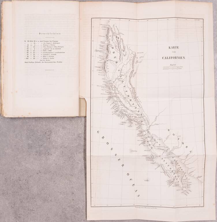
With a Rare 1849 Map of California. This early German description of California was published to take advantage of the keen European interest in the California gold discovery. Like many such publications, the author drew heavily upon previous travel...
![[Lower California]](/map/small/25667.jpg)
Early map of Baja California, printed in connection with an early Government exploration of the region.
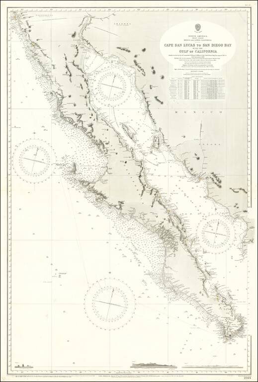
Large Sea Chart of Baja California and the Sea of Cortez / Gulf of California A fine example of the British Admiralty chart of Baja California and the Gulf of California, first engraved and published from London in 1879, and updated numerous times...
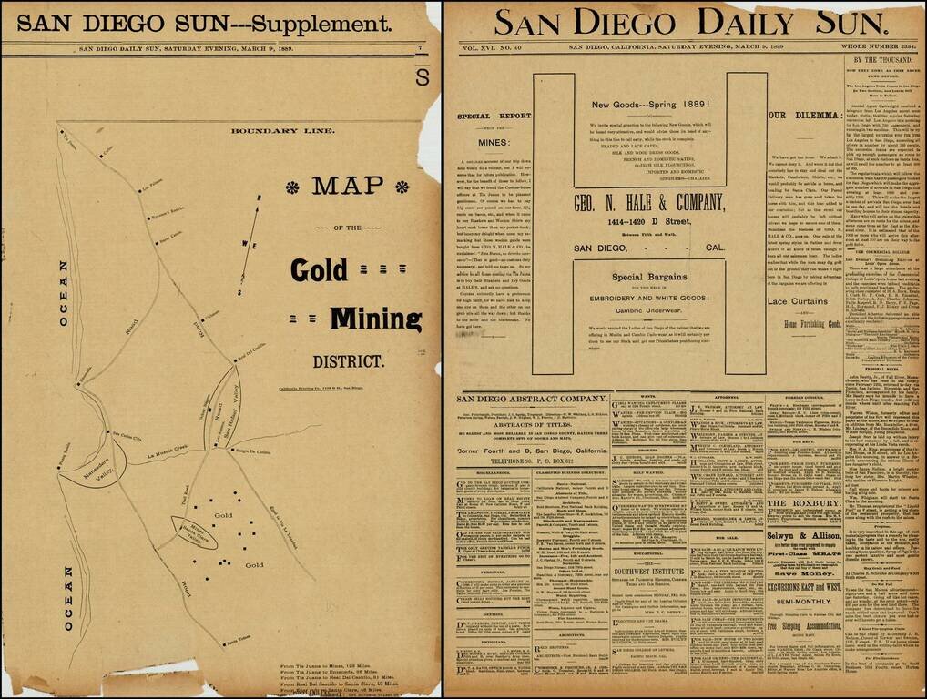
Rare map of the gold mining regions southeast of Ensenada near the Santa Clara Valley, published in the San Diego Sun in March 1889. The map shows the roads south from Tijuana to Ensenada and Santa Tomas, including the region identified as having Gold...
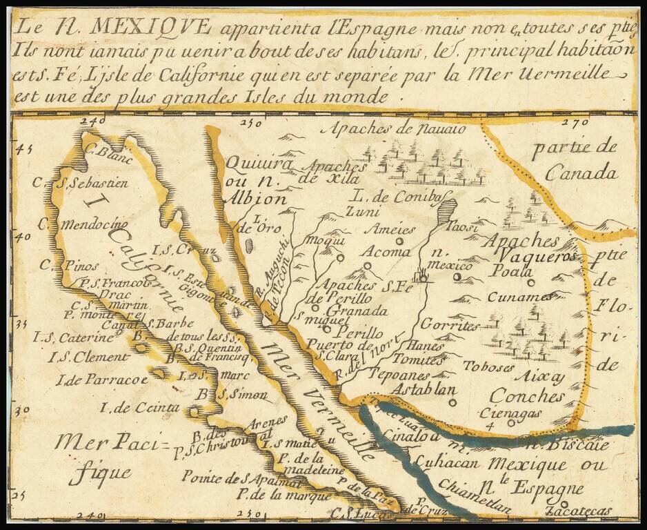
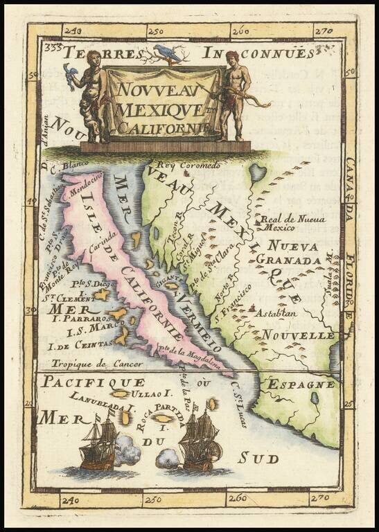
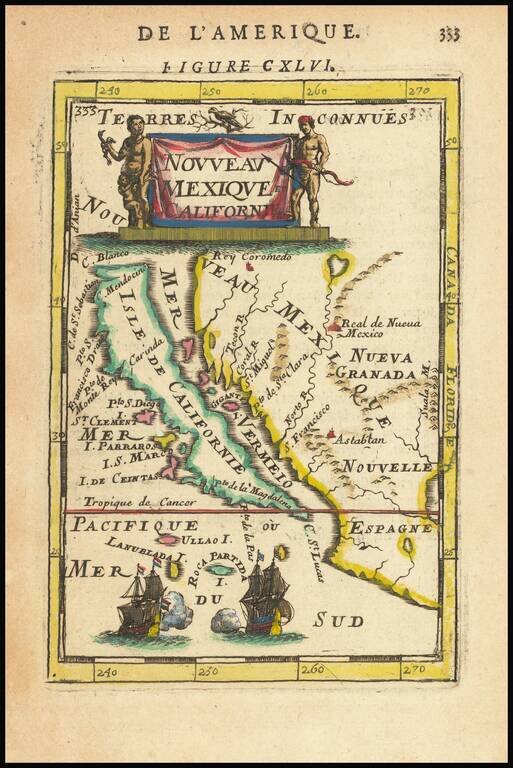
"The first map devoted so much to California"-- Burden A little, very rare, gem of a map of California as an Island, stretching eastwards into lands little known. Many places throughout this region are named, and colonial claims are shown. A long...
Fine, Distinct Map of the Island of California Striking and exciting map of California as an island, one of the few maps to focus so closely on the California region. First published in Paris in 1683, Mallet’s map is notable because it follows...
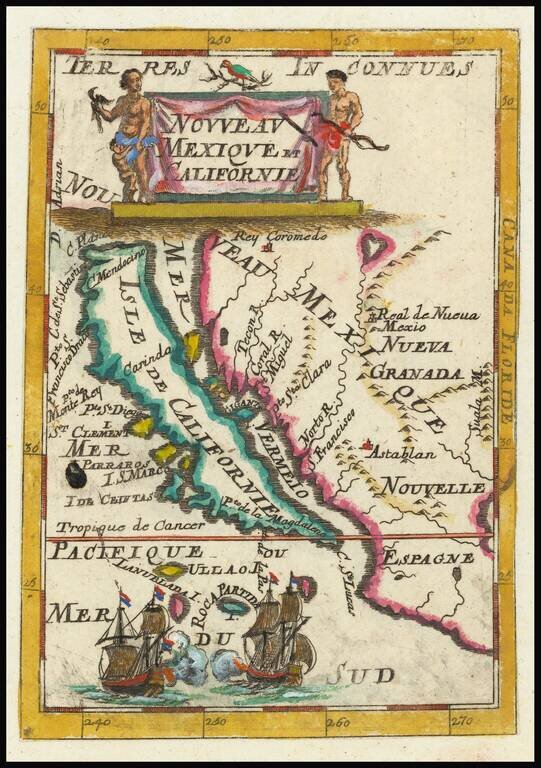
Fine, Distinct Map of the Island of California Striking and exciting map of California as an island, one of the few maps to focus closely on the California region exclusively. First published in Paris in 1683, Mallet’s map is notable because it...
Fine, Distinct Map of the Island of California Striking and exciting map of California as an island, one of the few maps to focus closely on the California region exclusively. First published in Paris in 1683, Mallet’s map is notable because it...
![[Untitled Map of Baja California & West Coast of Mexico]](/map/small/65439.jpg)
First Printing of Domingo del Castillo's 1541 Map of Baja and the West Coast of Mexico Fine example of Domingo del Castillo's map of Mexico, which appeared in Lorenzana's Historia de Nueva-España, escrita por su esclarecido conquistador Hernan...
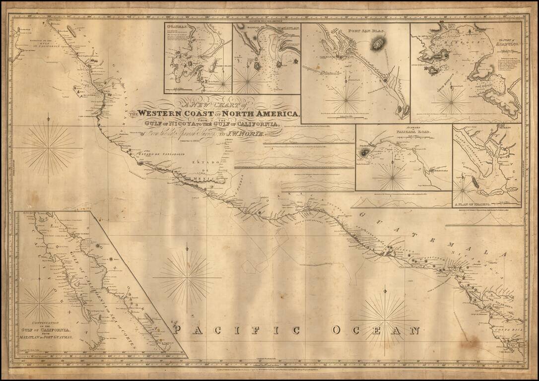
Engraved sea chart covering the area from Cape Blanco, Costa Rica, to the mouth of the Gulf of Mexico, with an inset map titled "Continuation of the Gulf of California, from Mazatlan to Port Guymas." The map includes the following harbor map insets:...
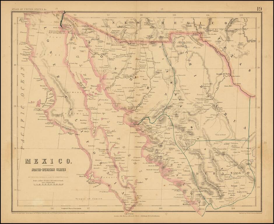
Rare map of Northern Mexico, from Rogers & Johnston's rare Atlas of the United States. The map is part of a wall map of the United States & Mexico, published by Rogers & Johnston. Conceived as a collaborative effort between W & AK...
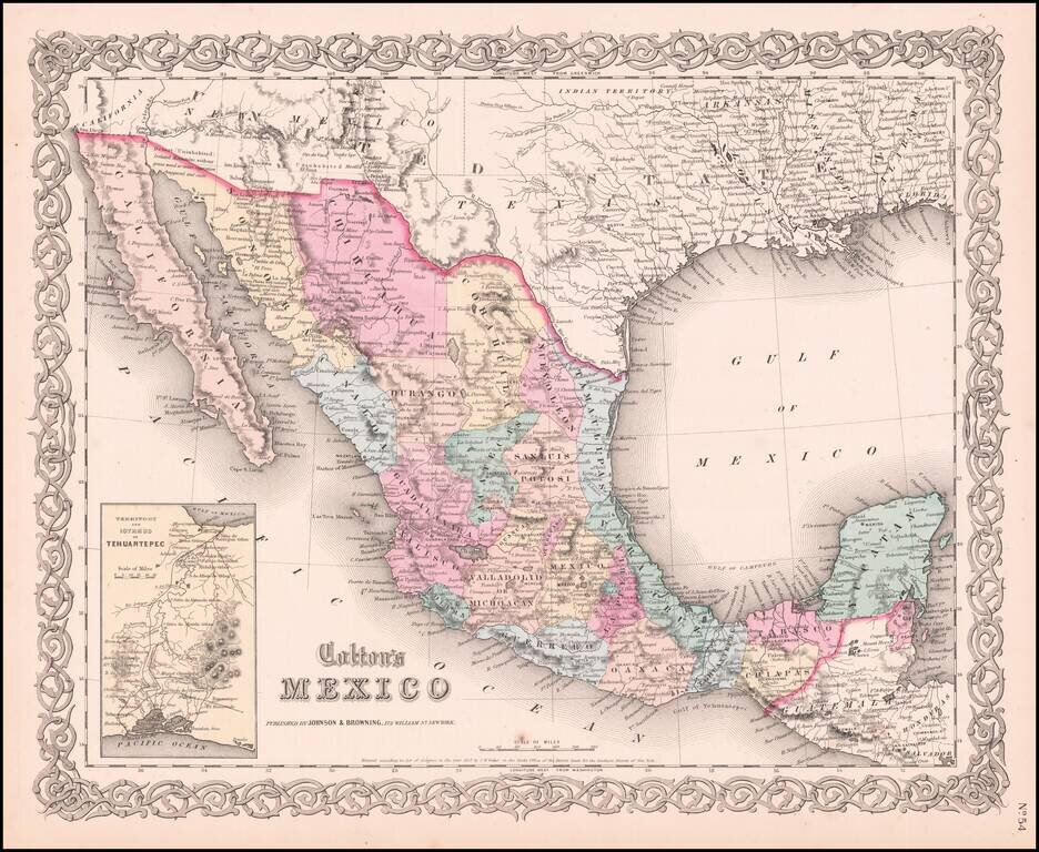
Very detailed map showing towns, counties, Gulf of Mexcico and Gulf of California with lovely decorative border and inset of Territory and Isthmus of Tehuantepec. An excellent pre-Civil War map. From the scarce 1859 edition of Colton's atlas, which is...
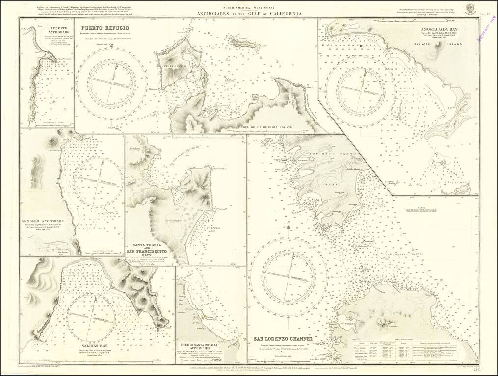
Detailed chart of the anchorages in the Gulf of California, including those on the eastern shores of Baja California. Much of the information comes from Henry Kellett's important 1845 hydrographical survey for the Royal Navy, undertaken on HMS Herald...
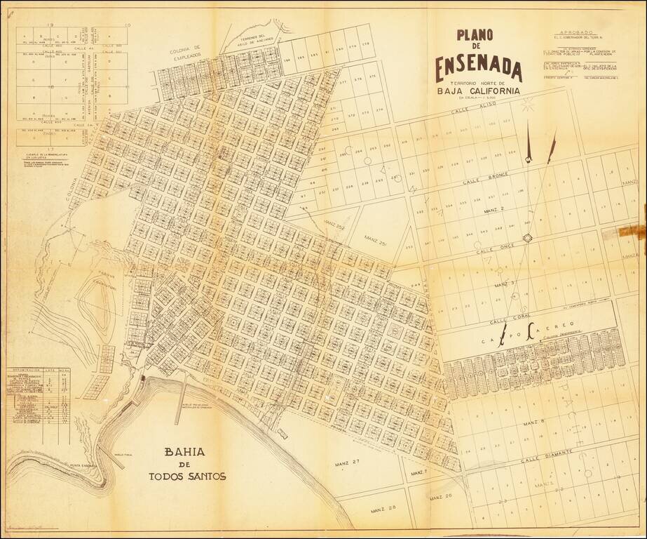
A mid-century map of Ensenada, Baja California del Norte. It shows the port of Todos Santos, the layout of the city and its neighborhoods, and plots of land not yet developed. The margins contain notes and tables showing how new plots should be labeled...
![Amer. Sep. No. 58 Partie De La Vieille Californie [Baja California, Gulf of California and Sonora]](/map/small/62785.jpg)
Highly detailed map covering the Baja from Isle Redonda to just south of Santa Margarita Island on the Pacific and Tiberon Island to Cerralbo and P. Arenas in the Gulf on the Sea of Cortez. Includes most of Sonora. Shows towns, roads, Missions, Bays,...