
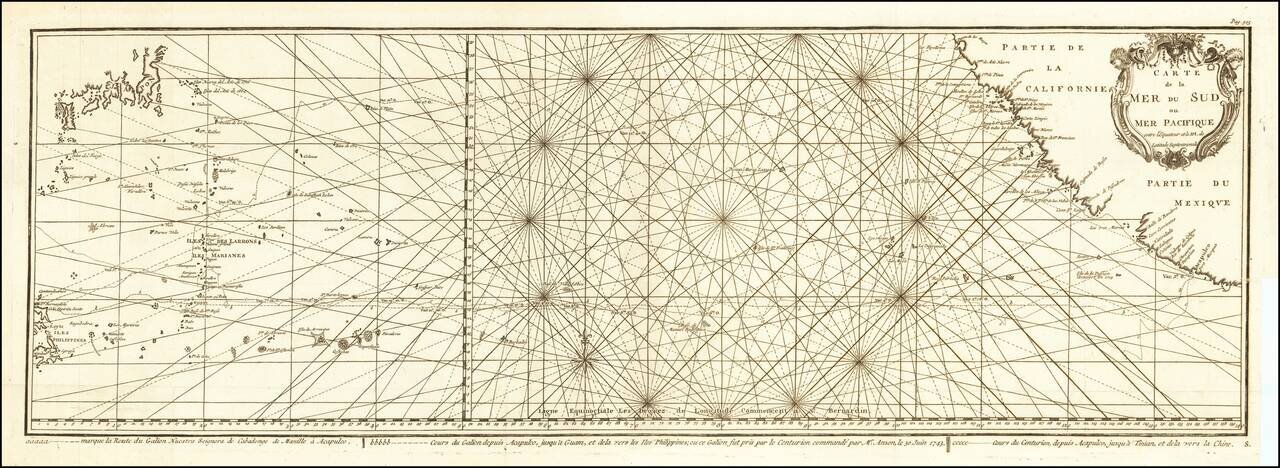
Impressive Chart of the Pacific Ocean Depicting a Thrilling Circumnavigation Dynamic chart of the mid-Pacific Ocean from the French-edition of Anson’s bestselling voyage account. It includes voyage tracks of Anson’s Centurion and the ship he...

The First Sea Chart Focused on the Coast of California Rare first edition of the earliest map to focus on the California Coast, published in Florence by Robert Dudley. The map appeared in Dudley's landmark sea atlas, the Arcana del mare, the first...
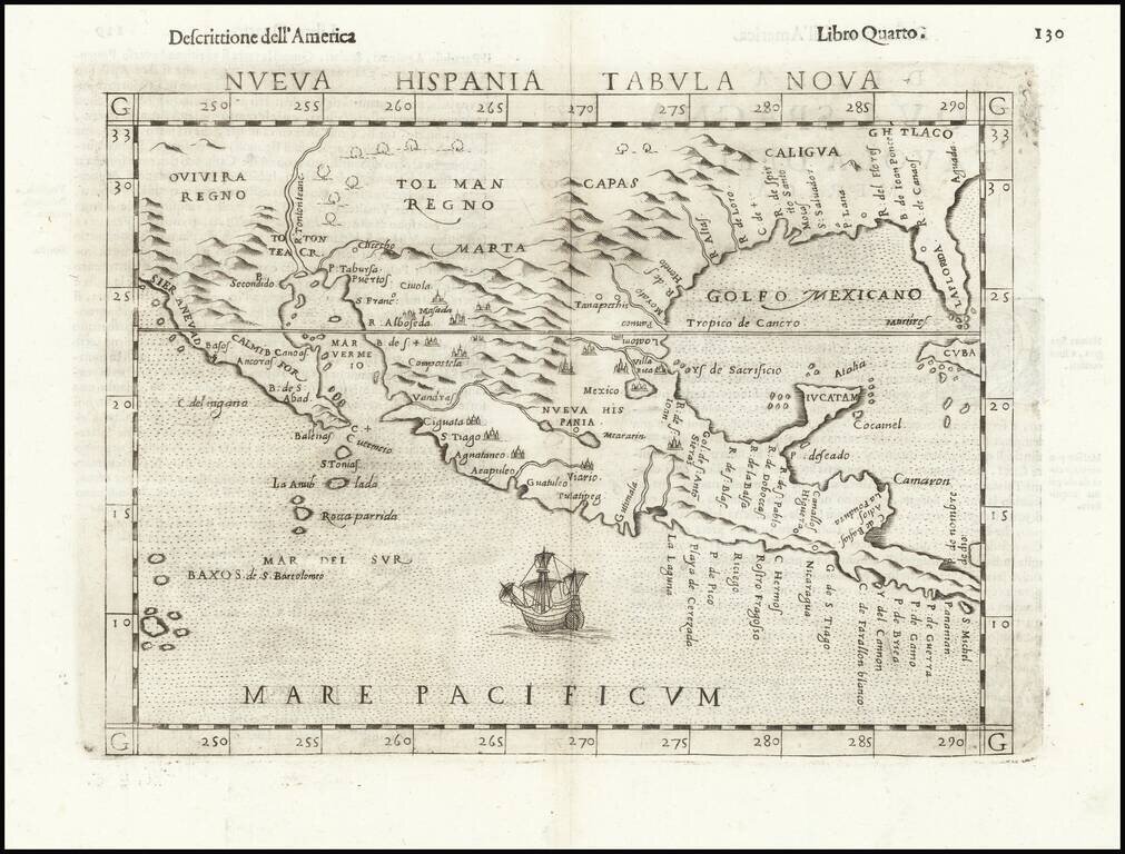
Second Earliest Obtainable Map of Florida, Texas, the Gulf Coast and the American Southwest—Rare Third State! Rare and influential regional map of the American South and Mexico, featured in Ruscelli’s edition of Ptolemy’s Geographia. This is an...
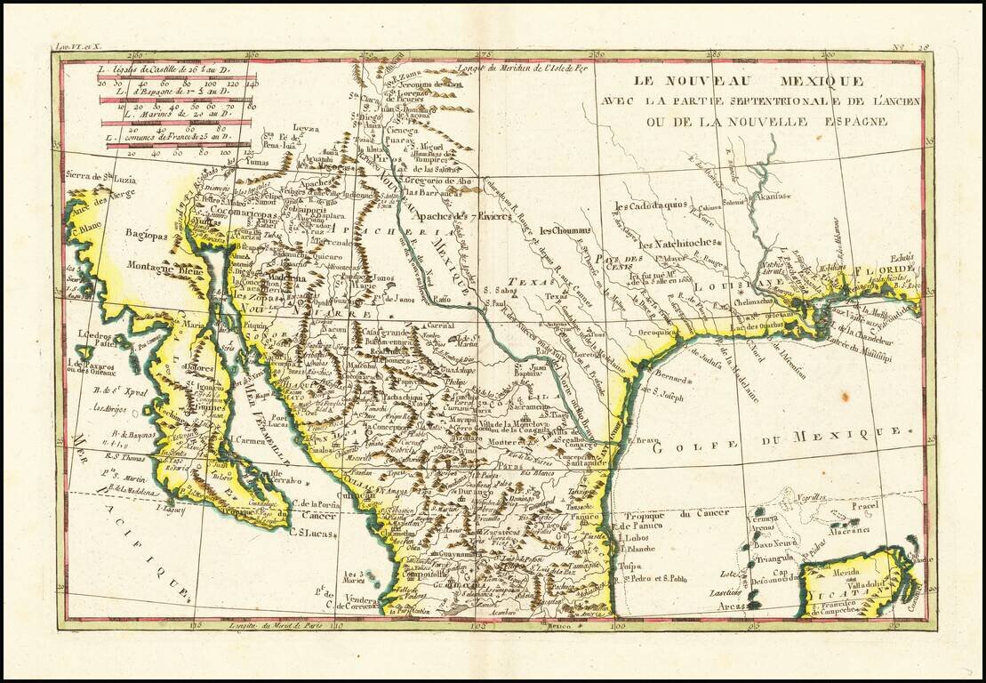
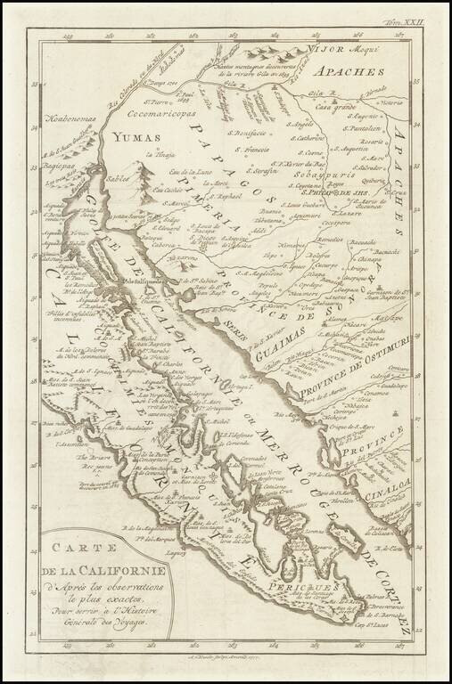
Fascinating map, showing excellent detail in Texas, Arizona and New Mexico. Includes a badly misprojected Baja California, as was normally the case with French maps of the period. Missions and settlements shown in the Texas interior. Indian tribes...
![[California & The Southwest] La Parte Occidentale Dell'Antico, E Nuovo Messico Con Florida E La Bassa Luigiana…. 1798](/map/small/18560.jpg)
Striking full color example of Cassini's map of California, Arizona, New Mexico, part of Texas, Baja California and Mexico. This is perhaps the only 18th Century map of the region to feature a decorative cartouche and vignette. The Rio Grande extends...
![[Provincia de Texas] A Map of Louisiana and Mexico. Carte de la Louisiane et Mexique . . . 1820](/map/small/39611dd.jpg)
An Early Appearance of the Provincia de Texas Rare separately issued map of Mexico, Texas, Louisiana, Mississippi, Southern California, Southern Arizona, Southern New Mexico and parts adjacent, published in Paris by Tardieu. As noted on the map This...
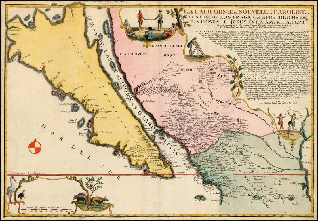
Largest Separate Representation of the Island of California Striking large-format map of the island of California—the largest separate representation of the island of California on a printed map. It is a later representation of the island (1720),...
A scarce map of Baja California, northwestern Mexico, and southern Arizona. The map is detailed, showing many settlements, mountain ranges, islands, missions, and much more. California is shown as a peninsula. The California as an Island in its most...
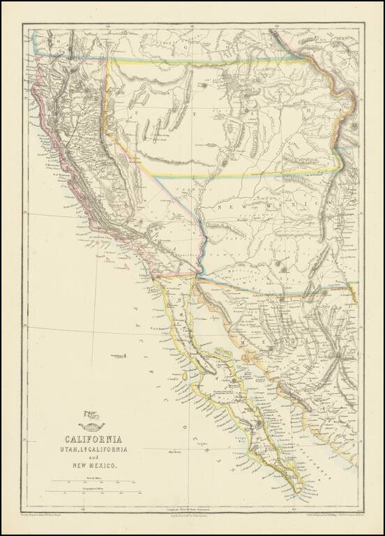
Nice example of the Ettling / Weekly Dispatch map of California and the Southwest, one of first atlas maps published in Europe to focus on the Territories of Utah and New Mexico. The map includes an excellent post Gadsden Purchase treatment of...
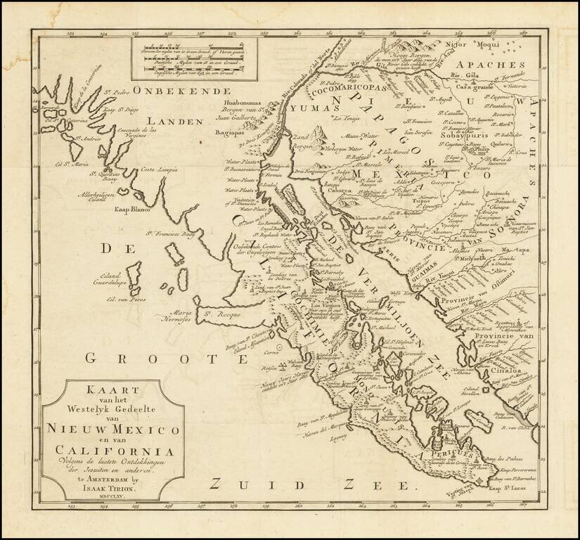
One of the Earliest Obtainable Maps of Southern California and Baja California Fine old color example of this early map of Baja California and parts of Alta California, Arizona and Sonora. Isaac Tirion's map of Baja California is one of the best...
![[Southern California, Arizona, Baja & Sonora] Amer. Sep. No. 53 Partie De La Vielle Californie](/map/small/47400.jpg)
Early mapping of Southern California, southwestern Arizona, northern Baja California and Sonora, published in Brussels. The California Coastline is shown from San Juan Capistrano in the north to the Bay of San Francisco in Baja Norte, centered on San...
![[California Coastline] Carta particolare della America e parte maestrale dal C: di Cedros… D'America carta XXXII](/map/small/58075.jpg)
The Earliest Obtainable Sea Chart of the Coastline of California Fine example of the first edition of Robert Dudley's chart of the California Coastline, the earliest obtainable chart of the region and the first printed map to note the prevailing...
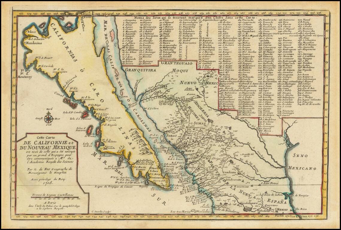
De Fer’s Map of the Southwest Based Upon the Earliest Reports of Father Kino -- One of the Few Regional Maps to Show the Island of California Scarce second state of De Fer's map of California, bearing the date 1705. This is one of a select few...
![[The 5 Californias] Carte De La Californie Suivant 1. La Carte manuscrite de l'Americque de Mathieu Neron Pecci olen dressee a Florence en 1604, 2. Sanson 1656 . . .](/map/small/67157.jpg)
Survey of the Fine Early Maps of California A historically important depiction of the 5 most influential cartographic depictions of California, showing the evolution of how California was mapped between 1604 and 1767. The earliest map is (upper...
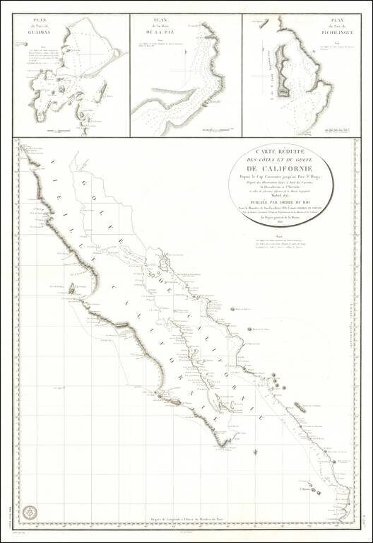
Baja California Immediately After Mexican Independence Rare large scale map Baja California, prepared by the French Government, based upon a Spanish Chart published the preceding year. In addition to all of Baja California, the map depicts the area...
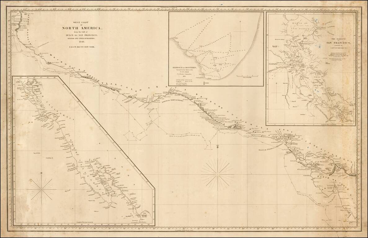
Rare sea chart of California, Mexico and Central American coastline, showing the southern sea route to San Francisco printed on the eve of the California Gold Rush. This fine chart depicts the length of the Pacific Coast of North and Central America,...