
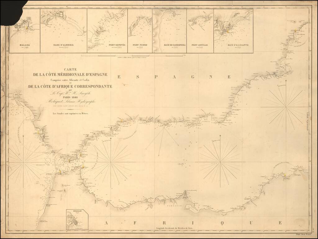
Rare separately published sea chart of the Strait of Gibraltar coast of Southern Spain and the corresponding coast of North Africa, published by Robique. Small inset maps of: Malaga Rade D'Almeria Port Genoves Port Pedro Baie de Carbonera Port...
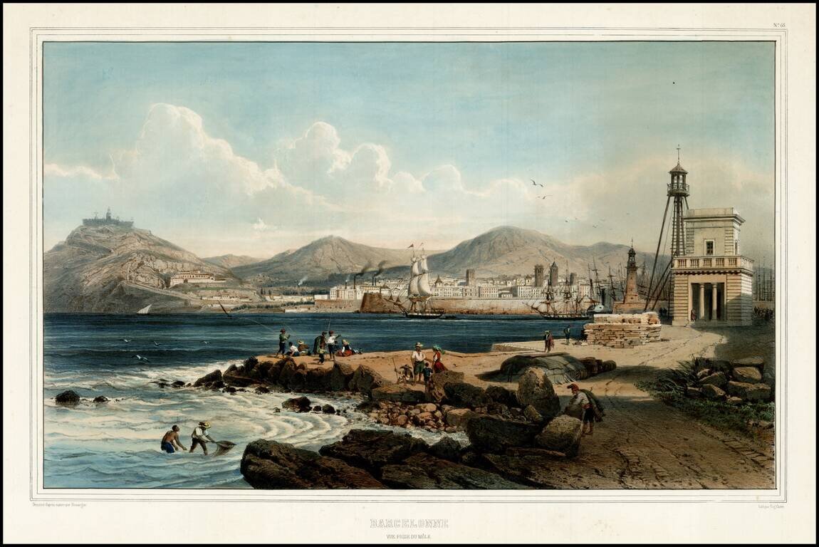
Decorative view of Barcelona from the Harbor, with Monjuic in the distance.
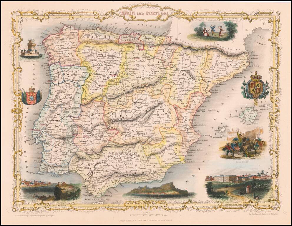
Striking full color example of this marvelous map. Decorative vignettes showing bull fighting, Madrid, Lisbon, Belem Castle, Gibralter, and two coats of arms. Engraved for R. Montgomery Martin's Illustrated Atlas. Tallis was one of the last great...
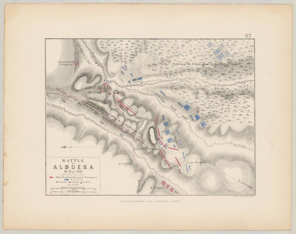
Detailed battle plan of the Battle of Albuera on May 16, 1811, prepared by Alexander Keith Johnston, F.R.G.S. The map is oriented with East at the top of the map, and shows the French (in blue), and the Allied English, Spanish and Portugese Forces (in...
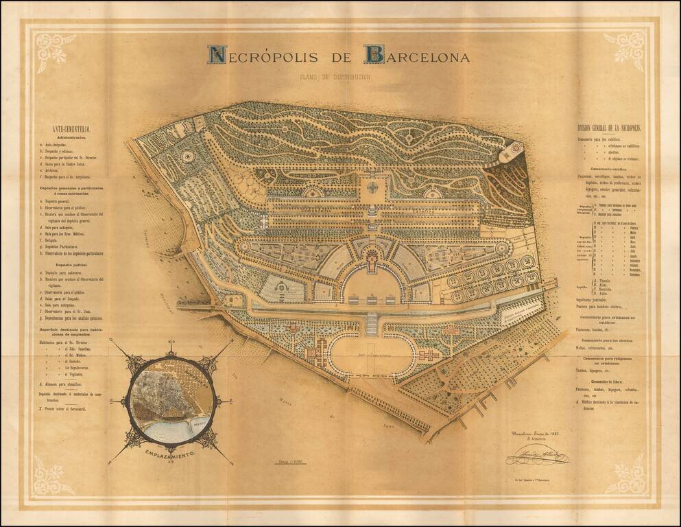
Striking chromolithographic view of the primary cemetery in Barcelona, with a smaller inset map showing the location in the city. An attractive multi-color chromolithographic image.
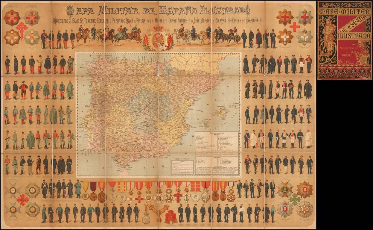
Highly decorative chromolithographic map of Spain, embellished by dozens of military figures, coats of arms, military medals and crests. An elaborare wall map illustrating the Spanish military in all its forms.
![[Grenada] Plano de Granada Comprobado con el Instituto Geogco. y Revisado por arquiteto municipal (Spain)](/map/small/61742.jpg)
Detailed map of Granada, Spain and vicinity, published in Barcelona. The map shows Alhambra and the Palacio de Generalife.
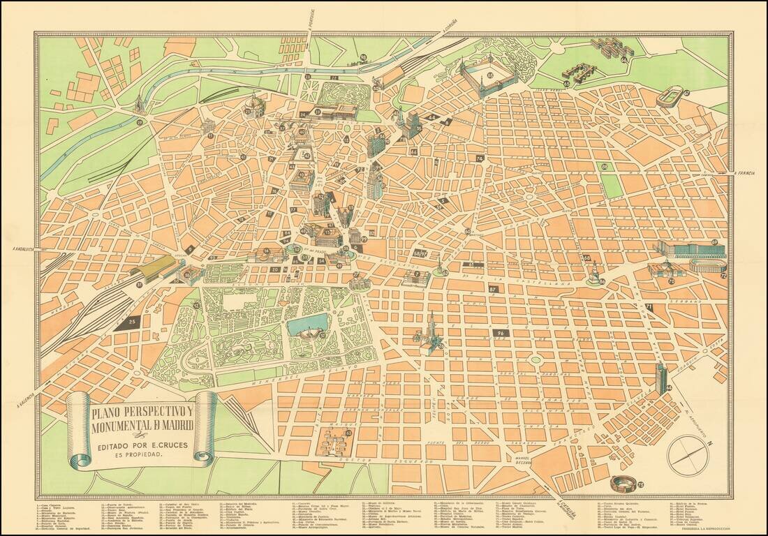
Scarce Tourist plan of Madrid, published in Madrid. Includes a key locating 99 places of interest. Major monuments are illustrated with small building vignettes. Rarity The map is apparently quite rare. OCLC locates 2 examples (Utrecht University...
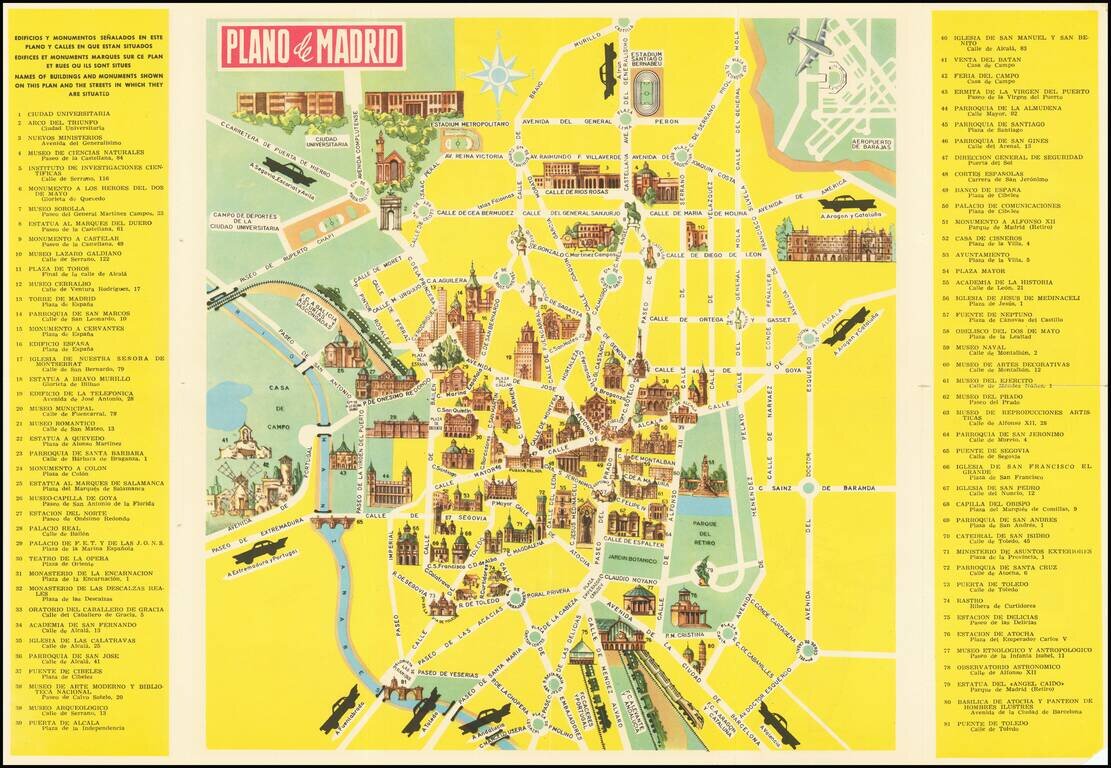
Pictorial Tourist map of Madrid, published for tourists. Features vignettes of Madrid's major monuments and points of interest. Includes advertising for the Hotel Carleton on the verso.
![[Sevilla / Seville] Plano Parcial de la Ciudad de Sevilla - 1964](/map/small/68025.jpg)
Interesting birdseye view style pictorial map of Sevilla, published for the local tourism board. On the front, an illustrated look at the city center is shown, ith an elegant depiction of major buildings, squares, streets, etc. in three dimensions....
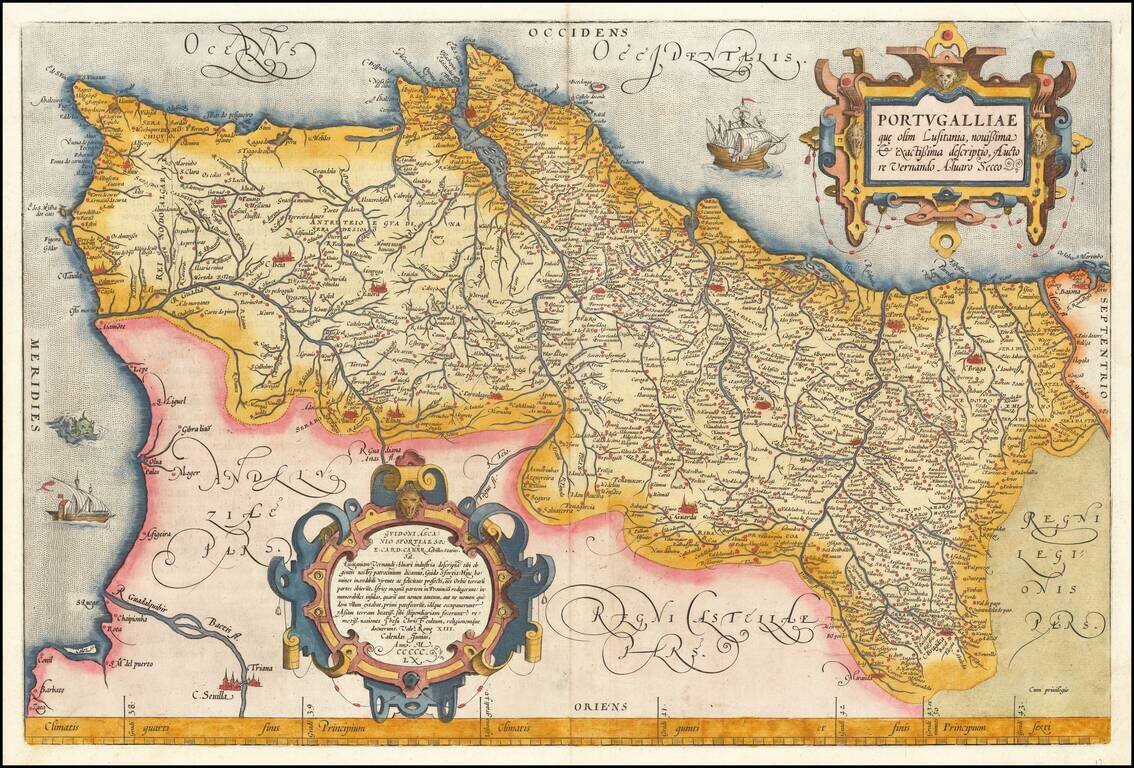
Full color example of Ortelius' map of Portugal, from Ortelius' Theatrum Orbis Terrarum, the first modern atlas of the world. Includes 2 ornate cartouches, sea monster and 2 sailing ships. Based upon Fernando Alvarez Secco's two-sheet map of...
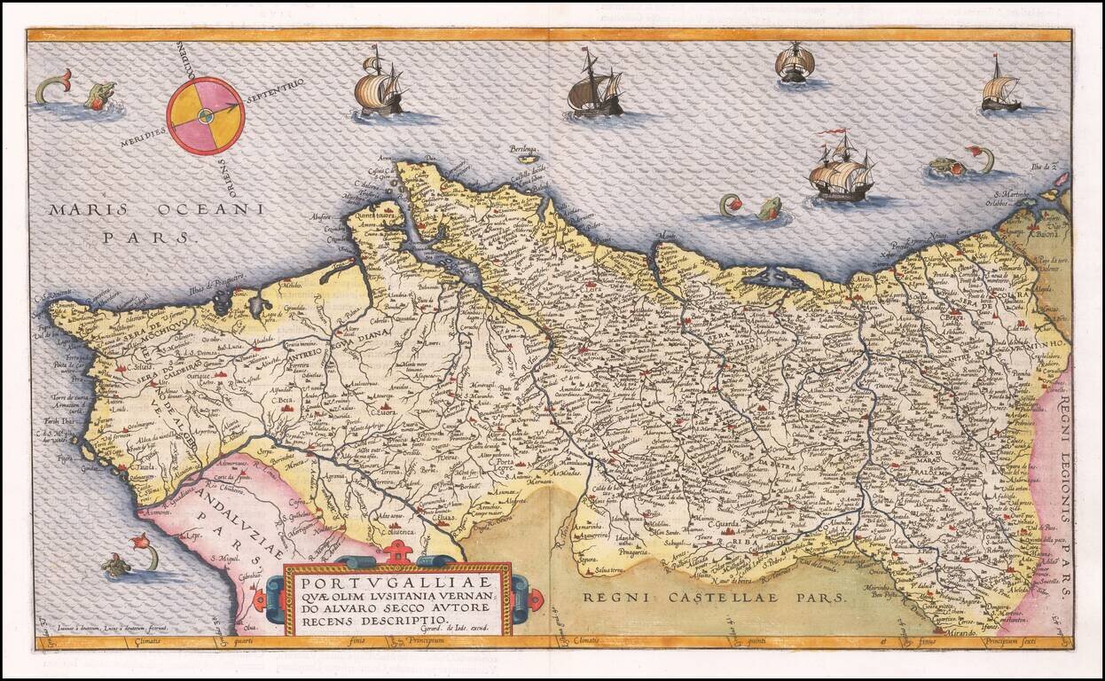
16th Century Antique Map of Portugal Finely executed map of Portugal, published by Dutch mapmaker Gerard De Jode, oriented with west at the top of the map. De Jode's map is based upon the work of Fernando Alvarez Secco, and was engraved by Joannes...
Fine example of this early modern map of Portugal. From a 1597 edition of Magini's Geographia Universae tum Veteris tum Novae Absolutissiumum.
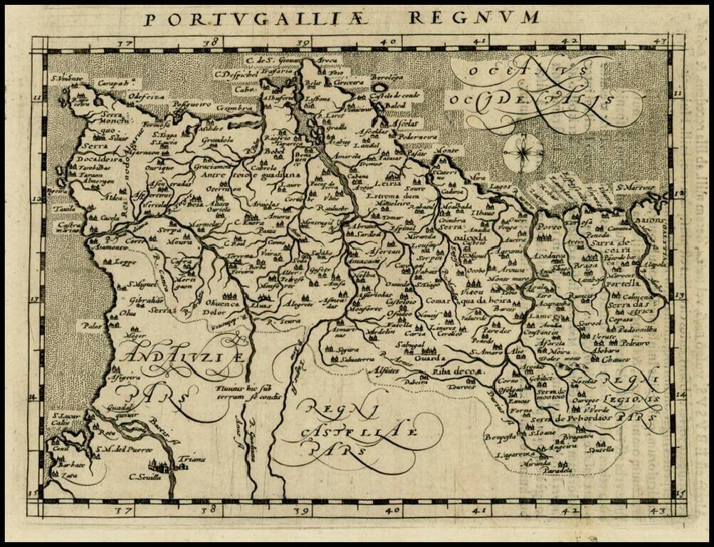
Rare 16th Century map of Portugal, published by Zacharias Heyns in his rare Le Miroir du Monde, ou, Epitome du Theatre d'Abraham Ortelius, published in Amsterdam in 1598. Zacharias Heyns was the son of Peter Heyns, who wrote the rhyming text for...
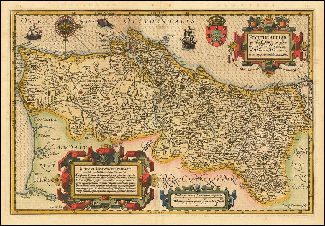
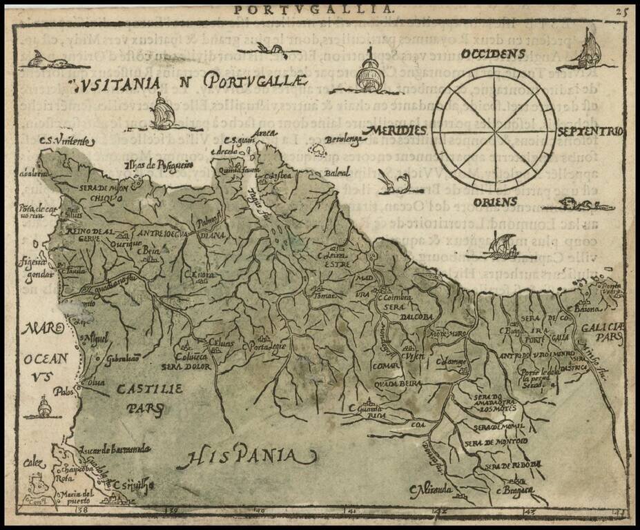
Fine example of one of the most beautiful of all maps of Portugal published in the 17th Century. This is one of the few maps engraved by Baptista van Doetecum for the Hondius Mercator Atlas and demonstrates the elegant style of one of the great master...
![[Portugal] Pascaarte vande Zeecusten van Portugal tusschen de Barlenges en de C. de S. Vincente geleghen, vertoonende nae't leven de ware geleghentheijt vande vermaerde Riviere van Lisbona . . .](/map/small/40065.jpg)
Finely engraved sea chart of the Portuguese coastline, centered on Lisbon, which appeared in Johannes Janssonius's Het Licht der Zeevaert or Le Flambeau de la Navigation, first published in 1620. Jansson's sea atlas is a copy of Blaeu's Atlas of the...