
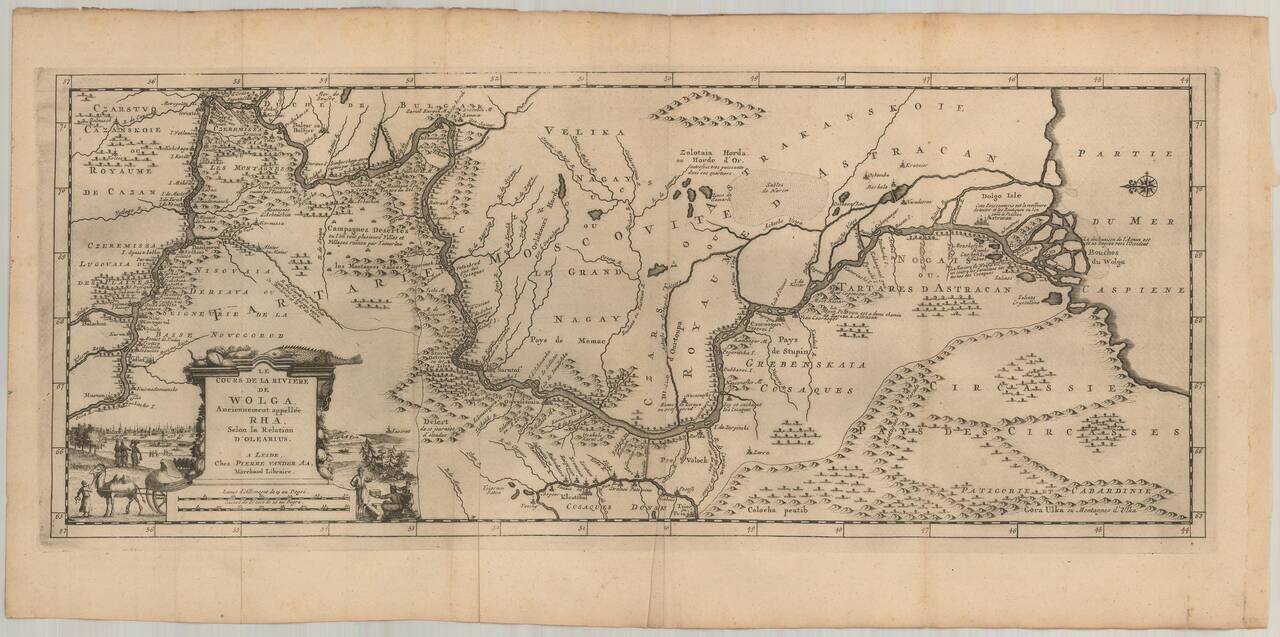
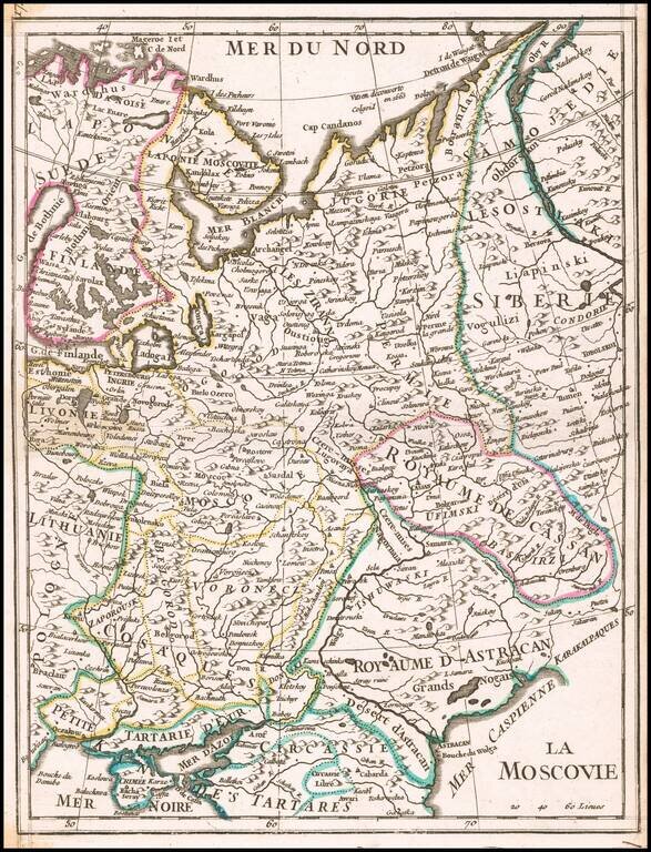
Nice example of Olearius' map of the Volga River, which first appeared in of Olearius' Relation du voyage d'Oléarius Adam en Moscovie, Tartarie, et Perse avec celui de I.A. De Mandelslo aux Indes Orientales - traduit de l'Allemand et augmenté par A....
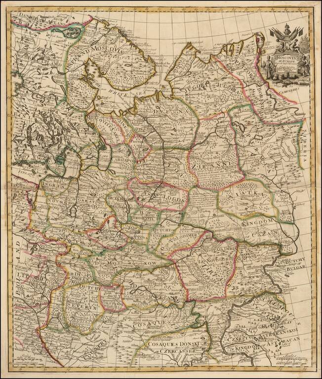
Fine example of Senex's scarce map of European Russia. The map extends to the "Cosaque" regions in the south, including the "Country of the Cosaques " and "Cosaques Donski or Czercasses". Highly detailed and colored by regions, with a small...
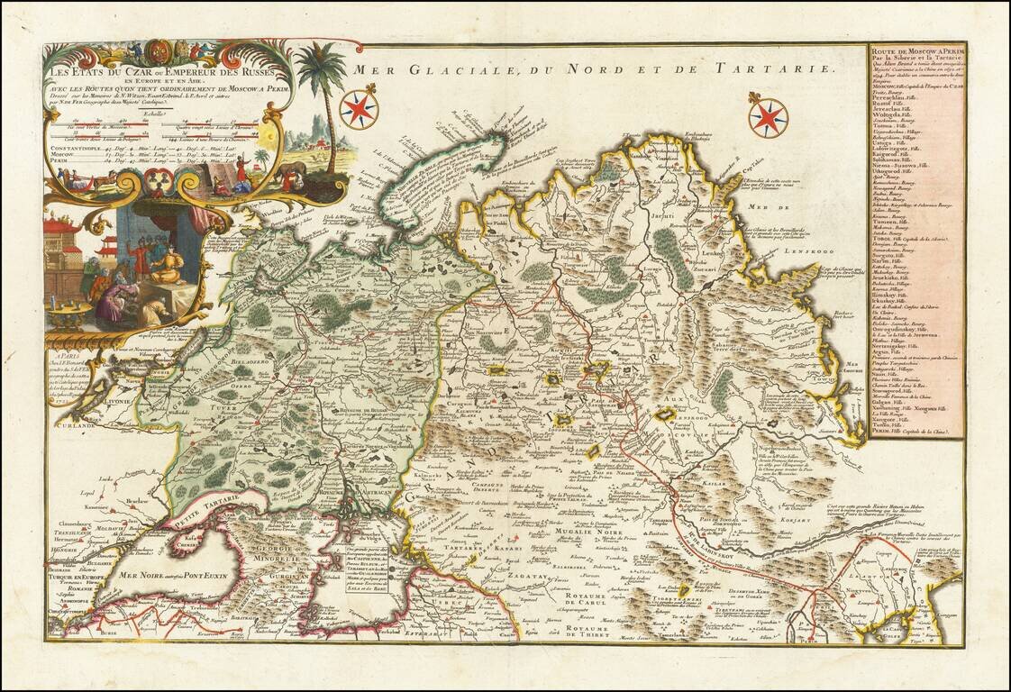
Rare large format map of Imperial Russia, extending from the Baltic and the Black Sea to China, prepared by Nicolas De Fer. De Fer's map is based upon the reports of Nicholas Witsen, Evart Esbrand (Evert Ysbrandzoon Ides) and Philippe Avril. Adam...
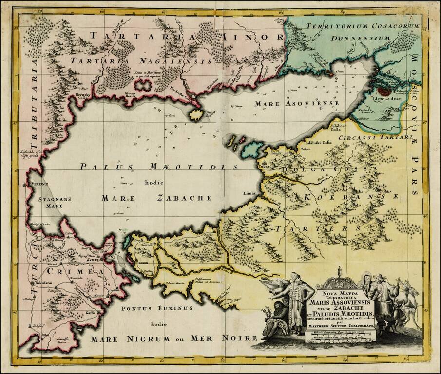
Striking map of the Sea of Azov and the surrounding regions, with a decorative allegorical cartouche, showing the costumes of the indigenous people of the region.
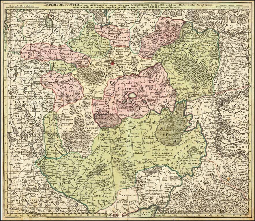
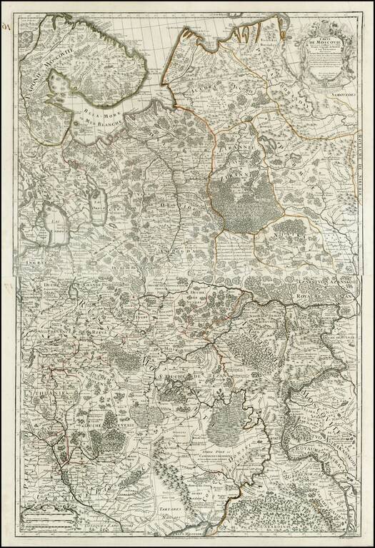
Centered on Moscow Detailed map of Southern Russia, including the Ukraine, Cosack Regions and the Southern part of Moscovie. Includes towns, roads, rivers, lakes, mountains, castles, forests and other details.
![[Book with map] Nova Descriptio Geographica Tattariae Magnae tam orientalis (with Das Nord =und Ostliche Theil von Europa und Asia . . . )](/map/small/68134.jpg)
First Edition of Strahlenberg's Seminal Work on Russia, bound with an English Edition of the Map Nice example of the London edition of Strahlenberg's map of Russia, one of the most important maps of Russia published in the 18th century, bound with the...
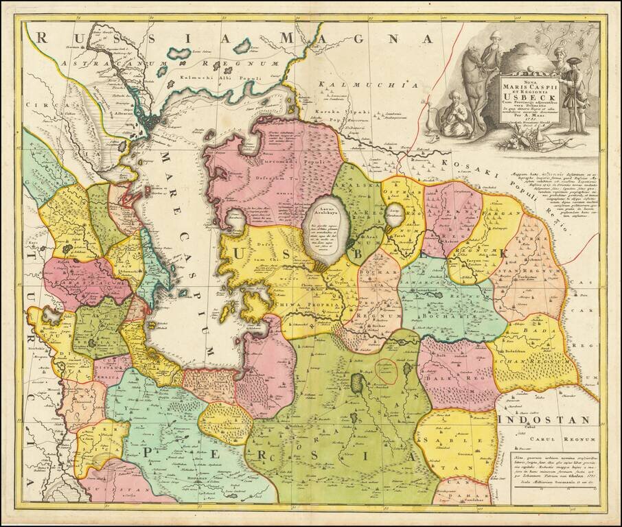
Antique Map of Usbekistan, Kazakhstan, Azerbaijan, Northern Iran, Turkmenistan and the Caspian Sea Region - The First Map to Name Usbekistan in the Title Decorative and detailed map of Usbekistan, Kazakhstan, Azerbaijan, Northern Iran, Turkmenistan...
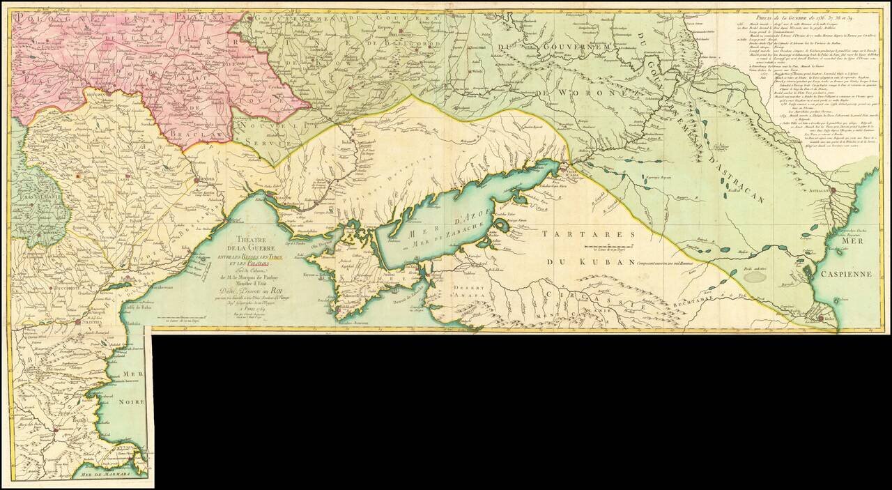
Rare Russian-Austrian Turkish War Map Fine map of the Theater of war in the south part of Ukraine and the contiguous coatlines of the Black Sea. According to an article in Neue Zeitungen von gelehrten Sachen auf das Jahr ...., Volume 33 (1738) at...
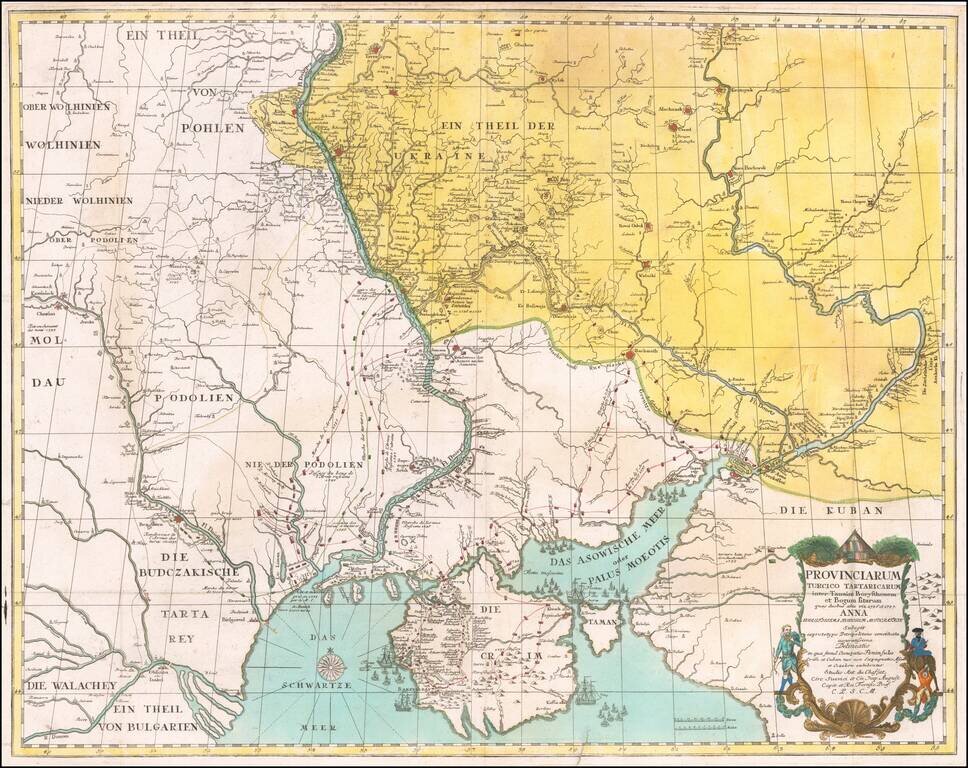
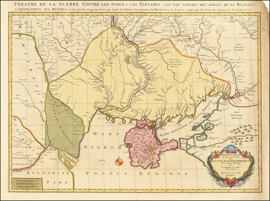
Fine Old Color Example Rare map of part of the Ukraine and the Black Sea region, showing the route of the Russian Army in its expedition against the Tartars in 1736 and 1737. Includes sailing ships, cartouche, compass rose and detailed movements of...
Fine old color example of this rare map depicting the theater of the Russo-Turkish War in the Ukraine in 1737. The map provides excellent detail of the fortifications including the Ukrainian line - a system of defenses from the Dnipro to the Donetz...
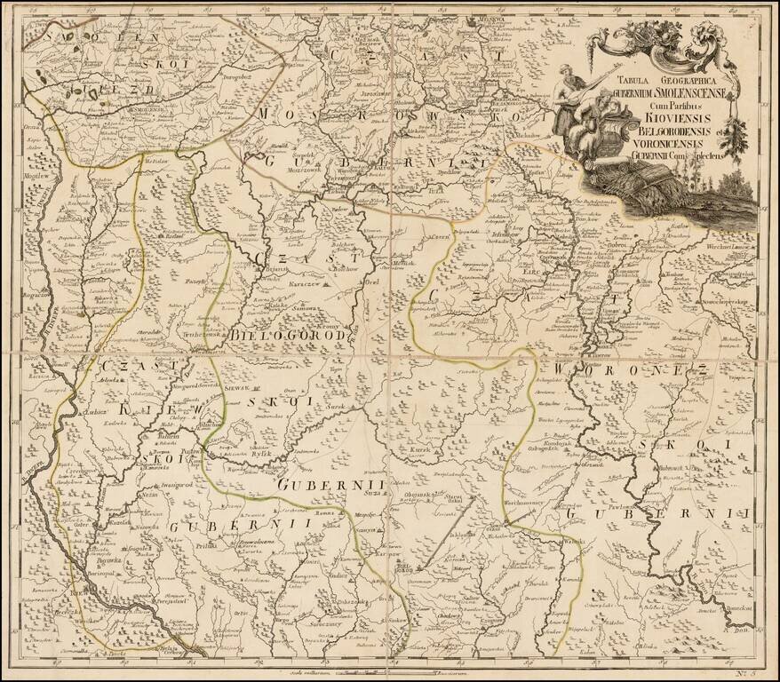
Fine separately issued example of JN De L'Isle's map extending from Moscow to the Ukraine, from the Atlas Russicus (Atlas Rossiiskoi). The first atlas of Russia, published by the Academy of Sciences in St. Petersburg, expanding on the cartographic...
Fine old color example of this rare map illustrating the Theater of Russo-Turkish War (1768-1774). The map emphasizes the territories located on the north and west coasts of the Sea of Azov and the Black Sea and Crimea, namely Bulgaria, Romania,...
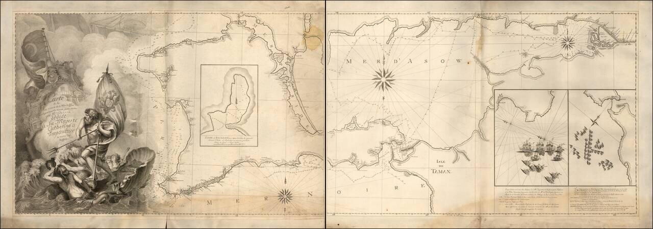
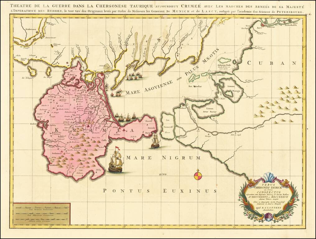
Imposing French Sea Chart of the Crimea Commemorating the Decisive Russian Victory over the Ottoman Empire. Two-sheet, separately issued engraved sea chart of Crimea, featuring insets of two naval battles during the Russo-Turkish War (1768-1774)....
Detailed map of Russia and Ukraine, based upon an earlier map by Guillaume De L'Isle.
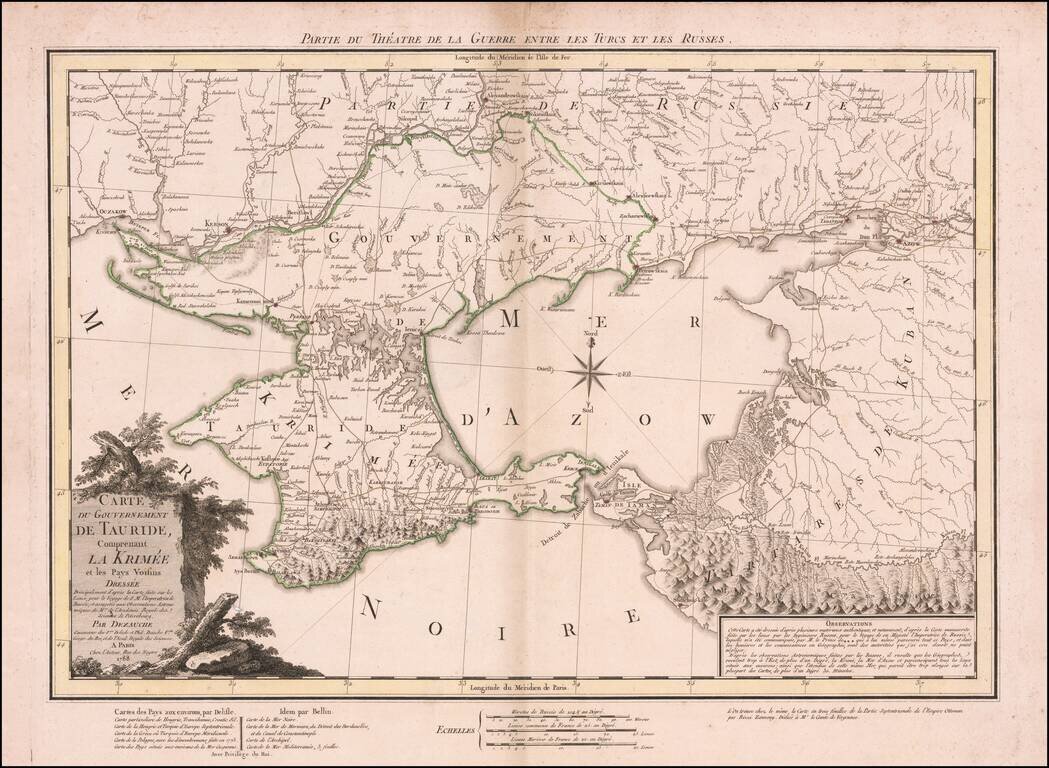
Dezauche's map illustrates the theater of the Russo-Turkish War that began in 1787, one year before the publication of the map. At the end of the previous Russo-Turkish War, Russia had annexed the Crimean Khanate, but the Ottomans sought to regain the...