
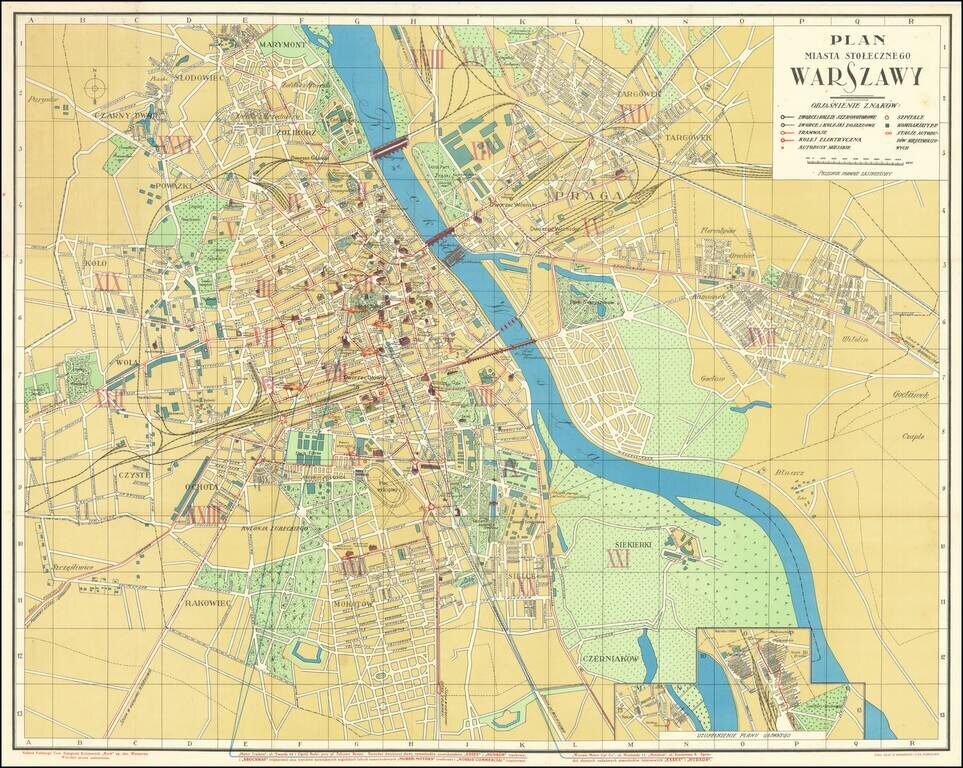
Wonderful Interwar Map of Warsaw. Detailed color-lithographed map of Warsaw issued by the famous Polish publisher and train station kiosk operator, RUCH. The map has an inset at the bottom showing a railway station. The map marks the main parts of...
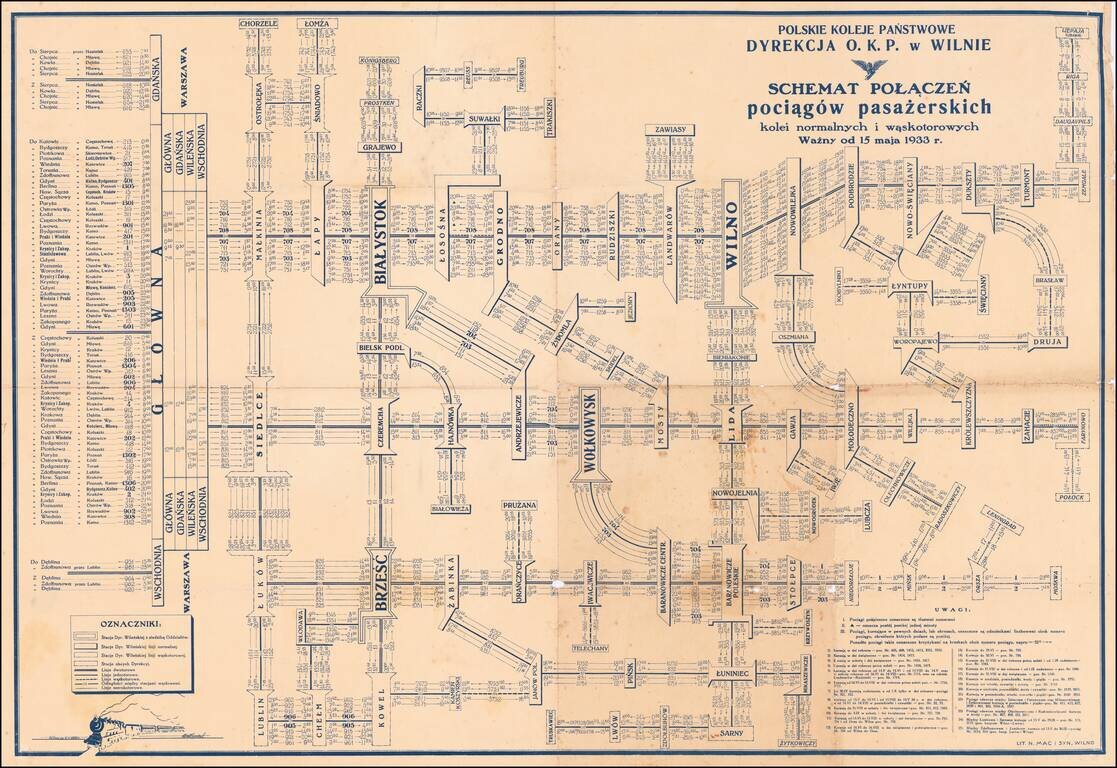
Detailed schematic map of the passenger train routes on normal and narrow gauge rail lines, centered on Vilnius and Bialystok. The title translates as: Polish State Railways Directorate P.K.P. Vilnius village - Diagram Connection of passenger trains...
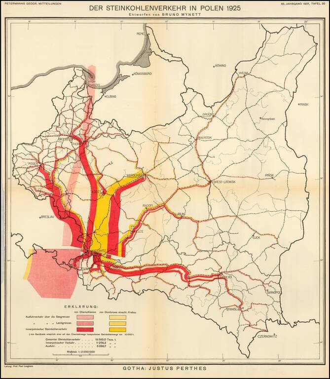
Thematic map of Poland, showing the Coal Industry in 1925, based upon the work of Bruno Mynett, Der Steinkohlenverkehr innerhalb Polens. The map was published by Augustus Petermann in 1937, based upon Bruno Mynett's book
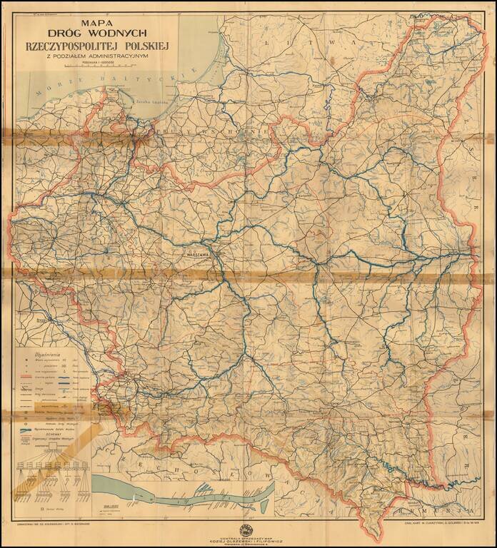
Detailed map of the waterways of Poland, focusing on both water routes and railroads (single, double and narrow gage) throughout country. The inset map shows the Vistula River route with marinas, sailing clubs and bridges.
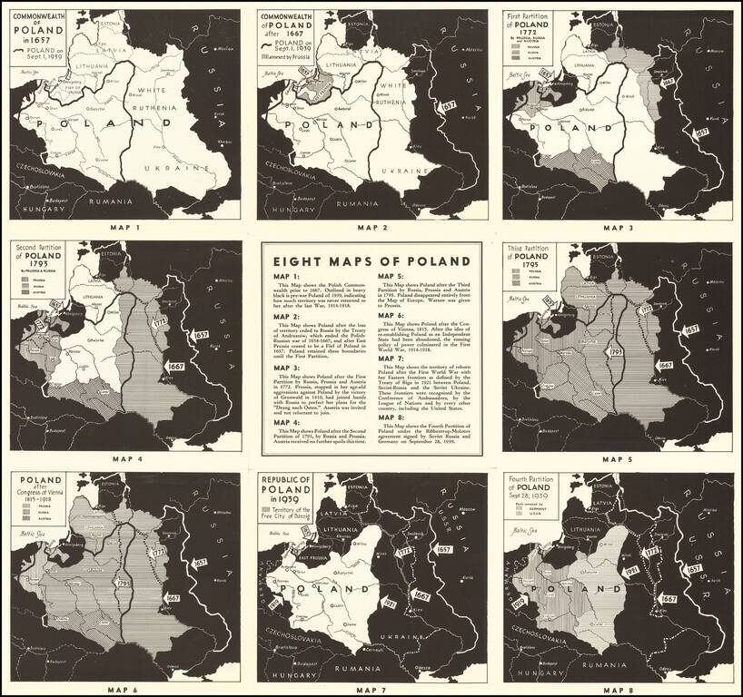
Polish Propaganda During World War II Interesting set of maps of Poland, illustrating the changing boundaries of Poland from 1657 through 1939, with a short explanation explaining each of the maps. On the verso, a set of 7 images of major Polish...