
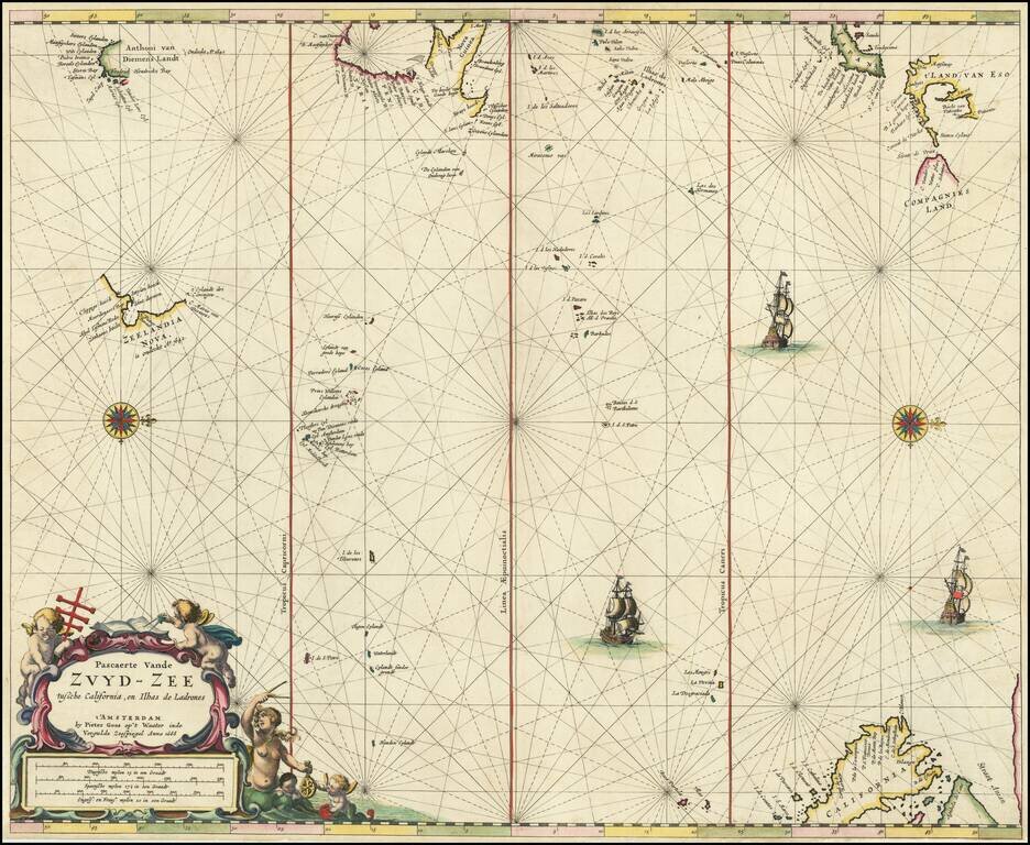
Rare Dutch Sea Chart of the Pacific Fine old color example of Pieter Goos' sea chart of the Pacific Ocean, extending from Australia, New Zealand and Japan to California. Oriented with west at the top, Goos's chart is among the earliest regional maps...
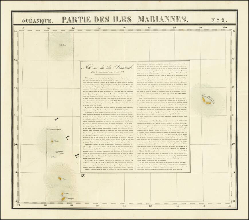
Interesting antique hand-colored lithographed map of the Marshall Islands, with a detailed description of Hawaii ("Note sur les iles Sandwich"). The map shows two "Iles Marshall" and speculates that they are probably the Jardine islands. The islands...

The Return of the First Fleet -- Fundamental Map for Australian Collectors A highly important map in the history of settling Australia, with the present example including annotations in pencil noting a ship wreck and other details. The track of the...
![(Second World War - Okinawa) [Large Battlefield Composite Map of Okinawa]](/map/small/63896.jpg)
6.5-Foot-Tall Battle-Used Map of Okinawa. Impressive battlefield composite map of Okinawa, composed of numerous sections of SECRET Army Map Service sheets cut and pasted together to form one large image. The map covers all of Okinawa, but for a small...
![(Second World War - Okinawa) [Battlefield Composite Map of Southern Okinawa]](/map/small/63897.jpg)
Battle-Used Map of Okinawa. Impressive battlefield composite map of Okinawa, composed of numerous sections of SECRET Army Map Service sheets cut and pasted together to form one large image. The map covers the southern most parts of Okinawa, including...
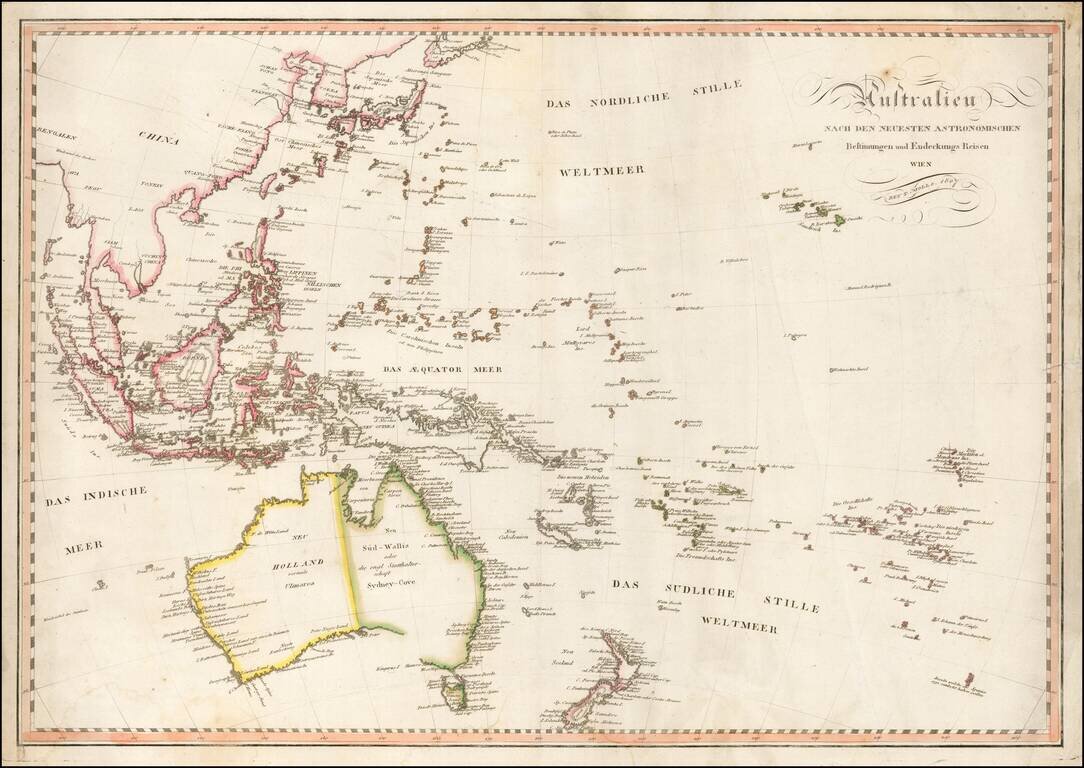
Fine early map of Oceana and Southeast Asia, published in Vienna by Tranquillo Mollo. Mollo's map includes a marvelous early depiction of Neu Holland vormals Ulimaroa. The coastline of Australia is still incomplete andther is no detail in the...
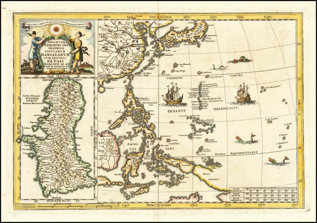
Fascinating map of the the Philippines, China, Japan and Korea, with a large inset of Guam, from Heinrich Scherer's monumental work. Includes a large inset of Guam. Heinrich Scherer (1628-1704) was a Professor of Hebrew, Mathematics and Ethics at the...
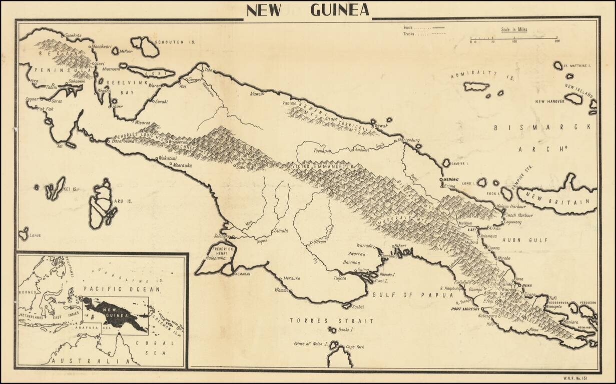
Anti-Nazi Propaganda Broadside of New Guinea Published in the British Empire Fascinating WWII broadside propaganda map illustrating the Theater of War during the New Guinea, published in India, in order to keep the local populous informed about the...
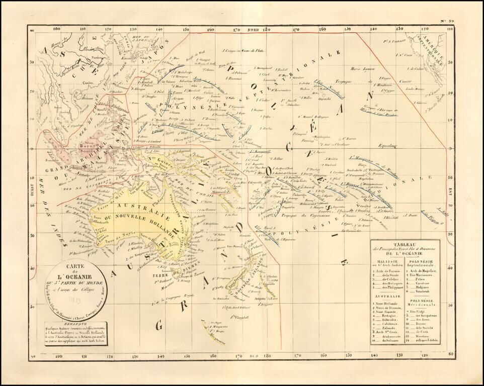
Rare large format map of Oceania and the Pacific which was apparently prepared for instructional purposes. An early example of lithography on French maps, perhaps the earliest we have ever seen. This is the first time we have offered this map.
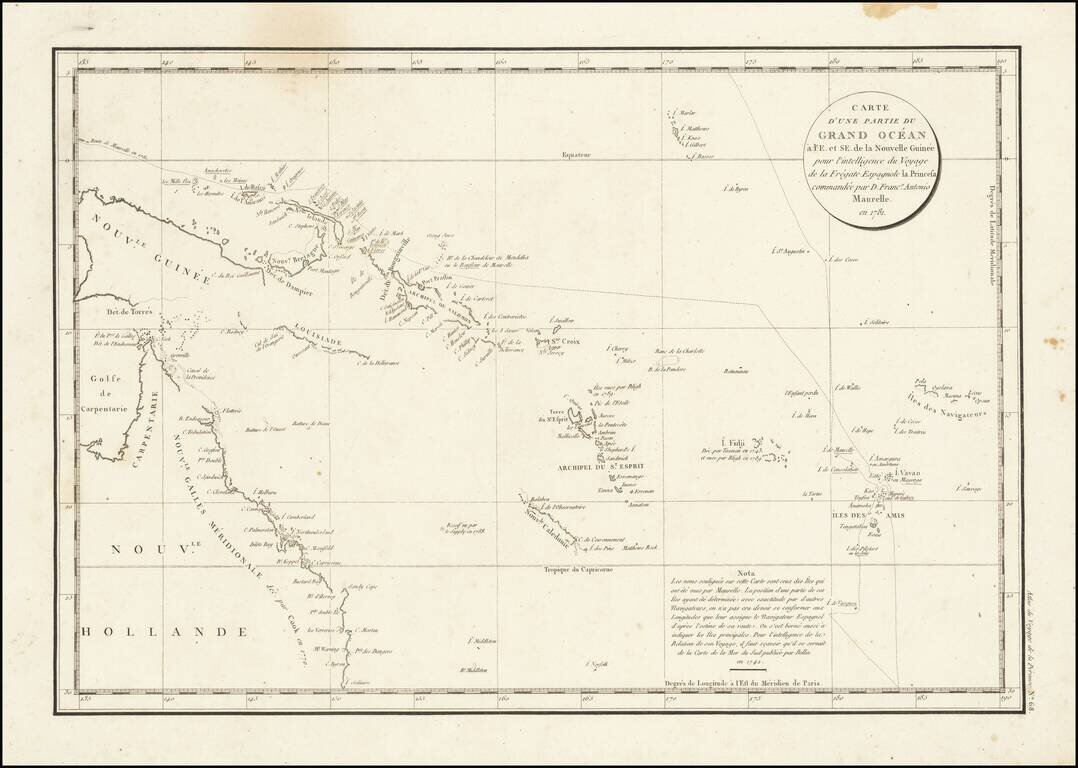
Interesting chart of Eastern Australia and part of the south-western Pacific, showing the routes taken by the Spanish explorer Don Francisco Antonio Maurelle in 1781 along the northern coast of New Guinea and across the Pacific to Fiji and Tonga,...
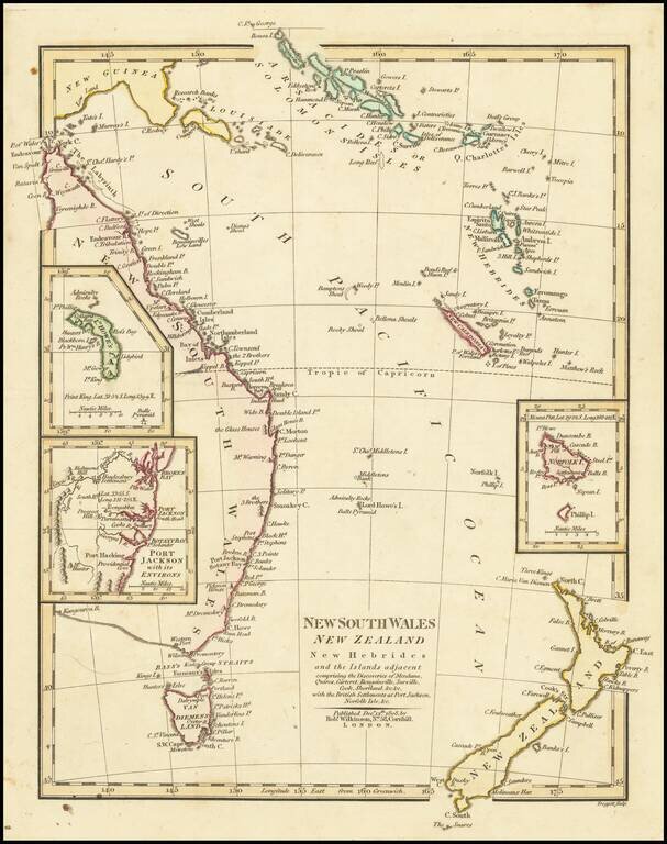
Interesting regional map of Eastern Australia and New Zealand, published by Robert Wilkinson. The map extends from the Solomon and Queen Charlotte Island in the North to New South Wales and New Zealand. Includes large insets of L. Howes and Norfolk...
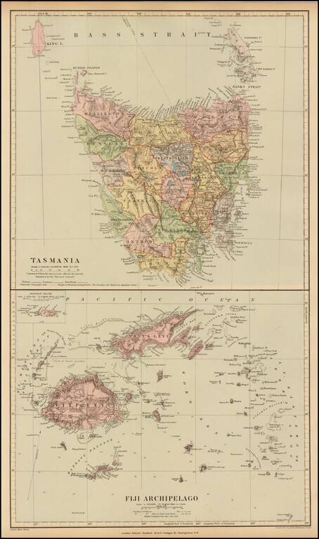
Fine and highly detailed map of Fiji and Tasmania, from Stanford's London Atlas. The map is meticulously colored by counties and shows fine detail throughout.
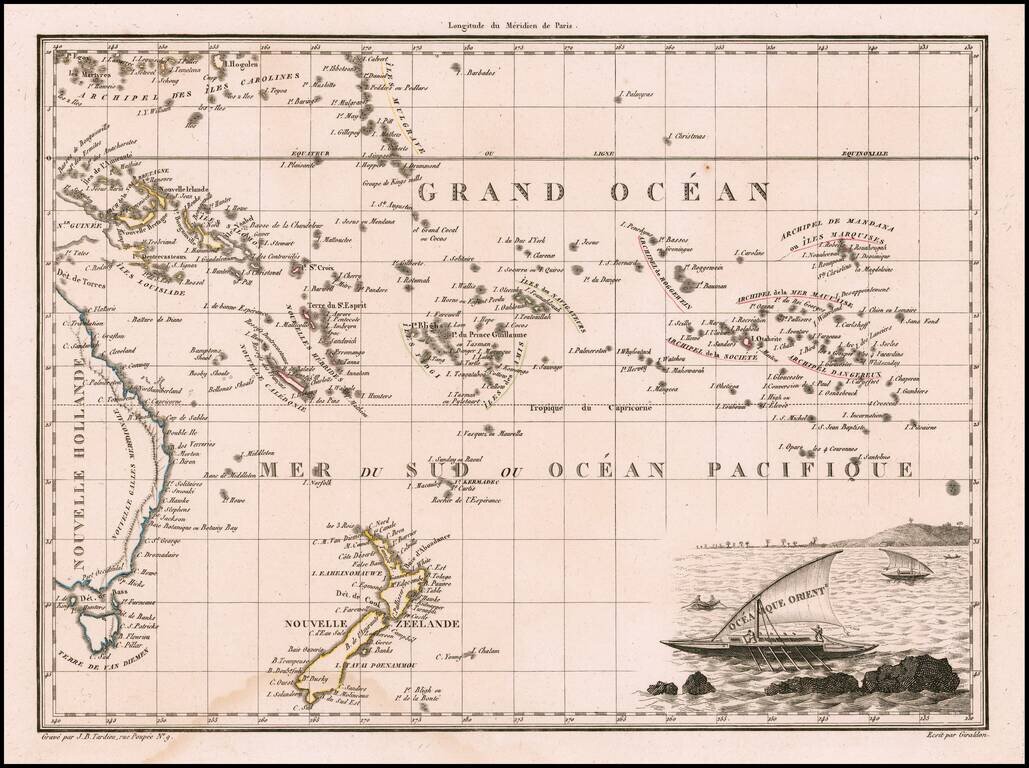
Decorative antique engraved map of the Eastern Pacific, from the Carolines, Eastern Australia, and Tasmania to the Marquesas, including all of New Zealand. Malte Brun's maps were extremely well researched, utilizing the most up to date information....
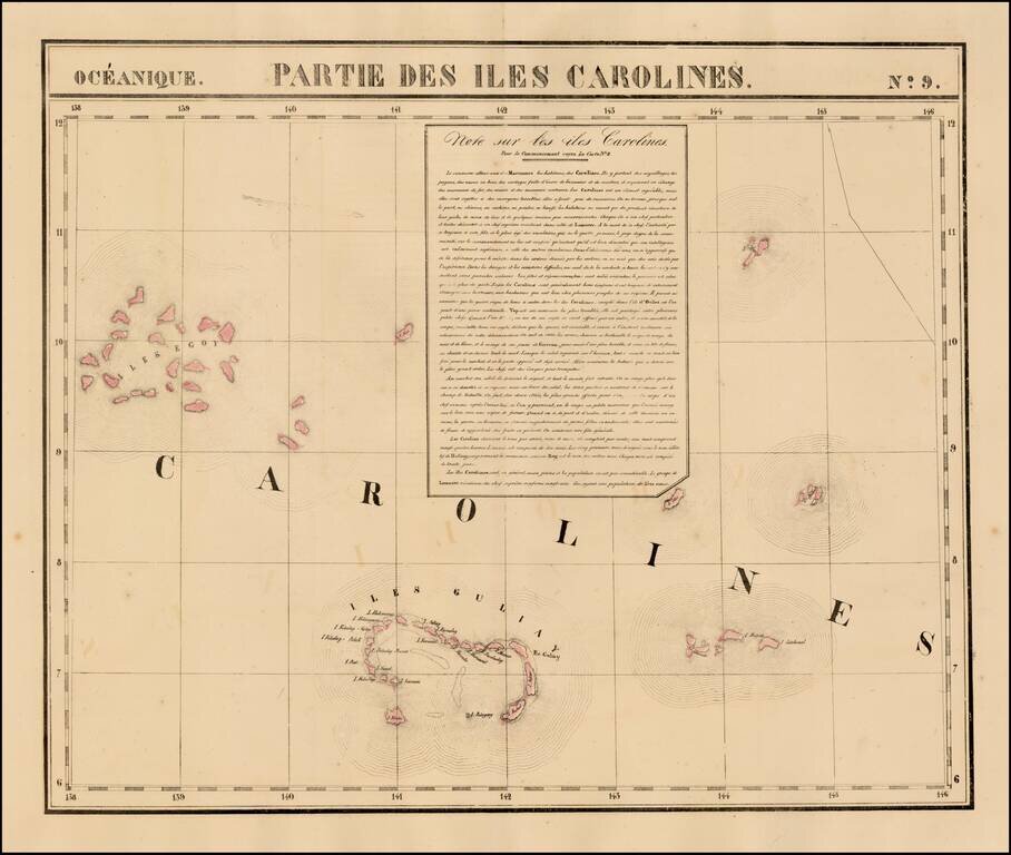
Highly detailed map of a portion of the Carolines, including Iles Guliay and Iles Egoy. Large text note included. Nice detail, especially for the period.
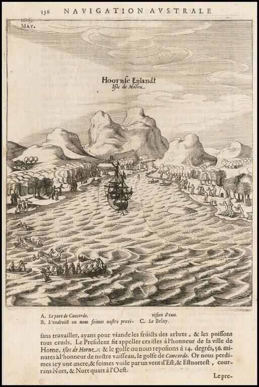
Scarce map of the bay and coast of the South Seas island of Futuna (Hoorn), from the voyage of Le Maire and Schouten. The bay shown was named after the ship Eendrachts (Unity Bay). Willem Cornelisz Schouten (1567-1625) was a navigator for the Dutch...
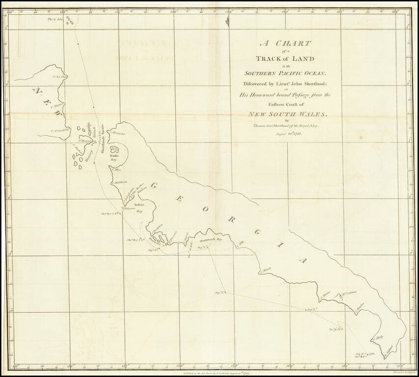
Detailed map of South Georgia, showing the tracks of Lieutenant John Shortland. John Shortland (1739–1803) entered the Royal Navy in 1755 as a midshipman and served under Admiral Boscawen off Newfoundland, under Admiral Byng off Minorca and under...