
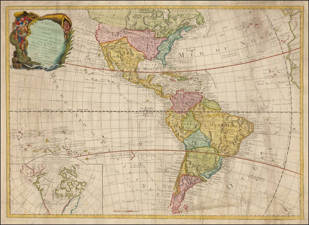
A fascinating early 19th Century reissue by the French firm of Chez Jean of the 1787 Clouet, revised to include the first voyage of Captain Cook. Gone is the Bay of the West, although the Northwest Coast still hints at some sort of inland sea. The...
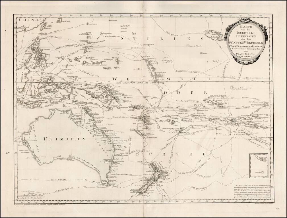
Detailed map of Oceania, published by Von Reilly in Vienna. The map provides the tracks of a number of early explorers, including Tasman, Cook, Surville, Marshall, Schoten, Quiros, Mendana, Bougainville, Magellan, Mulgrave, Byron, Roggeveen and...
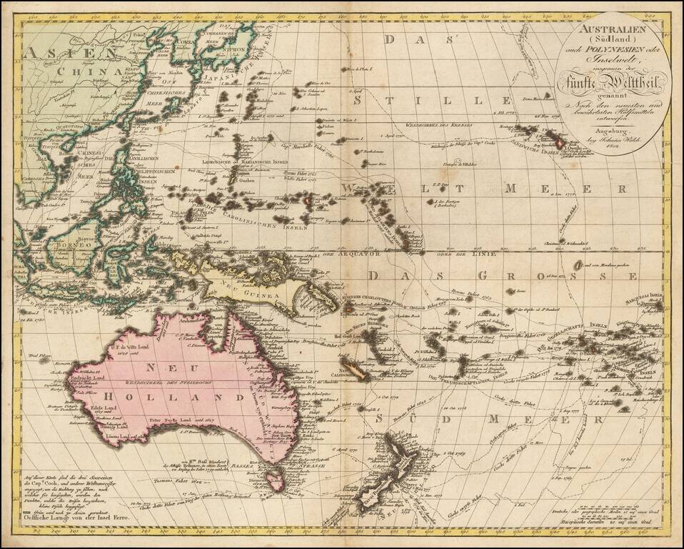
Exquisitely-Detailed Map of Australasia and the South Pacific -- Sea of Korea Fine example of Walch's map of the Western Pacific and Southeast Asia, first published in Augsburg in 1802. It celebrates the routes and encounters of the recent European...

Rare Separately Issued Example of the Entrecasteaux-eautemps-Beaupre Chart of Australia, New Zealand, etc. Remarkable sea chart of Australia, New Zealand and contiguous regions, extending to Borneo, Mindanao and the Straits of Malacca. Unlike most...
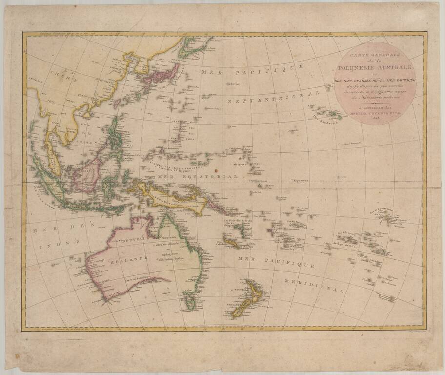
Scarce chart of the Western Pacific Ocean, published by Mortier, Covens & Fils. The map is based on Johann Matthias Christoph Reinecke's 1801 map of the region, which was the first German map to depict Tasmania as a separate island. The Mortier...
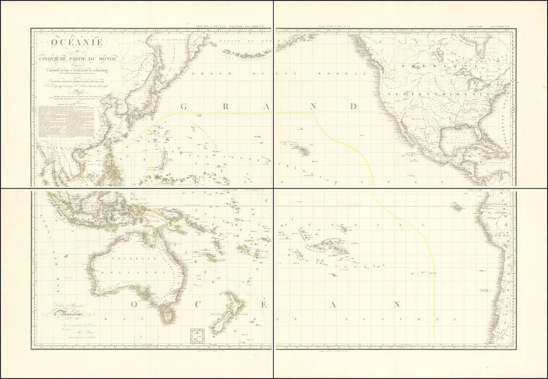
Stunning, Large-Format Map of the Pacific, the Origin of the Toponym Oceania Fine example of A.H. Brué's four-sheet map of the Pacific Ocean, first published in Paris in 1814 and here updated to 1817. The title in the upper left corner indicates...
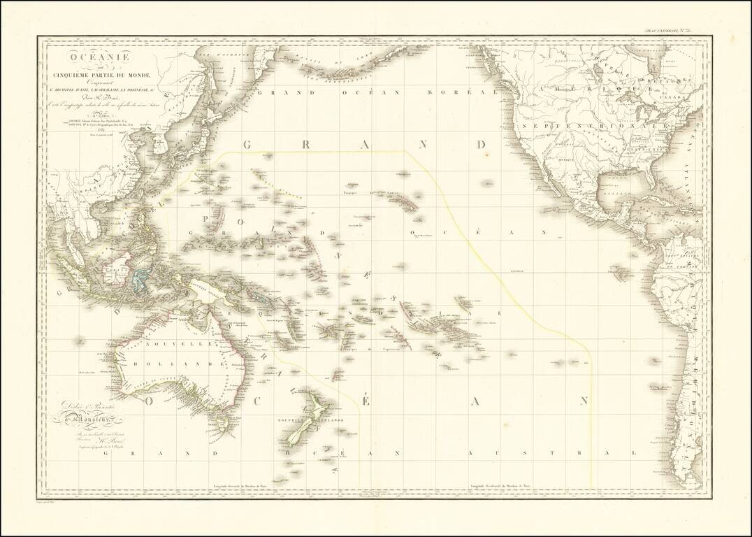
Striking Map of the Pacific, the Origin of the Toponym Oceania Fine example of A.H. Brué's distinctive map of the Pacific Ocean, first published in Paris in 1814 and here updated to 1816. The title in the upper left corner indicates that this map...
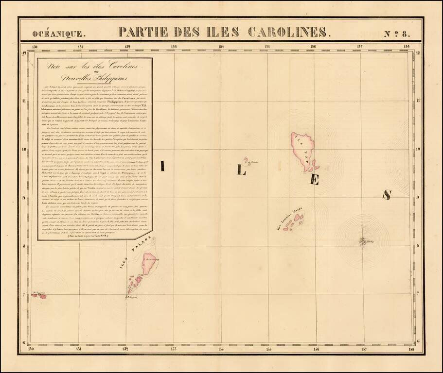
Highly detailed map showing Yap, Palao and neighboring islands. A rare map to focus on this region. A nice example of this early and highly detailed regional map. From Vandermaelen's remarkable 6 volume atlas, which if combined as globe gores forms...
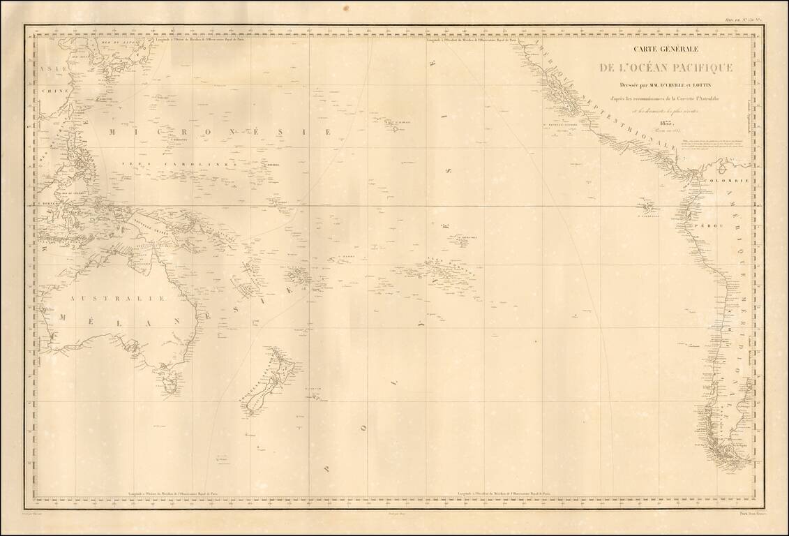
Fine separately published example of Dumont D'Urville's fine map of the Pacific, based upon his explorations. The map details the regions explored by the Astrolabe, under Dumont D'Urville's command. Rear Admiral Jules Sébastien César Dumont...
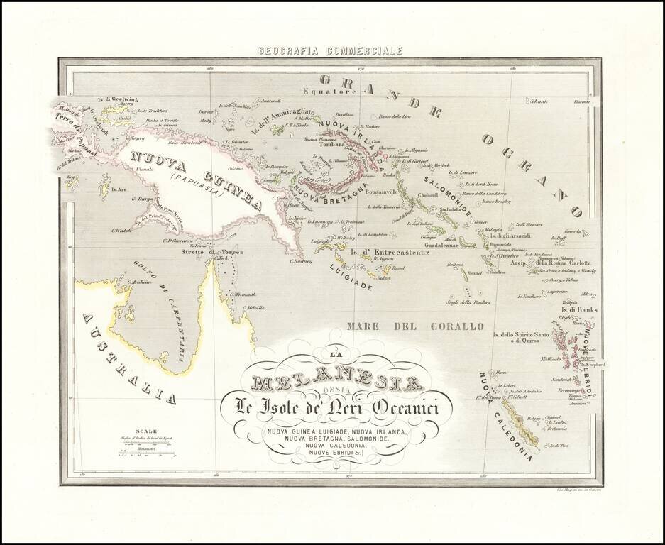
Rare map of New Guinea, the Solomon Islands, New Caledonia, the New Hebrides and the Gulf of Carpentaria, from Marmocchi's rare Geografia Commerciale.
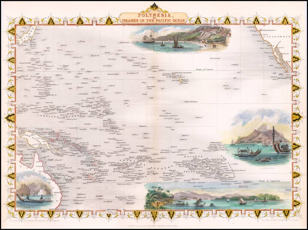
Nice full color example of John Tallis' map of the South Pacific. The map includes large vignettes of Kalakakooa Sandwich Islands, Otaheite, the Harbour of Dory in New Guinea and Resolution Bay, Marquesas. Engraved for R. Montgomery Martin's...
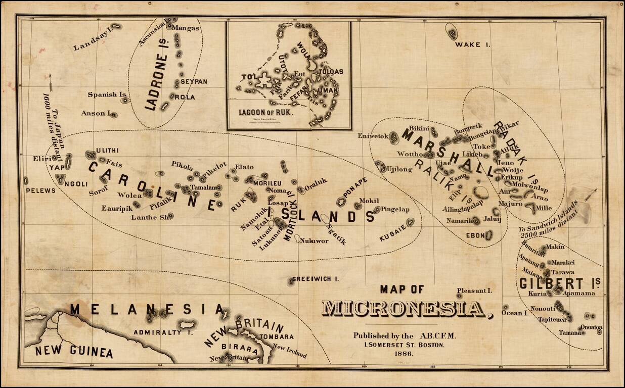
Rare map of Micronesia, published by the American Board of Commissioners for Foreign Missions in Boston. The American Board of Commissioners for Foreign Missions (ABCFM) was the first American Christian missionary organization. It was created in 1810...

Rare map showing the Catholic Missions on New Zealand, the Hawaiian Islands, Tahiti, Samoa, Tonga, New Caledonia, New Hebrides, Fijian Islands, the Marquesas, and a number of other islands, with a general map in the center, published as a Supplement to...
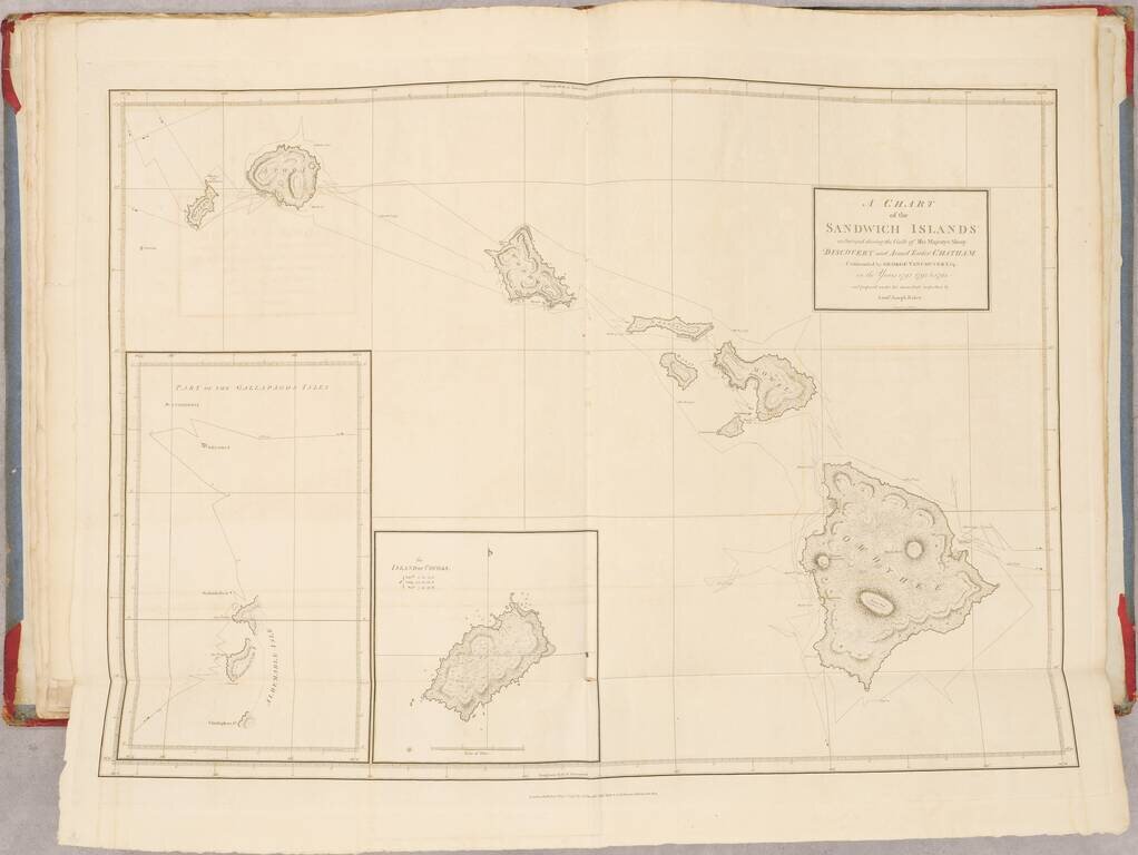
First Edition of Vancouver's Voyage of Discovery with Atlas, Containing Influential Charts of Hawai’i and the Pacific Northwest Fine, complete four-volume set of Vancouver’s A Voyage of Discovery to the North Pacific Ocean, and Round the World...
![[Straits of Le Maire, Nova Guinea, South Pacific]](/map/small/61345op.jpg)
The Earliest Printed Map of Le Maire's Voyage Around Cape Horn and Across The Pacific Nice example of Joris van Spilbergen's rendering of Willem Schouten and Jacob Le Maire's map / sea chart of a portion of his circumnavigation of the world, showing...

Fine example of Johannes Van Loons' sea chart of the Pacific Ocean, extending from Australia, New Zealand and Japan to California. Van Loon's chart is among the earliest regional maps to focus on the Dutch discoveries in New Zealand and Australia. Van...