Map size in jpg-format: 21.1486MiB
Click to open in high resolution (open in new tab).
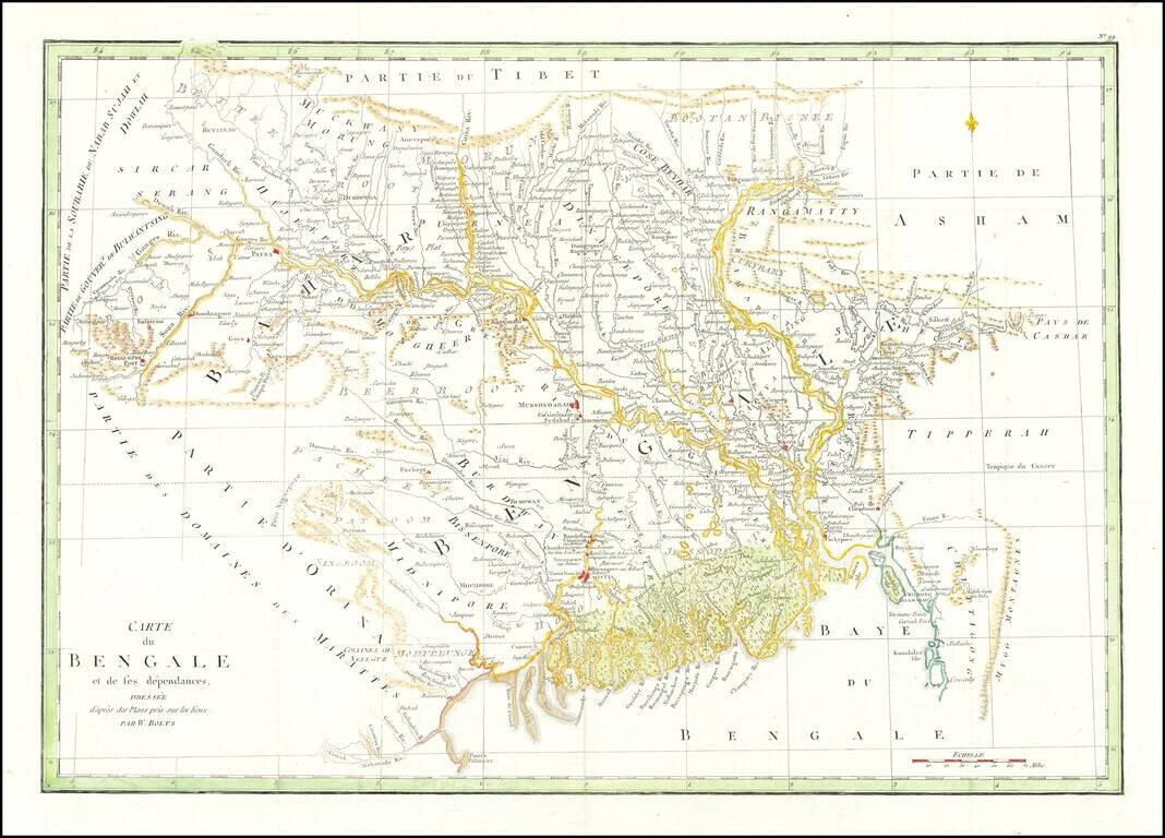
Striking map of Eastern India and Bangladesh, published in Paris.
Extends from the Calcutta region in the west to Bangladesh.
The map illustrates the work of William Bolts. William Bolts (1739-1808) was a Dutch-born eighteenth-century merchant active in India. He began his career as an employee of the British East India Company, and subsequently became an independent merchant. He is best known today for his 1772 book, Considerations on India Affairs, which detailed the exploitation and despoliation of Bengal by the East India Company which began shortly after the Battle of Plassey in 1757. The observations and experiences he recorded offer a unique resource for scholars inquiring into the nature of early British rule in Bengal. Throughout his life, Bolts continued to propose and execute various trading ventures on his own behalf and in conjunction with various commercial and governmental partners. The ventures of individual traders like Bolts did much to spur governments and large corporations into the expansion of their own interests and empires.
If you are a student, write to us in telegram: @antiquemaps and indicate what material you need and for what work you need a map in high detail. We are ready to provide material on special terms. For students only!

![Il Disegno Della Terza Parte Dell' Asia [Gastaldi's Wall Map of SE Asia with extra panels!]](/map/small/30554hbp.jpg)
