Map size in jpg-format: 4.69833MiB
Click to open in high resolution (open in new tab).
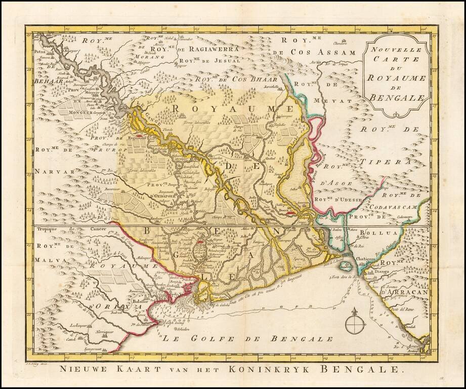
Detailed regional map of the Gulf of Bengal and the lower Ganges River. Marvelous detail.
Jakob van der Schley was a skilled draftsman and engraver who operated out of Amsterdam and had strong ties with the Hague. He was trained by Bernard Picart and his style resembles that of the elder man. Van der Schely was known for intricately engraved portraits and frontispieces. He signed most of the plates used in the Hague edition of the Abbe Prevost's Histoire generale des voyages.
If you are a student, write to us in telegram: @antiquemaps and indicate what material you need and for what work you need a map in high detail. We are ready to provide material on special terms. For students only!

![Il Disegno Della Terza Parte Dell' Asia [Gastaldi's Wall Map of SE Asia with extra panels!]](/map/small/30554hbp.jpg)
