logo

1862. Algerie d'apres Les Cartes De L'Etat-Major et Les Documents Du Ministere de la Guerre

  • Algerie d'apres Les Cartes De L'Etat-Major et Les Documents Du Ministere de la Guerre

Algerie d'apres Les Cartes De L'Etat-Major et Les Documents Du Ministere de la Guerre information:

Year of creation: 
Resolution size (pixels): 
 7780x5296 px
Disk Size: 
 7.39576MiB
Number of pages: 
 1
Place: 
 Paris

Print information. Print size (Width x height in inches):
Printing at 72 dpi 
  108.06 х 73.56
Printing at 150 dpi 
 51.87 х 35.31
Printing at 300 dpi 
 25.93 х 17.65

An example of detailing the file of this map of in a printable high-resolution:

Click to open in high resolution (open in new tab).
Attention! this is just the central piece (central area 960x960 px) of the map file!
This is an example, so that you can see and study the level of detail of a given map. The entire Map will be fully available after payment!

Algerie d'apres Les Cartes De L'Etat-Major et Les Documents Du Ministere de la Guerre

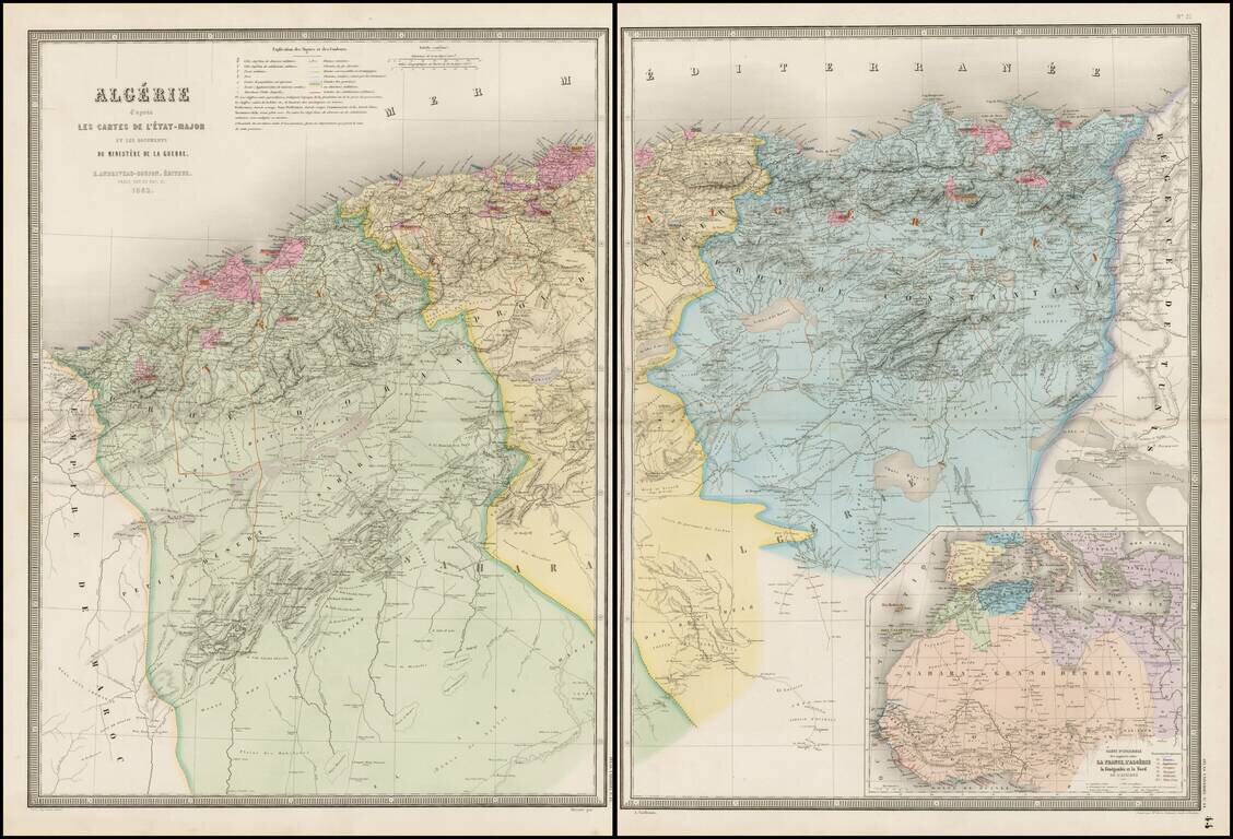
Stunning full color example of Andriveau-Goujon's 2-sheet map of Algeria.

Fantastically detailed map of Algeria, with towns, roads, rivers, mountains, lakes, etc.


Special conditions for students!

If you are a student, write to us in telegram: @antiquemaps and indicate what material you need and for what work you need a map in high detail. We are ready to provide material on special terms. For students only!

Item information:

Year of creation:
Size:
7780x5296 px
Disk:
7.39576MiB
Number of pages:
1
Place:
Paris
Author:
Eugène Andriveau-Goujon.
$14.99

Related item