The General Land Office (GLO) refers to the independent agency in the United States that was in charge of public domain lands. Created in 1812, it assumed the responsibilities for public domain lands from the United States Department of the Treasury. The Treasury had overseen the survey of the Northwest Territory, but as more area was added to the United States, a new agency was necessary to survey the new lands.
Eventually, the GLO would be responsible for the surveying, platting, and sale of the majority of the land west of the Mississippi, with the exception of Texas. When the Secretary of the Interior was created in 1849, the GLO was placed under its authority. Until the creation of the Forest Service in 1905, the GLO also managed forest lands that had been removed from public domain. In additional to managing the fees and sales of land, the GLO produced maps and plans of the areas and plots they surveyed. In 1946, the GLO merged with the United States Grazing Service to become the Bureau of Land Management.
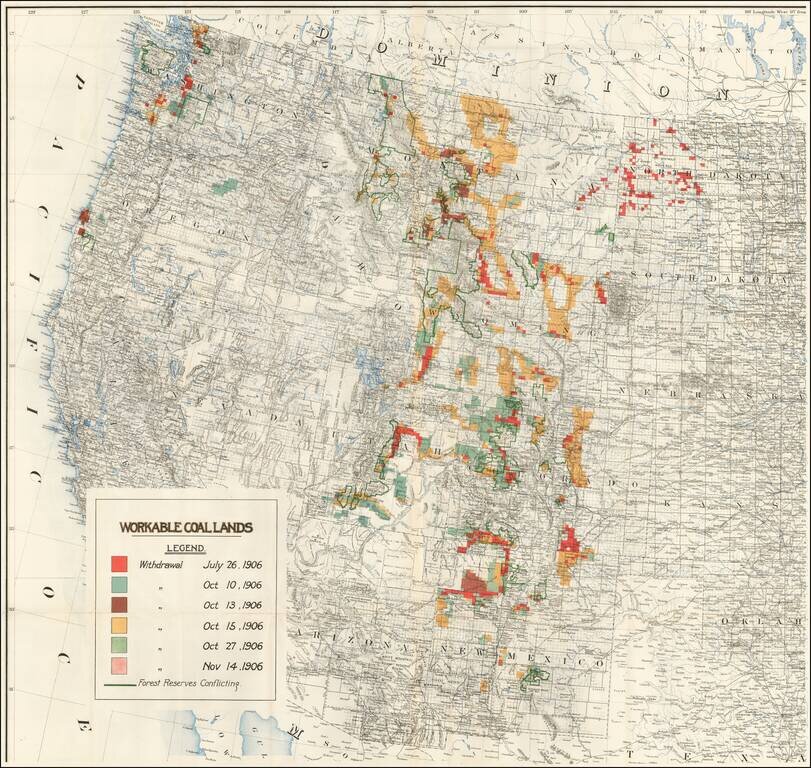
Rare separately published map of the Western United States focusing on coal production. While the map at first appears to be 1 sheet of a larger map, our research suggests that this map is in fact a re-use of the western sheet of a US Government...
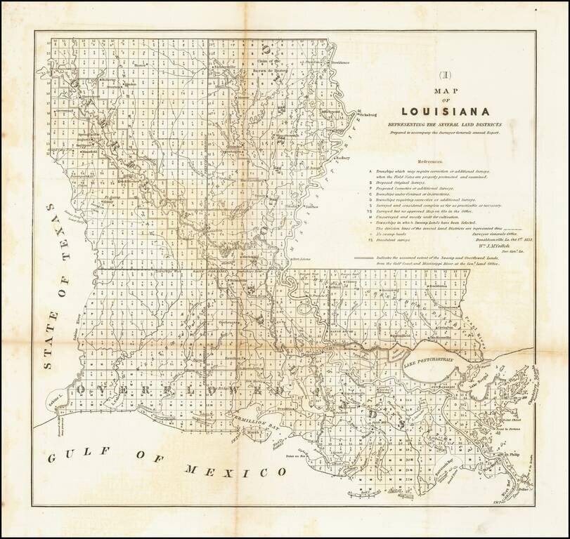
Early General Land Office Survey of Louisiana, prepared by the General Land Office. Includes a list of surveys and other sources, including a category (FS) for Fraudulent Surveys.
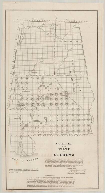
Detailed map of Alabama, illustrating the progress of the General Land Office Surveys as of October 10, 1844. Based upon a report signed in Florence, Alabama, on October 10, 1844, this map details both the progress on the surveys to date and those...
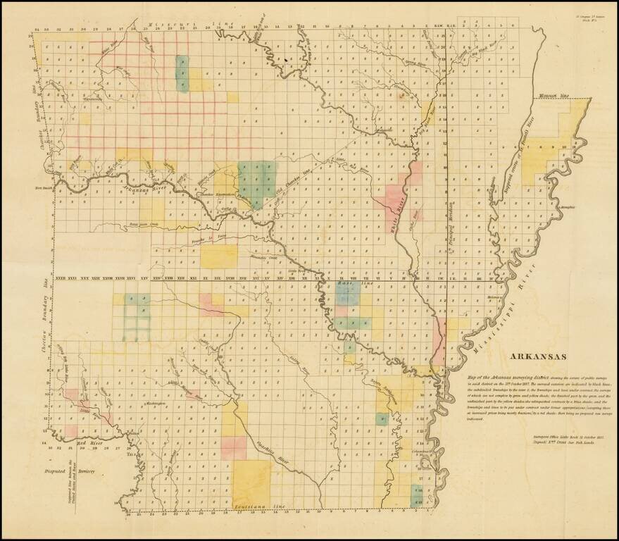
Early General Land Office Survey map of Arkansas, published in 1837. The map shows the extent of the public surveys in Arkansas with the following symbols. The various symbols and surveys reflect completed surveys, surveys contracted but not yet...
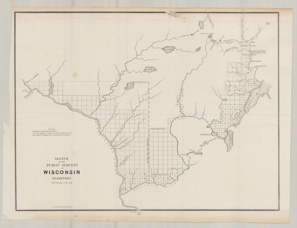
Fine example of one of the earliest obtainable maps focused on Wisconsin Territory. The map extends west to the Falls of St. Anthony and Fort Snelling, and north to the Headwaters of the Montreal Reiver, Ontonagon River and the area north of Green...
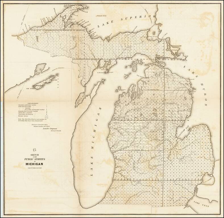
Lithographed map of the progress of the government surveys in Michigan up to 1853. The map has the statement of authority of Leander Chapman, Surveyor General of the Detroit Office, October 28th 1853. This state of the map includes the inset of Isle...
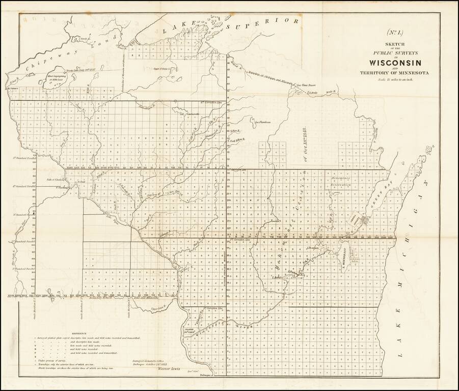
Antique map of Wisconsin and part of Minnesota Territory, produced by Warner Lewis, Surveyor General of the Dubuque Office, on October 21, 1853. The map shows the plats which had been surveyed and those which were in the process of being surveyed....
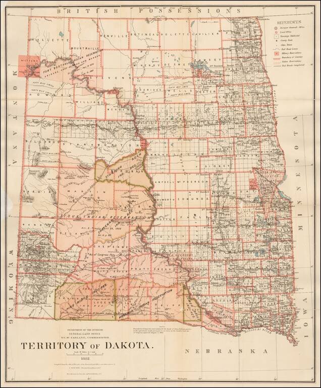
Detailed map of Dakota Territory, prepared by the General Land Office. The present example would appear to be a special issue, with the Standing Rock Indian Reservation, Pine Ridge Indian Reservation and the Lower Brule Indian Reservation highlighted...
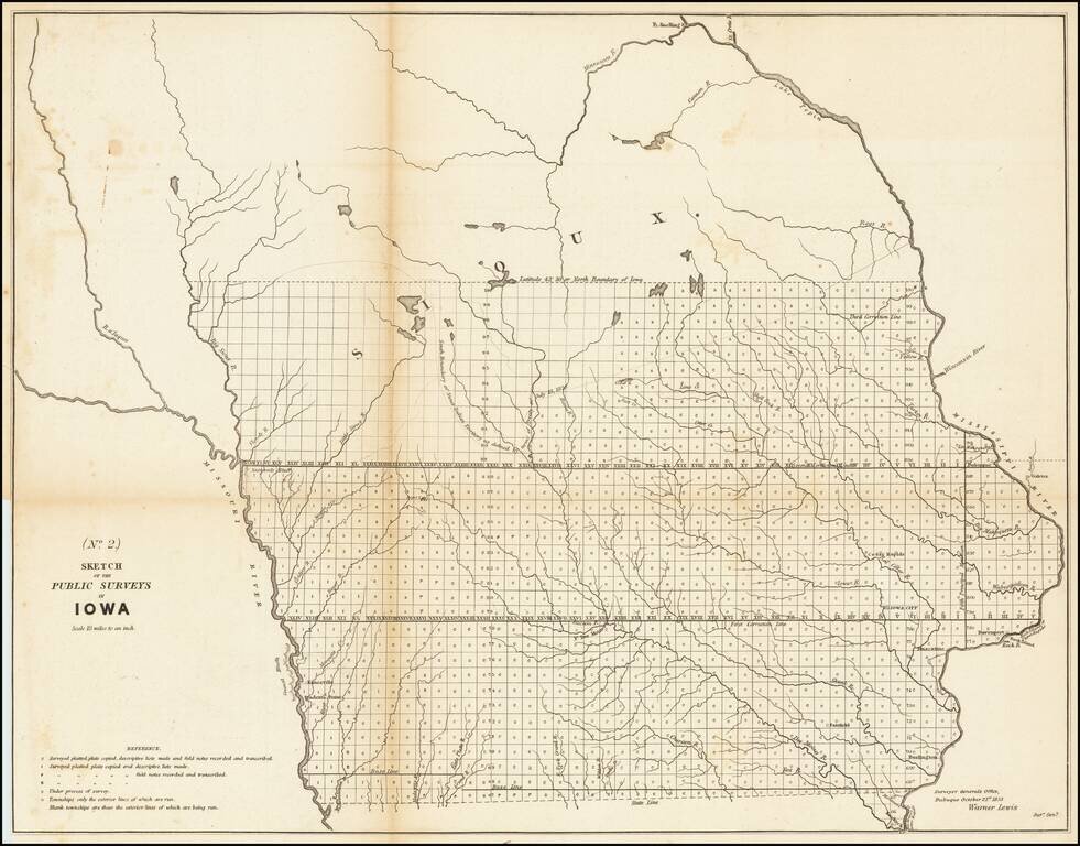
Nice example of the 1853 public survey map of Iowa prepared by Warner Lewis, Surveyor General of Iowa. The map shows the progress of township and baseline surveys in Iowa. The northern part of the state is still largely unsurveyed, as is a section...
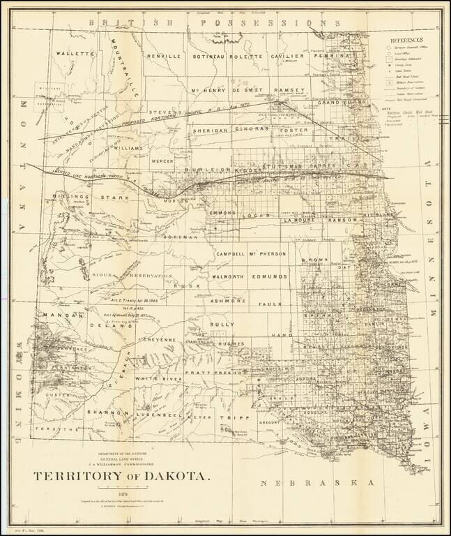
Detailed map of Dakota Territory, prepared by the General Land Office. The map shows early evidence of the township surveys in the west. The dates and details of the creation of a number of Indian Reservations are shown, including: Arikares,...
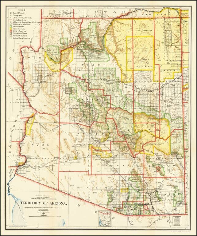
Fine Arizona Territorial Map One of the best and most highly detailed map of Arizona Territory of the period. The map was produced by the Dept. of the Interior, under the Supervision of Harry King. This edition is revised and reconstructed by R.H....
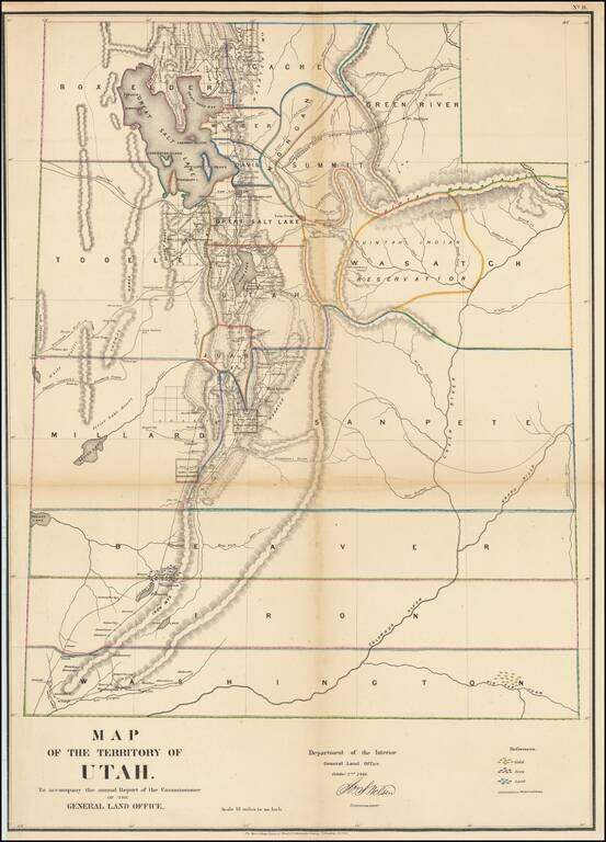
Important early map of Utah engraved by Major & Knapp for the General Land Office. This is perhaps the most detailed and accurate of all early Utah maps. The extent of the township surveys are noted. Gold, Iron & Lead mines are noted. Very...
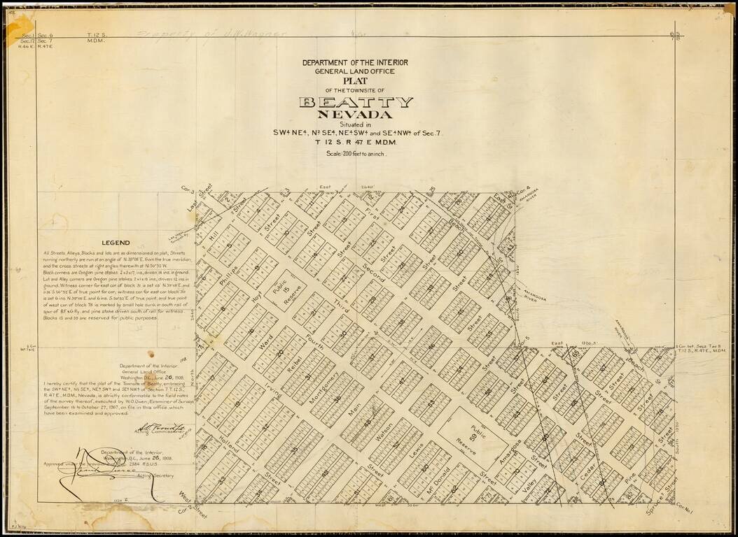
Detailed plan of Beatty, Nevada, one of the primary Nevada mining boom towns in the first part of the 20th Century, published by General Land Office. The present map is one of the earliest obtainable maps of the City, which had been laid out only a...
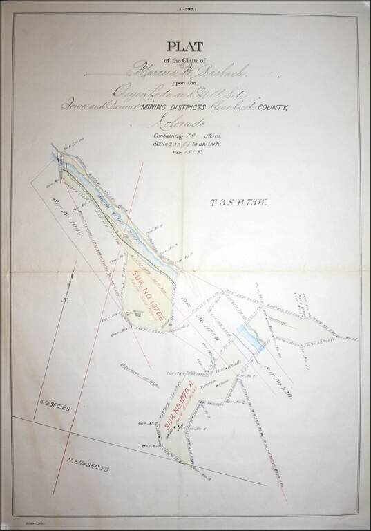
Fascininating Clear Creek County, Colorado Plat Map and GLO Mineral Certificate, confirming the mining claim of Marcus W. Rasbach to mining rights first claimed on June 30, 1881. A fine example of a General Land Office Mineral Certificate, consisting...
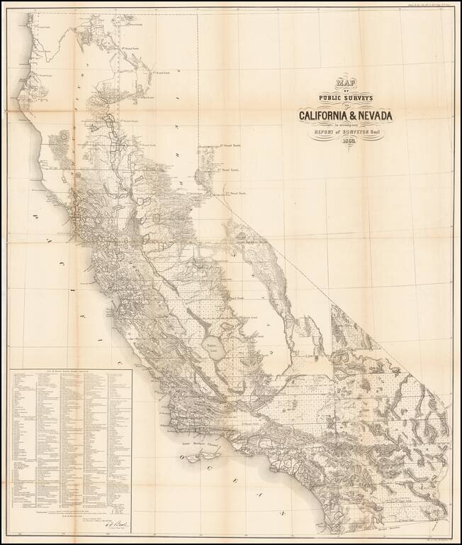
Remarkable large format map of California (along with some information in the Lake Tahoe area of Nevada), reporting the extent of the Land Office Surveys through 1863. The most notable feature is the list of 433 private land grants for which final...
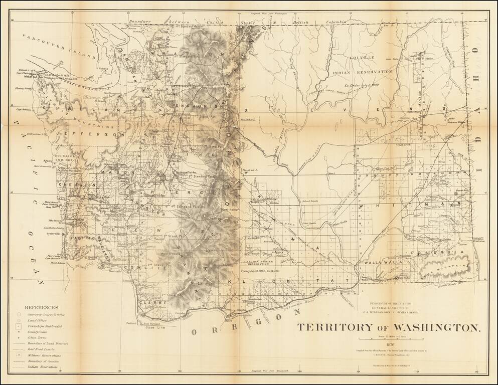
Fine, Detailed Map of the Washington Territory Large and intricate map of Washington Territory issued by the General Land Office under the direction of Principal Draughtsman Charles Roeser. It shows Washington just after it attained its present...