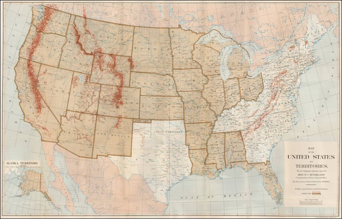
Large Map Illustrating the Public Land States and Territories Highly detailed map of the United States, issued to accompany the annual report of N.C. MacFarland, Commissioner, General Land Office for fiscal year which ended June 30, 1884. The map...
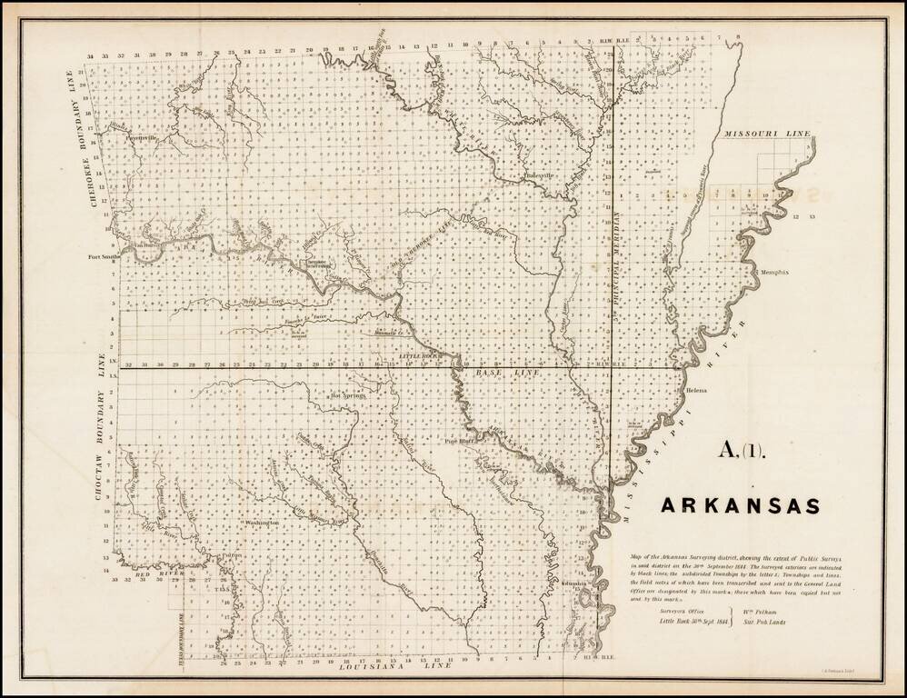
Interesting early survey map of Arkansas, showing the progress of the township survey work through 1844, along with a detailed explanation of the progress of the surveys through September 30, 1844, by William Pelham, the Surveyor General of Arkansas.
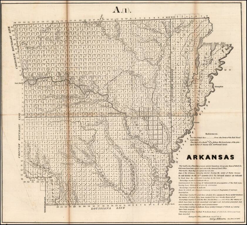
Interesting map of Arkansas, showing the progress of the township survey work through 1854, along with a detailed explanation of the progress of the surveys through October 1854, by George Milbourne, the Surveyor General of Arkansas.
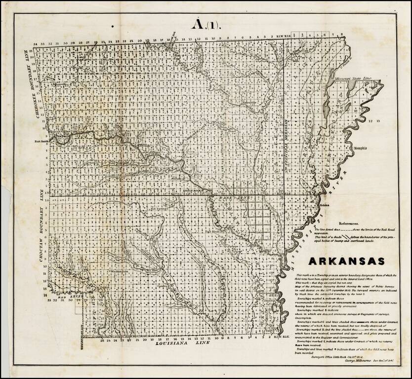
Interesting map of Arkansas, showing the progress of the township survey work through 1854, along with a detailed explanation of the progress of the surveys through October 1854, by George Milbourne, the Surveyor General of Arkansas.
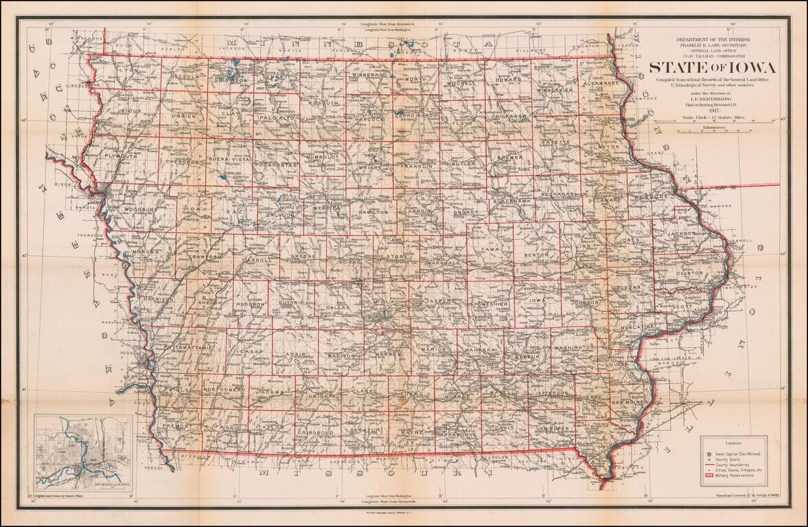
Highly detailed map of Iowa, published by the General Land Office. Shows county boundaries and railroad land-grant limits are shown in color. Also shows Private Claims, county names, public land surveys, towns, principal railroad stations, post...
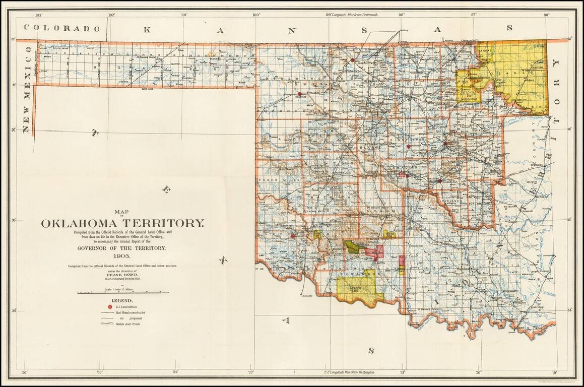
Rare Oklahoma Territory Map -- Pre-Dating Merger with Indian Territory. Rare map of Oklahoma Territory, issued by the Territorial Governor, during the brief period when Oklahoma and Indian Territory were separate Territories of the United States....
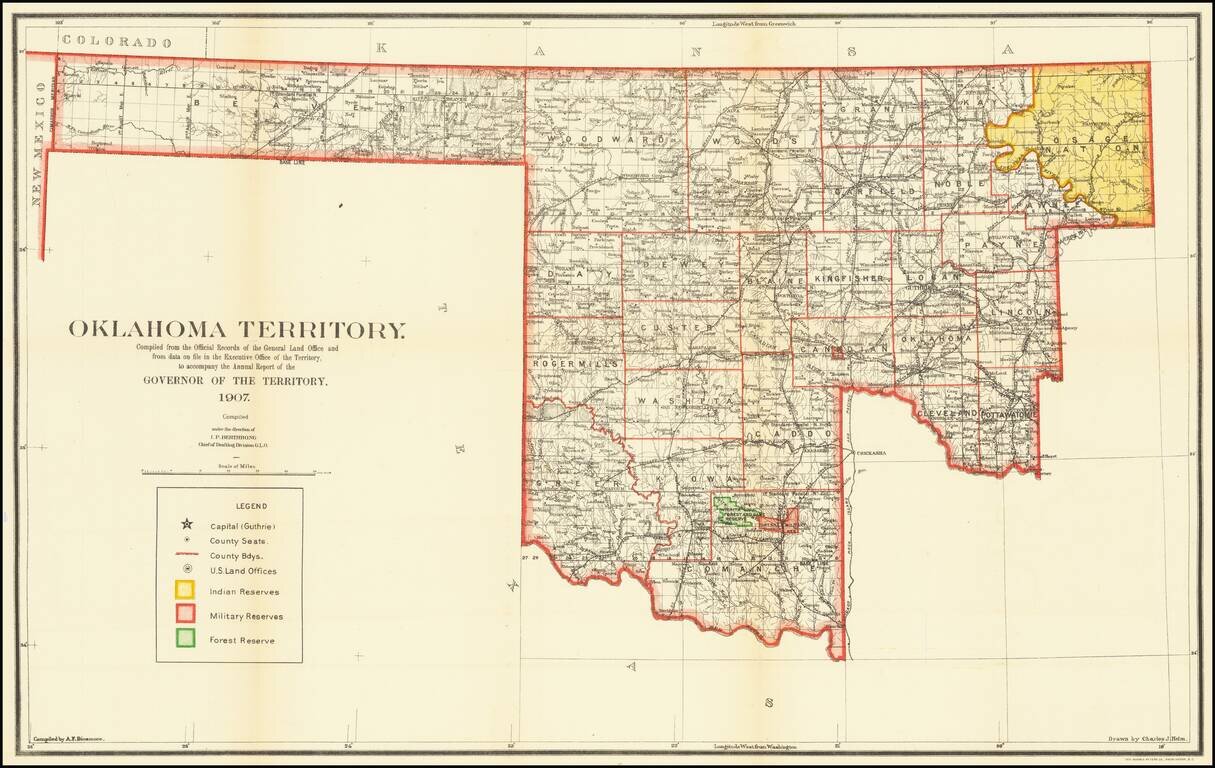
The Final Year of Oklahoma Territory Map -- Pre-Dating Merger with Indian Territory To Form The State of Oklahoma Rare map of Oklahoma Territory, issued by the Territorial Governor, during the brief period when Oklahoma and Indian Territory were...
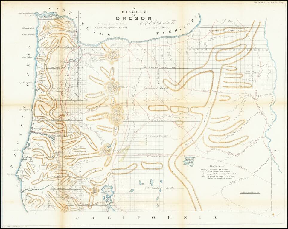
One of the earliest obtainable maps showing the progress of the public surveys in the State of Oregon. The map includes townships surveyed to 1863, towns, early roads, topographical details, Fort Boise, Mountains and other details.
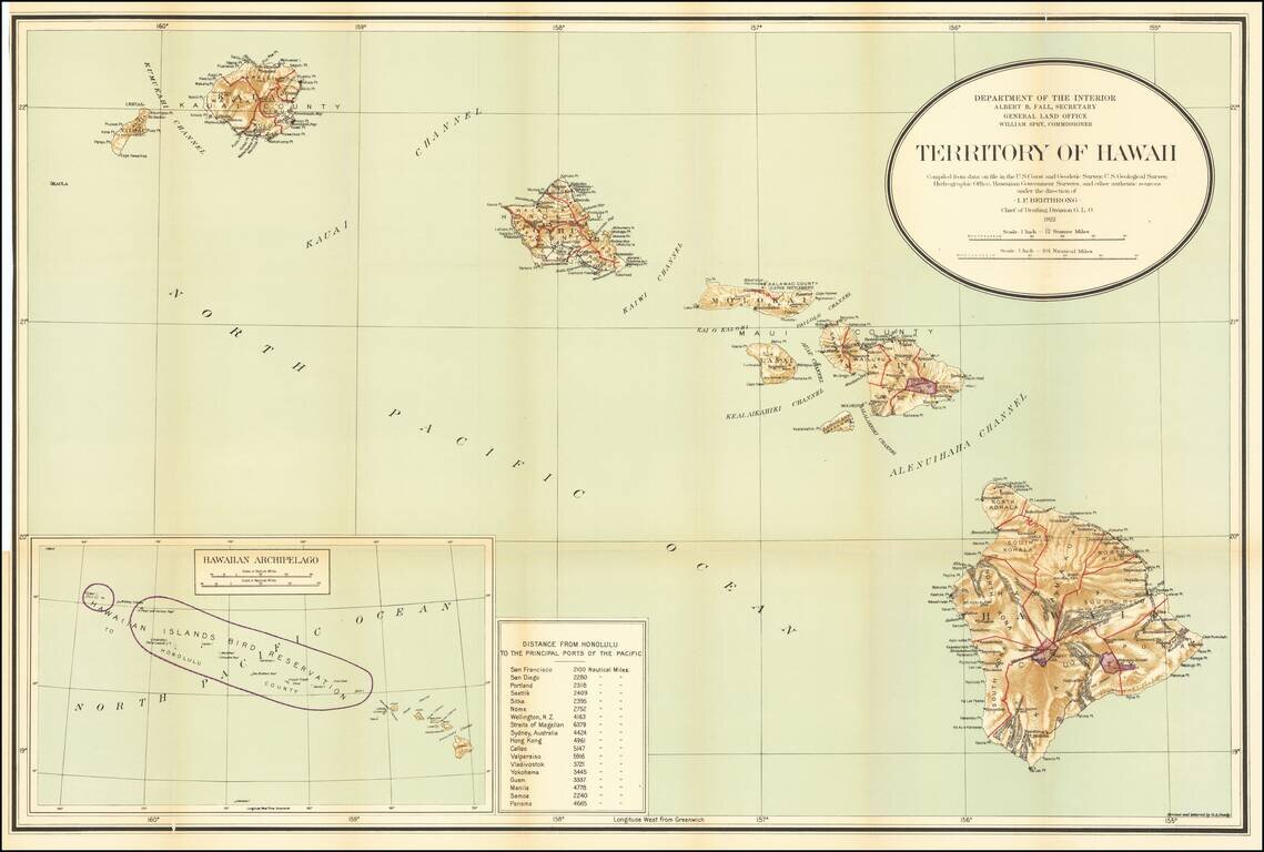
Detailed large format map of the Hawaiian Islands, published by the General Land Office. Finely detailed map, showing counties, towns, bays, points, mountain, rivers, elevations, volcanoes, volcano houses, halfway houses and Lava flows from various...