Gerard De Jode (1509-1591) was a pre-eminent mapmaker in the late seventeenth century, a time when the Dutch dominated the map trade. He was known for his many maps, some of which featured in Speculum Orbis Terrae (first edition Antwerp: 1578). Although never as successful as Ortelius’ Theatrum, the Speculum did get republished in a second edition in 1593, two years after De Jode’s death, by Arnold Coninx, and included this map. After his death, Gerard’s son, Cornelis (1568-1600), and his wife, Paschina, ran the shop. Unfortunately, Cornelis died young in 1600, aged only 32, and the stock and plates were sold to the publisher Joan Baptista Vrients.
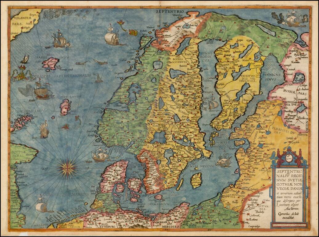
Colored example of De Jode's map of Scandinavia, the Baltic and Gulf of Finland, extending from Iceland and the Coast of Scotland to Novograd, St. Petersburg and the Norwegian Sea. The map is richly engraved by Joannes and Lucas van Deutecum's,...
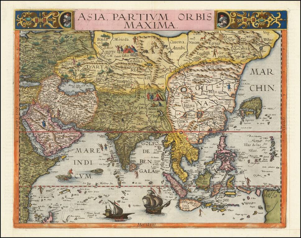
The First Appearance of Formosa Island on a Printed Map. Finely colored example of Gerard De Jode's map of Asia, published in his Speculum Orbis Terrae, in 1593. The map has a fascinating depiction of the Philippine Islands. Singapore is "Sincapura"....
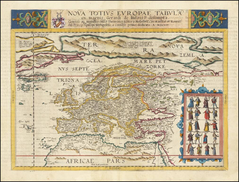
De Jode's First Map of Europe Striking full color example of De Jode's rare map of Europe, which appeared in De Jode's Speculum Orbis Terrarum. The British Isles are shown in an early blockish configuration, with an equally curious shape for...
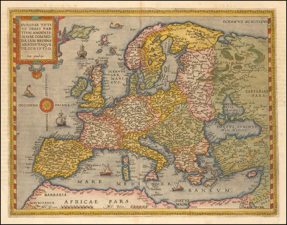
Striking full color example of Gerard De Jode's rare map of Europe, which was issued only in the second edition of the Speculum Orbis Terarrum in 1593. The map includes a massive Terra Nova Zembla, several Northeast Passages and a number of the great...
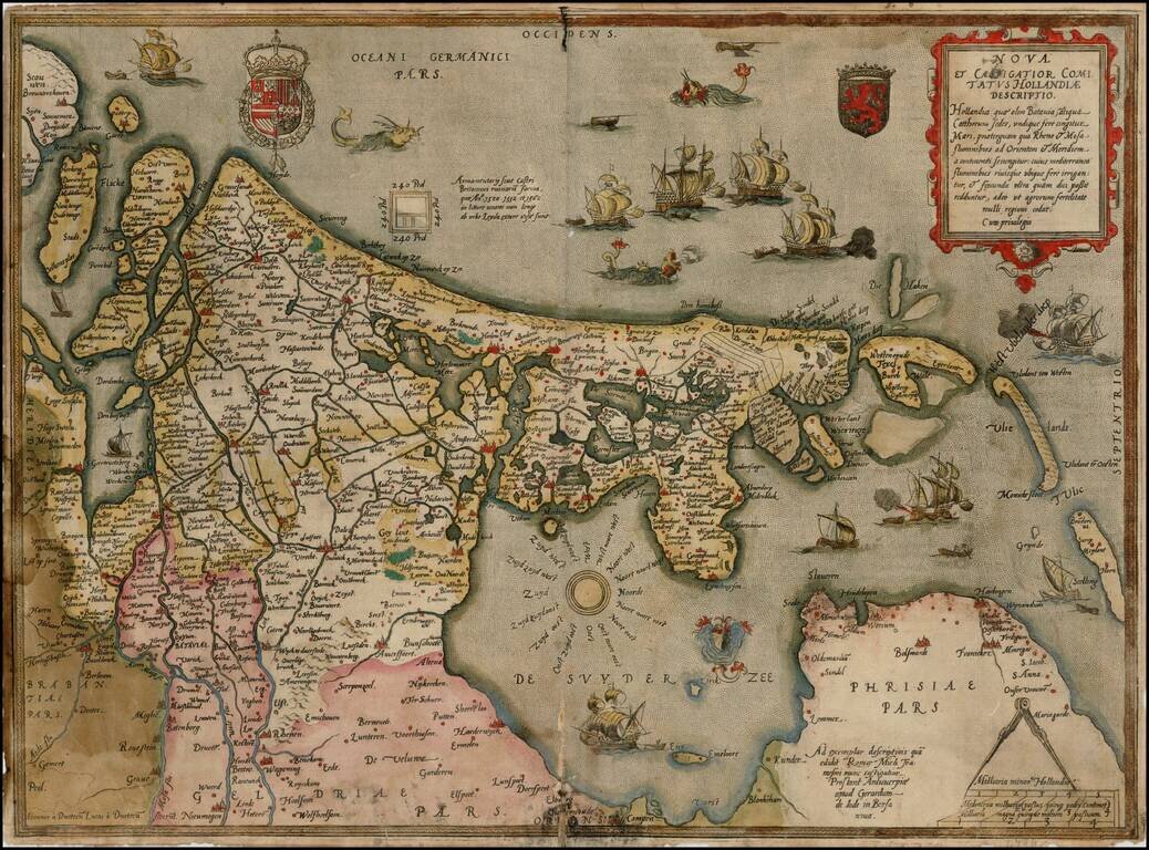
Old color example of the rare first edition of Gerard De Jode's map of the Netherlands from the 1578 edition of De Jode's Speculum Orbis Terrarum. De Jode was a contemporary of Ortelius and Mercator. The firs edition of his Speculum Orbis Terrarum was...
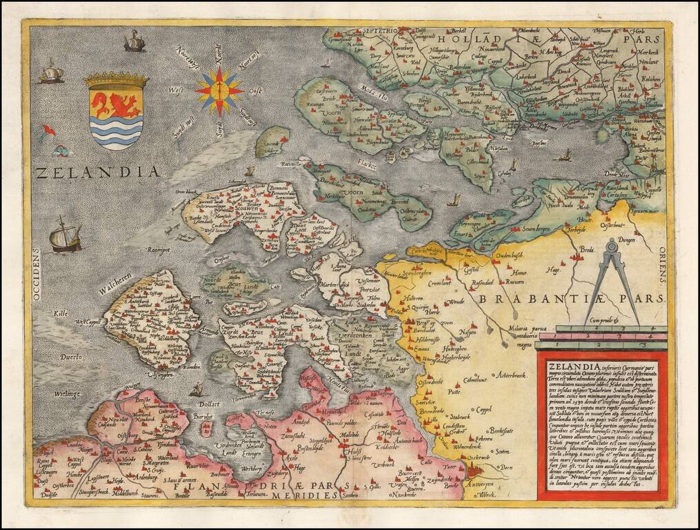
Rare early map of Zeeland, published by De Jode and engraved by Jan Van Doetecum. One of the earliest separate maps of Zeeland published in the Low Countries.
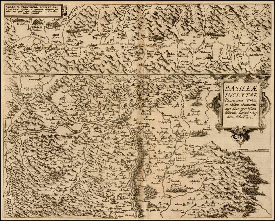
Nice example of De Jode's maps of Canton Valais and the Basel region, from the Speculum Orbis Terrarum, which along with Ortelius' Theatrum Orbis Terrarum are the earliest modern atlases of the World. As noted by Burden: In 1578 Gerard de Jode...

Rare separately issued example of De Jode's map of Palatinus Rheni (no text on the verso, which more commonly appeared in De Jode's Speculum Orbis Terrarum, which along with Ortelius' Theatrum Orbis Terrarum are the earliest modern atlases of the...
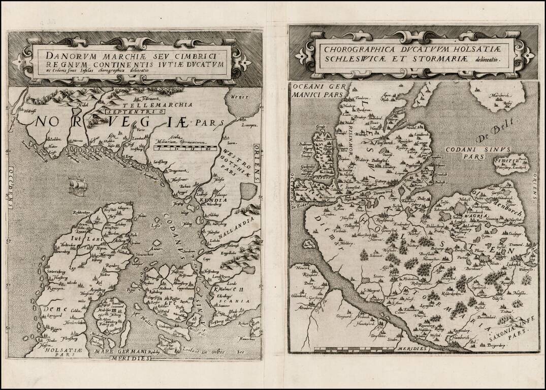
Rare pair of maps showing Norway and Denmark in one sheet and Denmark and Schleswig-Holstein in the second, from the second edition of De Jode's rare Speculum Orbis Terrae. While at first glance, the map appears somewhat similar to Ortelius's map of...
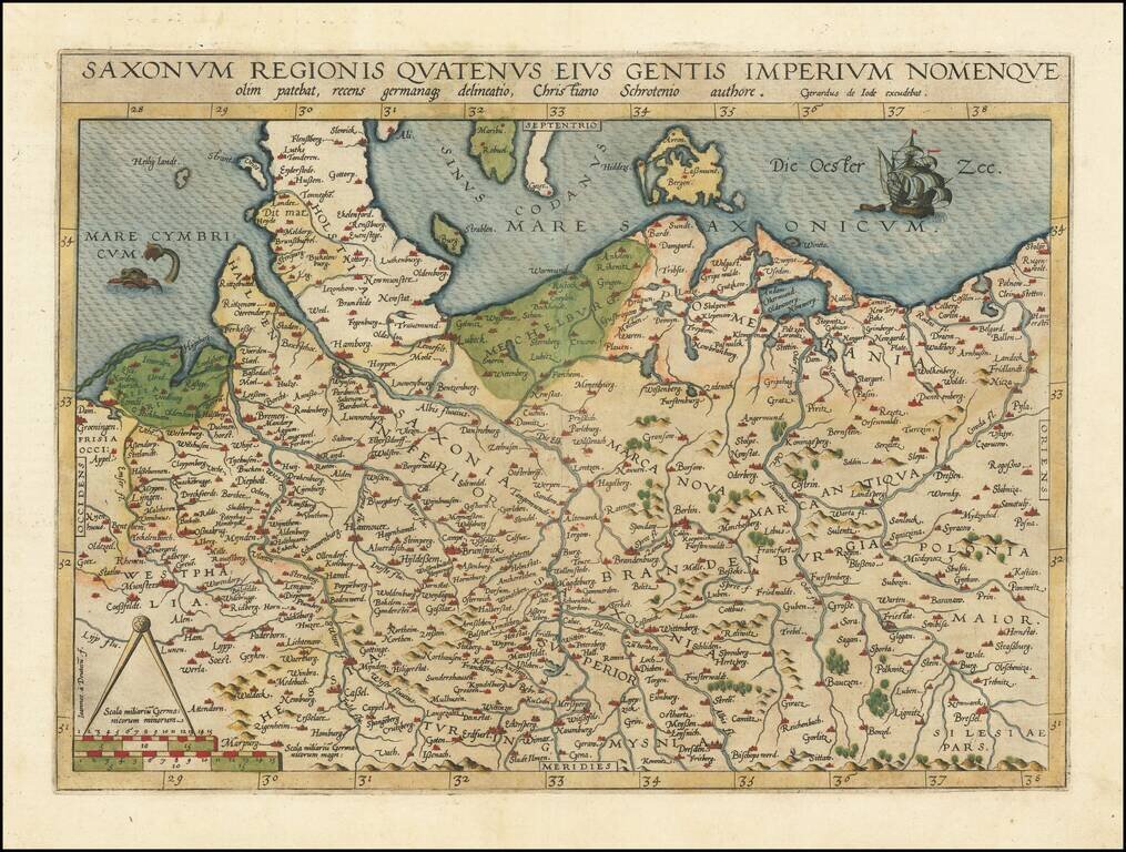
Fine old color example of Gerard de Jode's map of Northern Germany and Western Poland. The North Sea is adorned by a fish and the Baltic Sea by a sailing ship, and the borders of Schleswig-Posen-Dresden-Groningen are featured. The map is based on...
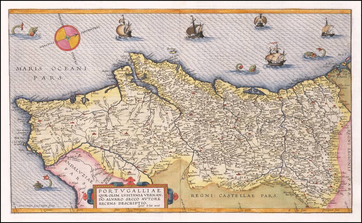
16th Century Antique Map of Portugal Finely executed map of Portugal, published by Dutch mapmaker Gerard De Jode, oriented with west at the top of the map. De Jode's map is based upon the work of Fernando Alvarez Secco, and was engraved by Joannes...
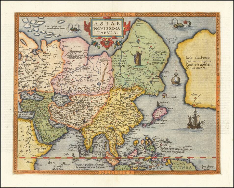
One of the Earliest Maps To Show The Philippines A fine example of the rare first edition of Gerard De Jode's map of Asia, which was both separately issued and included in his highly valuable Speculum Orbis Terrae. Engraved by Joannes and Lucas Van...
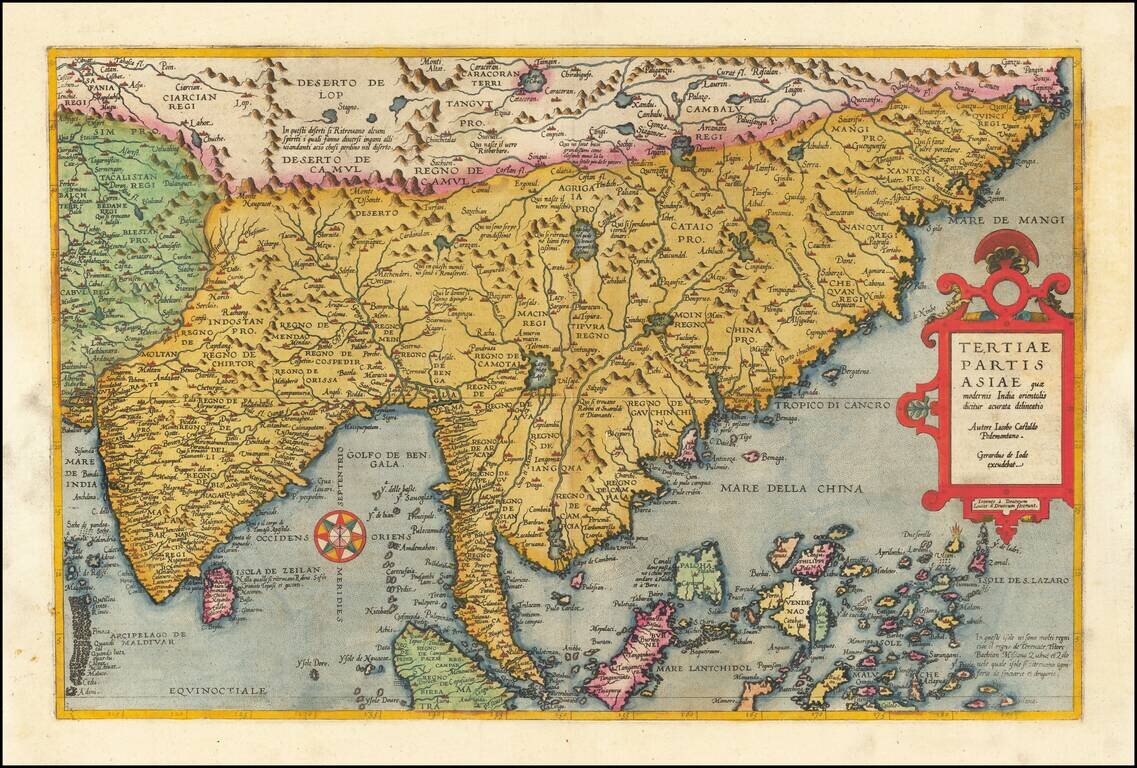
Fine old color example of Gerard De Jode's map of Eastern Asia, published in 1593, Engraved by Joannes and Lucas van Deutecum, who's signature is in the lower left part. De Jode's map is drawn directly from the first (northern) two sheets of Giacomo...
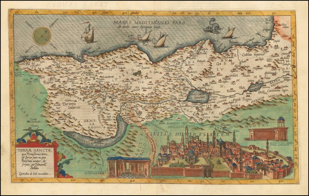
Fine old color example of the rare first edition of De Jode's map of the Holy Land. The map is based upon the map of Tilemannus Stella and is oriented with west at the top. The shoreline is irregular and runs from Tirus to Beersheba. The Dead Sea is a...
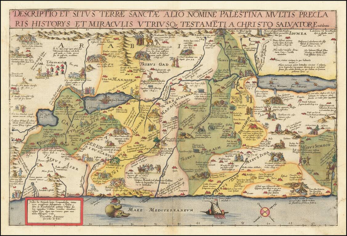
Striking example of Gerard De Jode's map of the Holy Land, which appeared in the 1593 edition of Cornelis De Jode's Speculum Orbis Terrarum. Oriented with east at the top, De Jode's map of the Holy Land is noteworthy for its inclusion of dozens of...
![Africae ut terra mariq[ue], lustrata est, propiissima ac vere genuina descriptio, observatis ad unguem gradibus longitudinis et latitudinis. Autore M. Iacobo Castaldo](/map/small/55794.jpg)
Rare old color example of De Jode's first map of Africa, from the 1578 edition of his Speculum Orbis Terrarum. The map is divided into two sections and includes an elephant, lions, battle scene, sailing ships and palm trees. The map is based on the...