Giacomo Giovanni Rossi (1627-1691) was an Italian engraver and printer. He worked in Rome, the heir to an important printing business founded by his father, Giuseppe de Rossi (1570-1639). Giuseppe began the press in 1633 and Giovanni and his brother, Giandomenico (1619-1653) took it over upon his death. The brothers expanded the business and by the mid-seventeenth century it was the best-known printing house in Rome.
For his maps, Giovanni worked with Giacomo Cantelli da Vignola. They produced the Atlas Mercurio Geografico. The first edition is undated, but the second was issued in 1692, a year after Giovanni’s death. The maps were by Cantelli. The firm also published maps based on those of Nicolas Sanson.
Later, the business passed to Lorenzo Filippo (1682-?). By 1738, the firm was known as Calcografia Camerale, then, from 1870 to 1945, as the Regia Calcografica. Today, the firm is still in business and is called Calcografia Nazionale. It operates as a free museum and offers one of the best collections of prints and plates in the world.
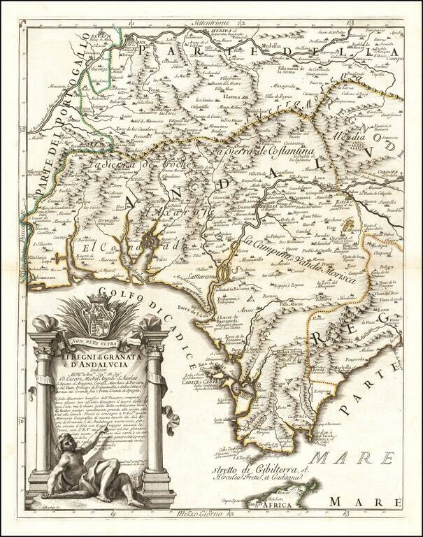
Western sheet of the Cantelli-Rossi map of Andalucia and Granata, based upon the work of Cantelli da Vignola and engraved by Aubrey Barbey, who apparently engraved a number of maps for Rossi. The map shows most of Andalucia and includes the...
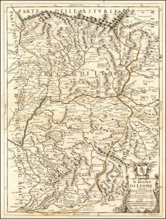
Antique engraved map of part of the Spanish region of Asturias, published by Giacomo and Domenico de Rossi in their Mercurio Geografico in Rome in 1696. The cartouche at the lower right aptly features the Leonese coat of arms with a rampant lion. The...

Antique engraved map of the Kingdom of Aragon. The map was published in Rome in 1696 by Giacomo Cantelli da Vignola and Giacomo Giovanni Rossi. The map shows the Aragon region in northeast Spain, roughly centered on Zaragosa ("Saragoza"). The map...
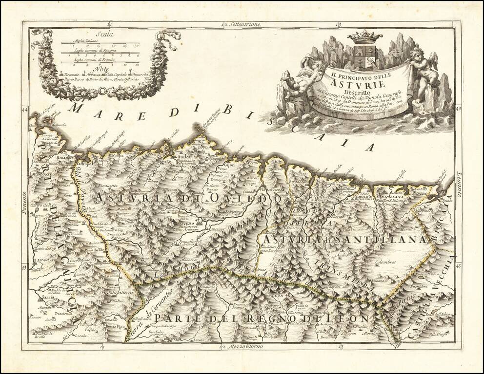
Finely engraved map of the Principality of Asturias on the northern Spanish coastline, based upon the work of Cantelli da Vignola and engraved by Aubrey Barbey, who apparently engraved a number of maps for Rossi. Divided into Asturia di Oviedo and...
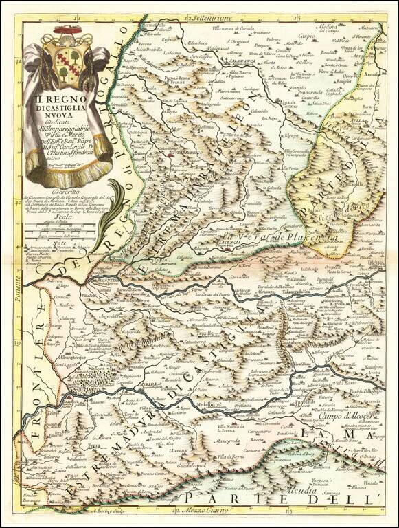
Antique engraved map of the Kingdom of New Castille. The map was published in Rome in 1696 by Giacomo Cantelli da Vignola and Giacomo Giovanni Rossi. The map is centered on The Tagus or Tajo River and includes Badajoz, Alcantara, Plancencia, and...
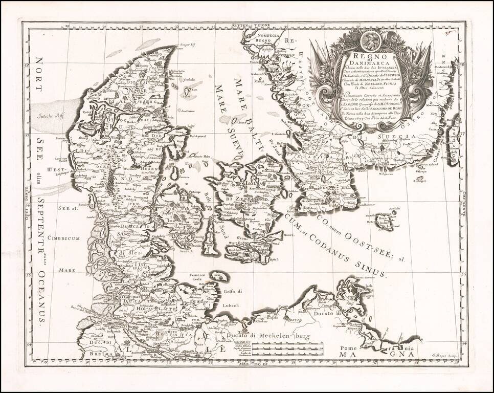
Striking map of Denmark and the southernmost part of Sweden, published in Rome by Giovanni Giacomo Rossi. The map is finely engraved, with an elaborate cartouche.
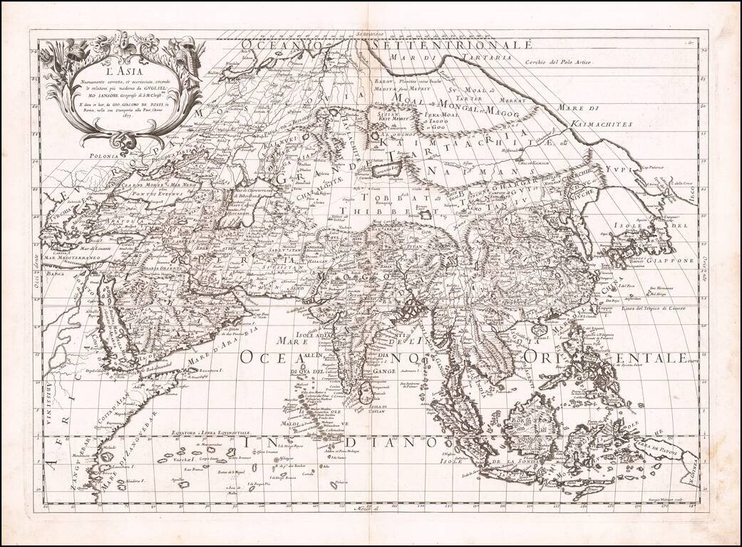
First state of Giacomo Rossi's map of Asia, published in Rome. The map provides an excellent depiction of the Philippines and China (revised to based upon Martini). To the north of Japan, the lands and coastal features are still largely unknown and...
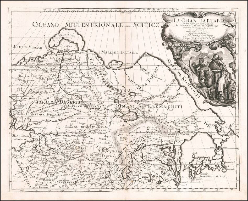
First edition of The Cantelli-Rossi map of Grand Tartary, extending from the Caspian to Japan and the Pacific and from Tibet to the Arctic. The Great Wall is shown, along with the Gobi Desert, Tibet, Korea and elongated peninsula, curiously shaped...
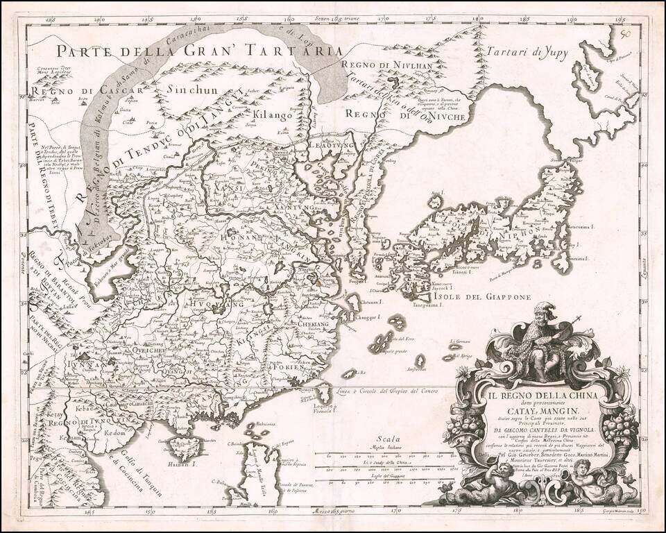
Rare 17th Century Italian Map of China Finely colored example of this rare early map of China, Japan and Korea, along with neighboring regions, by Cantelli da Vignola and published in Rome by Rossi. The map was engraved by Giorgio Widman for Rossi's...
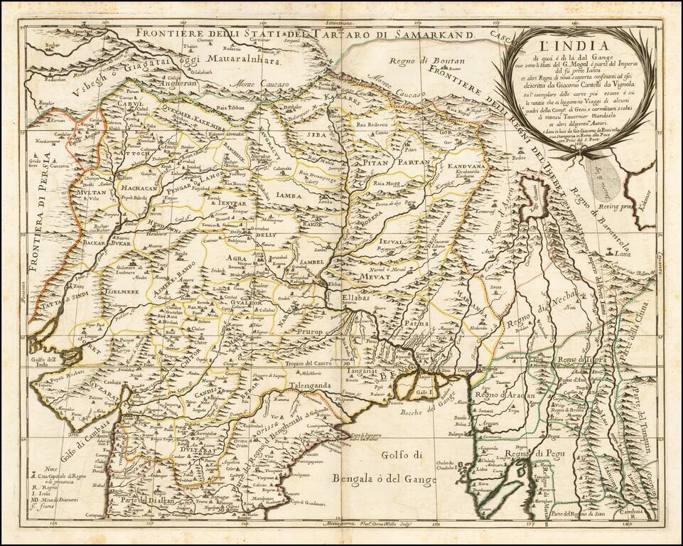
Nice example of the Cantelli-Rossi map of Northern India, Pakistan, Afghanistan and Tibet. The title carries a dedication to Jean-Baptiste Tavernier. Along the northern frontier, the map extends to Cabul, Samarkand, Nupal, Boutan and Lassa. The...
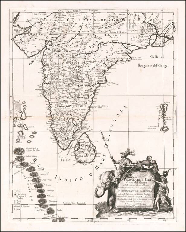
Scarce decorative map India, Ceylon, the Maldives and neighboring regions by Cantelli da Vignola and published in Rome by Rossi. The map provides one of the most detailed and up to date treatments of the region. Includes an ornate cartouche,...
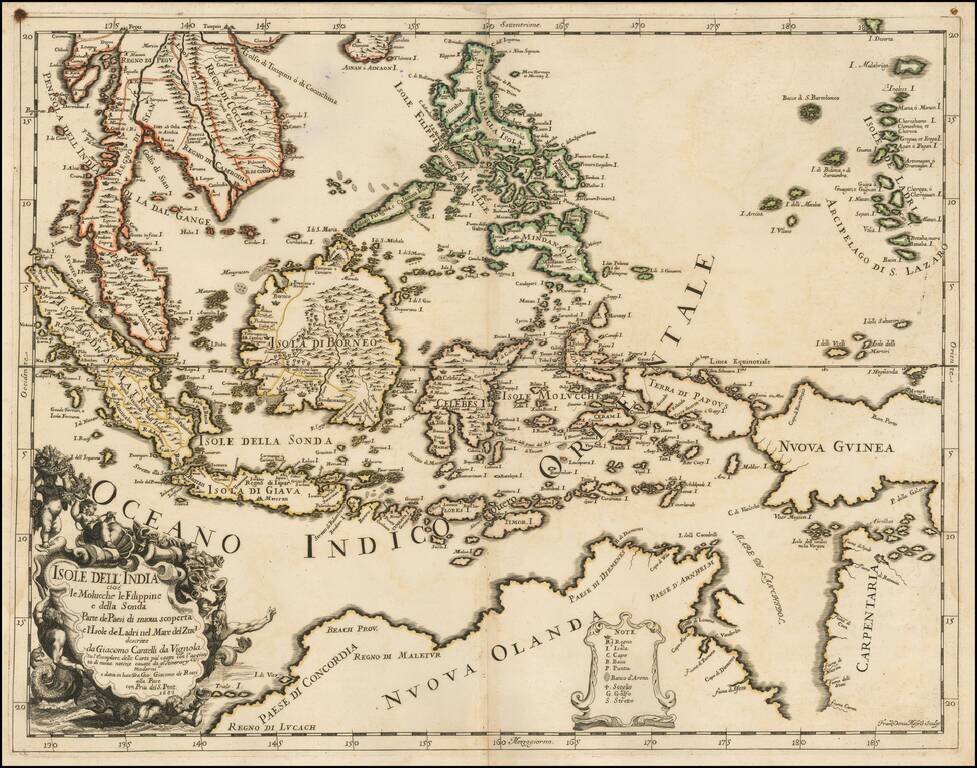
Scarce first state of this decorative map of Southeast Asia and the North Coast of Australia by Cantelli da Vignola and published in Rome by Rossi. Detailed and highly decorative 17th-century Italian map of northern Australia and the islands of...
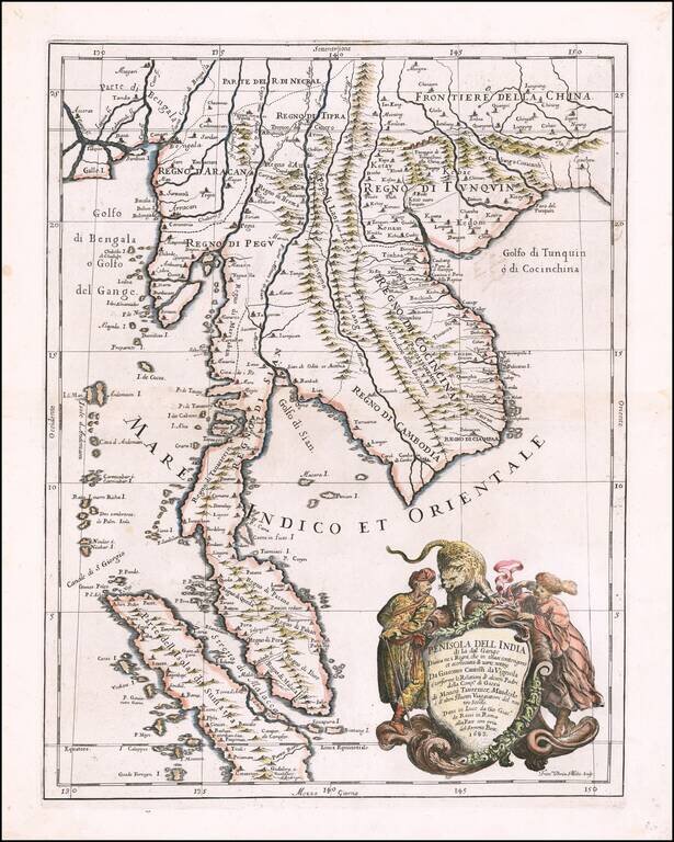
Decorative example of the Cantelli-Rossi map of part of Southeast Asia, extending from Singapore and the Straits of Malacca in the south, to the mouth of the Ganges and southeastern China in the north, produced by Cantelli da Vignola and published in...
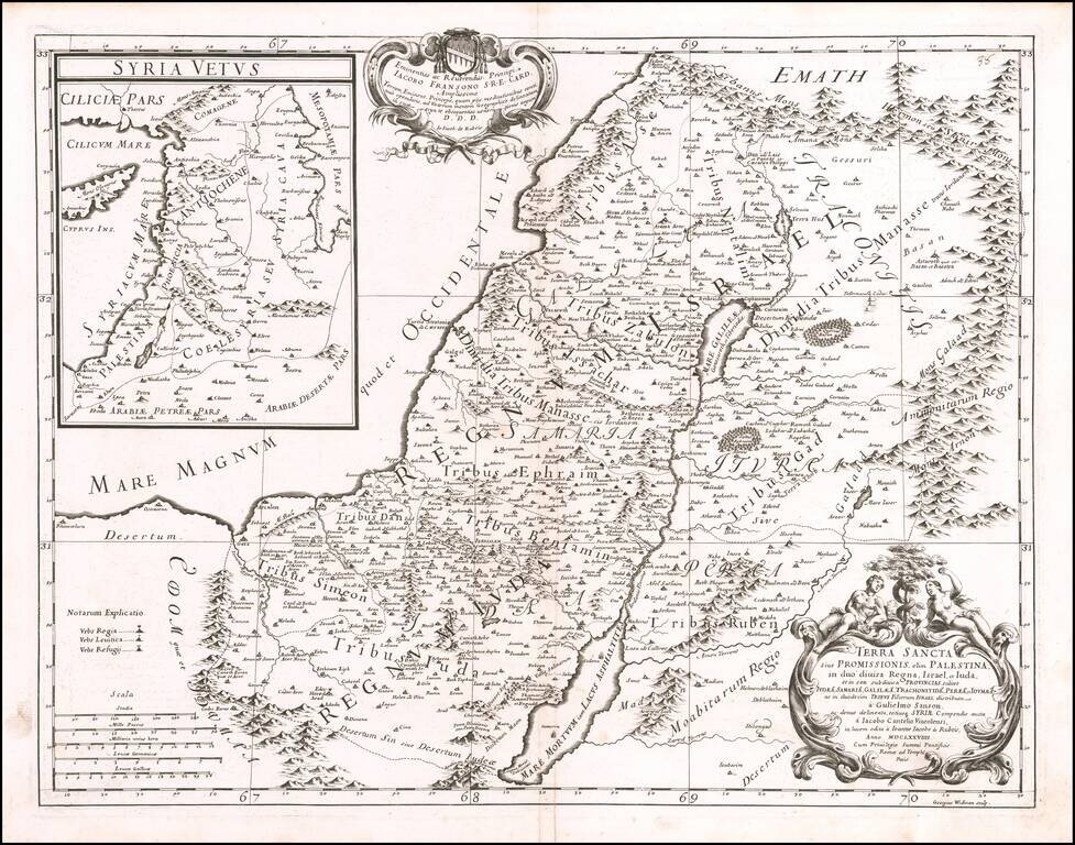
Decorative map of the Holy Land, published by Giacomo Rossi in Rome in 1679. The map includes an elaborate title cartouche and a large inset map of Ancient Syria.