Tobias Conrad Lotter (1717-1777) is one of the best-known German mapmakers of the eighteenth century. He engraved many of the maps published by Matthaus Seutter, to whose daughter Lotter was married. He took over Seutter’s business in 1756. Lotter’s son, M. A. Lotter, succeeded his father in the business.
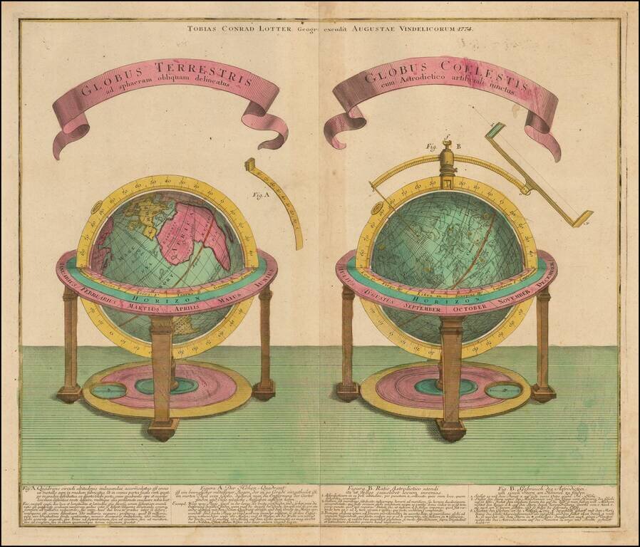
Finely engraved celestial and terrestrial globe, published in Augsburg by T.C. Lotter in 1774. Each of the spheres is described below the image in both Latin an German.
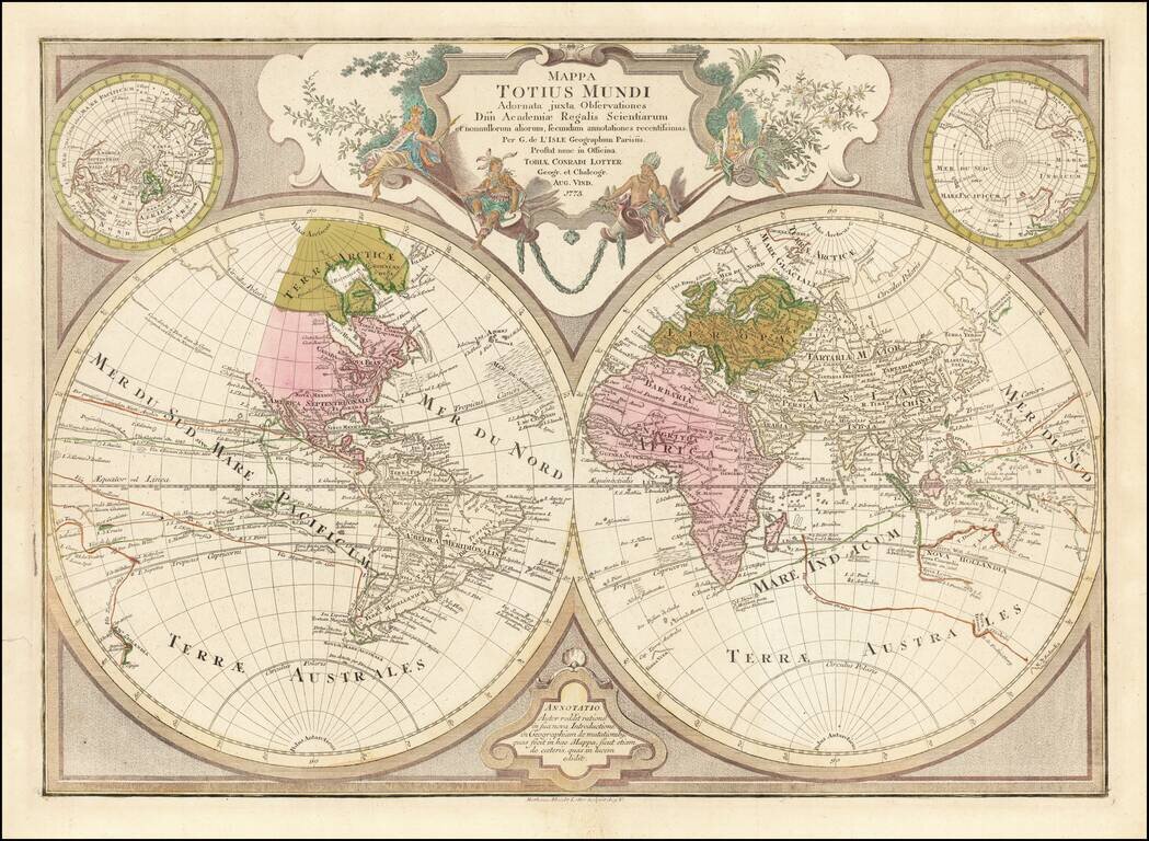
Decorative double hemisphere map of the World, published by TC Lotter in Augsburg. The map shows an number of early conjectural coastlines, including an incomplete coastline for Australia and New Guinea, New Zealand, the Northwest Coast of America,...
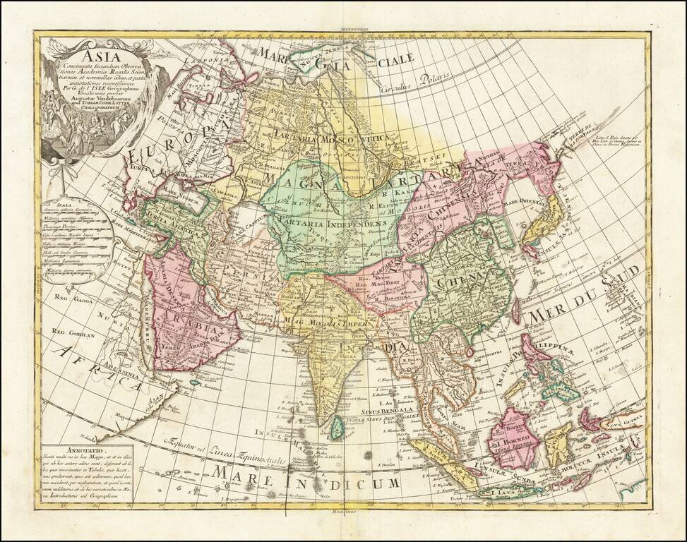
Striking Eighteenth-Century Map of Asia Fine example of Tobias Conrad Lotter's large format map of Asia, based on the cartography of the pre-eminent French cartographer of the eighteenth-century, Guillaume de L’Isle. The map embraces the whole of...
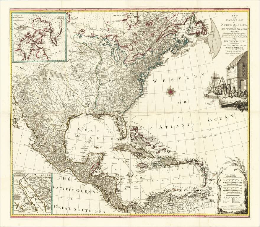
Fine example of Lotter's four-sheet map of the newly formed United States, based upon a map originally published by Bowen & Gibson and later by Jefferys, and Sayer & Bennett. The map is a completely different engraving and includes a striking...
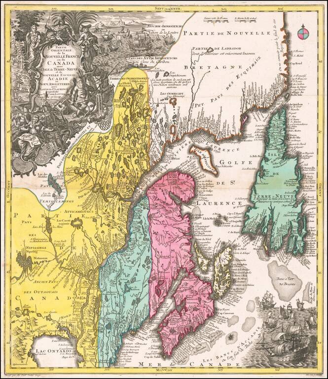
A beautiful map of Northeastern Canada, including Nova Scotia, Labrador, and Newfoundland, published by Tobias Conrad Lotter in Augsburg. The map's vertical format elongates the geography and distorts the true shape of Newfoundland. The St. Lawrence...
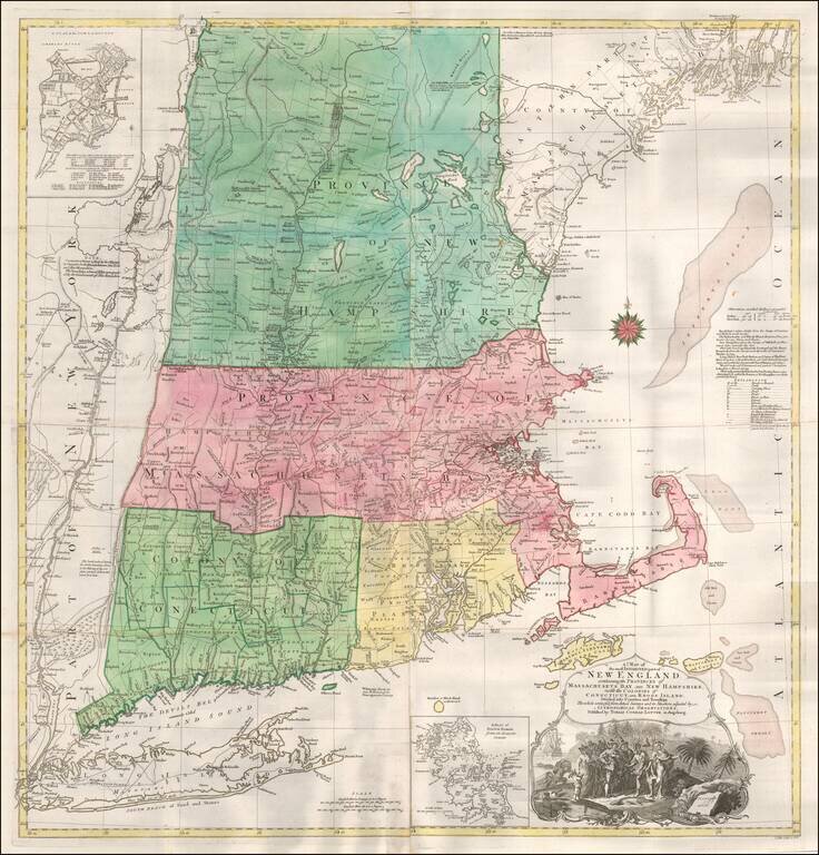
T.C. Lotter Edition of The Most Important Map of New England At The Time of the American Revolution. Fine old color example of the T.C. Lotter edition of Bradock Mead's 4-sheet map of New England & Long Island, the most important general map of...
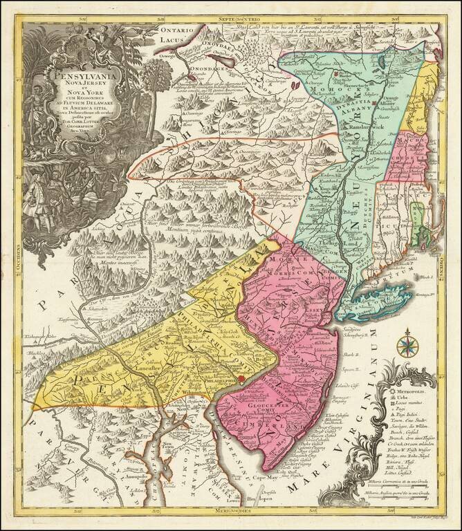
Fascinating Colonial Map of New Jersey, New York and Eastern Pennsylvania Nice example of T.C. Lotter edition of Seutter's map of the Middle British Colonies, based upon Lewis Evans' extremely rare map of 1749. Seutter's map is a notable...
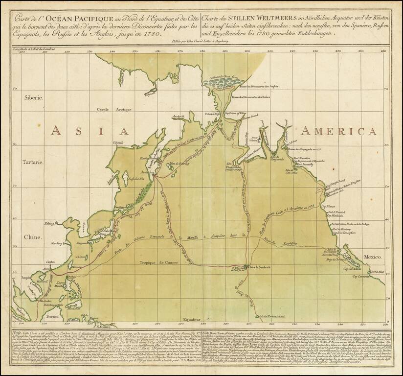
Striking Chart of the Northern Pacific, One of the Earliest to Show Hawai’i Rare chart of the Northern Pacific with the coasts of Asia and America, showing the voyage of the Spanish treasure galleons and Captain Cook’s third voyage. Based on...
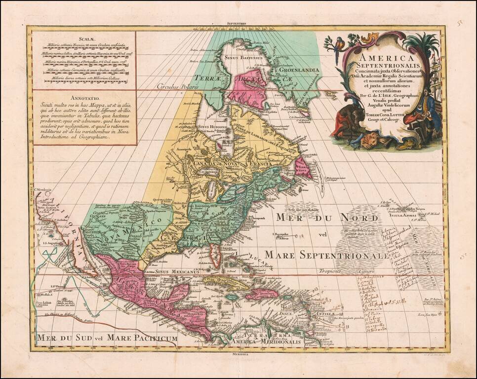
Striking Map of North America Based on De L’Isle’s Foundational Map of North America--With Manuscript Annotations! Lotter’s rendition of De L'Isle's highly important map of North America (1700), which was the first map to correctly place the...
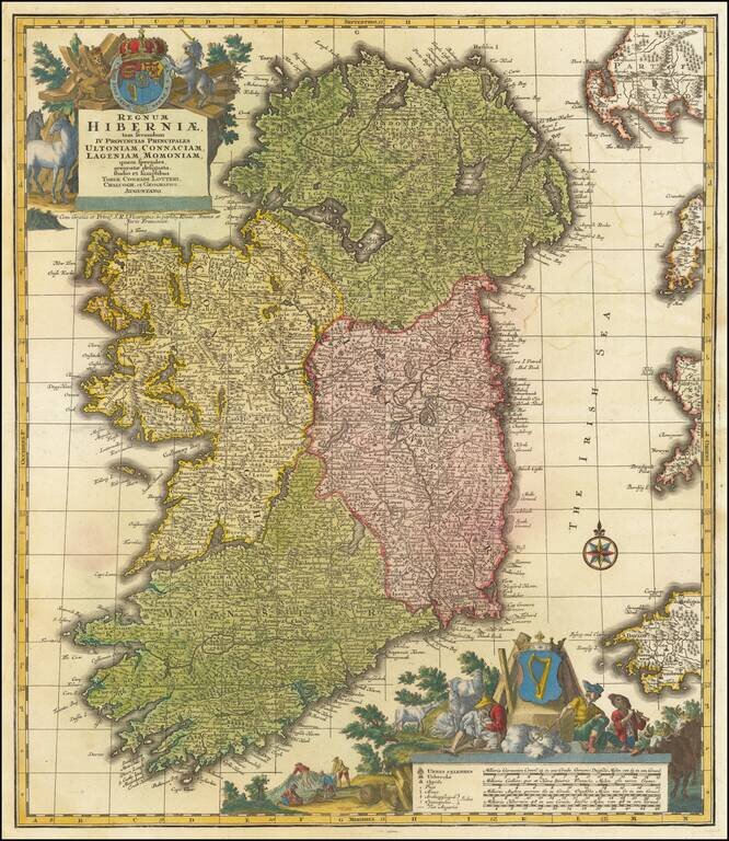
A finely colored example of Lotter's decorative map of Ireland, colored by regions and showing towns, roads, counties, rivers, lakes, castles, and more. Ireland is visible in its entirety, divided into its four provinces: Ulster in the north, Connacht...
![[Austria] Nova Mappa Archiducatus Austriae Superioris Ditiones in suos Quadrantes divisas conspectui sistens . . . .](/map/small/62749.jpg)
Highly detailed regional map, centered on the course of the Danube River, from Ips to Braunau. Also shows Salzburg, Rachstats, Rottenman, Loeben, Waiddhofen, Zwetl, Weitra and Passau. Ornate cartouche.
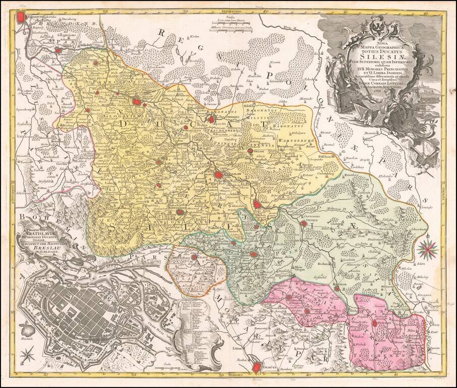
Detailed map of the region of Silesia, centered on Breslau (Wroclaw). Includes a large view of the town of Breslau (Wroclaw) in the lower left corner.
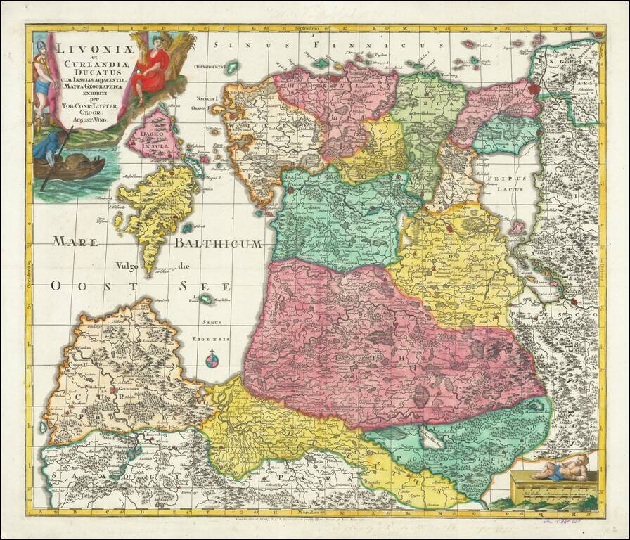
Finely engraved map of the Baltic region, published by Lotter. The map includes a striking allegorical vignette engraved by Abraham Drentwet.
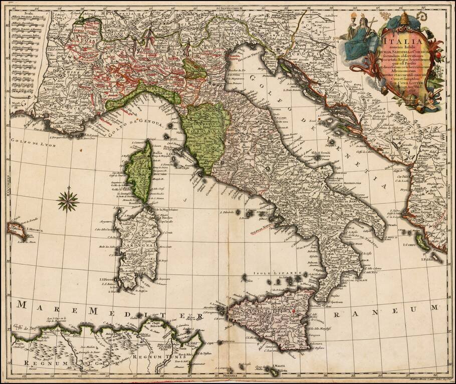
Scarce map of Italy, published by TC Lotter. Includes Sicily (Mt. Aetna erupting), Corsica and Sardinia. Fine dark impression.
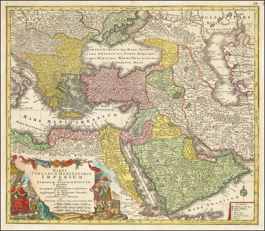
Striking regional map of the Turkish / Ottoman Empire, centered on Turkey and Asia Minor, and showing the Eastern Mediterranean, Balkans, Greece, Persia, Saudi Arabia, the Black Sea and the Caspian Sea. Includes a decorative cartouche in the lower...
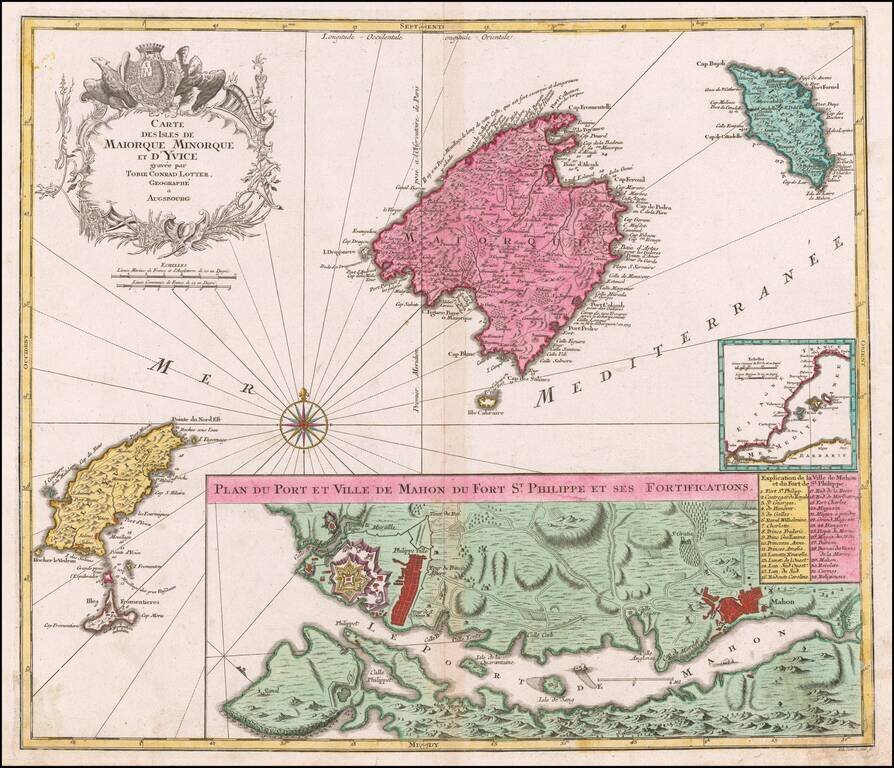
Striking map of the Balearic Islands, with a large plans of the Harbor and Town of Mahon. The map includes a striking coat of arms and windrose.