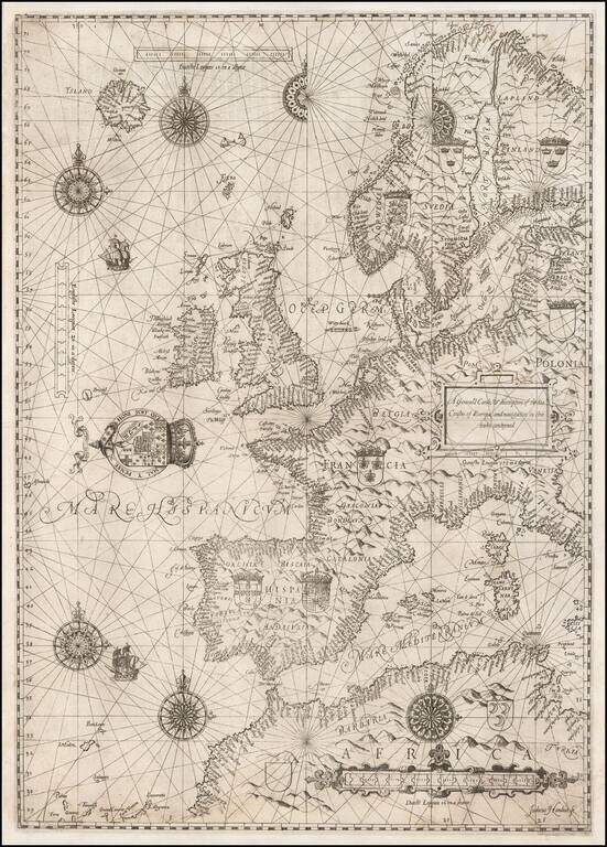
The Rare English Copy of Waghenaer's General Sea Chart of Europe -- The Earliest Sea Chart Engraved in England Important early sea chart of Europe, engraved by Jodocus Hondius for the The Mariner's Mirrour, an English translation of Waghenaer's...
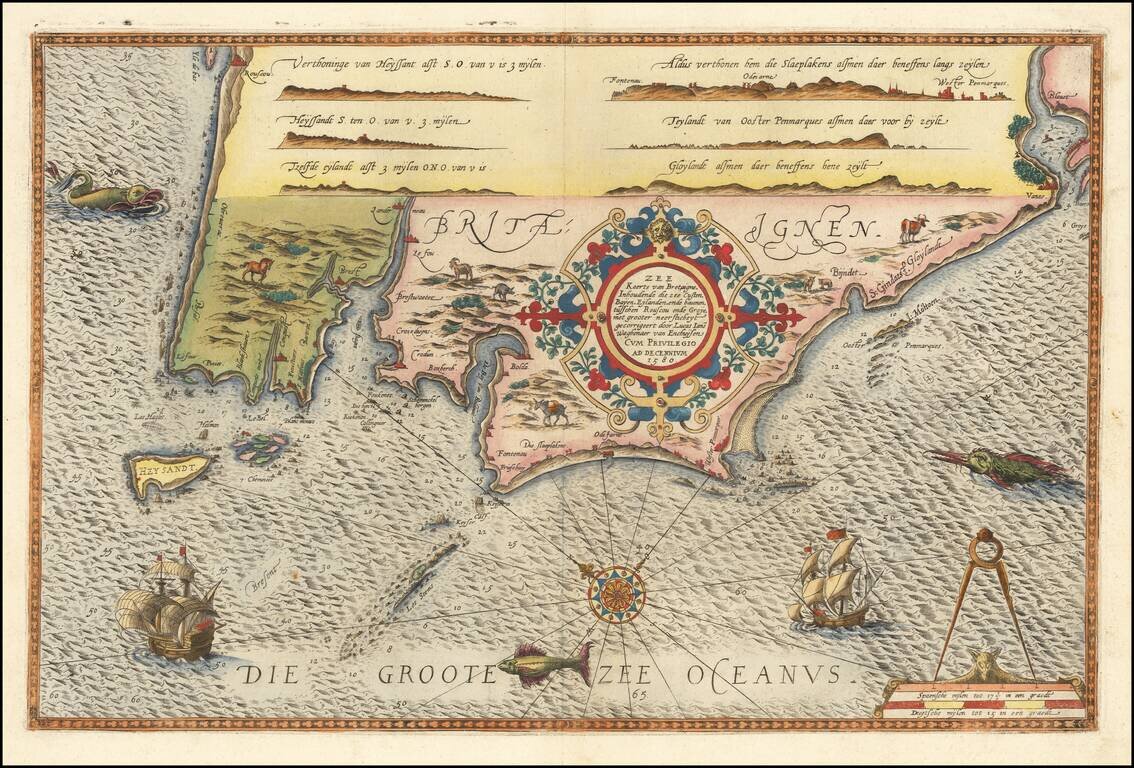
Striking full color example of Wagenhaer's map the French Bretagne Coastline, showing the western most part of Bretagne, centered on the area around Brest and Crozon. Wagenhaer was a Dutch pilot who produced the first set of effective navigational...
![[Ile de Re and La Rochelle] Die Zee Custe Van tLandt van Poictou ende Bordeaux tuschen Picqueliers ende de Riviere van Bordeaux alsoe hem tlant aldaer vuyt der zee opdoet ende verhoont.](/map/small/61451.jpg)
Striking full color example of Wagenhaer's map the French Coastline, from Bordeaux to Poictou, with the Islands of Ile de Re and Oleron, centered on La Rochelle Wagenhaer was a Dutch pilot who produced the first set of effective navigational charts,...
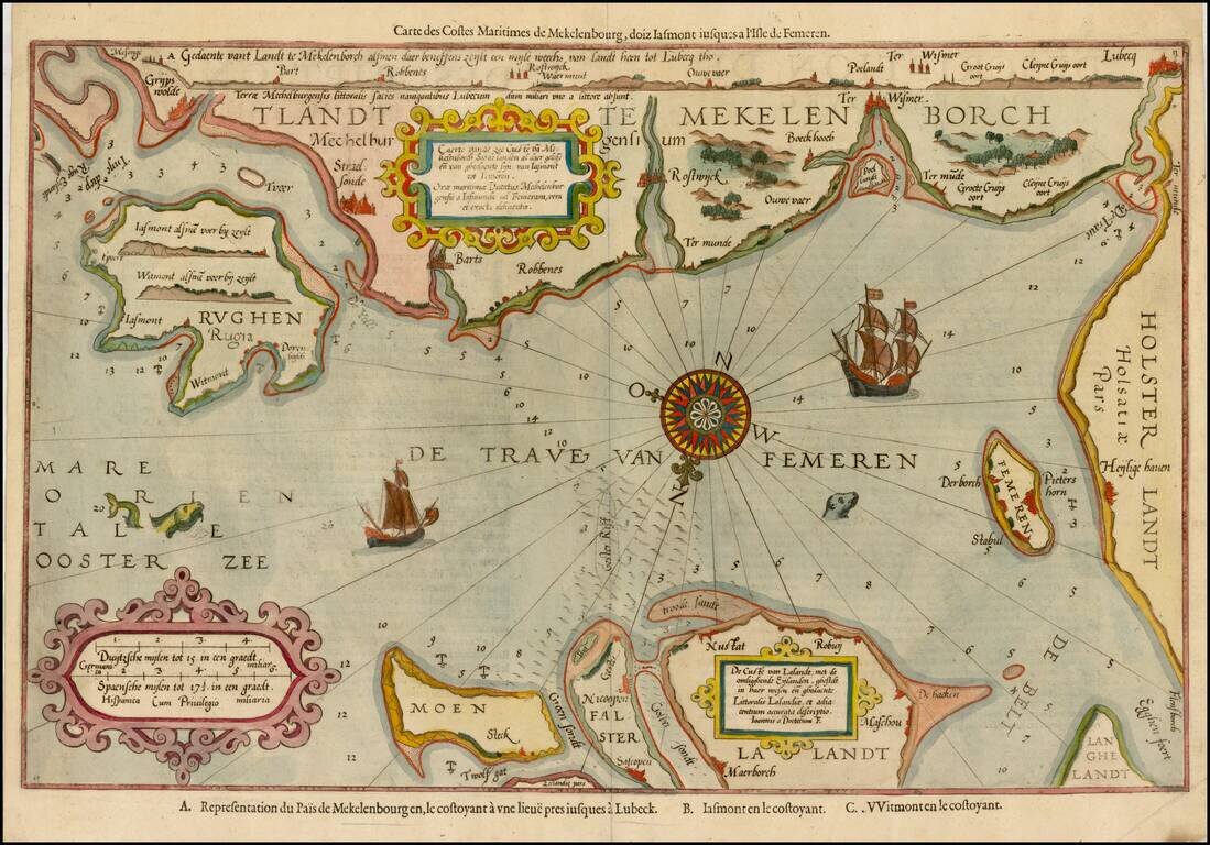
Striking example of the scarce French edition of Waghenaer's sea chart showing the coastlines of Northern Germany and Denmark. The chart includes the modern cities of Greifswald, Stalsund, the island of Rugen, Barth, Wismar, Rostock, and Lubeck and...
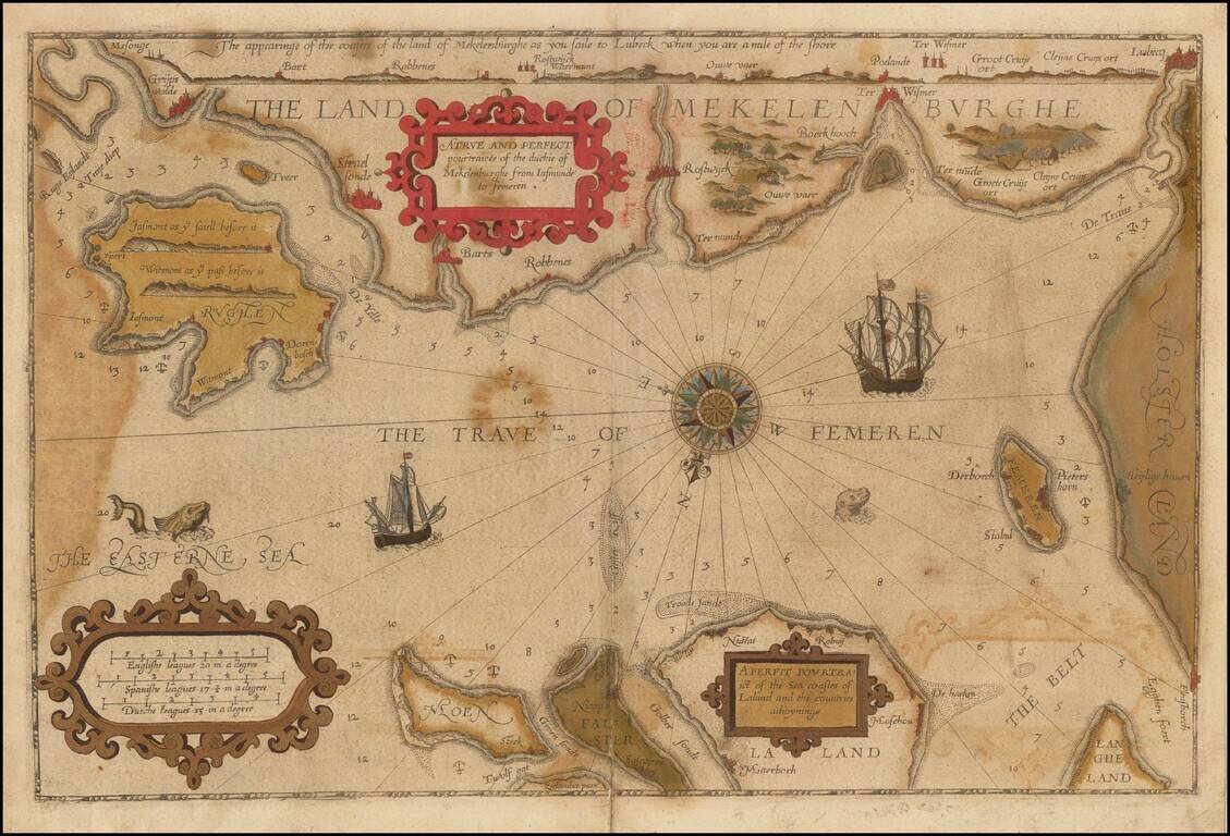
Striking example of the scarce English edition of Waghenaer's sea chart showing the coastlines of Northern Germany and Denmark. The chart includes the modern cities of Greifswald, Stalsund, the island of Rugen, Barth, Wismar, Rostock, and Lubeck and...
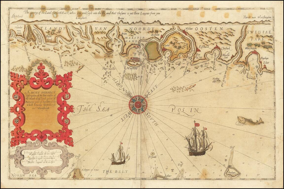
Rare English Waghenaer Map of Southwestern Swedish Coastline Old color example of this scarce English edition of Waghenaer's sea chart showing the coastlines of Sweden, centered on Marstrand and the coastline west of Gothenberg. The chart is oriented...
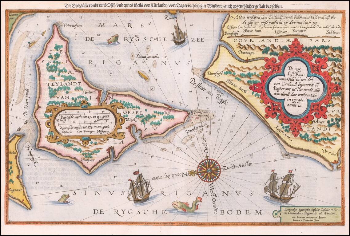
Antique map of Saaremaa and the Estonian Coastline. Striking example of the antique sea chart of the Gulf of Riga, along the Latvia-Estonia border. Includes sea monsters, sailing ships, a compass rose, and decorative cartouches, soundings, and...
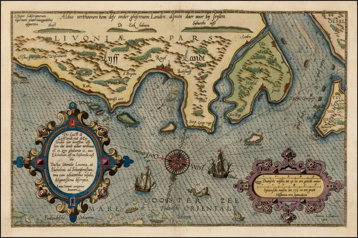
Fine early example of Waghenaer's map a portion of the Gulf of Finland showing Wyburch (Vyborg), Telsborch, Narua, Niewkerck, Reisenburg, and the region just west of St. Petersburg, from Lucas Waghenaer's Spiegel der Zeevaerdt. Includes sea monsters,...
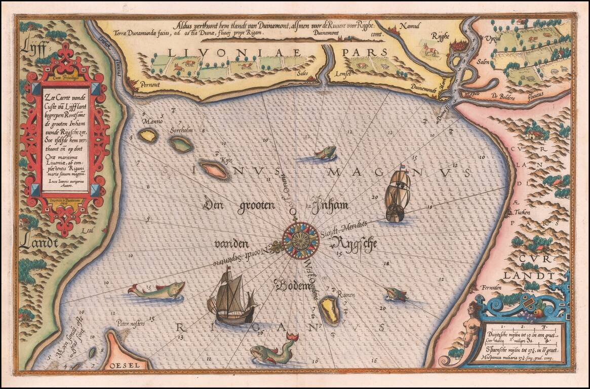
Striking example of Wagenhaer's map of the coast of Latvia, including the area around Riga and part of Curland. Includes sea monsters, sailing ships, compass rose, decorative cartouche, anchorages and soundings. Wagenhaer was a Dutch pilot who...
![[Basque Coast] Die Zee Custen van Biscaijen tuschen Laredo en Sentillana soe hem dat Selue landt all daer vertthoornt enn opdoet . . . 1583](/map/small/61468.jpg)
Striking full color example of Wagenhaer's map of the northwestern coast of Spain, from Lhanes to Laredo, centered on the Santander Region. Includes 2 sea monsters, 2 sailing ships, a compass rose, and 2 decorative cartouche, soundings, and...
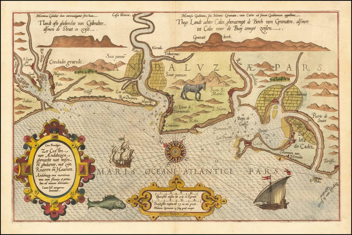
Striking full color example of Wagenhaer's map of the southwestern coast of Spain, including the Bay of Cadiz. Extends inland to Sevilla and south to Cadiz, with northeast at the top of the map. Includes a sea monster, 2 sailing ships, a compass...
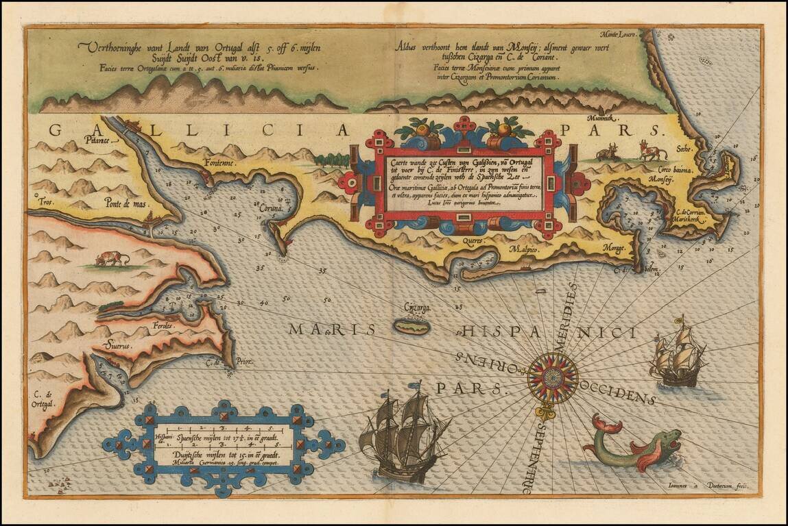
Beautifully hand-colored example of Waghenaer's map of the Galician Coastline, from Cape de Ortegal in the east, to Monte Louro and Cape Finisterre in the west, centered on Coruna, Malpica de Brigantinos and Ferrol. Lucas Waghenaer was a Dutch pilot...
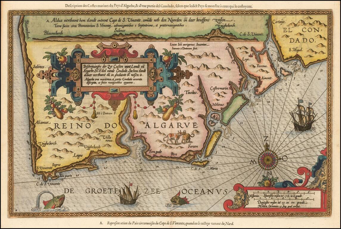
Striking full color example of Wagenhaer's map of the Algarve coastline, extending from just north of Sines in Portugal and the Lagos area to the Rio de Piedras area in Spain. Wagenhaer was a Dutch pilot who produced the first set of effective...
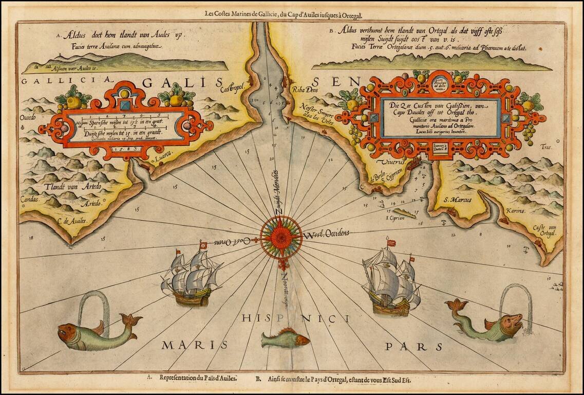
Decorative example of Wagenhaer's map of the northwestern coast of Spain, from Ortiguera to Cape Aviles. The chart is one of Waghenaer's most decorative productions, with 3 sea monsters, 2 sailing ships, a compass rose, and 2 decorative cartouches,...
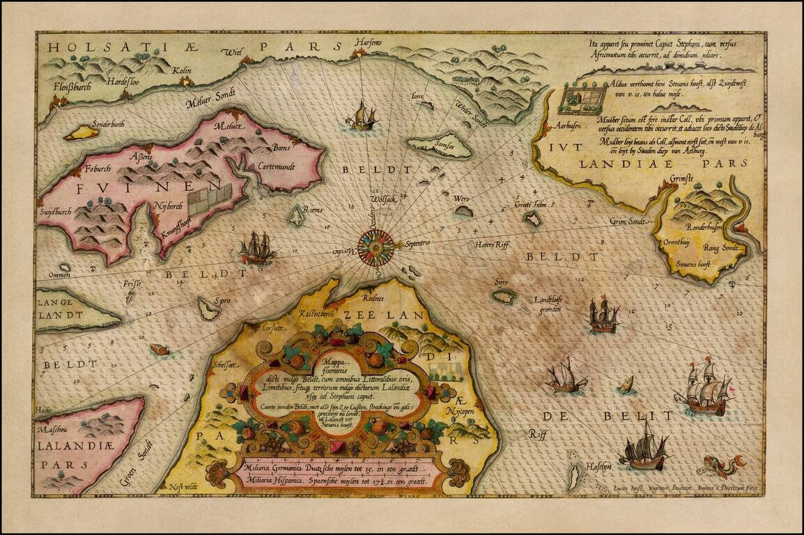
Old Color, gold heightened example of Waghenaer's sea chart showing a significant part of the coastline of Denmark. The chart includes the modern cities of Randers, Kalundborg, Korsor, Aarhus, Horsens, Vejle, Kolin, Haderslev, Sonderborg, Nordborg,...
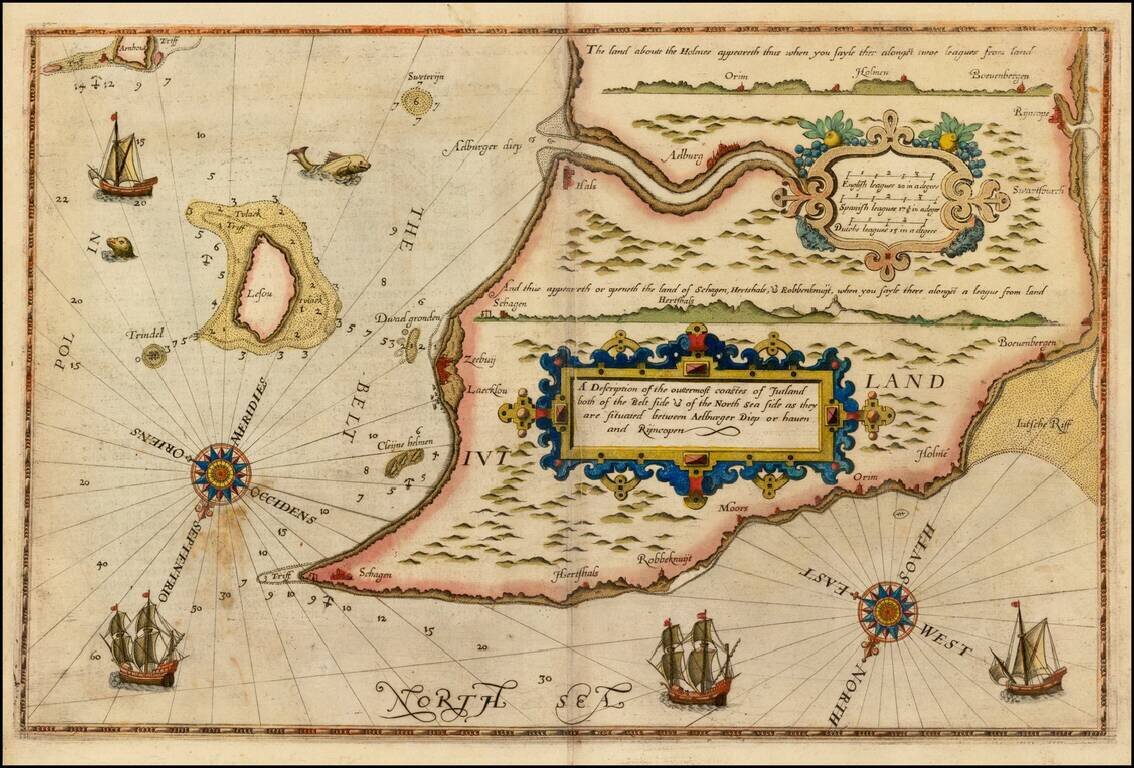
Rare unauthorized English Edition Waghenaer's map of the Jutland Coastline. Oriented with southeast at the top, the map extends from Aalborg and Hals to Skagen at the northern tip of Jutland. The English map is a copy of the first state of...