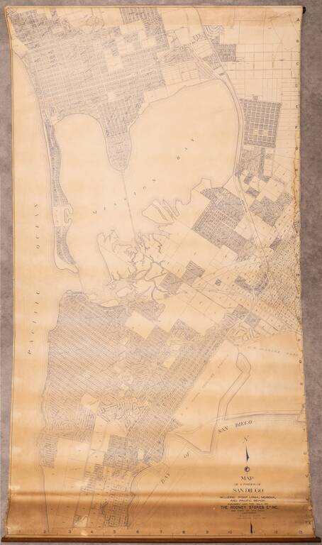
Large wall map of the San Diego neighborhoods of Point Loma, Mission Bay, Mission Beach, Pacific Beach, and Bay Park. This is a very large and detailed wall map of these neighborhoods, depicting them at 1:400 feet. One of the most interesting aspects...
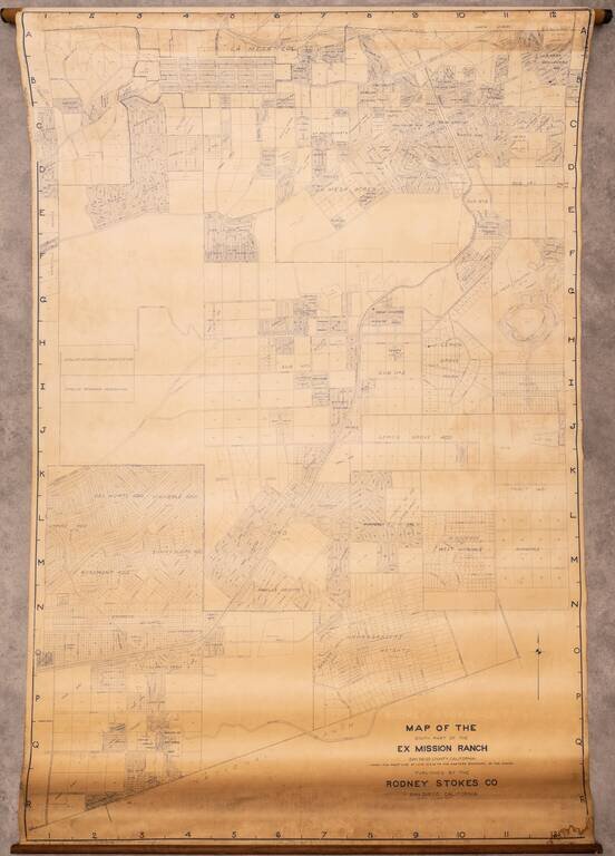
Large wall map of eastern San Diego, showing parts of Lemon Grove and La Mesa. In the west, the map is bounded by Lake Chollas, and the Chollas Heights Naval Radio Station, which is now military housing. There is plot level detail in the areas that...
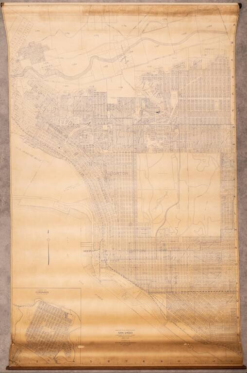
Large wall map of San Diego, showing Downtown, Balboa Park, and the neighborhoods of North Park, Banker's Hill, Little Italy, Mission Hills, and with an inset of Coronado. This is a very large and detailed wall map of central San Diego, shown at 1:400...
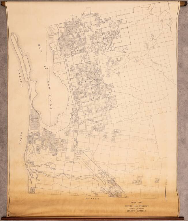
Rare Wall Map of the South Bay Interesting map of the area south of San Diego, extending from National City to Tijuana, centered on Chula Vista. The map covers what is today Imperial Beach, National City, Chula Vista, San Ysidro, and Bonita, however,...
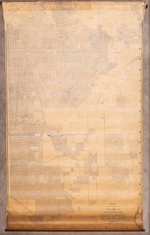
Very large wall map of a portion of San Diego, centered on City Heights and extending through the Mountain View and Southcrest neighborhoods to San Diego Bay in the lower-left corner of the map. At the top edge of the map is Kensington and Kensington...
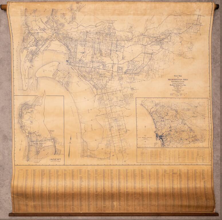
Large wall map of the San Diego Metropolitan Area, from Coronado to El Cajon, with an inset of Pacific Beach and La Jolla, and a further inset of the County of San Diego. This is a very large and detailed wall map of central San Diego, shown at 1:4000...