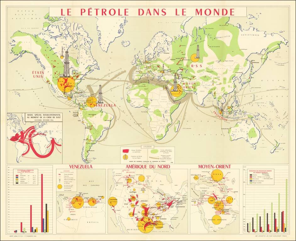
Vintage wall map of the global petroleum industry of the 1950s. The yellow circles show the key regions that produce oil, with the size of the oil rig towers representing the amount of crude oil produced. The red areas are the operating oil fields...
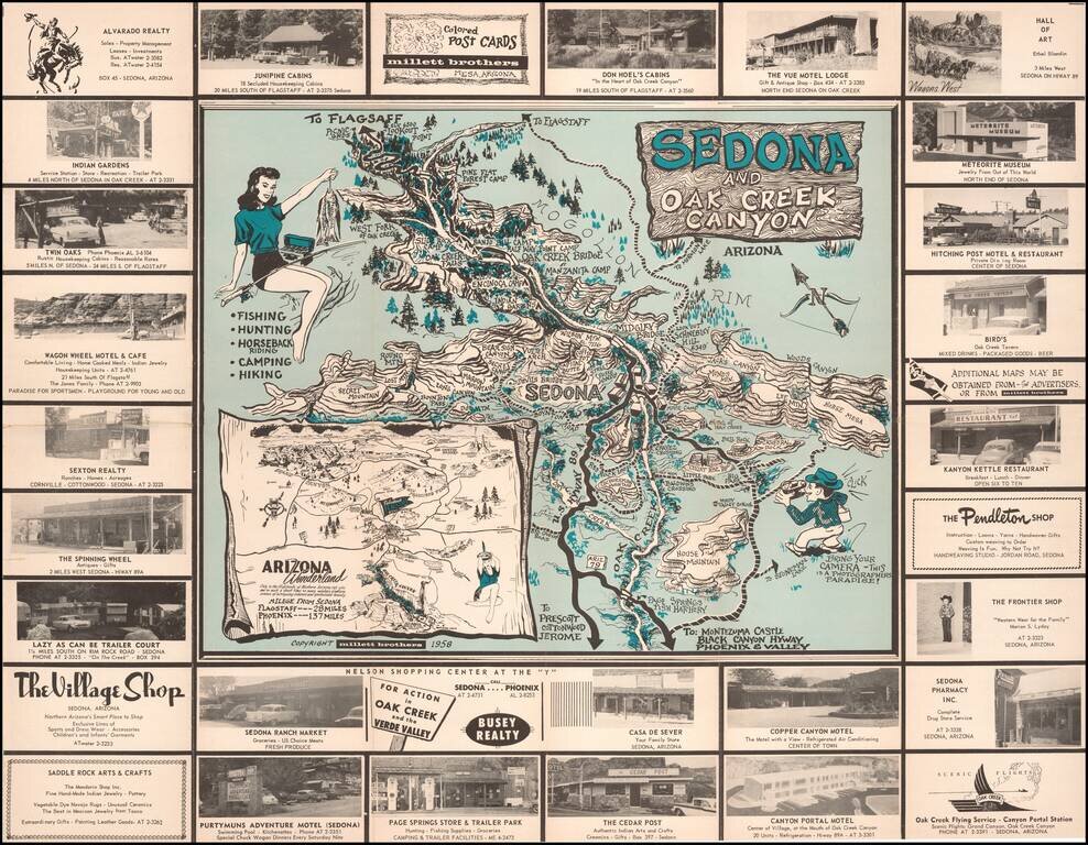
Bring Your Camera -- This is A Photographers Paradise! Rare pictorial promotional map, advertising Sedona and the Flagstaff area. The Sedona side provides a marvelous whimsical look at Sedona and Oak Creek Canyon, with its tourist attractions and...
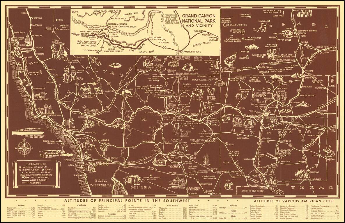
Scarce pictorial map of the American Southwest, published by Fred Harvey. The map provides a detailed pictorial image of the American Southwest, with an inset of the Grand Canyon. The verso includes a table of Indian Signs and Symbols, along with...
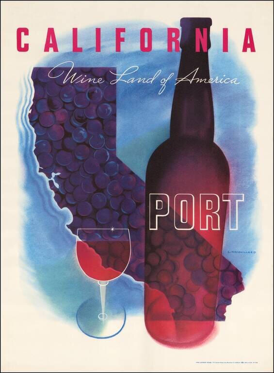
Striking map of California by Louis Macouillard in 1958. This is one of a series of Macouillard's images prepared for the California Wine Advisory Board in the 1950s, but to our knowledge, the only one to include a map image. Part of the great...
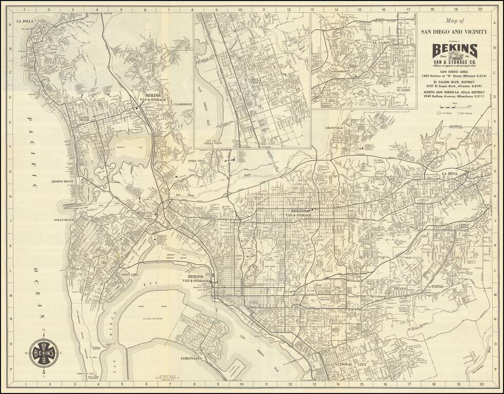
Detailed vintage map of San Diego, by the famous Bekins Van & Storage Co., published in 1958. The map shows Mission Bay before it was fully dredged and developed into the recreational area it is today. La Jolla has considerably more development...
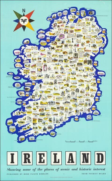
Vintage pictorial poster map of Ireland, issued by the Irish Tourist Board (Bord Failte Eireann) circa 1958. The map features dozens of captioned illustrations covering Ireland's many landmarks and points of interest. The map poster was printed by...
![[Soviet Union] Our Country -- From Wooden Plough To Sputnick](/map/small/47092.jpg)
Fascinating Soviet map and promotional brochure, prepared for the USSR Section of the Brussels Universal and International Exhibition, 1858. The map shows the Russians at the North Pole and prosperously exploiting their bountiful natural resources....
![ЛЕНИНГРАД СПУТНИК ТУРИСТА [Leningrad Tourist Companion]](/map/small/54850.jpg)
Attractive color-printed Soviet tourist map of Leningrad (present-day St. Petersburg) published by the Soviet Navy. The map features parks and landmarks, the latter of which are shown pictorially. The map is in Russian.
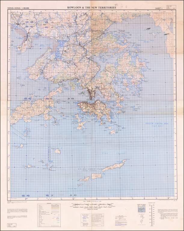
Detailed War Office and Air Ministry Two-Sheet Chart of Hong Kong. Detailed British military mapping of Hong Kong, published in two sheets (here joined as one), in 1958. The sheets are labeled first editions and have as their sources RAF Air Survey...
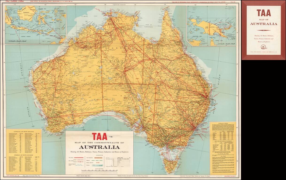
Scarce Trans Australia Airlines map of the continent of Australia, highlighting the air routes of TAA wihtin and beyond Australia. A key at the bottom left shows approximatetly 50 domestic and approximately 30 overseas air routes (including...