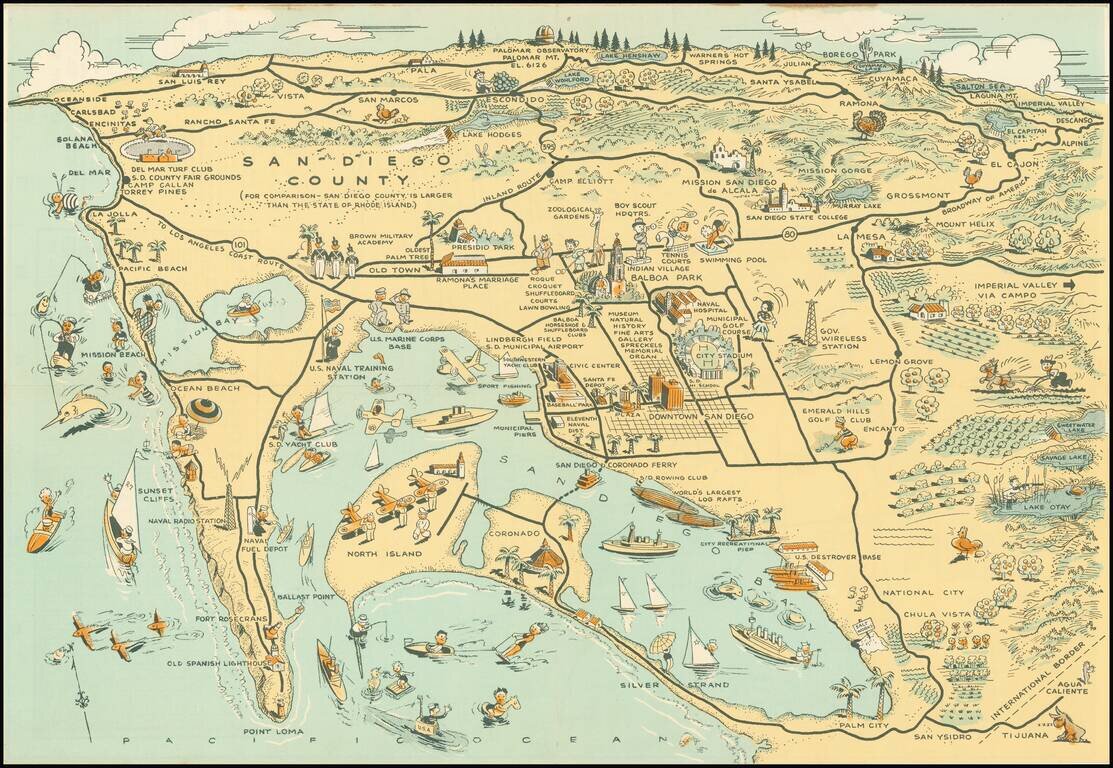
Whimsical map of San Diego County, showing a host of activities throughout, with a larger city street map. Among the more timely inclusions in the map are the Baseball field next to the County Administrative offices and Balboa Stadium, next to San...
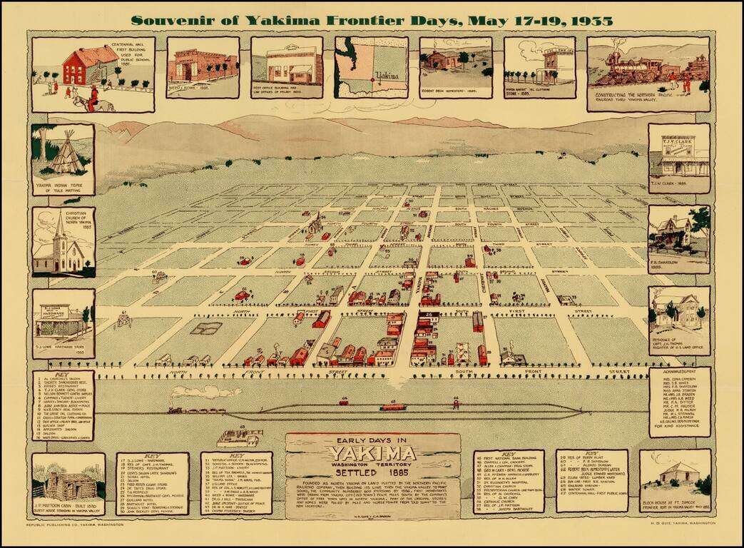
Scarce view of the town of Yakima, Washington, as it appeared in 1885. The view shows a plan of the City, naming streets and identifying 67 early structures. The map is surrounded by views of early buildings, including the Block House at Ft. Simcoe...
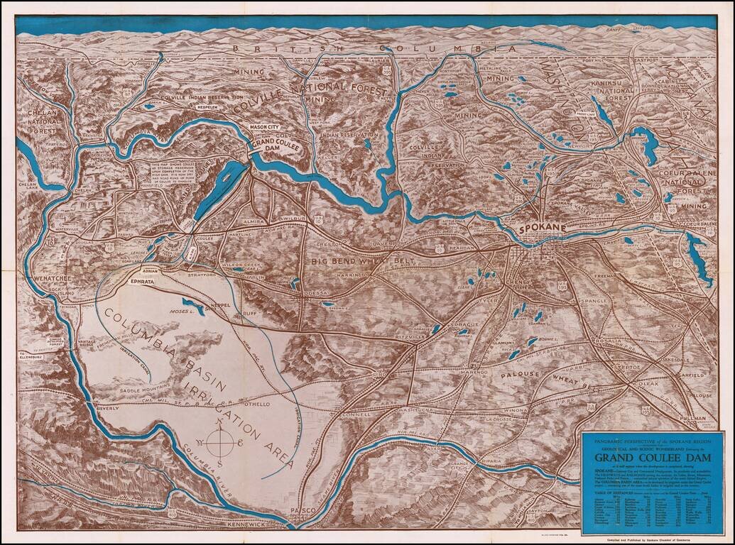
The Beginning of Construction at Coulee Dam Detailed birdseye view style map of the region bounded by Banff, Pullman Washington and the Pacific Ocean, centered on Lake Roosevelt and Grand Coulee Dam. The map is marvelous graphical depiction of the...
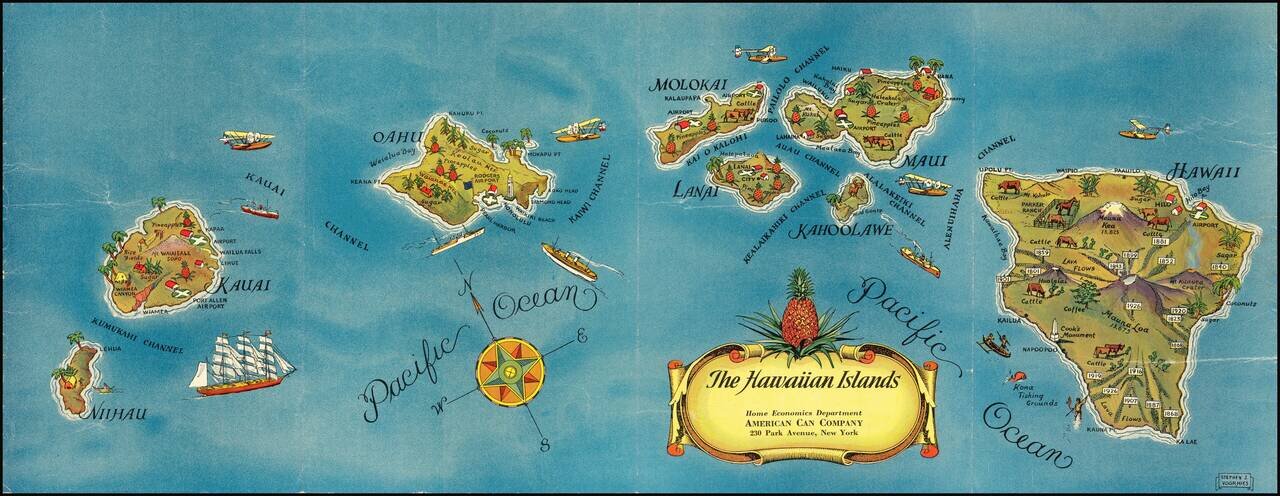
Pictorial map of Hawaii, published for the American Can Company. Each of the Hawaiian Islands includes monuments illustrating indigenous crops (lots of pineapples!), live stock, volcanoes, airports and other points of local interest. This is the...
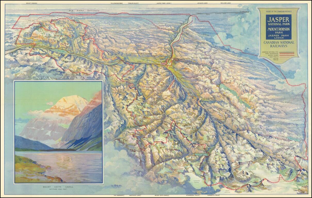
Finely illustrated vintage view-map of the Jasper National Park and environs, published by the Canadian National Railway. Color coding identifies Canadian National Railway lines, Park Boundaries, Motor Roads, Government Trails, and Indian Trails....
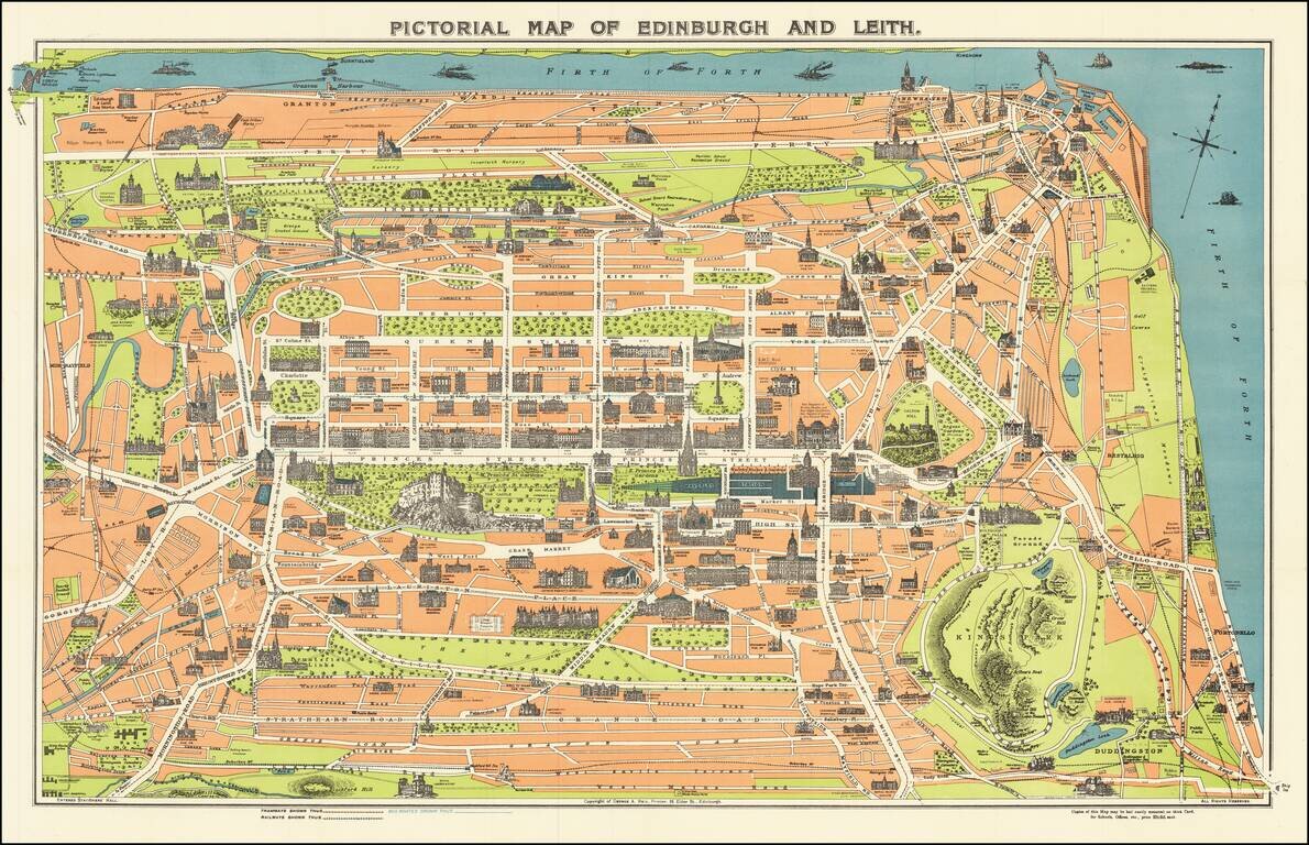
Vintage pictorial map of Edinburgh, Scotland, with the landmarks and major building, illustrated pictorially. The map was issued for tourists by George A. Reid, an Edinburgh-based publisher. On the verso are the stories of Mary Queen of Scots, Sir...
![(Second World War - Nazi Germany) L'Allemagne Paradis du Tourisme. [Germany The Paradise of Tourism.]](/map/small/63210.jpg)
Striking propaganda and travel map of Germany, published by the Reichsbahnzentrale fur den Deutschen Reiseverkehr and the German Railways Information Bureau. Text, map, and graphics on the verso. Includes decorative border alternating crests and "La...
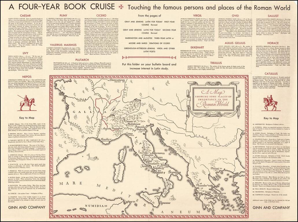
Fascinating "map of the Roman World", illustrating a Ginn & Company promotional advertising brochure promoting its Latin and other educational text books.
![[Shanghai]](/map/small/68131.jpg)
An attractive map of Shanghai, dating to just before or during the Japanese invasion. The map focuses on the International Settlement and the French concession, and extends into the "Chinese City." Shanghai is large, but far from the metropolis it...
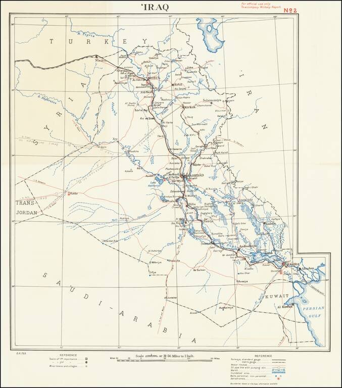
For official use only To accompany Military Report This is a simple and attractive military map of Iraq dating to the mid-twentieth century. The map is detailed, showing roads, cities, rivers, pipelines, cables, and more. Detail extends slightly into...