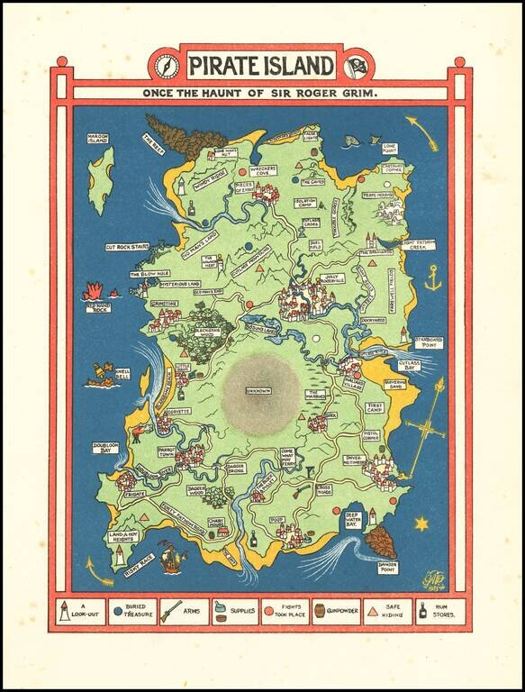
Excellent Golden-Age of Illustration Fantasy Map of a Pirate Island. Color-lithographed fantasy map of "Pirate Island" by Gilbert Anthony Pownall, published in London in 1924. The map includes a key showing: lookouts, buried treasure, arms, supplies,...
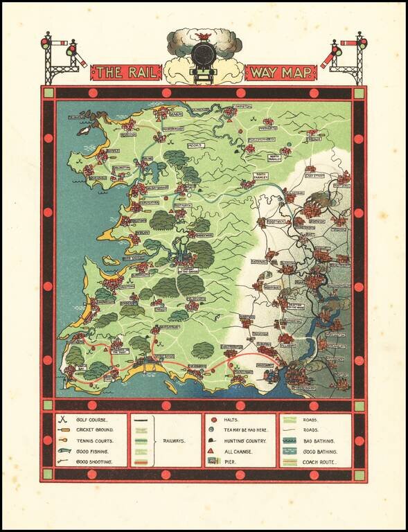
Excellent Golden-Age of Illustration Pictorial Map of the Go Where You Please Rail Way Scarce fantasy pictorial map, with accompanying text. The map was published in Traveller's Joy A Device, written by Dion Clayton Calthrop and illustrated by...
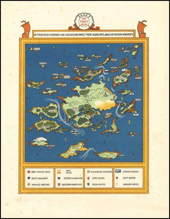
Excellent Golden-Age of Illustration Fantasy Map of the lands of Forty Isles of G. Robinson -- A Voyage of Self Discovery Scarce fantasy pictorial map -- very much of the period in terms of cultural and social values. "Fortunately for him, he found...
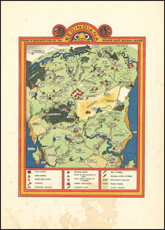
Golden-Age of Illustration Map of Redindiana (Fictious Land of American Indians] Color-lithographed fantasy map of "Redindiana" by Gilbert Anthony Pownall, published in London in 1924. The map and text tell the story of the taming and "westernizing"...
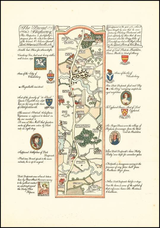
Golden-Age of Illustration Road Map of the Fictional Journey of Mr. Neronius Quarrell. Color-lithographed fantasy road map by Gilbert Anthony Pownall, published in London in 1924. The map was published in Traveller's Joy A Device, written by Dion...
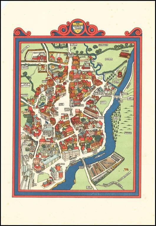
Golden-Age of Illustration of "The Market Town" Color-lithographed "market town, drawn by Gilbert Anthony Pownall, published in London in 1924. The map was published in Traveller's Joy A Device, written by Dion Clayton Calthrop and illustrated by...
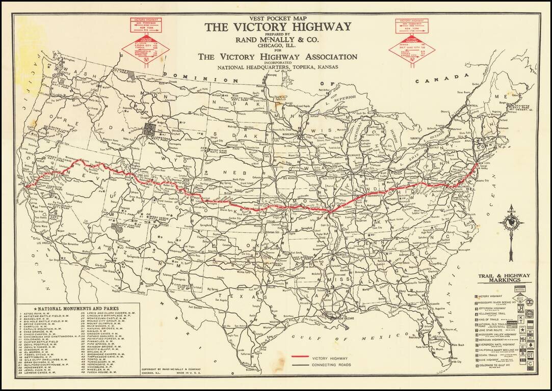
An Early Transcontinental Highway Nice example of this scarce map of the United States published by The Victory Highway Association, with its National Headquarters in Topeka Kansas. The Victory Highway is highlighted in red, differentiating it from...
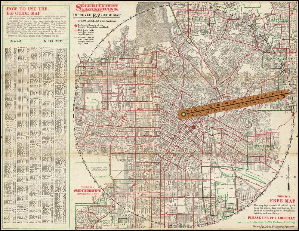
Rare folding map of Los Angeles and Vicinity, with riveted rotating pointer. Interesting promotional map for Security Trust & Savings Bank, with an Index and direction on how to use the map, which shows the locations of the bank's branches,...
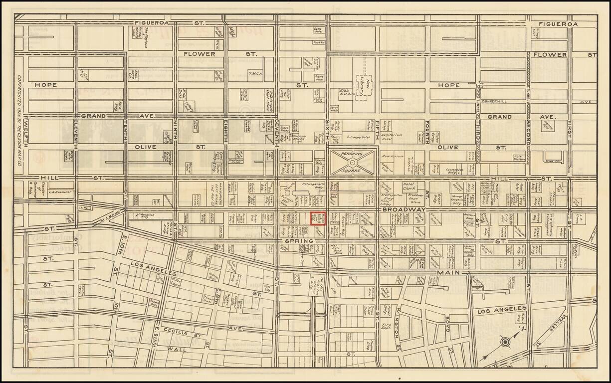
Detailed map of downtown Los Angeles in 1924, featuring building-level detail and an extensive enumeration of businesses in the area. The map is roughly bounded by Figueroa on the west, Wall Street on the east, First Street in the north, and Twelfth...
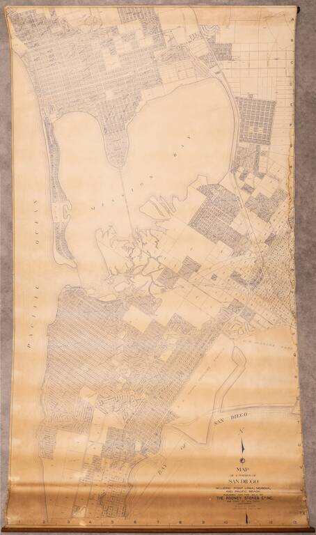
Large wall map of the San Diego neighborhoods of Point Loma, Mission Bay, Mission Beach, Pacific Beach, and Bay Park. This is a very large and detailed wall map of these neighborhoods, depicting them at 1:400 feet. One of the most interesting aspects...
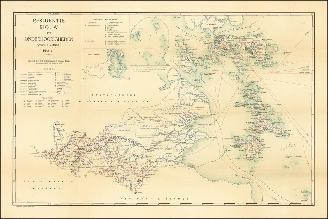
Jakarta Imprint -- Residency of Riau and Dependencies Rare map of the the Riau Residency of Indonesia, extending north to Singapore, published in Batavia (Jakarta). The map covers the area south of Singapore and the Malacca and Singapore Strait,...