
Map size in jpg-format: 10.6593MiB
Click to open in high resolution (open in new tab).
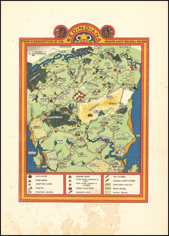
Golden-Age of Illustration Map of Redindiana (Fictious Land of American Indians]
Color-lithographed fantasy map of "Redindiana" by Gilbert Anthony Pownall, published in London in 1924.
The map and text tell the story of the taming and "westernizing" of the Indian lands of Redindiana, beginning with the encounter between the Ipawar chief, Big Bull Moose, and Ezra Jonson, Founder of the Honk River Company (fur traders).
While the message of the text is peaceful -- Jonson and Big Bull Mouse meet and make a peaceful agreement of "co-existence," the message is not so subtly steeped with "traditional" American views on Indian relations -- "Where you may see upon the map tobacco plantations and cotton fields and buildings, there was one nothing but wild and arid country; all this did Ezra do. Of course there were small Indian Wars, and some scaping and stores set of fire, but such things had to be . . . " --clearly a fictional account of what was then the prevailing historical explanation of life and progress on the American Frontier.
The map was published in Traveller's Joy A Device, written by Dion Clayton Calthrop and illustrated by Gilbert Pownall.
If you are a student, write to us in telegram: @antiquemaps and indicate what material you need and for what work you need a map in high detail. We are ready to provide material on special terms. For students only!


