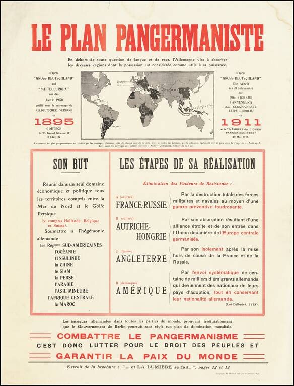
Fantastic anti-German polemic broadside map, issued in France during World War I, published by Adrien Maréchal. The map focuses on the so-called "Pan-Germanic Plan" of world domination. It rallies the French against the ever-expanding influence of...
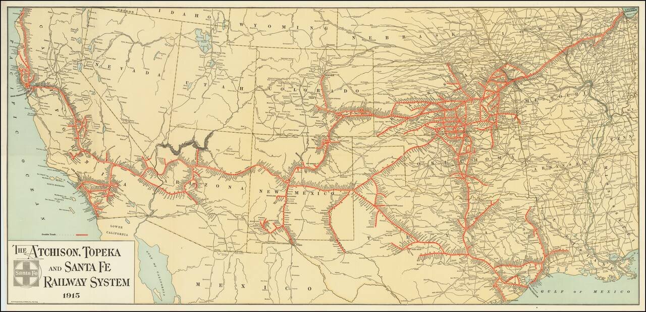
Fine example of The Atchison, Topeka and Santa Fe Railroad's general promotional map for 1915. Includes all the routes and train stations along the route in fine detail.
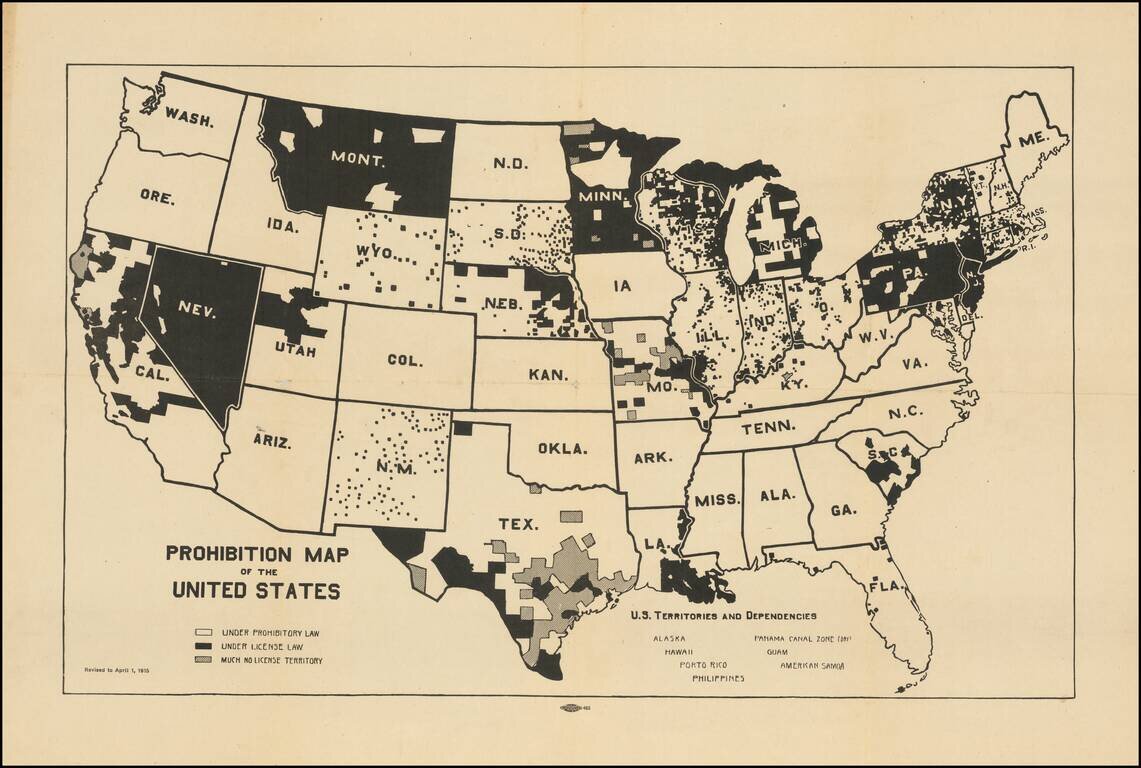
Pre-prohibition map of the United States, illustrating the various local laws that controlled the consumption and sale of liquor in the US. The map illustrates interesting geographical (and underlying cultural) variables in the implementation of...
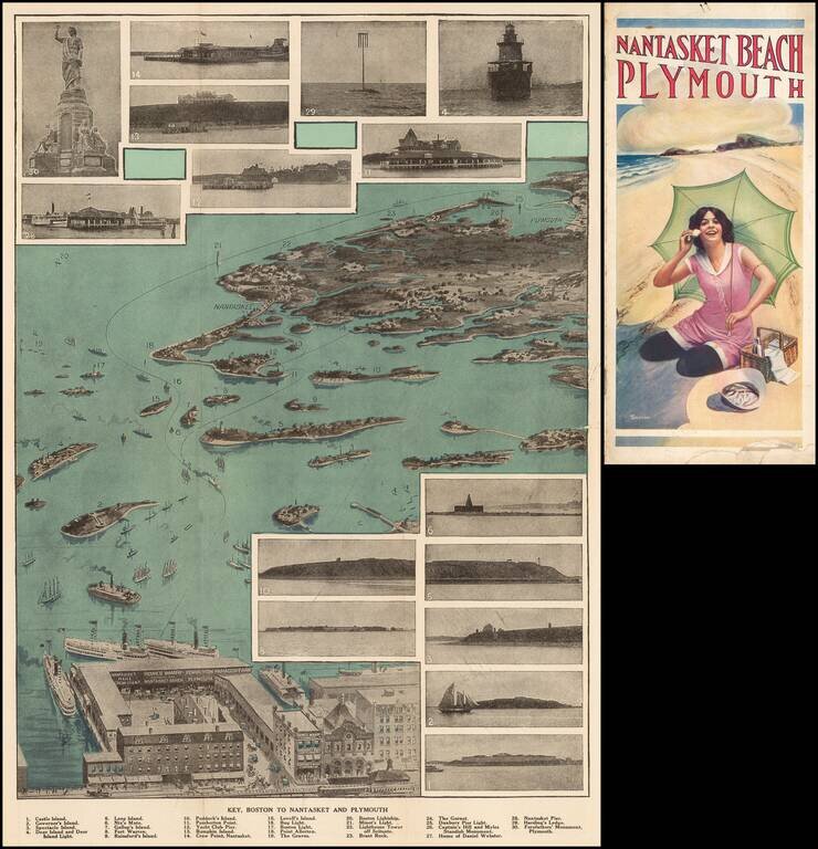
Fine view of the coastal region from Boston to Nantasket and Plymouth. A key references the 30 photographic inset images. Comes with 10 pages of text and illustrations.
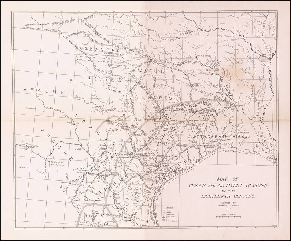
Scarce map showing Texas and adjacent regions as they would have been in the 18th Century. The map was prepared by Herbert Bolton, one of the most prolific and important writer/scholars of the 20th Century. The map shows the major Indian tribes and a...
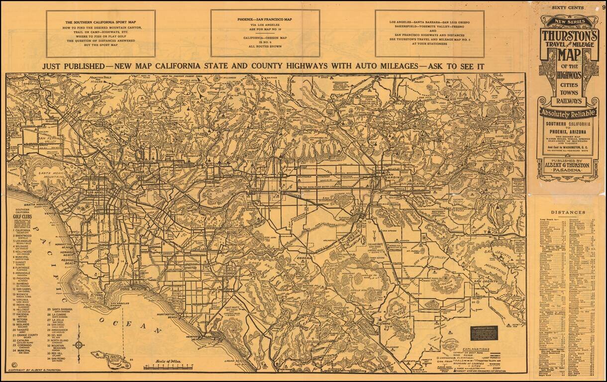
An Early Road Map of the Southwest Fantastic early automobile map of the Desert Regions between Southern California and Phoenix, published in 1915 by Albert G. Thurston and drawn by D.C. McClain. The desert map is quite extraordinary, providing a...
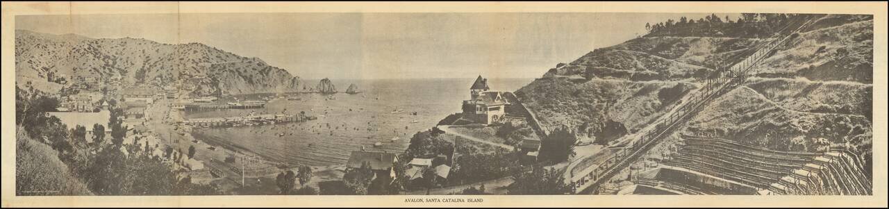
Scarce early Catalina Island promotional brochure, issued by the Wilmington Transportation Co. The brochure opens to reveal a panoramic view of Avalon, Santa Catalina Island, served by Steamers of Wilmington Transportation Line, Banning Line, the...
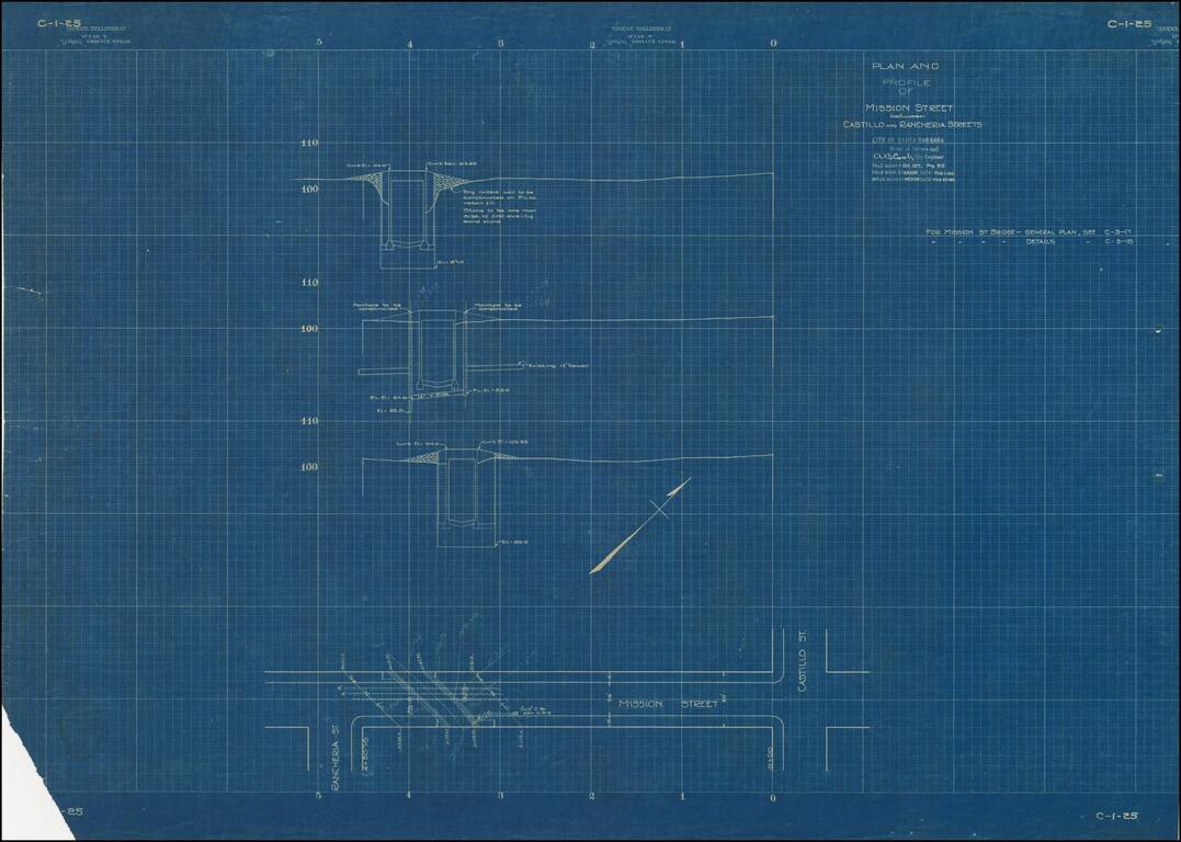
Ephemeral blueprint plan of engineering work on Mission Street in Santa Barbara, California. The map bears the facsimile signature of A.B. Cook, City Engineer for Santa Barbara.
![[Bering Land Bridge, Alaska] Teller-Kougarok Area Compliments of Lomen Commercial Company Nome, Alaska](/map/small/45000jc.jpg)
Detailed map of the Teller-Kougarok area of the Seward Peninsula, the westernmost point of the mainland of Alaska, just across the Bering Straits from Russia. The map is named for the town of Teller and the Kougarok River. The map was a promotional...
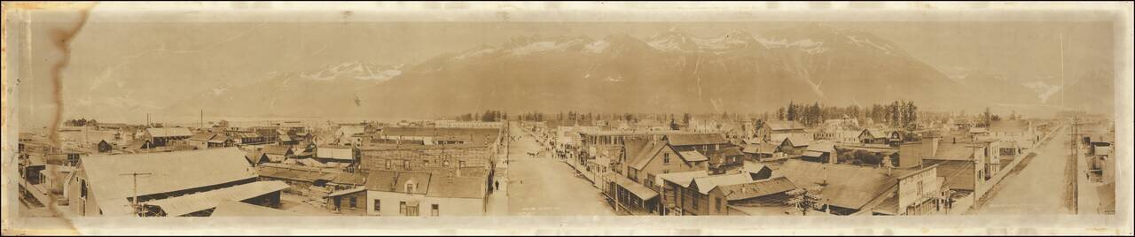
Panoramic photographic view of Valdez, Alaska, likely taken by Sheelor at the later end of the Klondike Gold Rush. The city was named in 1790 after the Spanish Navy Minister Antonio Valdés y Fernández Bazán. A former Gold Rush town, it is located...
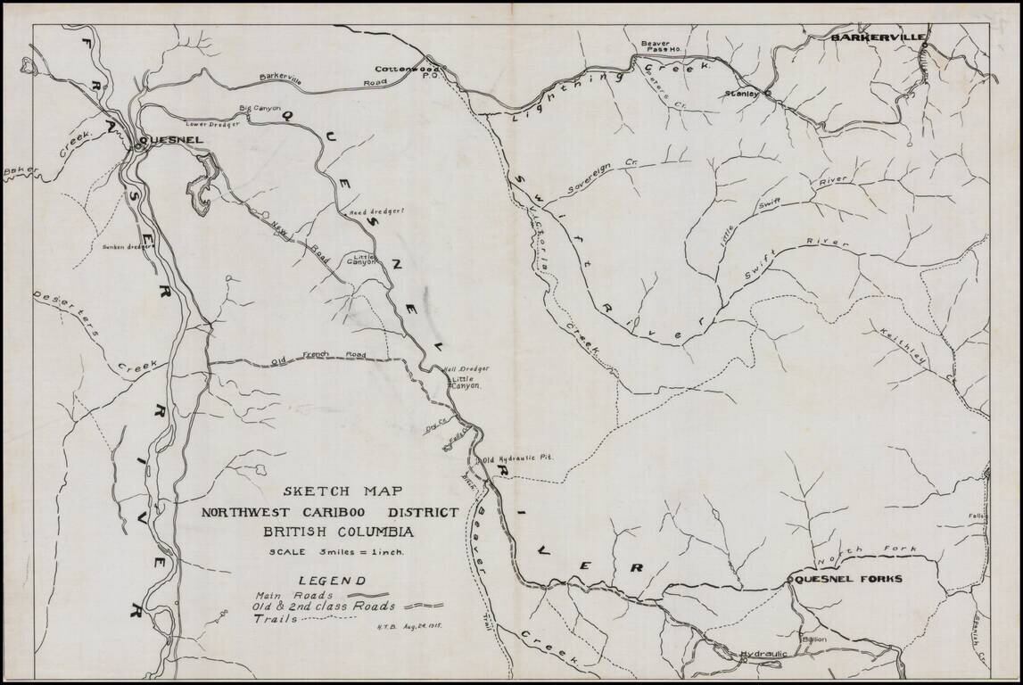
Detailed map of the Northwest Cariboo District, in British Columbia, drawn on a scale of 3 Miles = 1 inch. The legend shows main roads, old and second class roads and trails. The map focuses on the region between the Fraser River to the west and...
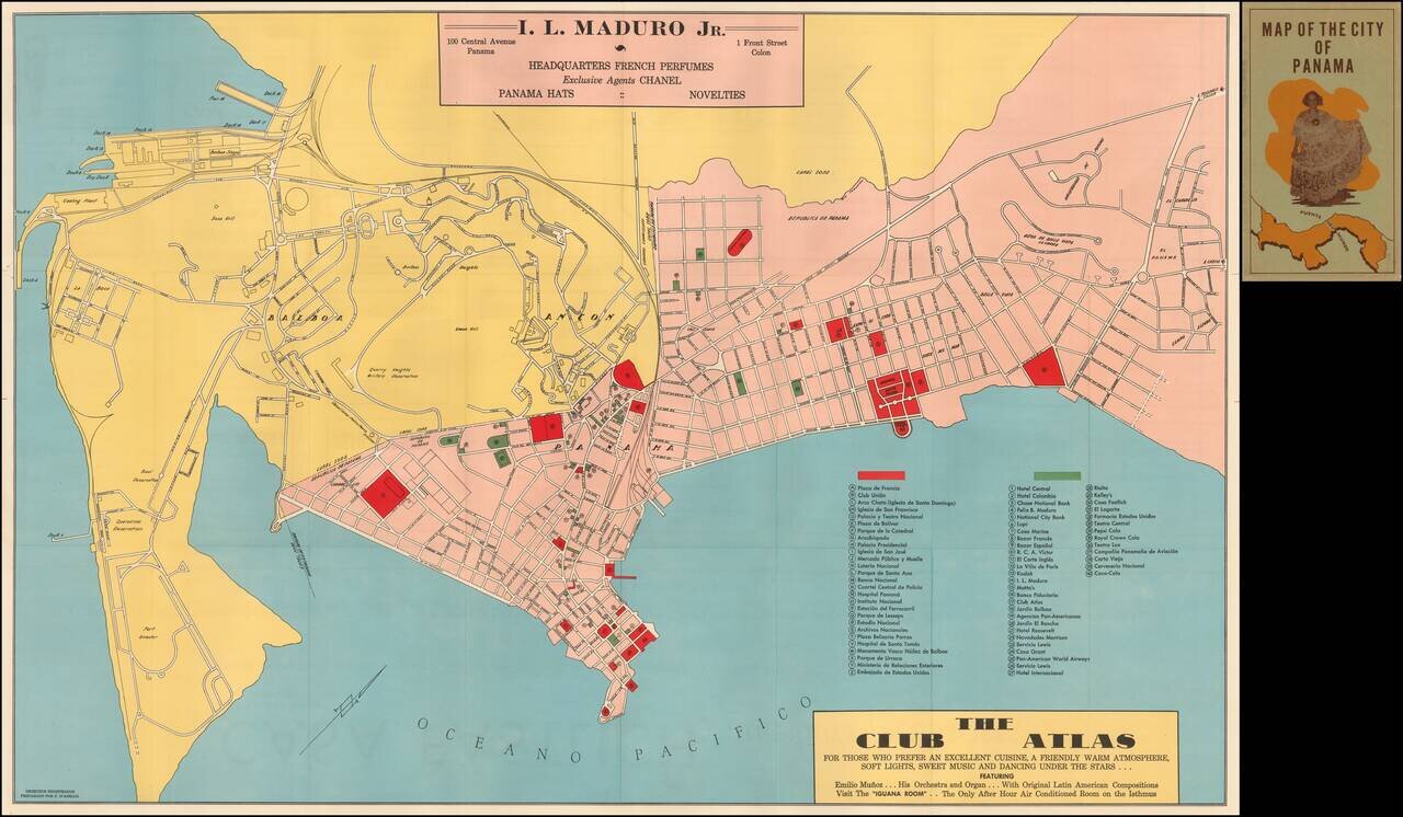
Rare early map of Panama City, published in Panama. The map was prepared as a promotional map for I.L. Maduro Jr. and Club Atlas. Includes a key locating 40 locations.