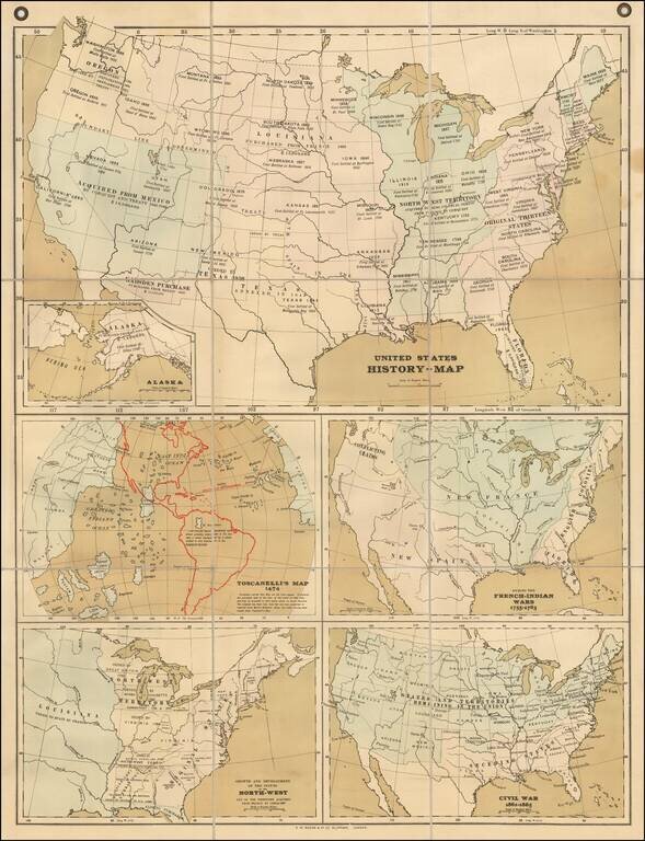
Rare teaching map of the history of the United States, advertised for sale by Bacon in 1899. The map was part of Bacon's Excelsior School-Map series and specifically the "Excelsior Wall-Atlases For Secondary Schools" The present set of 5 maps on a...
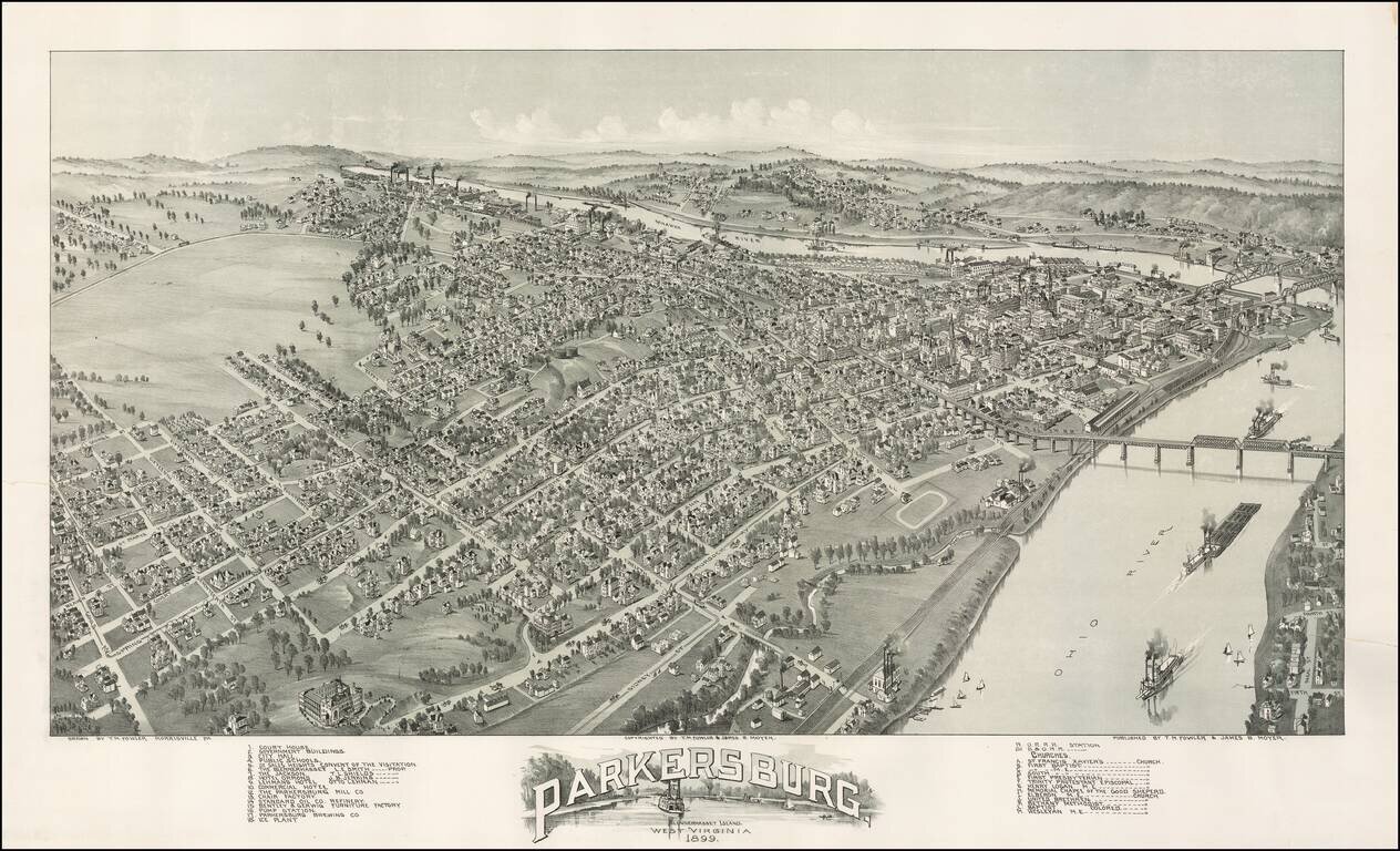
Striking view of the town of Parkersburg, West Virginia, approximately 40 miles north of Charleston, West Virginia. A stiking and highly detailed view, showing street names, buildings and the river. A classic late 19th Century view.
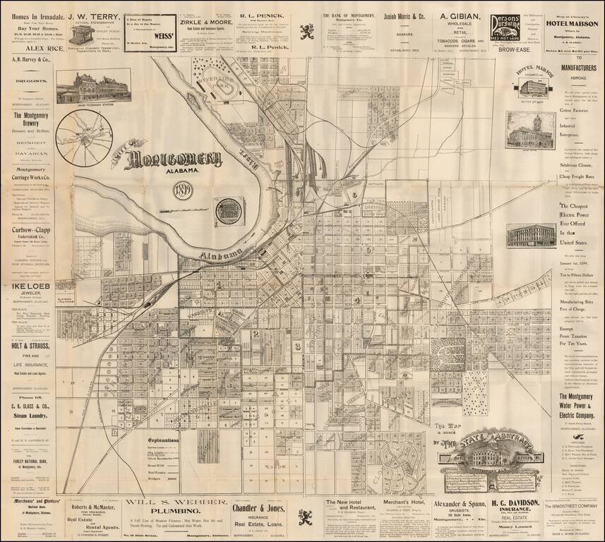
Rare separately issued promotional map of Montgomery Alabama, published by the State Abstract Company. Includes decorative vignettes of the Union Passenger Station, Court House, State Capital Building, and illustrating the town in exceptional detail,...
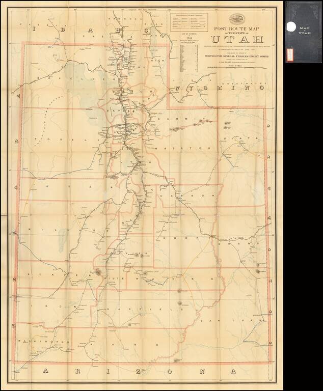
Highly detailed map of Utah, focusing on the post roads and postal details as of June 1899. All the post offices and discontinued post offices in Utah are noted. The routes on the map are color coded to note delivery schedules, including: Purple:...
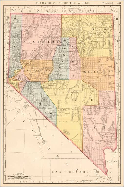
Large format detailed map of Nevada, showing towns, rivers, railroads, mountains, lakes, etc. Beautifully colored with many statistics. From Rand Mc Nally & Co's Business Atlas.
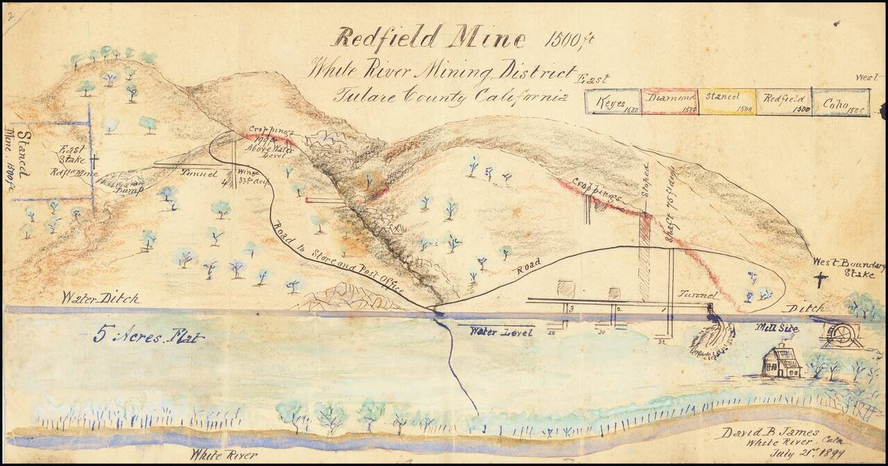
Manuscript View of Mining District By California Inventor David Bice James. Highly detailed rendering of the area around the White River, Mining District, drawn by David B. James, who would then have been serving as Mining Superintendent. James story...
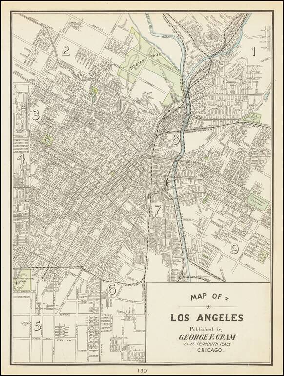
One of the Earliest Obtainable Separately Issued Maps of Los Angeles This is the rare Cram map of Los Angeles, showing the city roughly from Echo Park to Alameda. Detail is extensive on this street map, with many roads named in this region. To the...
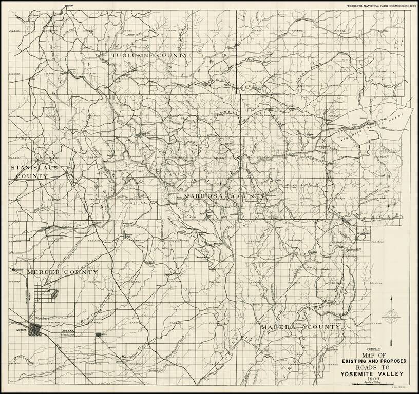
Fine example of the large format map of the entire Yosemite National Park and adjoining regions, which accompanied the Official Report of the Yosemite National Park Commissions. The subject map is the result of a ten year effort to increase public...
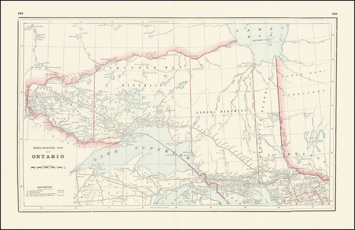
Detailed railroad map, showing counties, railroad lines, towns, rivers, township surveys, lakes, mountains, creeks, waterfalls, and a host of other information. Focuses on the northern Great Lakes, specifically Lake Superior, and shows Ontario north...
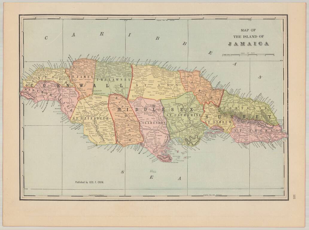
Attractive and highly detailed map of Jamaica, issued in Cram's scarce American Railway Atlas.
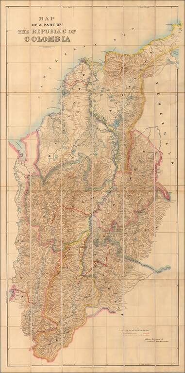
Bogota as the Prime Meridian! Rare large format map of most of Colombia (omitting a small portion of the west coast, to the west of the Rio Quito, bearing the signature of William Lidstone, C.E. The map contains political division with added color,...
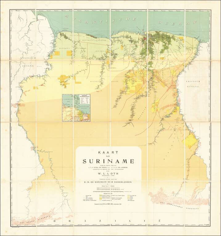
The First Modern Map of Suriname Fine example of W. L. Loth'a large map, generally regarded as the first 'modern' map of Suriname. The vast majority of information depicted on the map appears along the major Rivers in the interior of the country,...
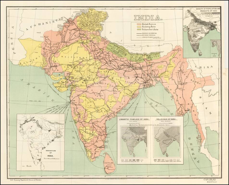
Detailed map of India, showing density of population, lingusitic information, religion, etc. The map is color coded to show British Provinces, Fendatory Provinces and Independent Provinces.
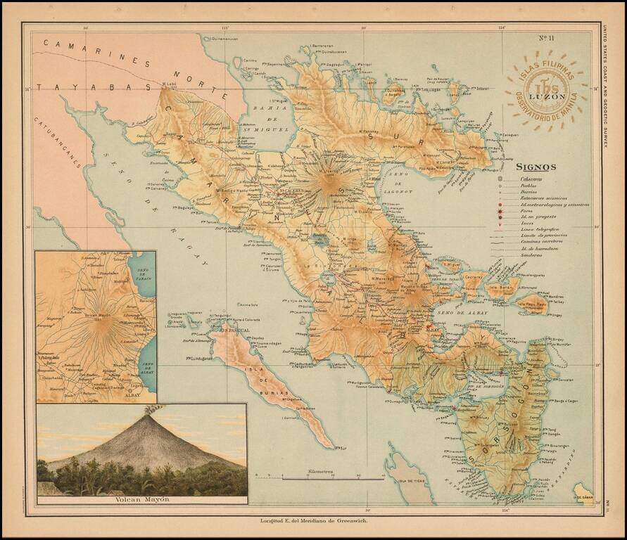
Fine map of part of Luzon published under the direction of Jose Algue and the United States Coast and Geodetic Survey in 1899. The map appeared in Atlas de Filipinas: Colleccion de 30 mapas trabajados por delineantes filipinos bajo la direccion del P....
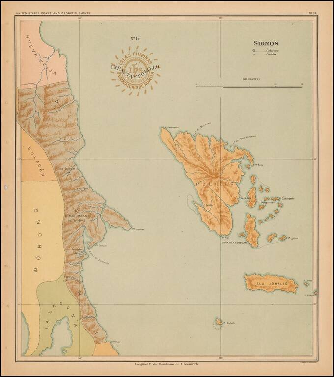
Fine map of the islands of Infanta and Polillo, published under the direction of Jose Algue and the United States Coast and Geodetic Survey in 1899. The map appeared in Atlas de Filipinas: Colleccion de 30 mapas trabajados por delineantes filipinos...
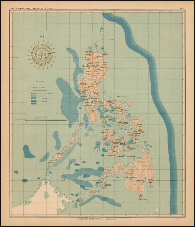
Fine orographical map the Philipines, published under the direction of Jose Algue and the United States Coast and Geodetic Survey in 1899. The map appeared in Atlas de Filipinas: Colleccion de 30 mapas trabajados por delineantes filipinos bajo la...