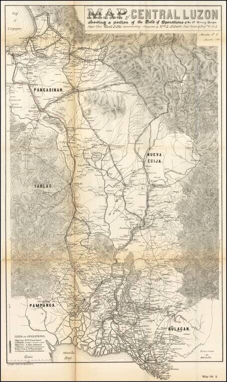
Rare military map showing part of the Island of Luzon, issued at the height of the Philippine-American War, compiled by William L. Sibert of the 8th Army Engineering Corp. The map covers central Luzon, from Manila Bay to Lingayen Gulf. The map shows...
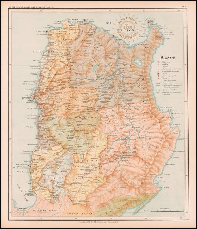
Detailed map of Luzon, published under the direction of Jose Algue and the United States Coast and Geodetic Survey in 1899. The map appeared in Atlas de Filipinas: Colleccion de 30 mapas trabajados por delineantes filipinos bajo la direccion del P....
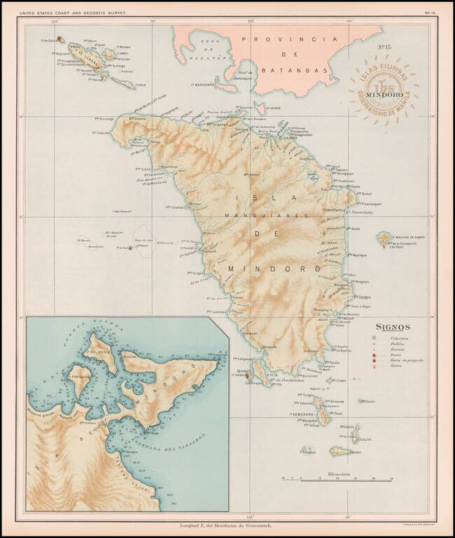
Fine map of the Island of Mindoro, published under the direction of Jose Algue and the United States Coast and Geodetic Survey in 1899. The map appeared in Atlas de Filipinas: Colleccion de 30 mapas trabajados por delineantes filipinos bajo la...
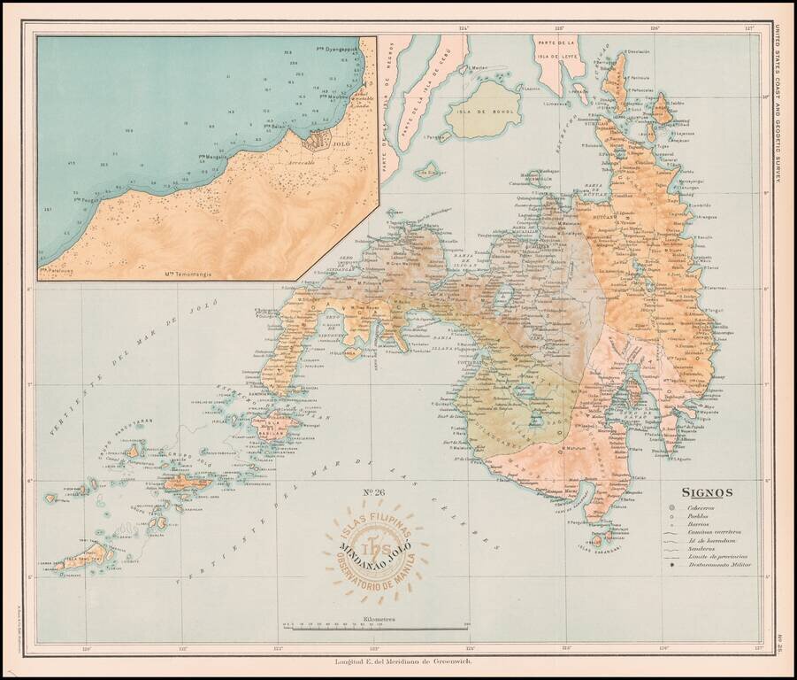
Fine map of the Island of Mindanao, with a large image inset of the area around Jolo, published under the direction of Jose Algue and the United States Coast and Geodetic Survey in 1899. The map appeared in Atlas de Filipinas: Colleccion de 30 mapas...
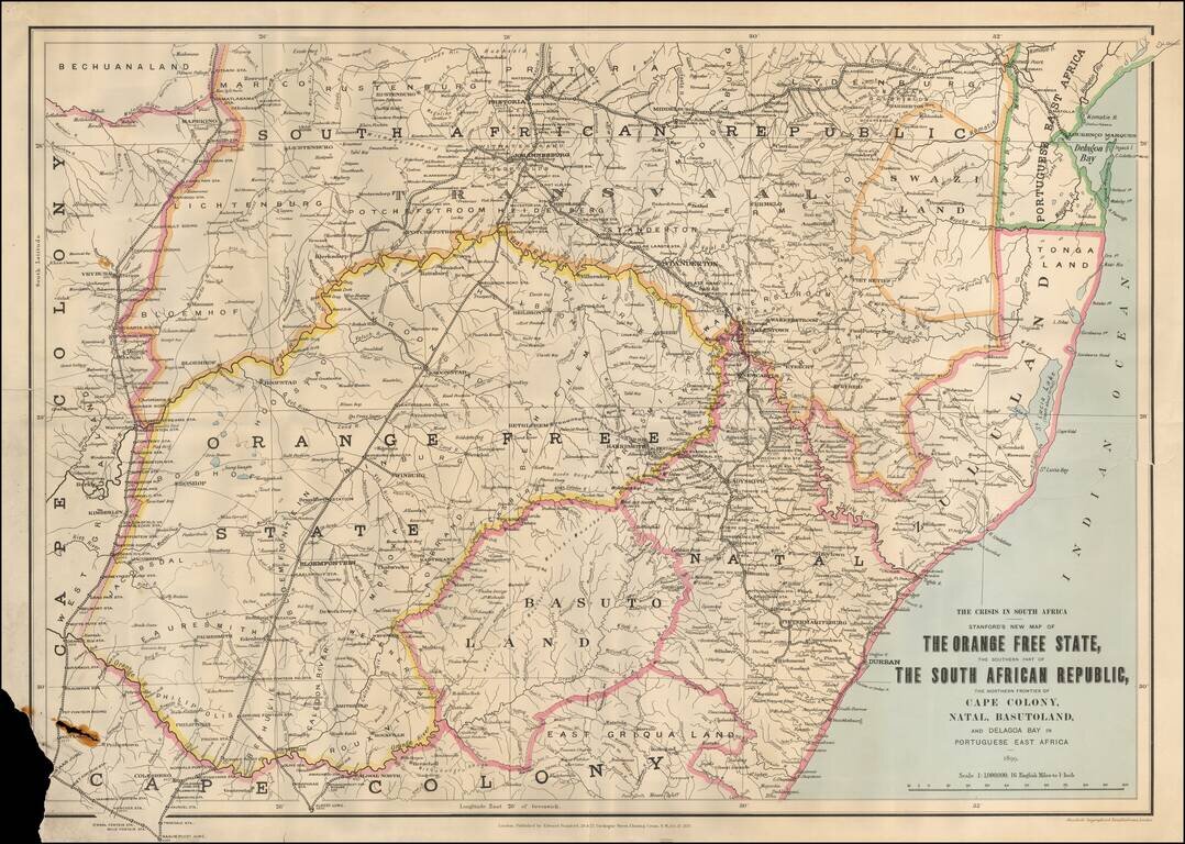
First edition of this scarce regional map of South Africa and neighboring regions, published during the "Crisis in South Africa." On December 30, 1880, a Boer republic was proclaimed and fighting broke out until the treaty of Pretoria (April 5, 1881)...
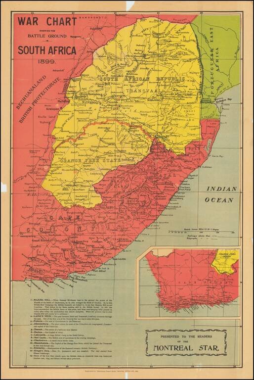
First Shots of the Second Boer War Large colorful map of South Africa, which appeared as a Supplement to the Montreal Dail Star, October 21, 1899. The map illustrates the state of affairs following the first week of Boer attacks against the British...