
Rare map showing the Catholic Missions on New Zealand, the Hawaiian Islands, Tahiti, Samoa, Tonga, New Caledonia, New Hebrides, Fijian Islands, the Marquesas, and a number of other islands, with a general map in the center, published as a Supplement to...
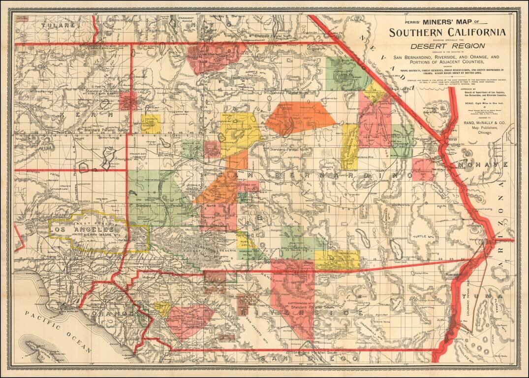
First State of Perris' Rare Mining Map of Southern California Rare map of the Desert Region of Southern California, focusing in on the regions Mining Districts, Forest Reserves and Indian Reservations. The map is criss-crossed with early Southern...
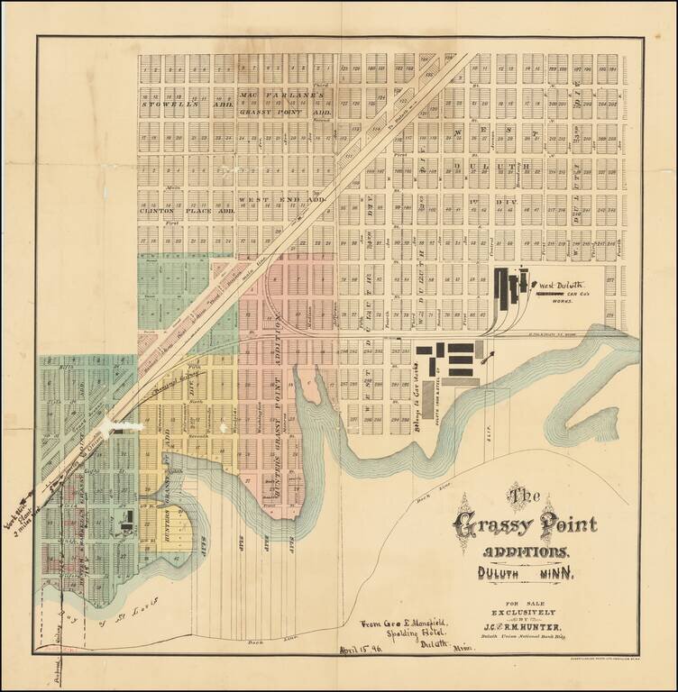
Rare 19th century Duluth, Minnesota, cadastral map, focusing on a burgeoning industrial and worker housing area in West Duluth. The factories of the Duluth Iron & Steel Co., Minnesota Car Co's Works (crossed out to read: "West Duluth Car Co.'s...
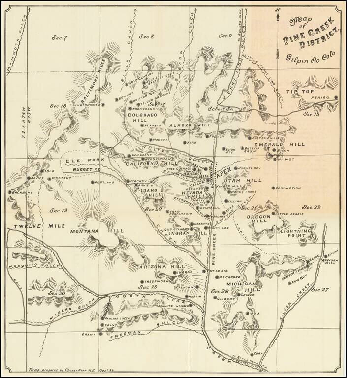
A Rare Colorado Mining Map and Pamphlet Rare Colorado mining pamphet, with a map showing the Pine Creek District in Gilpin County. The map was prepared by Chase & Rank M.E. (Mining Engineers?), in September of 1896. This example is an 1897...
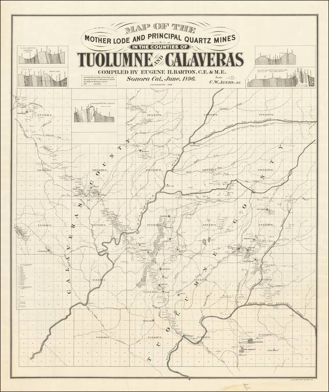
Mother Lode in Calaveras and Tuolumne Counties An interesting and little known map, centered on the Stanislaus River in Gold Country. The map is quite exceptional, "covering 860 square miles of territory and showing location of 500 different mines....
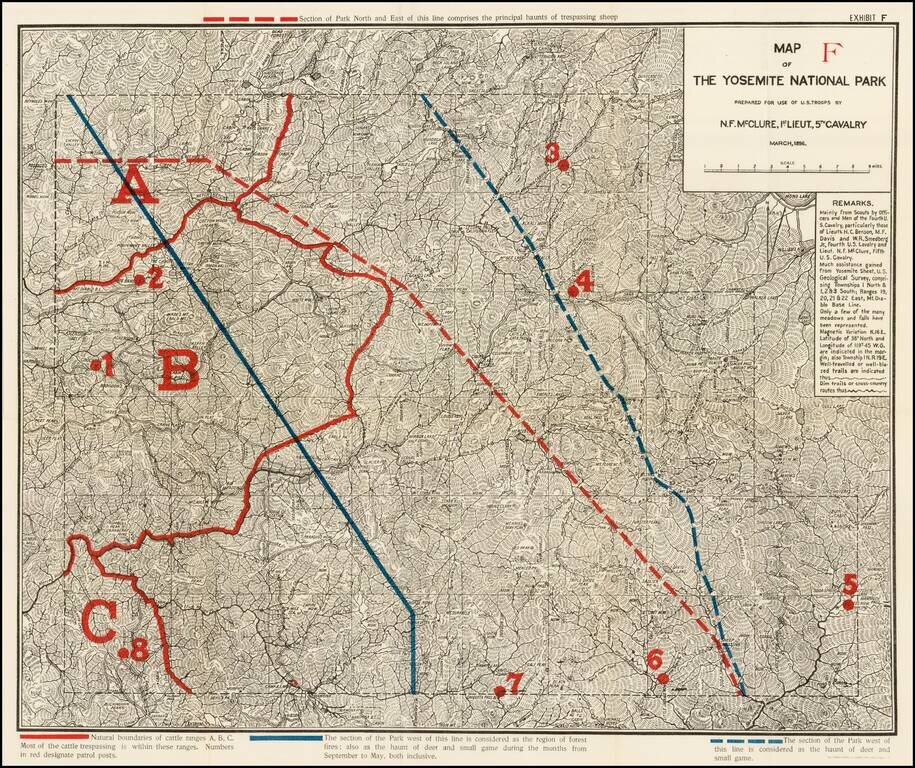
Highly detailed map of Yosemite National Park, prepared by N.F. McClure, during the period when the Park was controlled by the U.S. Army. Includes outlines in Red and Blue, showiing natural boundaries of cattle ranges, section of the park susceptible...
![[Cuba] Croquis de la Provincia De Puerto Principe Formado por el E. M. de la Capitania General de la Isla de Cuba ampliado y stampado en colors por el Deposito de la Guerra 1896](/map/small/33368.jpg)
Rare 2 sheet map of the Province of Puerto Principe, published by the Spanish War Department on the eve of the Spanish American War. Puerto Principe (now Camaguey) is shown in remarkable detail for the period. This is one of a series of series of...
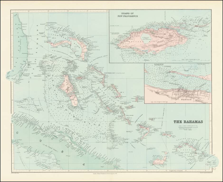
Fine and highly detailed map of the Bahamas from Stanford's London Atlas. Includes an inset map of Nassau and an inset map of the Island of New Providence.
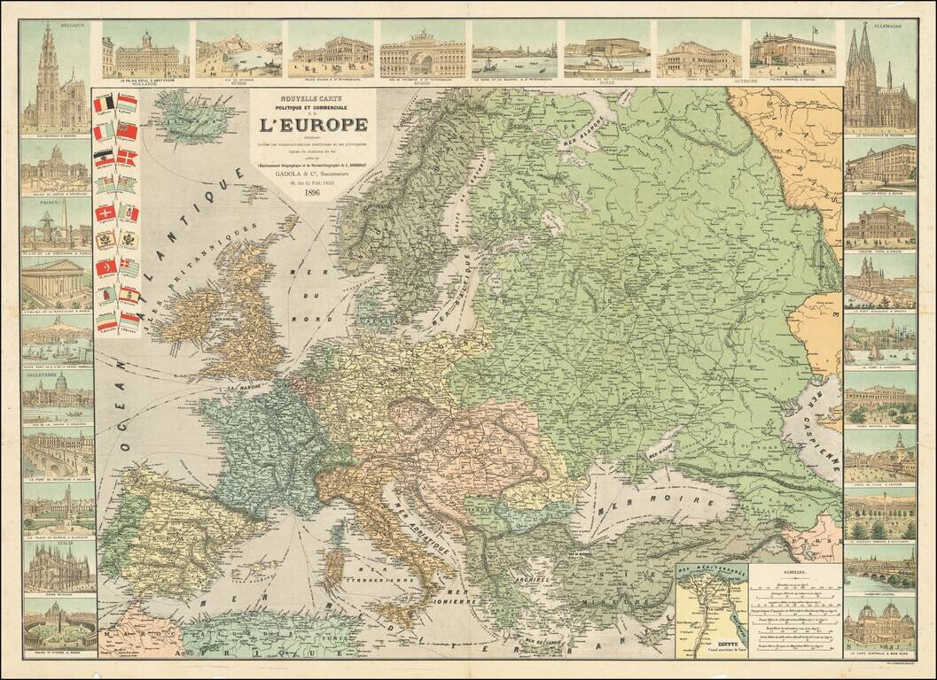
Includes 28 Vignettes and 18 National Flags Decorative map of Europe by Jean Dosseray, published in Paris. The map provides a detailed look at Europe and its major lines of communication. Along the sides, there are images of famous landmarks and...
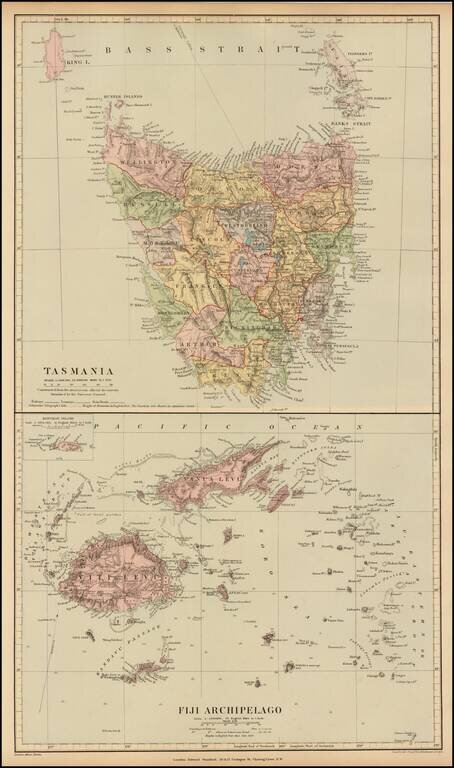
Fine and highly detailed map of Fiji and Tasmania, from Stanford's London Atlas. The map is meticulously colored by counties and shows fine detail throughout.
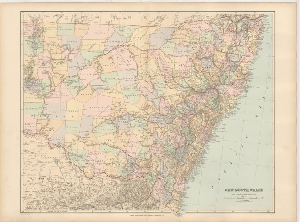
Fine and highly detailed map of New South Wales, from Stanford's London Atlas.
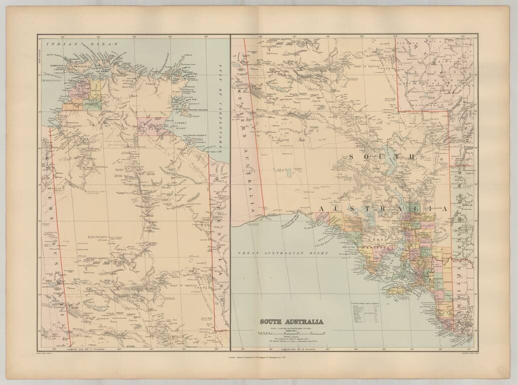
Fine and highly detailed pair of maps of South Australia, from Stanford's London Atlas.
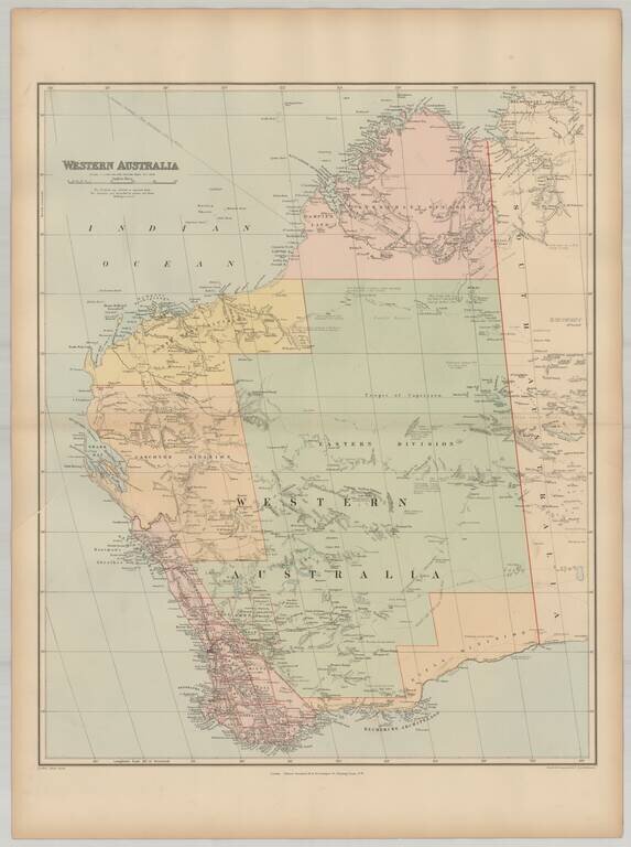
Fine and highly detailed map of Western Australia, from Stanford's London Atlas.
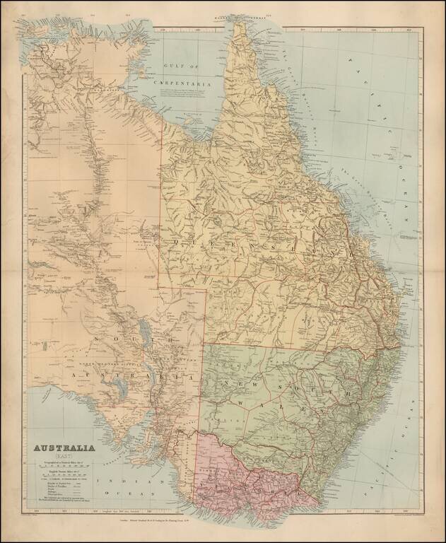
Fine and highly detailed map of Eastern Australia, from Stanford's London Atlas.
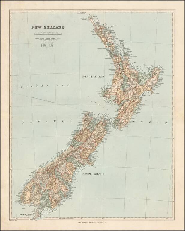
Fine and highly detailed map of New Zealand, from Stanford's London Atlas. The map is meticulously colored by counties and shows fine detail throughout.