logo

1896. Nouvelle Carte Politique et Commerciale due L'Europe indiquant toutes les communications maritimes et les principales lignes de chemis de fer . . . .1896

  • Nouvelle Carte Politique et Commerciale due L'Europe indiquant toutes les communications maritimes et les principales lignes de chemis de fer . . . .1896

Nouvelle Carte Politique et Commerciale due L'Europe indiquant toutes les communications maritimes et les principales lignes de chemis de fer . . . .1896 information:

Year of creation: 
Resolution size (pixels): 
 24214x17587 px
Disk Size: 
 149.912MiB
Number of pages: 
 1
Place: 
 Paris
Author: 

Print information. Print size (Width x height in inches):
Printing at 72 dpi 
  336.31 х 244.26
Printing at 150 dpi 
 161.43 х 117.25
Printing at 300 dpi 
 80.71 х 58.62

An example of detailing the file of this map of in a printable high-resolution:

Click to open in high resolution (open in new tab).
Attention! this is just the central piece (central area 960x960 px) of the map file!
This is an example, so that you can see and study the level of detail of a given map. The entire Map will be fully available after payment!

Nouvelle Carte Politique et Commerciale due L'Europe indiquant toutes les communications maritimes et les principales lignes de chemis de fer . . . .1896

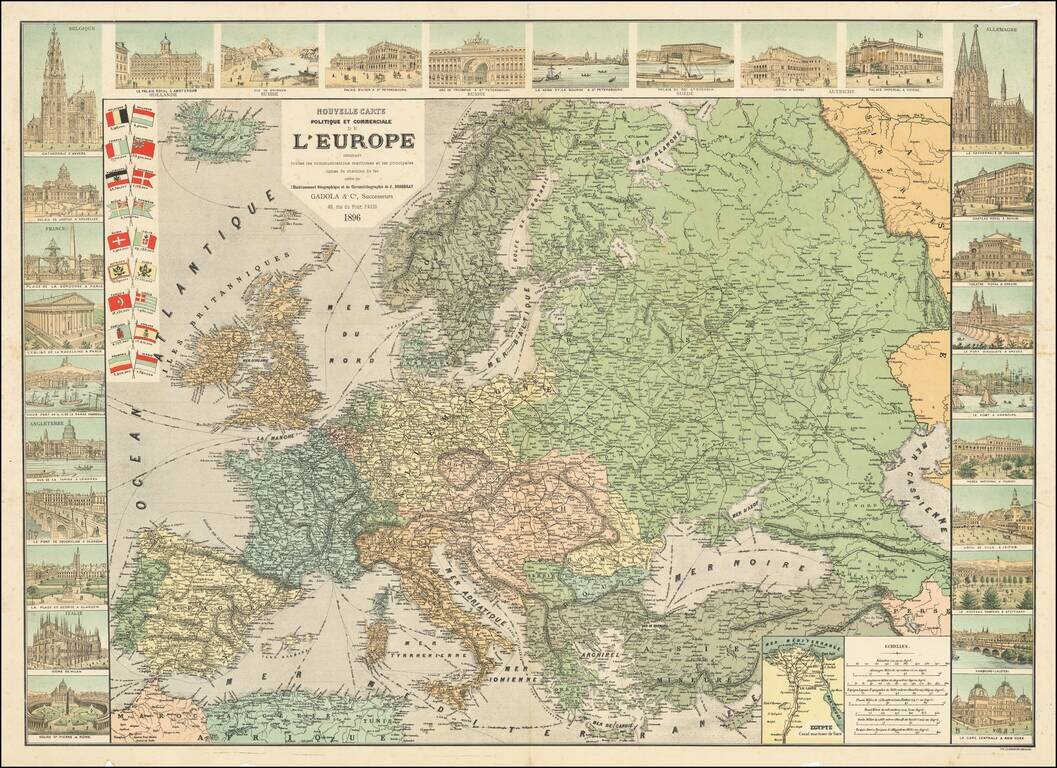
Includes 28 Vignettes and 18 National Flags

Decorative map of Europe by Jean Dosseray, published in Paris.

The map provides a detailed look at Europe and its major lines of communication.

Along the sides, there are images of famous landmarks and buildings from major European cities. Some of the featured landmarks include the Cathedral of Milan, St. Peter's Basilica in Rome, Kölner Dom, Hofburg Palace, Place de last Concorde and views of Glasgow, Saint Petersburg, New York, Amsterdam, Marseille etc.

The the upper left corner features the flags of the European states. In the lower right corner is an inset map of Egypt.

Published in Paris by Gadola & C. in 1896.


Special conditions for students!

If you are a student, write to us in telegram: @antiquemaps and indicate what material you need and for what work you need a map in high detail. We are ready to provide material on special terms. For students only!

Item information:

Year of creation:
Size:
24214x17587 px
Disk:
149.912MiB
Number of pages:
1
Place:
Paris
Author:
Jean Dosseray.
$21.99

Related item