logo

1889. Nordost-Afrika und Arabien

  • Nordost-Afrika und Arabien

Nordost-Afrika und Arabien information:

Year of creation: 
Resolution size (pixels): 
 10798x8946 px
Disk Size: 
 27.8608MiB
Number of pages: 
 1
Place: 
 Gotha
Author: 

Print information. Print size (Width x height in inches):
Printing at 72 dpi 
  149.97 х 124.25
Printing at 150 dpi 
 71.99 х 59.64
Printing at 300 dpi 
 35.99 х 29.82

An example of detailing the file of this map of in a printable high-resolution:

Click to open in high resolution (open in new tab).
Attention! this is just the central piece (central area 960x960 px) of the map file!
This is an example, so that you can see and study the level of detail of a given map. The entire Map will be fully available after payment!

Nordost-Afrika und Arabien

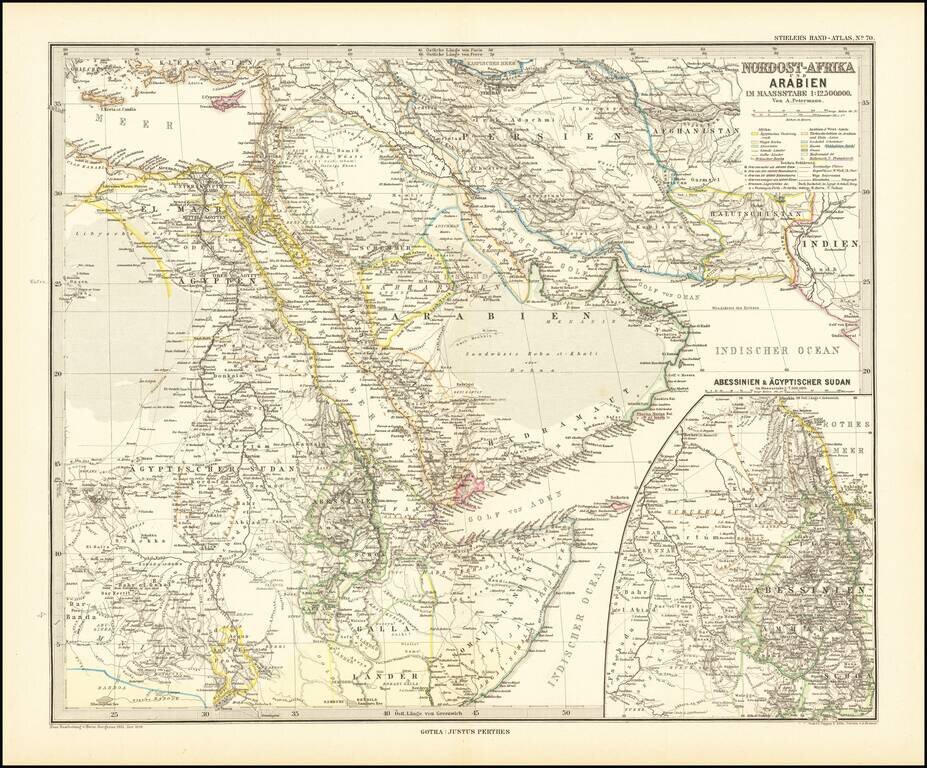
Finely detailed map centered on the Arabian Peninsula, published by Germany's leading mapmaker.

Abu Dhabi is named (Abu-Debi), as is Schardscha (Sharjah), and Dibba.

Katar (Qatar) is named, as is Sabara (Zubara), El Bedaa (Doha / El Bedaya) and Wakra (Al Wakra).

Other place names include Dalmeh (Dalma Island), Sohar, Muskate (Muscat)

In the center, Riyad is shown (Er'Riad), as are Medina and Mecca.


Special conditions for students!

If you are a student, write to us in telegram: @antiquemaps and indicate what material you need and for what work you need a map in high detail. We are ready to provide material on special terms. For students only!

Item information:

Year of creation:
Size:
10798x8946 px
Disk:
27.8608MiB
Number of pages:
1
Place:
Gotha
Author:
Adolf Stieler.
$14.99

Related item