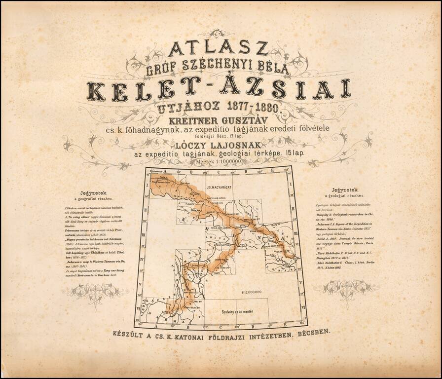
The First Geological Atlas of Tibet Rare geographical atlas of the northern Tibetan Mountains, published in Vienna by the Military Geographical Institute, published to accompany Széchenyi's three-volume account of his travels. From 1877 to 1880...
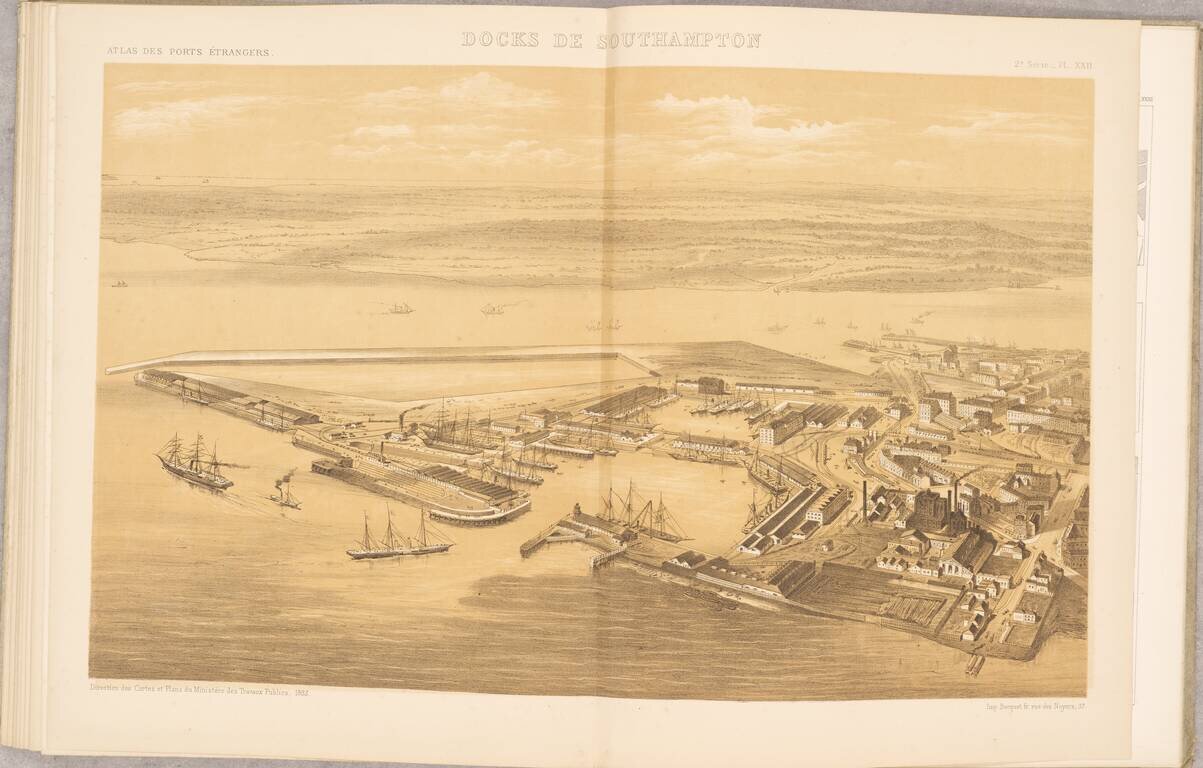
Scarce French Atlas of "foreign" ports, published by the French Ministry of Public Works. The atlas consists of 20 mostly double page and folding maps, including: Hamburg Hamburg (piers and wharfs) Boston Charleston Rio de Janeiro Cardiff and...
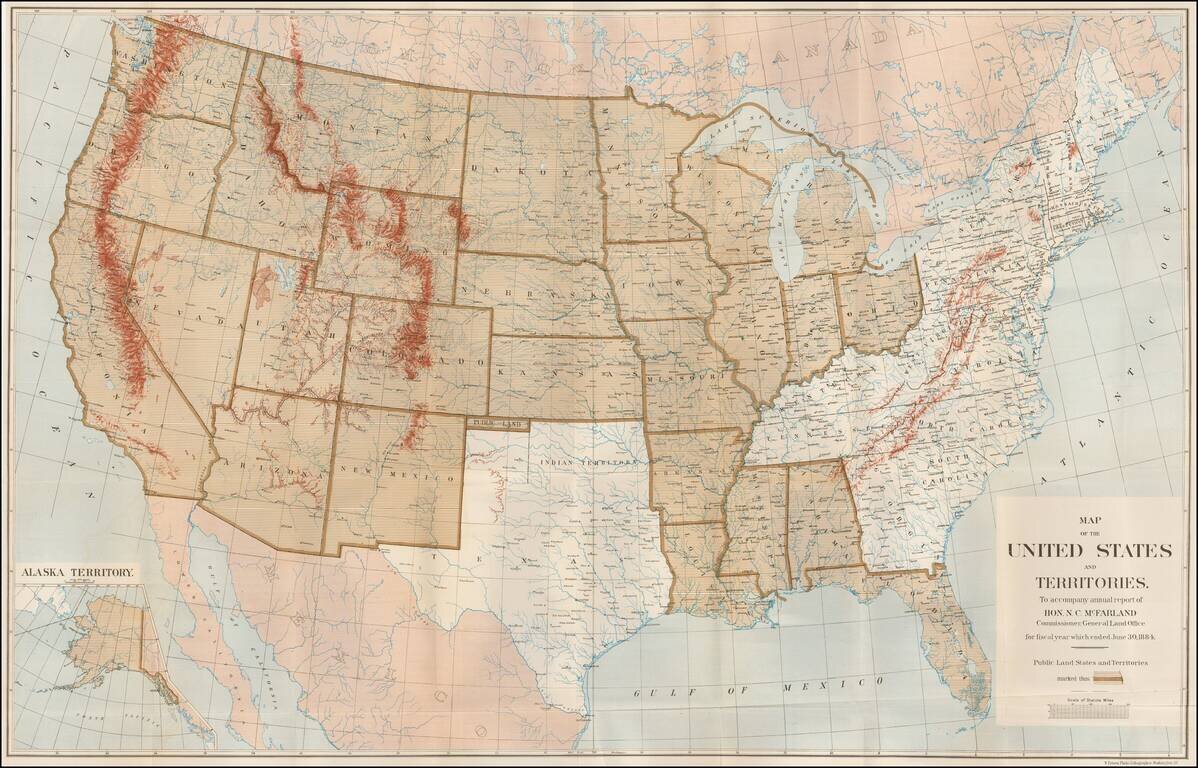
Large Map Illustrating the Public Land States and Territories Highly detailed map of the United States, issued to accompany the annual report of N.C. MacFarland, Commissioner, General Land Office for fiscal year which ended June 30, 1884. The map...
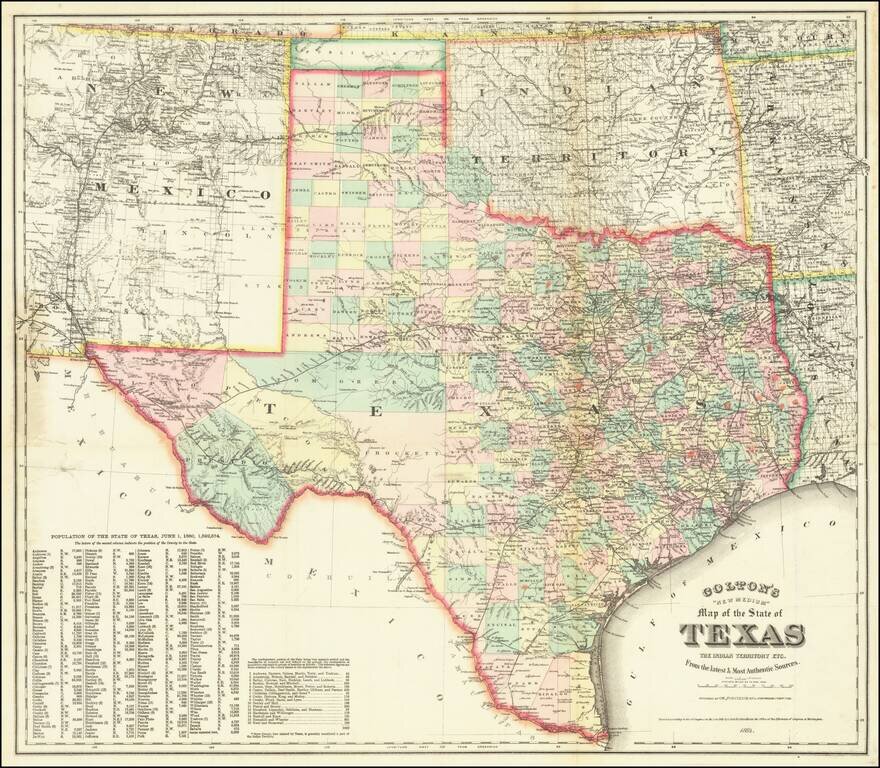
A Texas Rarity Fine large separately published map of Texas, published by GW & CB Colton in 1884. The map provides a detailed treatment of Texas, Indian Territory, and New Mexico, the latter two of which have now been extensively surveyed and...
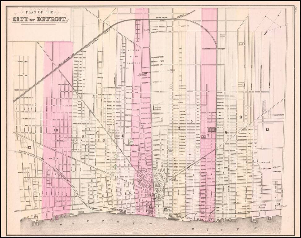
Detailed map of the city of Detroit, hand colored by wards. Shows the Michigan Central RR and Depot, Detroit & Milwaukee RR and Depot, Michigan Exchange, Biddle House, Post Office, Masonic Hall, Board of Trade, Water Works, Harper Hospital,...
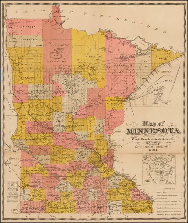
Interesting separately issued map of Minnesota, published by the State Immigration Board. The map is colored by counties and showing County Seats, towns, villages, post offices, railroads, railway stations, townships, lakes, etc. The Northern...
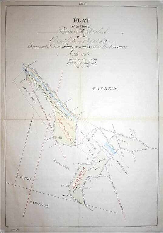
Fascininating Clear Creek County, Colorado Plat Map and GLO Mineral Certificate, confirming the mining claim of Marcus W. Rasbach to mining rights first claimed on June 30, 1881. A fine example of a General Land Office Mineral Certificate, consisting...

Excellent early map of Idaho, Montana and Wyoming Territories, published by SA Mitchell Jr. Includes early county configurations for each: Wyoming has only 7 counties; Montana has 11 counties; Idaho has 13 counties. The map shows Indian...
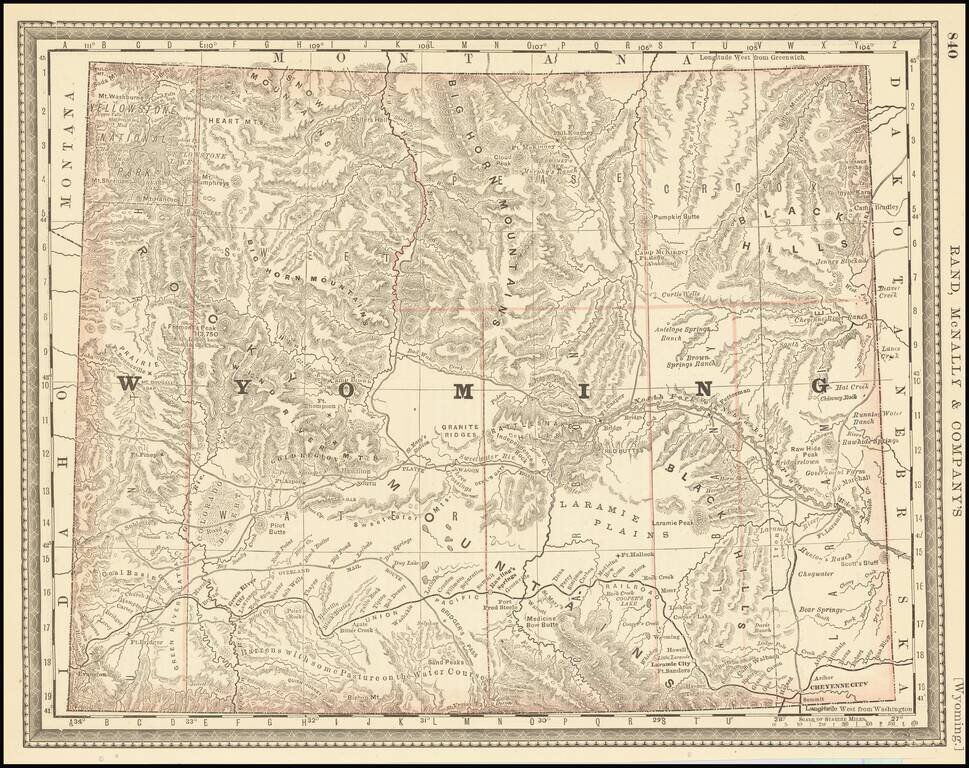
Highly detailed map of Wyoming Territory, showing towns, rivers, railroads, mountains, lakes, etc. One of the earliest seperately issued maps of Wyoming to appear in a commercial atlas.
![Map Showing the Summer Resorts on the Pacific Coast, adjacent to the lines of the Central and Southern Railroads. [California Tourist. Yosemite, The Big-Tree Groves Geysers, Monterey and other Popular Summer Resorts of Californa]](/map/small/41461.jpg)
Detailed railroad map of the area around San Francisco Bay, extending to Virginia City, Nelson, Willows, Cloverdale, Clear Lake, Monterey, Madera, and Yosemite. The map shows the various railroad lines servicing the above listed destinations, via the...
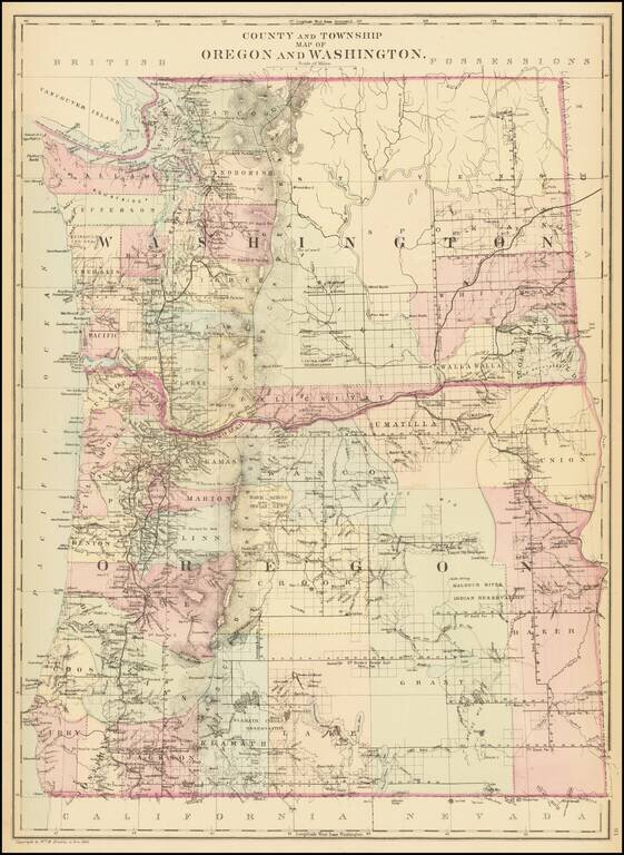
Detailed map of Washington and Oregon, which appeared in a late edition of Mitchell's General Atlas, pubished by William Bradley. The map is colored by counties and showing towns, roads, railroads, rivers, lakes, and a host of other details. SA...
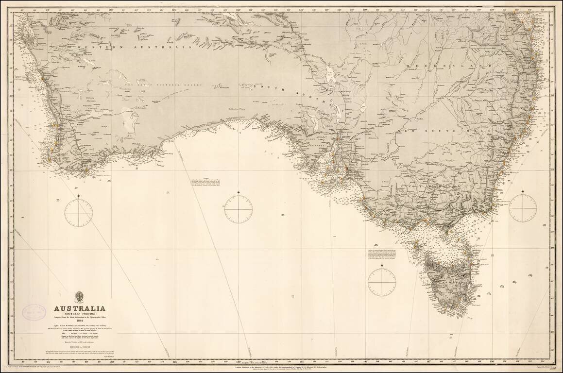
Fine rare format chart of the Southern part of Australia, published by the British Admiralty. Includes Brisbane, Syndey, Melbourne, Adelaide, Perth, and Tasmania.