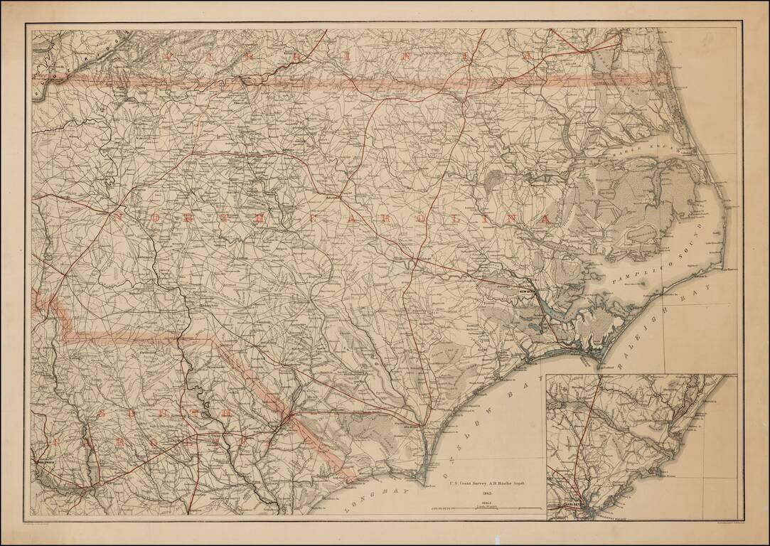
Rare printed color example of this extremely rare map of North Carolina, with the adjoining parts of Virginia and South Carolina, produced by Lindenkohl and lithographed by Krebs at the direction of the US War Department in 1865. During the Civil War,...
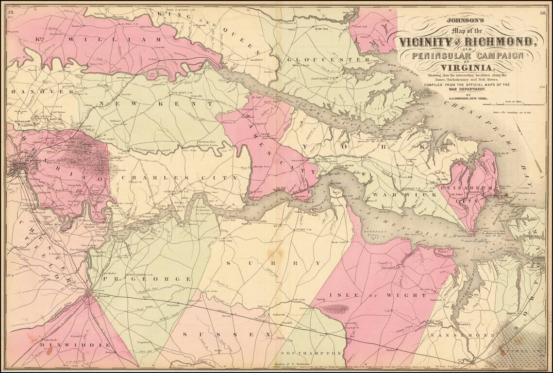
Johnson's map of the Vicinity of Richmond, colored by counties. Includes the line of advance and retreat of the Union Army, several battles and other details. Shows towns, roads, rivers, lakes, bays, islands, soundings, railroads, court houses and...
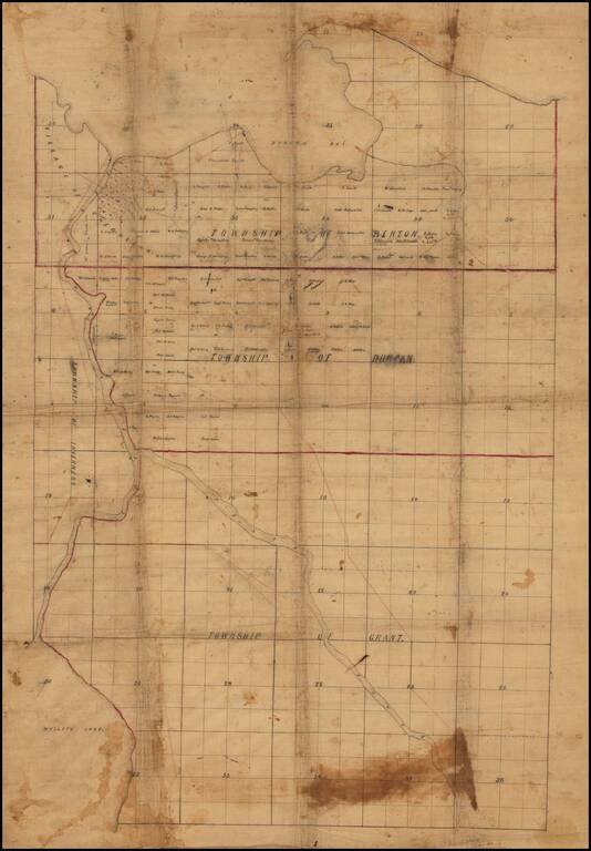
Finely drafted map of part of Cheboygan County in northern Michigan, likely drafted by a local surveyor. Place names include: Village of Cheboygan Township of Benton Township of Duncan Township of Grant Township of Inverness Information on...
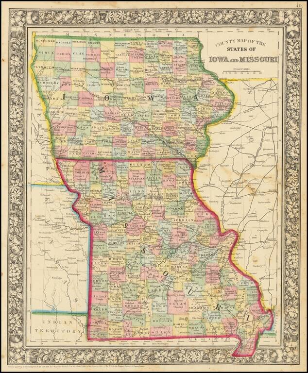
Attractive map of Iowa and Missouri, colored by counties. Shows towns, roads, railroads, rivers, etc.
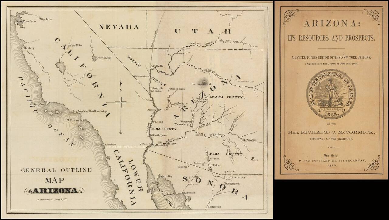
Very early Arizona Territory promotional pamphlet including an unusual pre-1866 map of Arizona inclusive of Mojave County, which would be ceded to the State of Nevada shortly thereafter. Folding map. 22 pages. 8vo, original printed wrappers with...
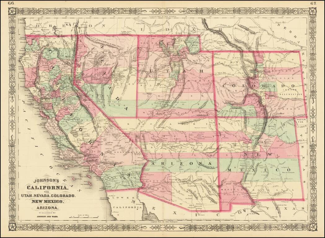
Interesting map of the southwest, hand colored by counties and showing a number of interesting territorial anomalies. Nevada has its lower corner truncated, leaving Las Vegas in Arizona. In each of the states and territories, the county configurations...
![[Yosemite / Half Dome Photo] Tasayac, The Half Dome 5000 ft.](/map/small/62639.jpg)
Carelton Watkins photo showing the Merced River in the foreground and Half Dome in the distance.
![Map of Oregon, Washington, Idaho and part of Montana [Early appearance of Montana]](/map/small/70803.jpg)
Interesting early map of the Northwest, hand-colored by counties or territories. The map is copyright-dated 1860, and has counties in eastern Oregon but not in Idaho or Montana. The existence of Montana dates the publication to 1864 or later. A fine...
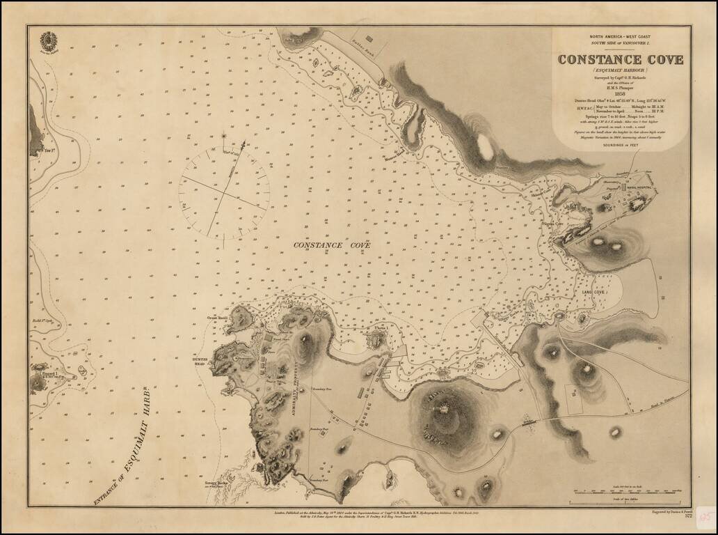
Surveyed For The New Headquarters of the British Navy's Pacific Fleet Rare British Admiralty Chart of Constance Cove, Esquimalt Harbour, home to the British Royal Navy's Pacific Fleet beginning in 1865 and thereafter the Canadian Royal Navy. This is...
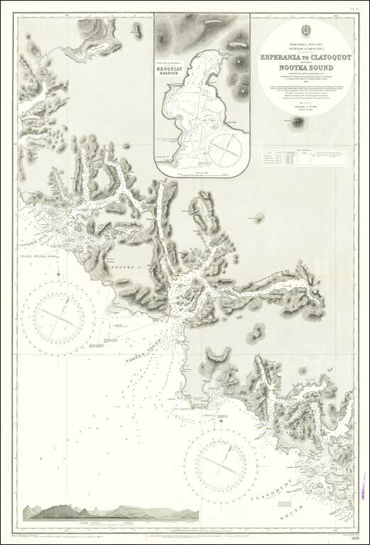
Finely detailed sea chart of a portion of the Western Coast of Vancouver Island, published by the British Admiralty. The chart is centered on Nootka Sound and extends north to Atluck Lake and the Fair Harbor area, and south to Vargas Island and...
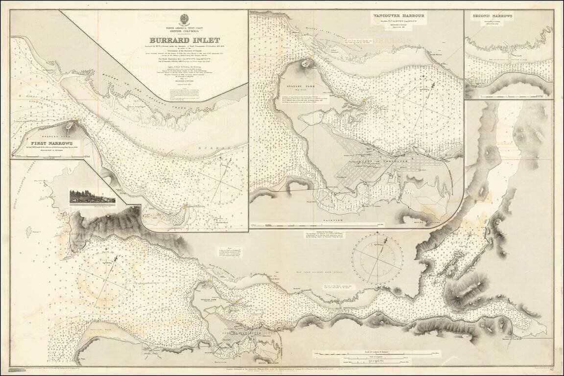
Attractive Chart Showing a Nascent City of Vancouver This is a navigational chart of the area around the Burrard Inlet on the Salish sea. The map, comprised of several detailed inlays, extends inland to Harrison Lake. Navigational detail on the map is...
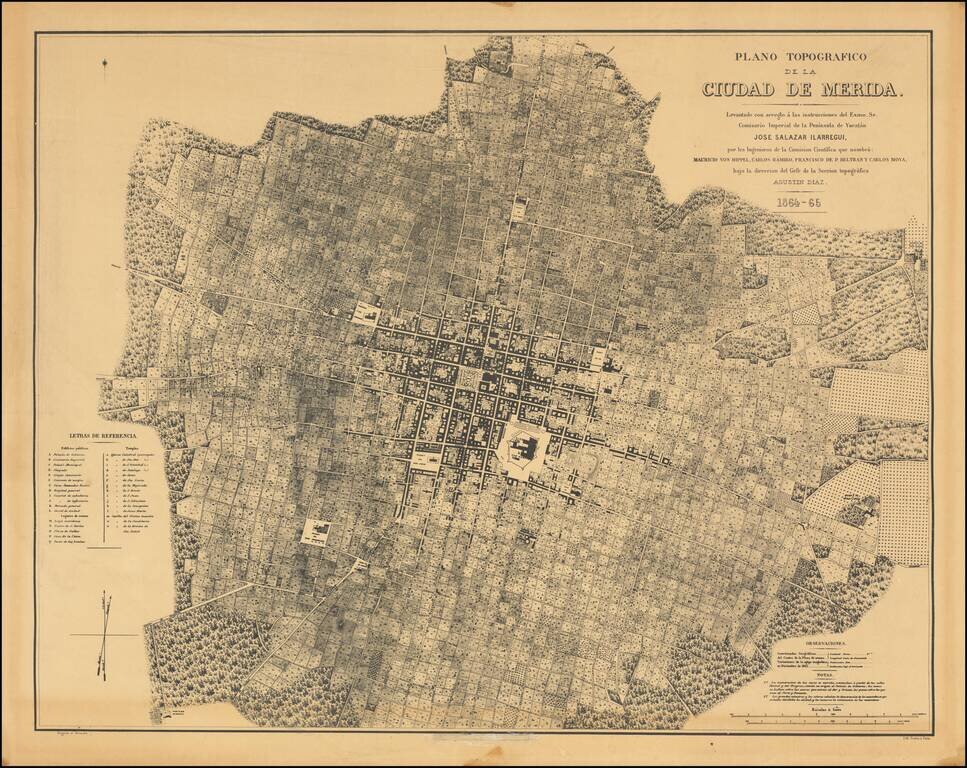
Fine photo-lithographic reproduction of Augustin Diaz's rare plan of Merida, originally published in Paris in 1865 for the Comision Cientifica. The map notes at the bottom center (obliterated on this copy) that it was reproduced by the Engineer...
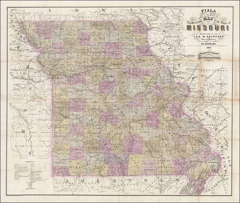
Rare separately published map of Missouri by Fiala and Haren, published in St. Louis by James M. Crawford. The map is hand colored by counties and subdivided by townships, with an extensive explanation of symbols at the bottom left corner. Among the...
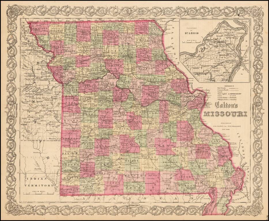
Detailed map of Missouri, colored by counties. Shows roads, railroads, towns, villages, post offices, rivers, lakes, stations and a host of other details. Inset of St. Louis vicinity in upper right corner. Decorative border. A terrific map, from JH...

Decorative map Curacao, the Leeward Islands and Surinam (or Dutch Guayana). Includes a large view of the Residence Offices and Tent-Barte of the Cacao Plantations of Alkmaar on the River Commewina and a view of Curacao from the east.
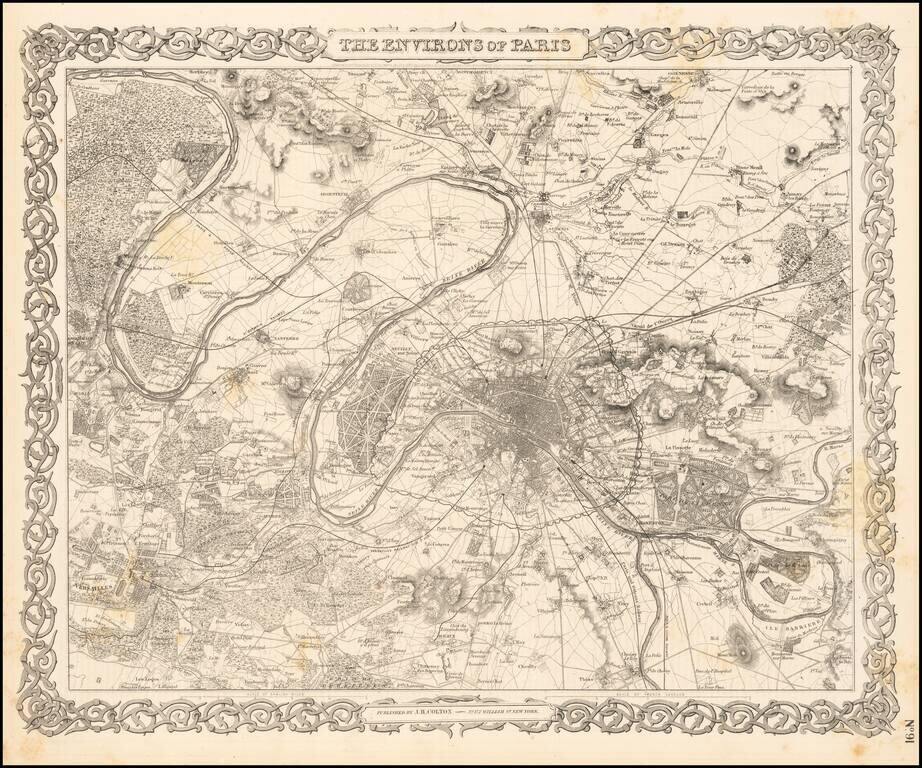
Detailed plan of Paris and surrounding towns and countryside. Decorative border. A terrific map, from JH Colton, one of the most prolific American mapmakers of the mid-19th Century.