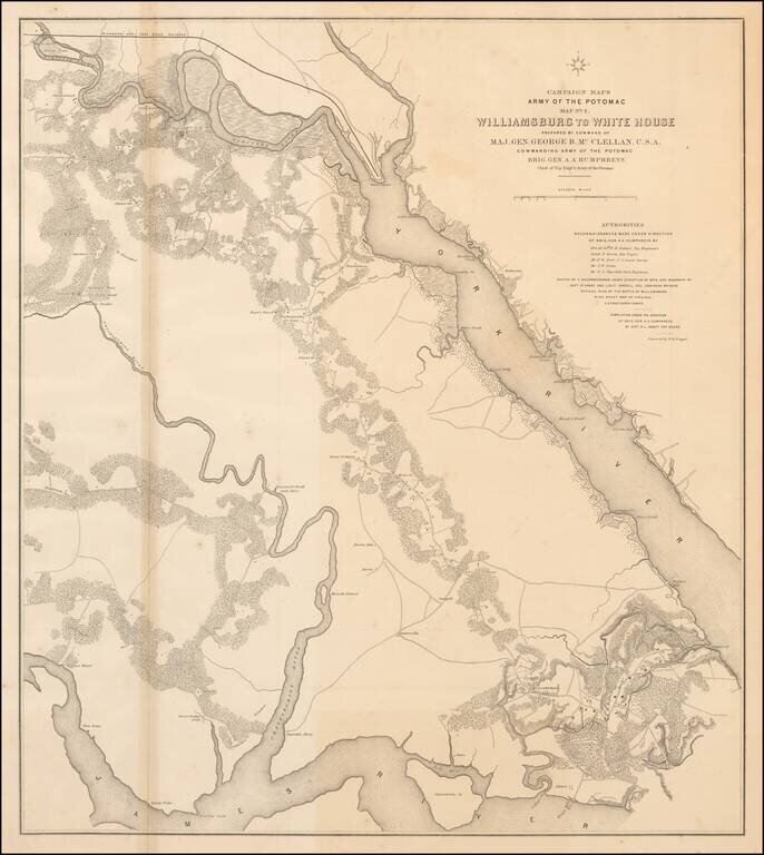
Large lithographed map of the area from Williamsburg, Virginia to "White House" on the Pamunkey River, prepared for McClellan and published in 1862. The map was one of a series of maps showing the theater of operations of the Army of the Potomac. The...
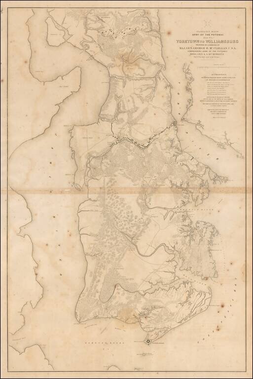
Large lithographed map of the area from Yorktown, Virginia to Williamsburg, prepared for McClellan and published in 1862. The map was one of a series of maps showing the theater of operations of the Army of the Potomac. The map shows Fortress Monroe,...

The First Battle of the Iron Clads. In a Contemporary Civil War-Era Lithograph. Three-stone color lithograph of the most famous naval battle of the Civil War; the engagement between the Iron Clads Virginia (of the CSA, a.k.a. "Merrimac") and Monitor...
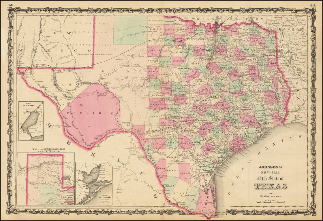
A striking large format map of Texas, colored by counties, with large insets of the northern panhandle, Galveston and Sabine Lake. The map reflects the relative expansion of the Counties of Texas, with more or less the current configurations in the...
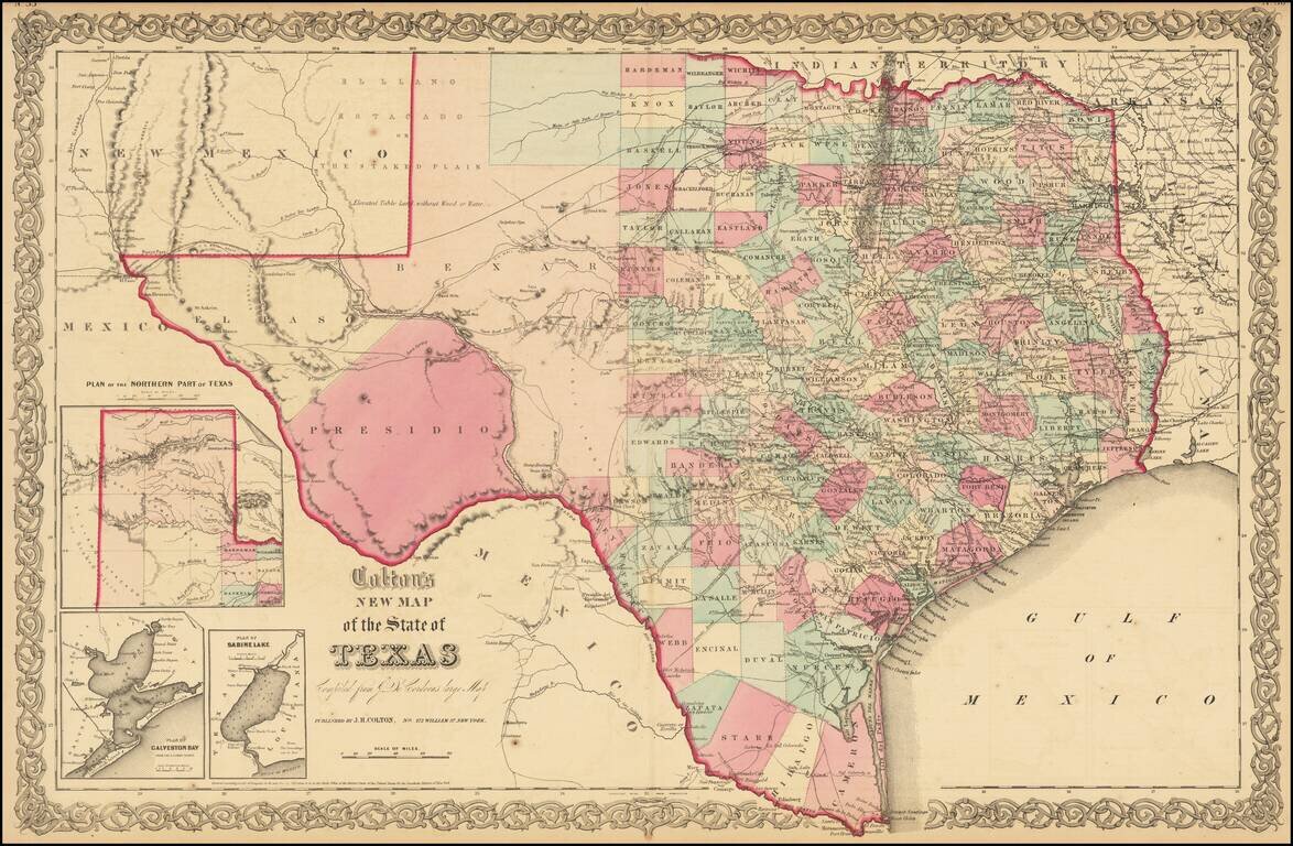
Detailed map of Texas, colored by counties and showing the primitive county configurations in the west. The map is based upon Jacob De Cordova's seminal map of the state, which was first issued in 1849. The map illustrates many early roads, towns,...
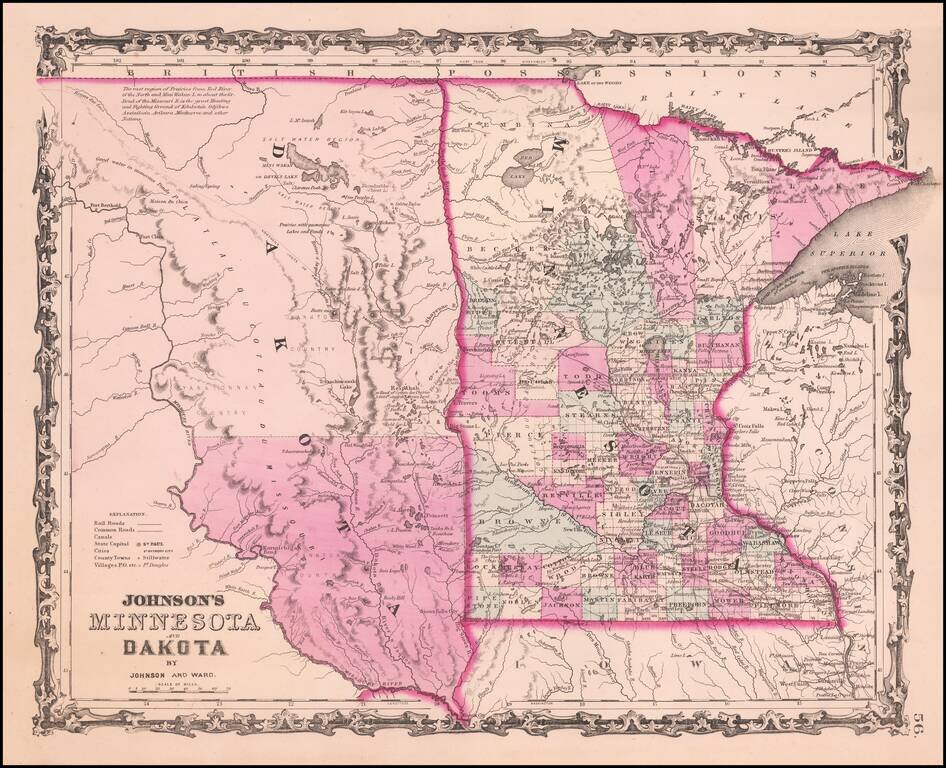
Detailed map of Minnesota and Dakota Territory, colored by county, with only two counties in Dakota and 4 large counties in northern Minnesota. Many Indian Tribal names and notes. Minneapolis is named.
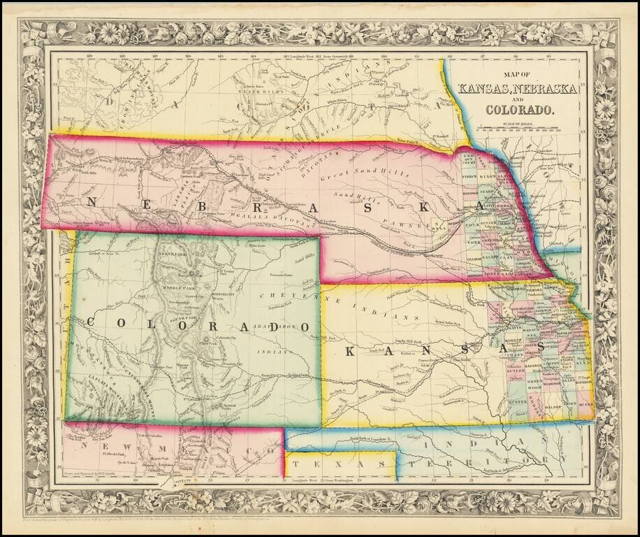
Excellent early map of the regional map of the Plains and Rocky Mountains, published by S.A. Mitchell Jr. Kansas counties cover only the eastern third of the state. Nebraska counties cover only a very small fraction of the state, which stretches all...
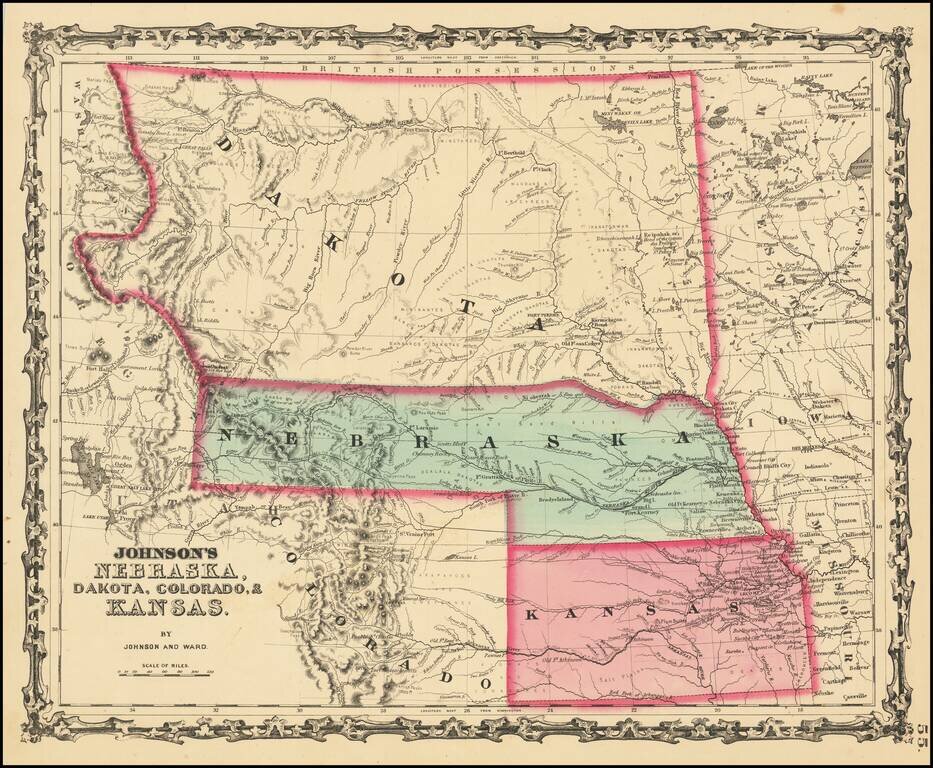
Massive Dakota Territory -- Pre-dating Wyoming and Montana. This is the third map in the series of Johnson's maps of this region and the first to include Colorado. Kansas gives way to Colorado, Nebraska is truncated by Dakota, but still extends to...
![Map of Mexico, Central America, and the West Indies [Insets of Bermuda, Cuba, Jamaica and Panama Railroad]](/map/small/51948.jpg)
Attractive map of Mexico, the Caribbean and the Gulf Coast, published by SA Mitchell Jr. Includes large insets of Cuba, Bermuda, Jamaica, and the Isthmus of Panama and a small inset of Jamaica. Shows shipping routes from New Orleans to points...
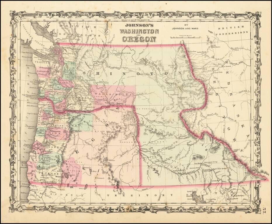
Scarce early edition of Johnson's Washington & Oregon. The map is colored by counties. Washington wraps around Oregon to the east of the Oregon State line, including the yet to be formed Idaho Territory. Includes many Indian tribes, forts, roads...
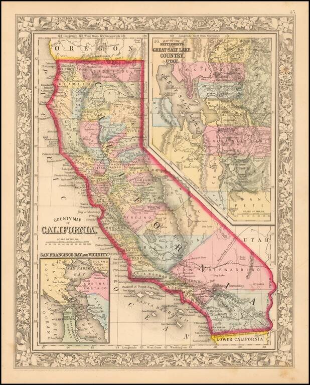
Attractive map of California, colored by county. Predates a number of Southern California Counties. Includes a detailed inset plan of San Francisco, colored by wards. Shows towns, roads, railroads, rivers, lakes, mountains, missions, etc. Decorative...
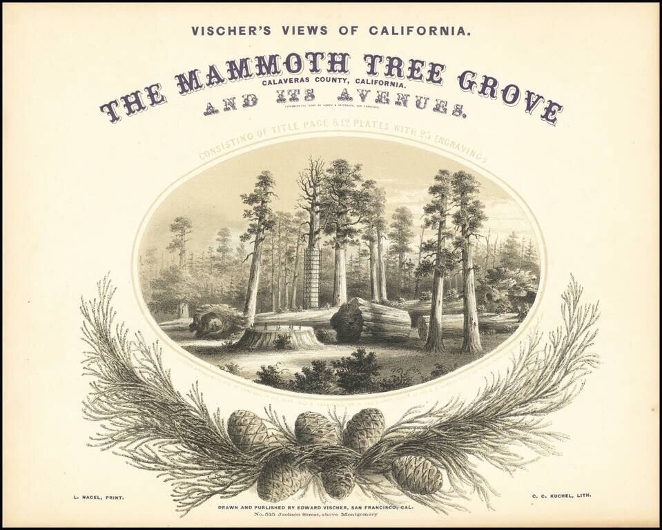
One of the Great California Plate Books. With Superb Lithographs of California's Giant Sequoias. This is the first edition, third issue (with three more plates called for by the title than the earlier issues), of Edward Vischer's great work on the...
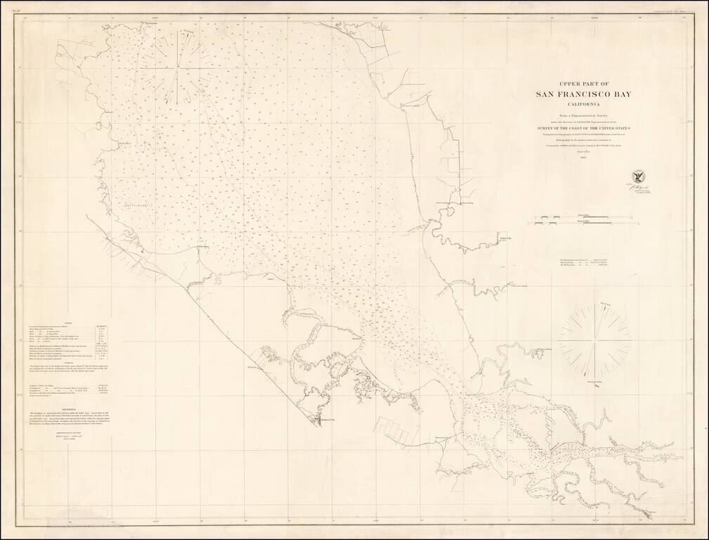
Rare separately issued chart of "Upper San Francisco Bay," published by the United States Coast Survey in 1862. The most northerly point on the map is Pt. Avisadero, just north of Candlestick Point and extending south to San Jose. The chart provides a...
Presentation Copy! -- One of the Earliest Maps of San Francisco published in the City. Finely detailed map of the populated areas of San Francisco, oriented to the west. The map extends west to Divisadero; south to Alta. The present example is...
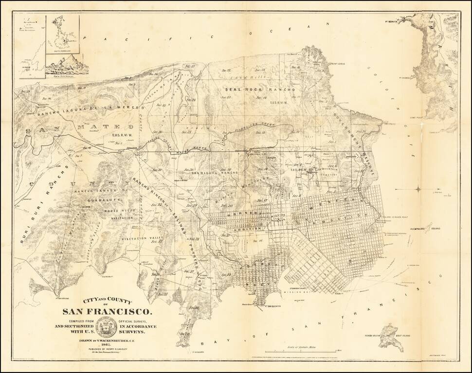
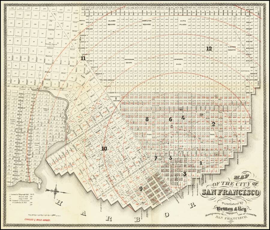
San Francisco at the Height of The Litigation over Land Ownership Claims Rare early map of the City and County of San Francisco, prepared by San Mateo County Vitus Wackenreuder and printed by Britton & Co in San Francisco. This is one of the...
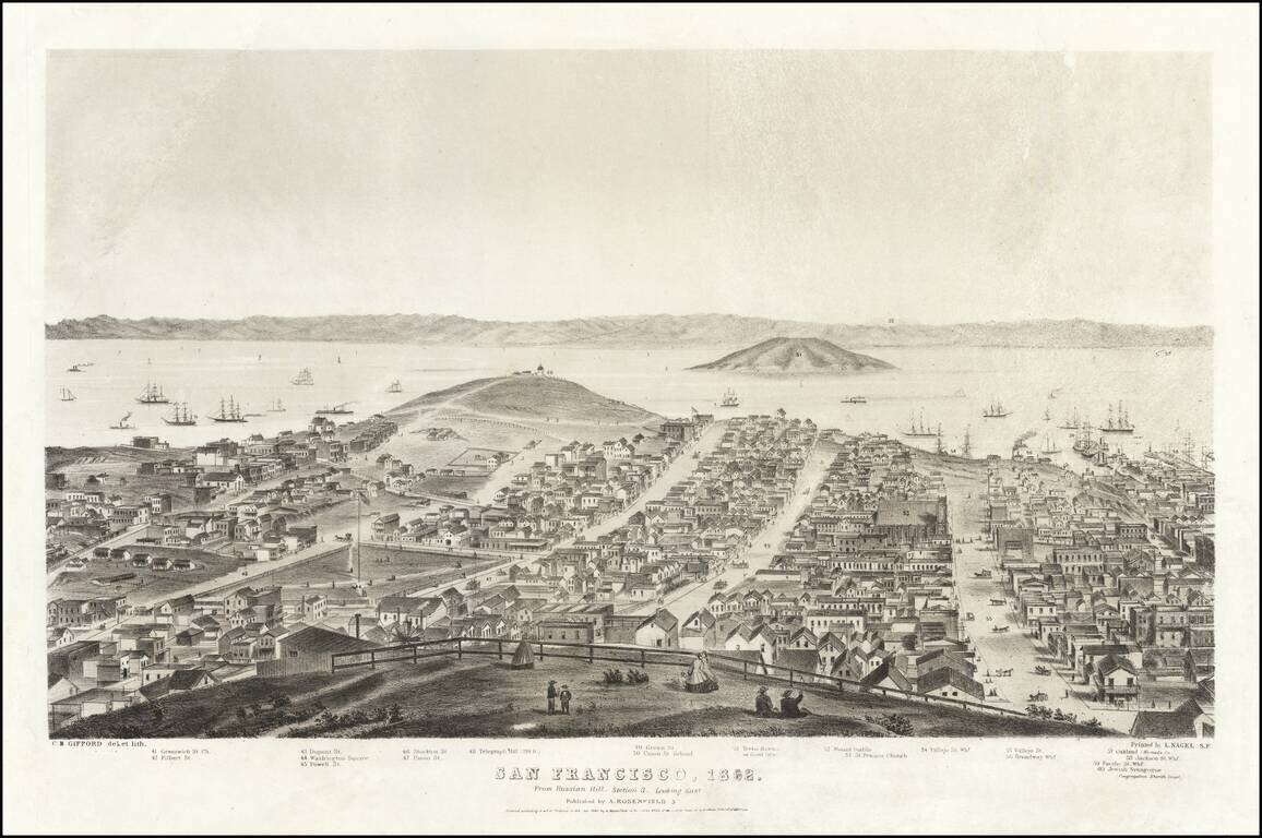
Sheet 3 of Gifford's rare 5-sheet (9 foot) panorama of San Francisco, published by A. Rosenfield in San Francisco, in 1862. The present sheet is centered on Telegraph Hill and Yerba Buena or Goat Island, with Oakland and the East Bay in the distance...