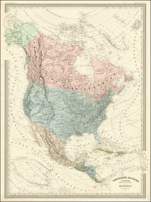
Detailed wall map of North America, published by A.H. Dufour. Arizona is below New Mexico (the Baylor Line), a vestige of the attempt to create a slave and non-slave territory prior to the Civil War. Colorado is named (the map shows Colona in the...
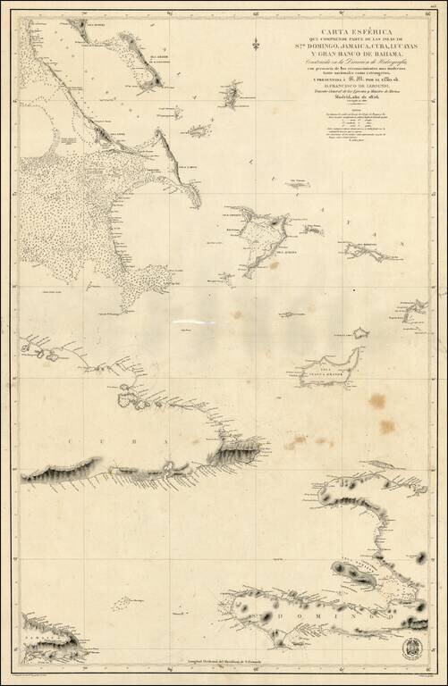
Scarce Spanish Sea Chart of the southern part of Haiti, the Caicos and neighboring Islands.
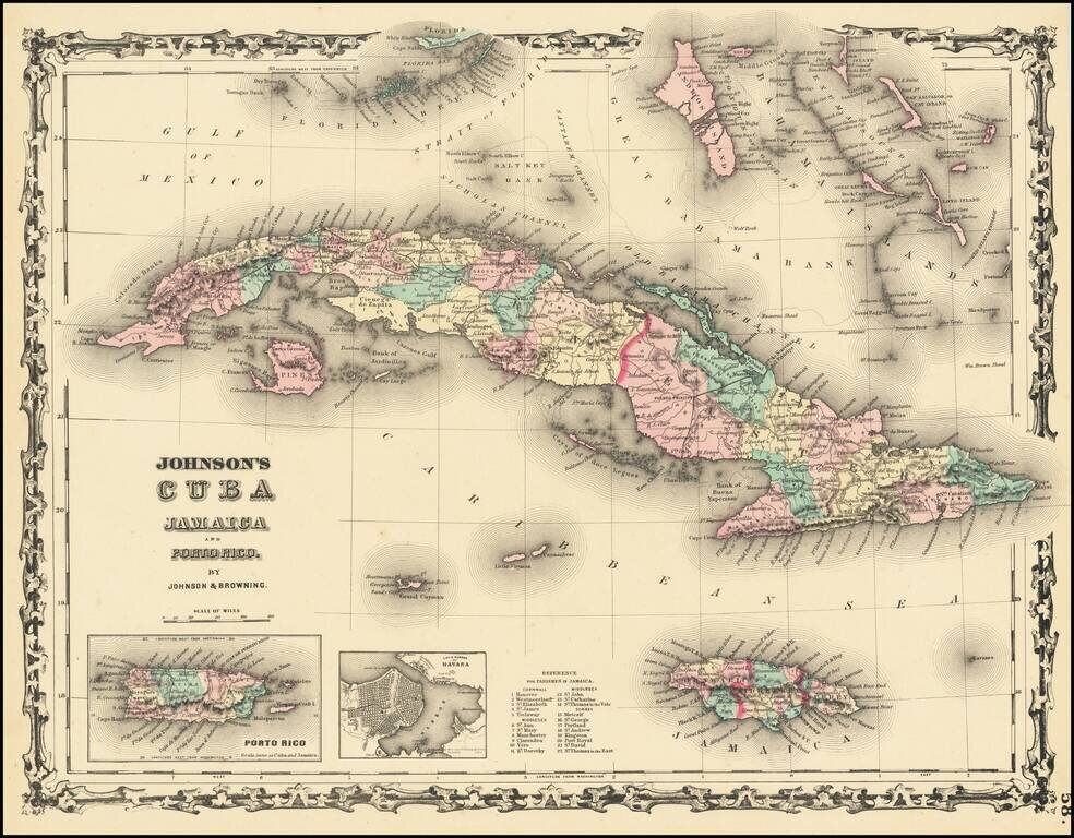
Attractive map of Cuba, the Florida Keys, the Bahamas, Jamaica, and the Caymans. Shows towns, rivers, mountains, etc. Inset maps of Havana and Puerto Rico.
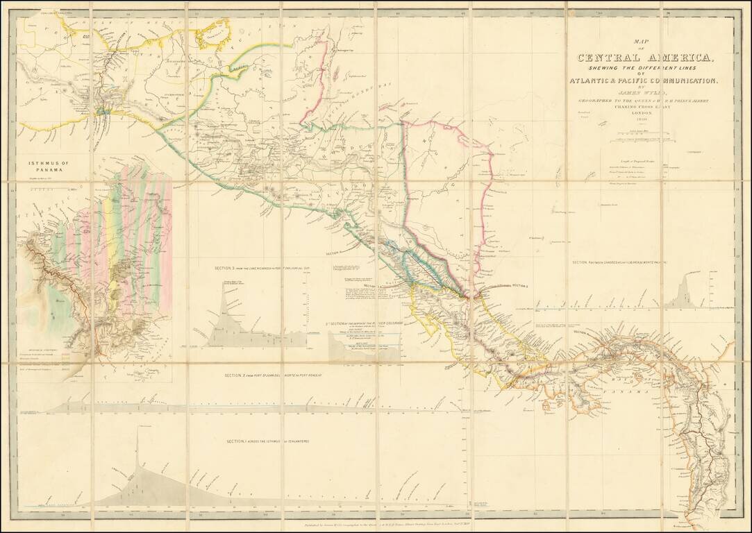
Early Edition of Wyld's map of Central America -- Including the first geological survey of Panama. Fine map of Central America, which includes the first geological survey of Panama published in London by James Wyld. This is the earliest edition of...
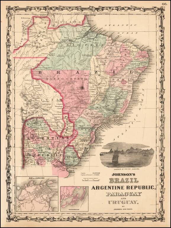
Attractive regional map, colored by provinces and showing towns, mountains, rivers, bays, etc. Large vignette of the harbor of Rio De Janeiro and insets of Rio and Pernambuco.
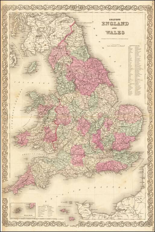
Nice large format map of England & Wales, hand colored by counties.
![Johnson's Ireland [with] Johnson's Scotland](/map/small/71010.jpg)
Detailed maps of Scotland and Ireland, each hand colored by counties, with decorative borders. Shows towns, rivers, lakes, islands, roads, railroads, etc.
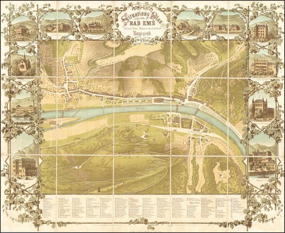
An Important 19th Century German Spa Town -- Host to Czars and other Nobility Rare separately published map of the spa town of Bad-Ems, 5 miles west of Koblentz. The map consists of elegant green spaces, bath houses and the main road along the north...
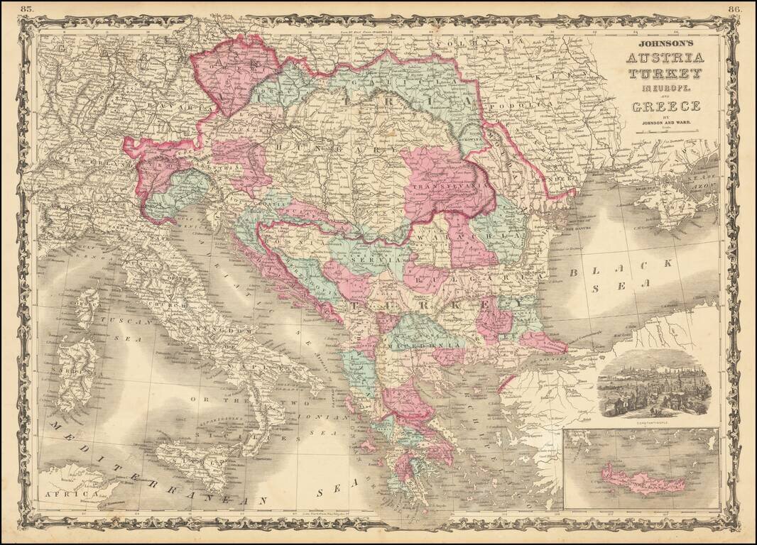
Marvelous map showing Greece, Turkey and a very large Austrian Empire, including all of Hungary, Transylvania, Galitzia, Bohemia, Moravia, etc. Excellent delineation of the Balkans states, at a time when they all had their current names. Plus, a few...
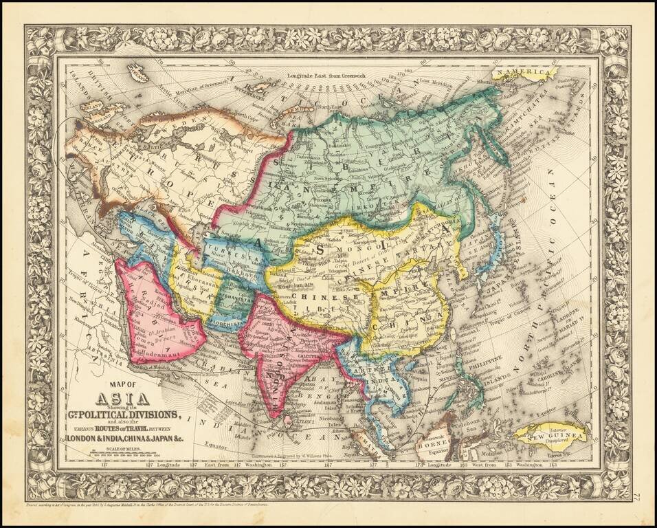
Detailed map of Asia, colored by country. Includes the classical SA Mitchell decorative border of the period.
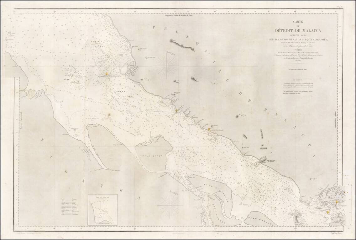
A rare large-format 1860s sea chart of the southern part of the Straits of Malacca, including Singapore Island, published by the French Dépôt de la Marine. This highly detailed sea chart embraces the Straits of Malacca from a point just north of...
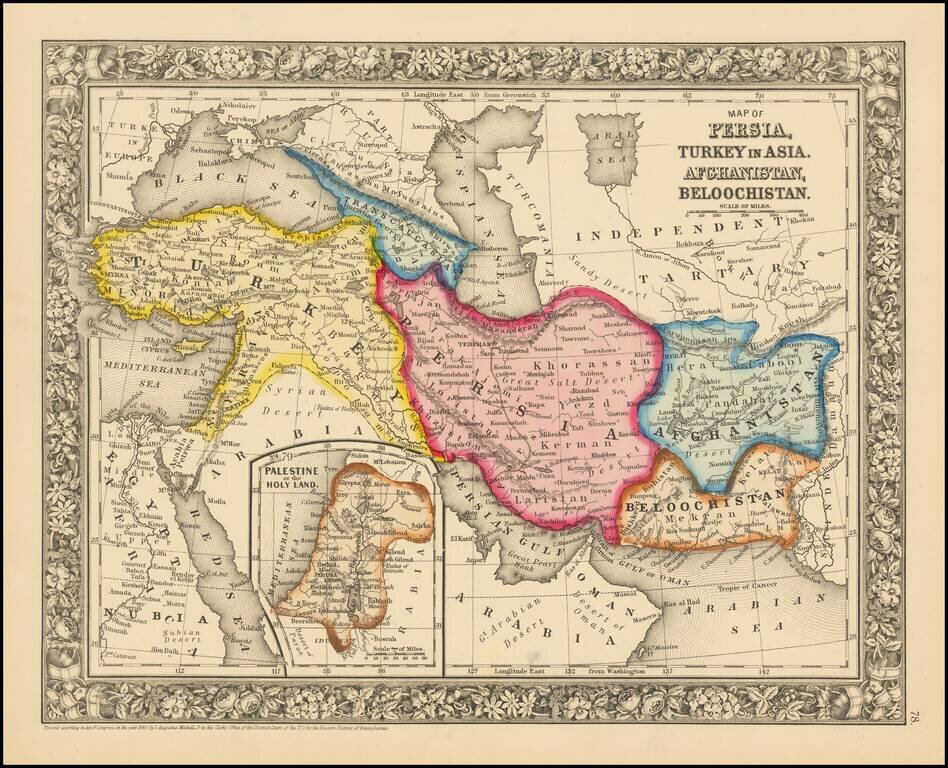
Attractive map centered on Persia and extending from Turkey and the Black Sea to Afghanistan and Beloochistan. Colored by countries Shows towns, tribes, roads, rivers, mountains, lakes, etc.
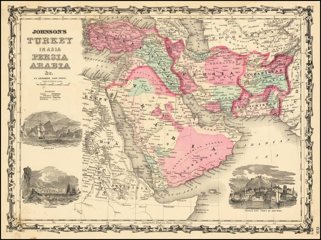
Decorative map of Turkey, Persia, Arabia, Afghanistan, Beloochistan and contiguous regions, with large inset views of Smyrna, Trebisond and Muscat. Shows excellent detail, including towns, rivers, mountains, deserts, roads, etc.
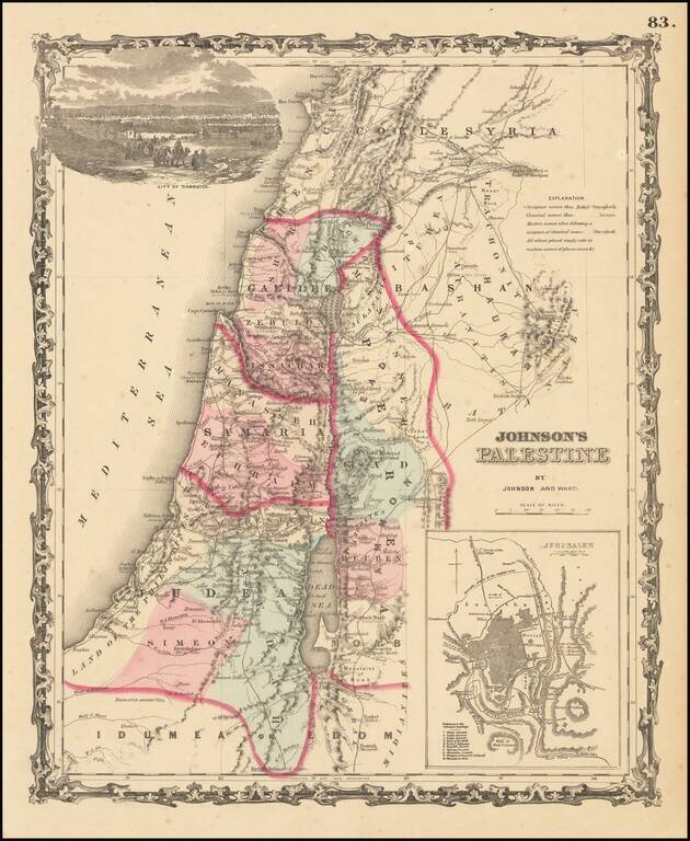
Attractive map of the Holyland, based upon the 12 tribes and contemporary (to mid-19th Century) borders. Insets of view of Damascus and town plan of Jerusalem. Shows towns, roads, rivers, lakes, mountains, etc. Includes biblical, classical and...
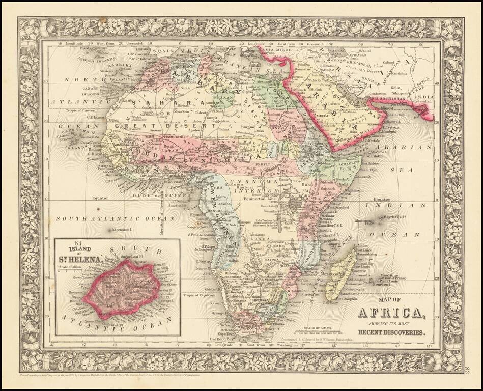
Decorative and detailed map of the African Continent, with an inset map of St. Helena. SA Mitchell Jr. acquired his father's former business from DeSilver in 1860 and relaunched a very successful atlas publishing business which survived another 20+...
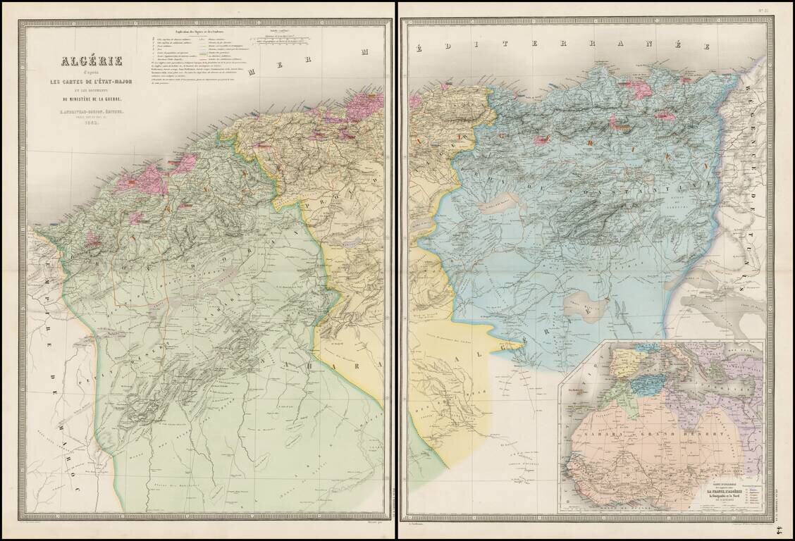
Stunning full color example of Andriveau-Goujon's 2-sheet map of Algeria. Fantastically detailed map of Algeria, with towns, roads, rivers, mountains, lakes, etc.