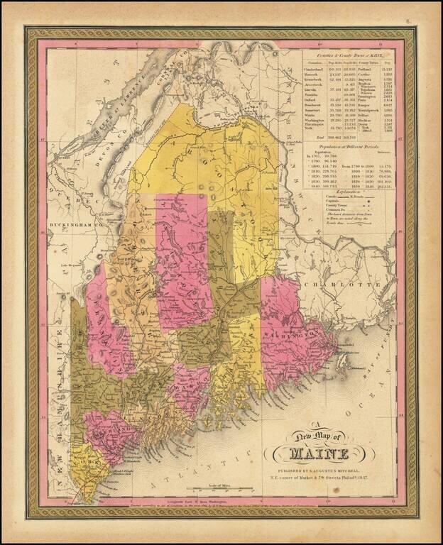
Detailed map of Maine from Mitchell's New Universal Atlas, showing early railroads, townships, canals, etc. The map is hand colored by counties, and includes statistical table showing county populations. One of the most detailed of all atlas maps of...
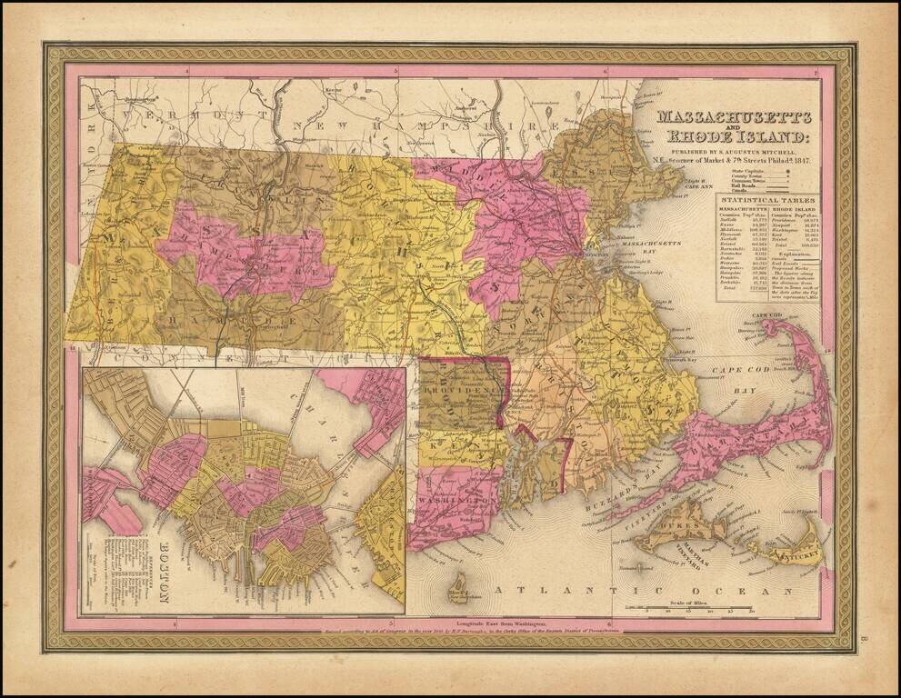
Detailed map of Massachusetts and Rhode Island from Mitchell's New Universal Atlas, showing railroads, townships, canals, etc. Hand colored by county. Statistical table shows population by county. Inset of Boston showing important buildings. An...
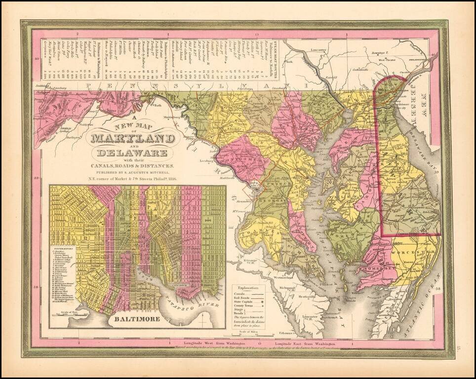
Detailed and interesting map of Maryland and Delaware, hand colored by county and showing towns, rivers, bays, lakes, railroads, roads, distances, etc. This 1849 state of the map includes for the first time a number of railroads not present in earlier...
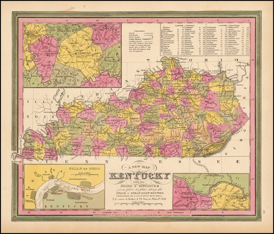
Detailed and interesting map of Kentucky, hand colored by county and showing towns, rivers, lakes, railroads, roads, distances, forts, etc. Tables of Steam Boat routes and distances. Large insets of area around Lexington, the Washington and Clarksburg...
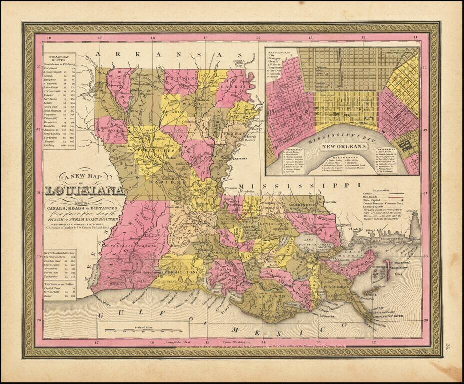
Detailed and interesting map of Louisiana, hand colored by parish, and showing towns, rivers, bays, lakes, railroads, swamps, etc. Includes a Table of Steam Boat routes and distances. Large inset map of New Orleans, colored by wards. An early map of...
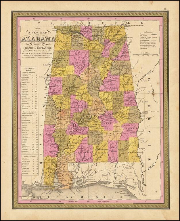
Detailed and interesting map of Alabama, hand colored by county and showing towns, rivers, bays, lakes, railroads, roads, distances, forts, etc. Includes tables of Steam Boat routes and distances.
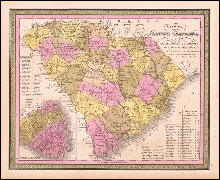
A fine map of South Carolina from the Antebellum Era. This interesting map depicts all of South Carolina, as it appeared in 1846, during an era of rising political tensions, which would eventually lead to the U.S. Civil War (1861-5). However, it was...
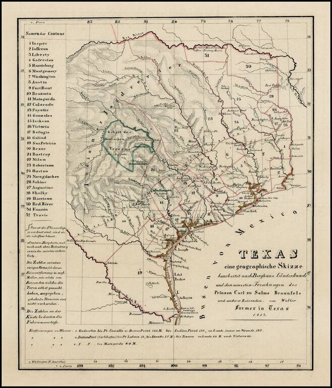
Extremely rare map of Texas, not listed in Day, Phillips, Streeter, Taliaferro, or any other Texas reference. While the map is unrecorded and its source is unknown, we are of the opinion that the map was printed, but ultimately never included in a...
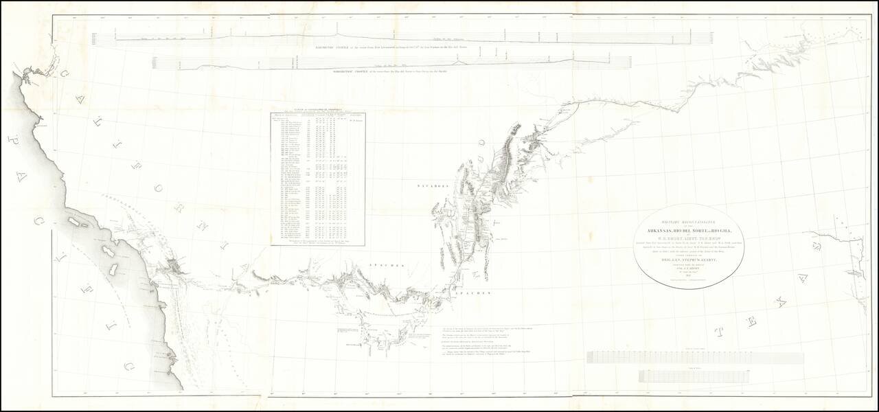
Fine example of the William Emory's milestone mapping of the Southwestern United State, from Ft. Leavenworth to the West Coast, from Emory's Notes of a Military Reconnaissance, from Fort Leavenworth, in Missouri, to San Diego, in California . . ., one...
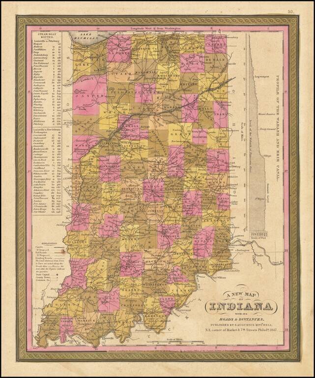
Detailed and interesting map of Indiana, hand colored by county. Shows towns, rivers, lakes, railroads, roads, distances, forts, etc. Includes table of steamship routes, distances, etc.
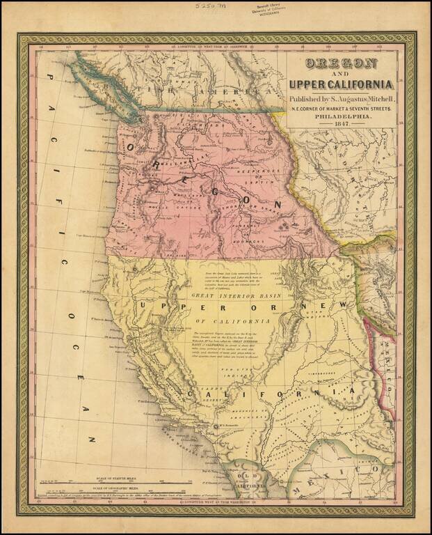
Rare 1847 edition of the best atlas map of the Western United States issued prior to the Civil War, reflecting Americans' contemporary knowledge of the West. The map shows the Spanish Trail, Lewis & Clark's Canoe Route, Oregon Trail, early roads,...
![Меркаторская Генеральная Карта, части Российскихъ Владеній въ Америкѣ (Mercator's [or Mercatorial] General Map, parts of Russian Possessions in America)](/map/small/55959.jpg)
"The First Printed Map of the Interior of Alaska Along the Lower Courses of the Yukon" (Streeter) Rare separately published example of Zagoskin's map of Alaska. According to the Streeter catalogue, “the map must be one of the first, if not the...
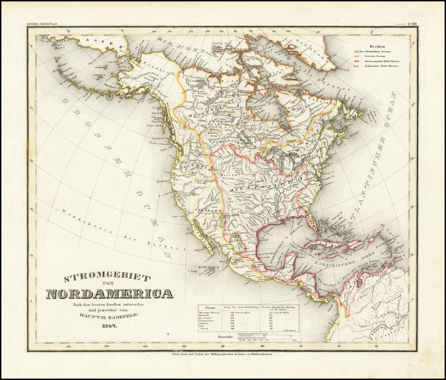
A fascinating early geographical map of North America, showing the various regions drained by major North American Rivers, including Colorado, Columbia, Mississippi, Rio Del Norte, Mackenzie, Saskatchewan, and the St. Lawrence, among others. Very...
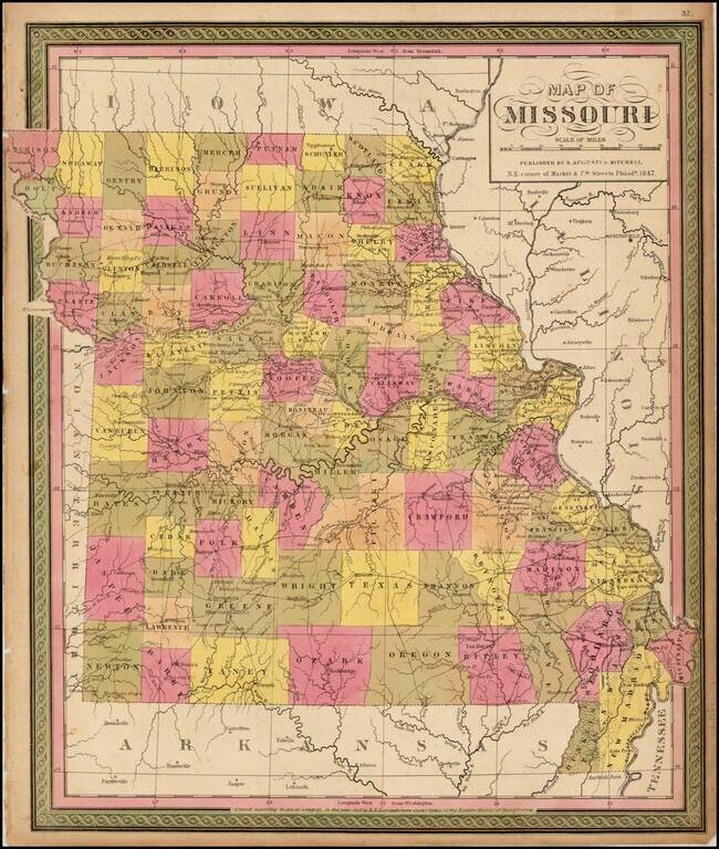
Detailed map of Missouri, hand colored by counties, and showing towns, roads, rivers, mountains, lakes, forts, Post Offices and other details. From one of the leading map makers of the mid-19th Century.
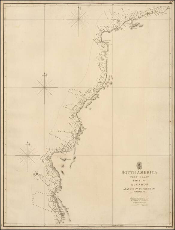
Rare coastal chart of the northern part of the Coast of Ecuador, published by the British Admiralty. The map extends from the Valdivia Region in the south to just north of Esmeraldas. Henry Kellett Henry Kellett (1806-1875), joined the Royal Navy in...
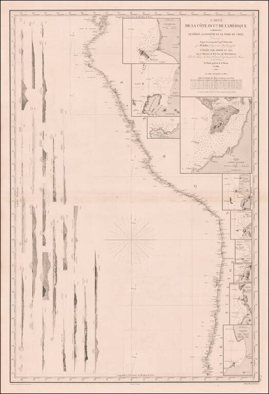
Remarkable sea chart of part of the West coast of South America, published by the French Hydrographic Survey. The chart extends from Guayaquil in the North to the Bay of Coquimbo in Chile, centered on Arica. The map includes large insets plans of:...