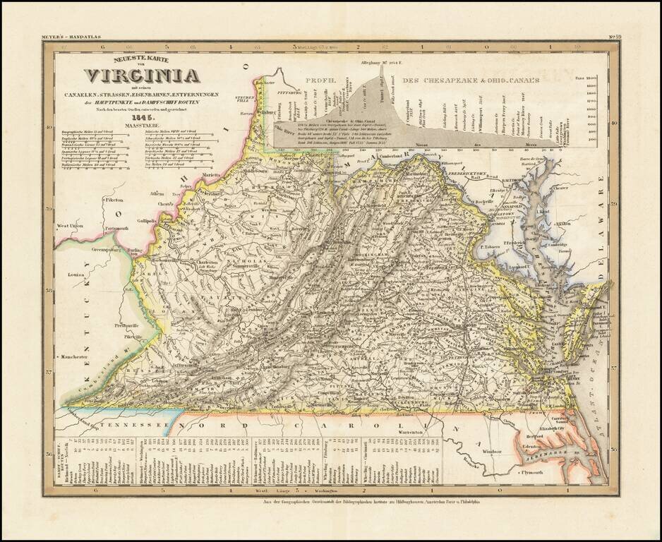
Elegantly engraved & detailed map of Virginia, taken based upon Tanner's work in the early 1840s. Shows counties, towns, roads, railroads, mountain ranges, etc.
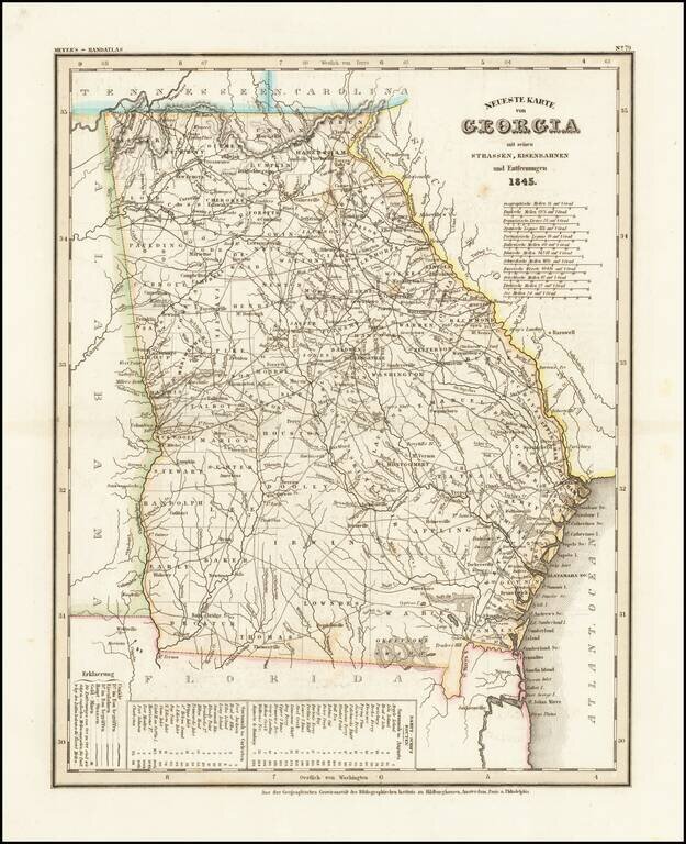
Elegantly antique engraved map of Georgia, produced by Joseph Meyer in Hildburghausen in 1845. The map shows counties, towns, roads, canals, lakes, etc. There are several editions of the map, this being the first.
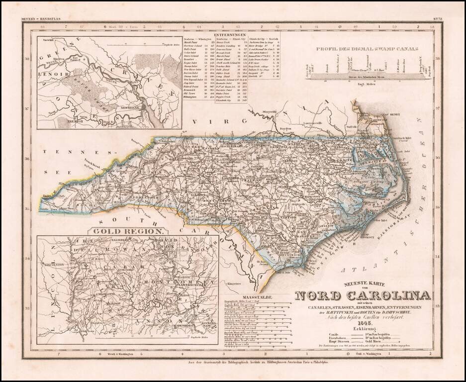
Elegantly engraved & detailed map of North Carolina, based upon Tanner's work in the early 1840s. Shows counties, towns, roads, canals, lakes, etc. Detailed insets of the Gold Region. While often referred to as the "German Mitchell," this is an...
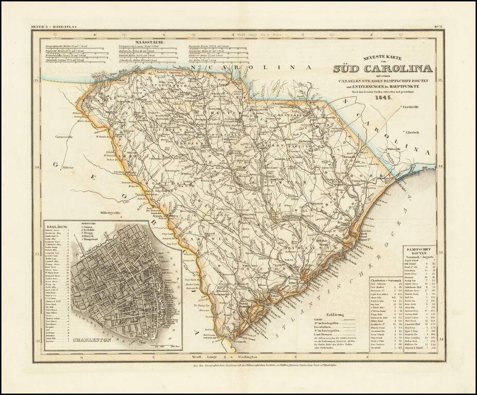
An antique map of South Carolina with German-language description based upon H. S. Tanner's map. The map purports to show the routes, railroads, and distances in the state, though it also locates various other features including rivers, canals, and...
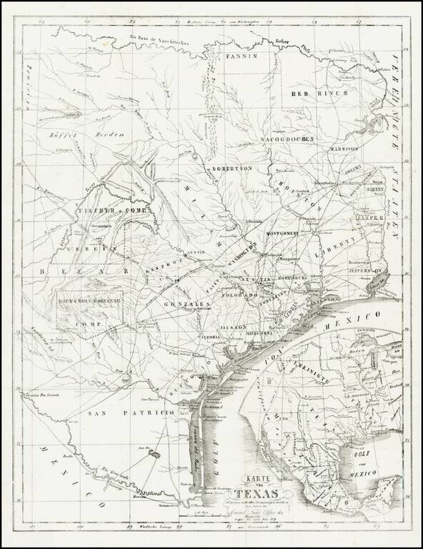
Rare and important early German immigration map of Texas prepared in connection with the Solms-Braunfels promotion of German colonies in Texas, based upon the larger Hunt & Randel map of 1839. The map provides a detailed look at Texas during its...
![[Republic of Texas] Map of Texas From the most recent authorities . . .](/map/small/32223.jpg)
Nice example of Henry Schenk Tanner's map of the Republic of Texas, issued in Tanner's Universal Atlas. The present example is the rare first state of Tanner's 1845 map of the Republic, pre-dating, the addition of a number of Texas Counties formed in...
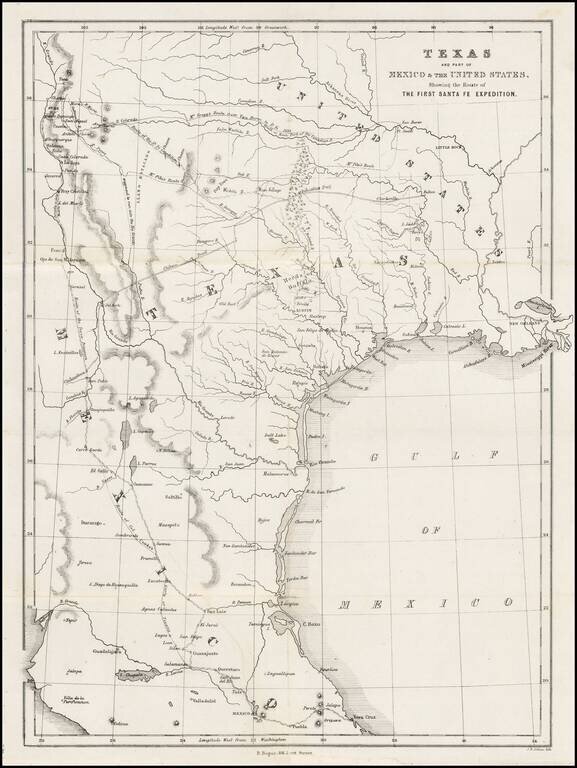
A Milestone Work, Which Re-Invigorated Interest In Settlement in the Republic of Texas Detailed map of Texas, eastern New Mexico and part of Mexico, illustrating the region covered by the Santa Fe Expedition. Based upon the maps of Zebulon Pike and...
![Mexico, Mittel-America, Texas [Republic of Texas]](/map/small/64181.jpg)
Nice example of Carl Flemming's detailed map of Texas and the Southwest, published shortly after Texas was annexed by the United States in 1845. The map was issued immediately after the annexation of Texas and prior to the creation of Utah and New...
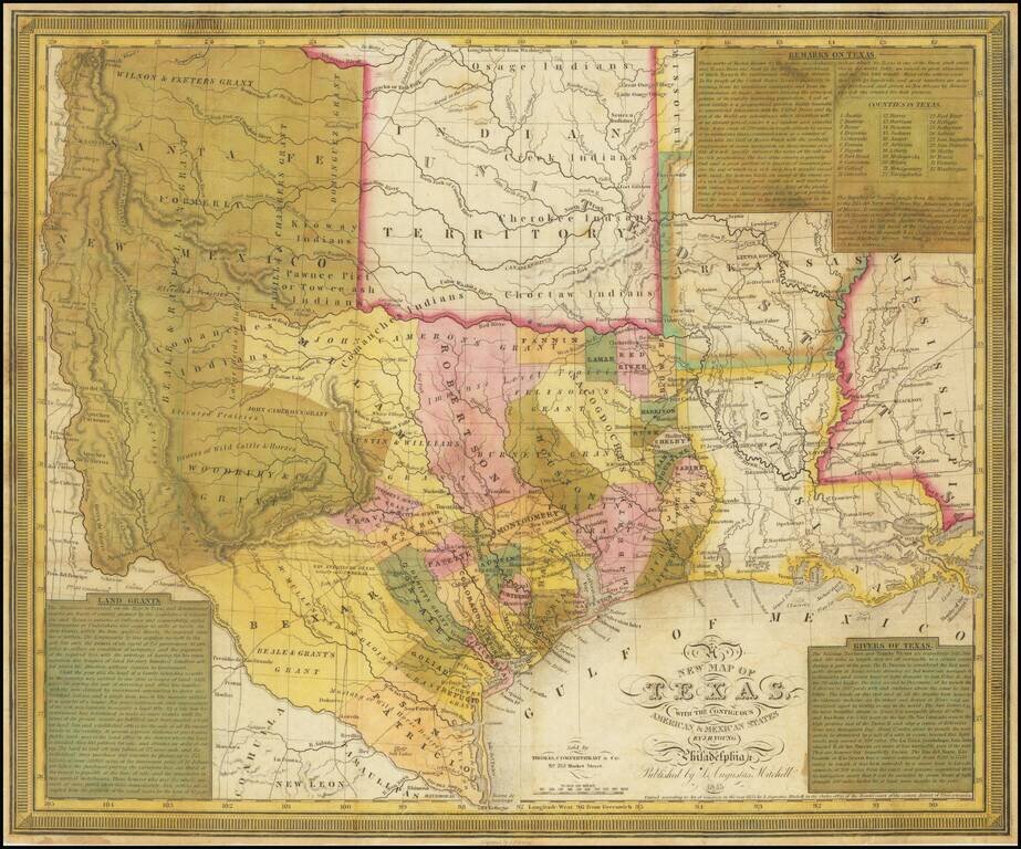
The Final Edition of the Mitchell-Young Map of Texas. One of Only Two or Three Known Examples. Hand-colored engraved antique map of Texas as a republic, by S. Augustus Mitchell and J.H. Young. This is the last edition of the map, from 1845, and this...
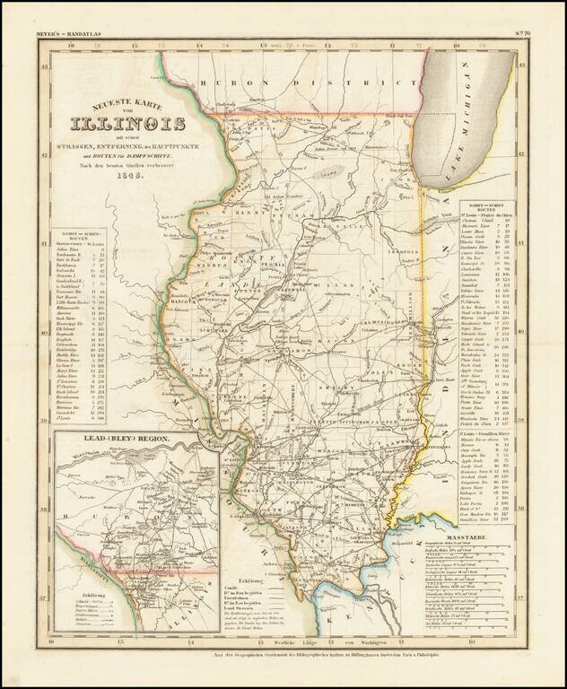
Fine example of this elegantly engraved & detailed map of Illinois, based upon Tanner's work in the early 1840s. Shows counties, towns, roads, rivers, lakes, etc. While often referred to as the German Mitchell, this characterization is unfair, as...
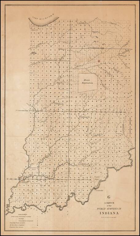
One of the earliest obtainable government survey maps of Indiana. The map is divided into surveyed townships and includes notes as to whether the field notes of the survey have been transcribed and/or recorded, township plats recorded and proposed new...
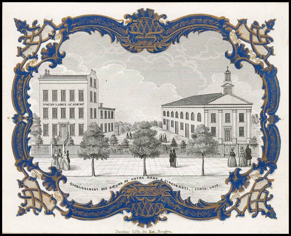
Rare " Porseleinkaart", showing the "Instituut der Soeurs de Notre-Dame te Cincinnati" (Young Ladies Academy of the Sisters of Notre Dame in Cincinnati. Archdiocese of Cincinnati established the Young Ladies Literary Institute and Boarding School in...
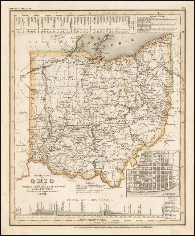
Elegantly engraved and detailed map of Ohio, with an inset map of Cincinnati and profiles of the Ohio Canals, taken based upon Tanner's work in the early 1840s. Shows counties, towns, roads, canals, lakes, etc. While often referred to as the German...
![Map of Milwaukee | Population in 18[35] None | In 1843 6068.](/map/small/68734.jpg)
First State of the Second Map of Milwaukee, with Contemporary Property Ownership Annotations. This is an exceedingly rare early map of Milwaukee, made by the important Milwaukee cartographer Increase Lapham. This is the first printed map to show a...
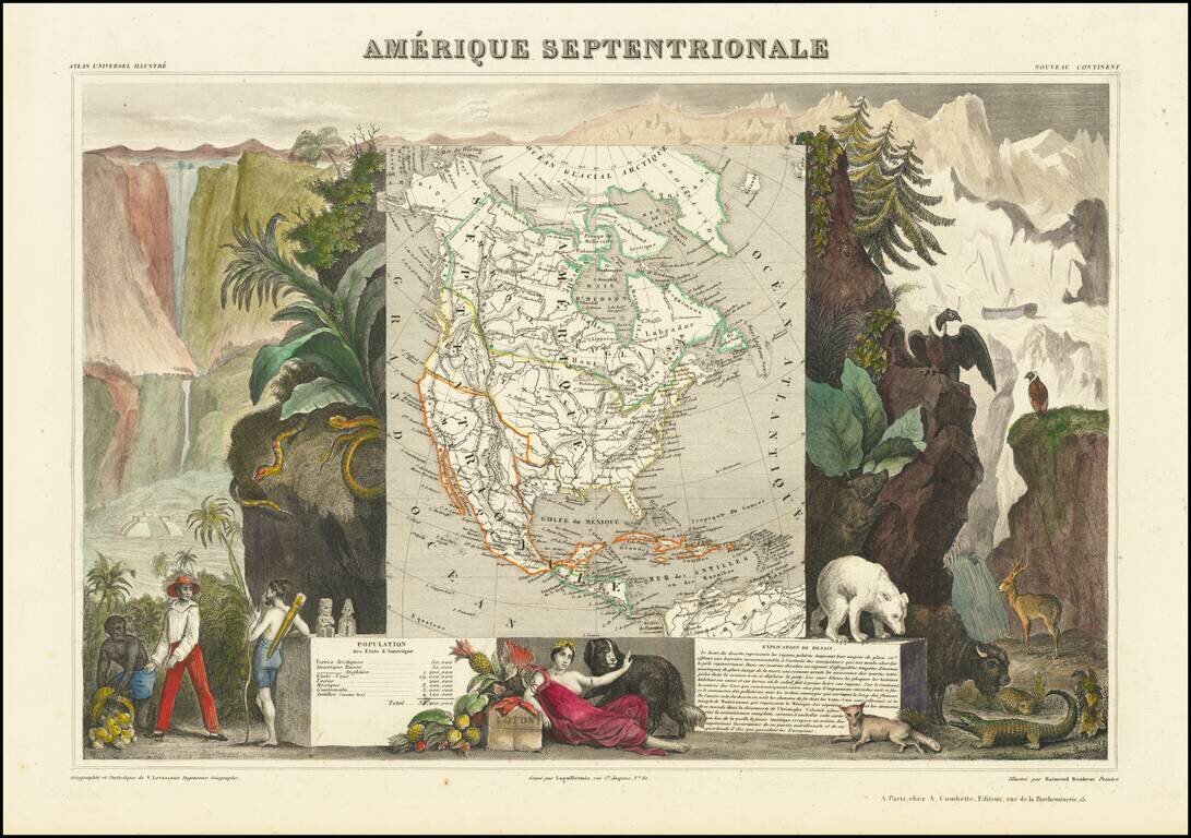
Decorative map of North America, showing the Republic of Texas and a "54-40 or Fight" border with Canada, extending far north of the final boundary. The map is surrounded by decorative allegorical scenes. Engraved by Raimond Bonheur, father of the...
![El numero 1 q[ue] se haya en la orilla de la ???ya que corre a San Ysidro es el gran ?? de partida siguencio? la numeracion immediata a los puntos amarillos ?on los ?inderos, hasta? el numero 19 con que vierra en el terreno marcados con la letra C.](/map/small/65664ba.jpg)
Resolving a Land Dispute In Temascalcingo, Mexico in 1845 Finely construted map of a large portion of the city of Temascalcingo in the State of Mexico, which officially set the boundary markers (mojoneras, spelled here with an h), for different...