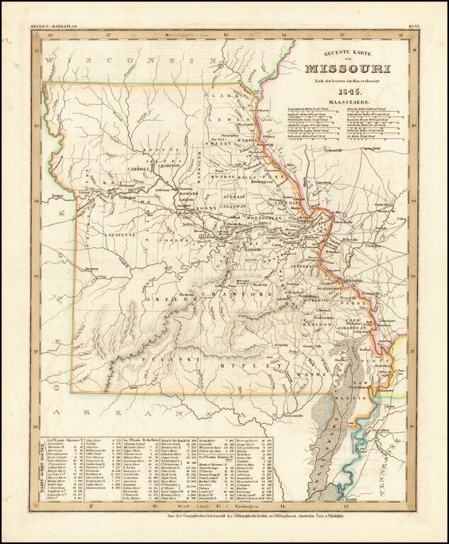
Elegantly engraved & detailed map, taken based upon Tanner's work in the early 1840s. Shows counties, towns, roads, mountain ranges, rivers etc. Includes a table of Distances and times for various steamship routes along several rivers.
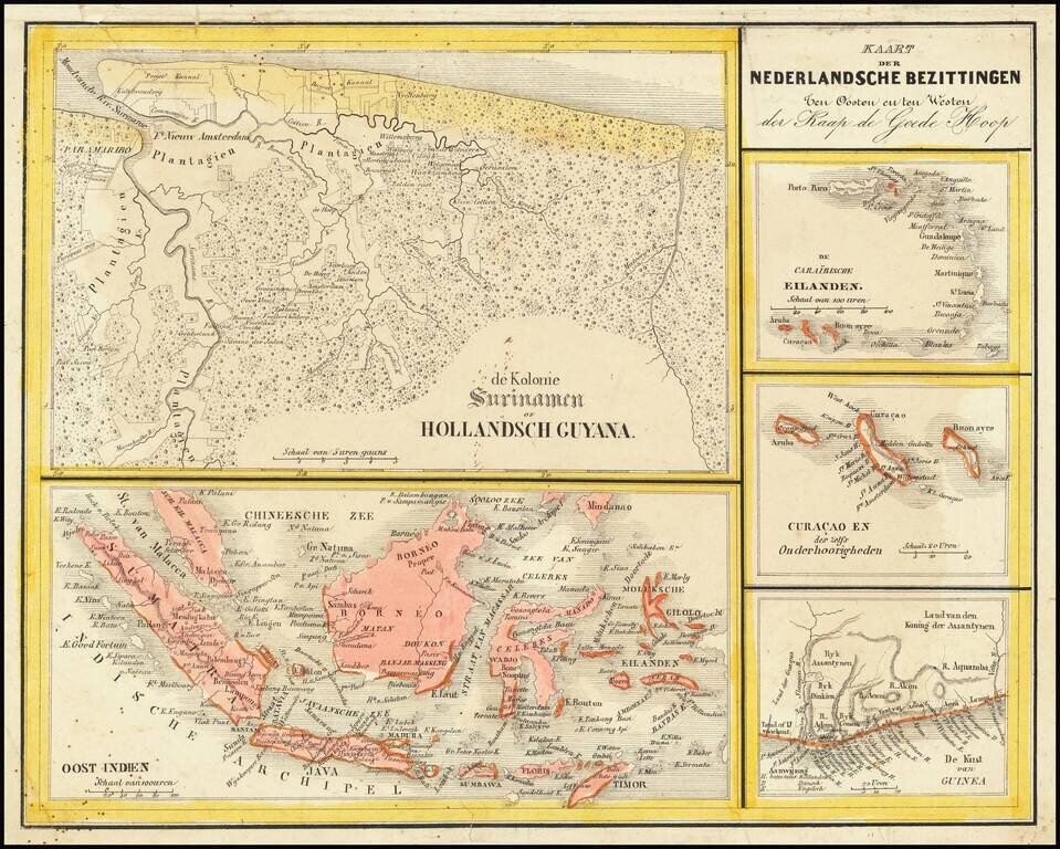
Interesting Map of the Dutch Colonies. The map consists of 5 separate maps, entitled: The Caribbean Islands Curacao and Dependencies The Suriname Colony The Coast of Guinea in Africa East Indies The map appeared in Nieuwe Atlas van het...
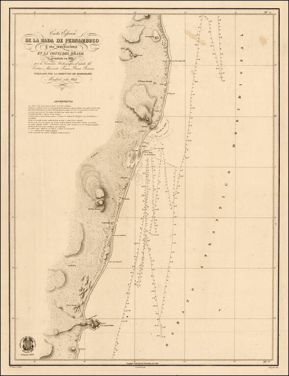
Scarce chart of the coast of Brazil, from Cape St. Agostinho to Gurparim, along the Pernambuco Coast. The charts produced by the 'Direccion de Hydrografica' were detailed surveys meant for marine use. Not unlike the well known blue-back charts of the...
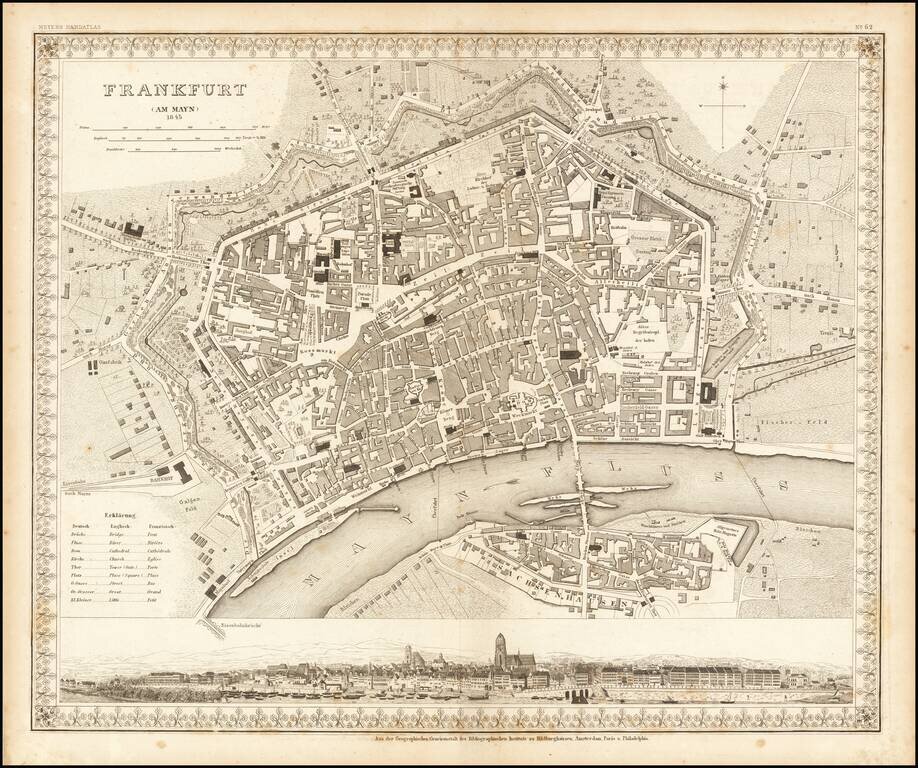
Striking plan of Frankfurt Am Main and Sachsenhausen across the river. Includes a large panoramic view of the city from the river at the bottom.
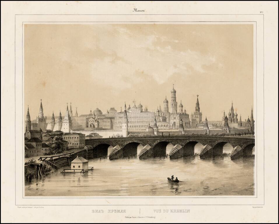
Fine lithographic view of the Kremlin, from a series of views of Moscow and Petersburg, published by Daziaro in Moscow and St. Petersburg.
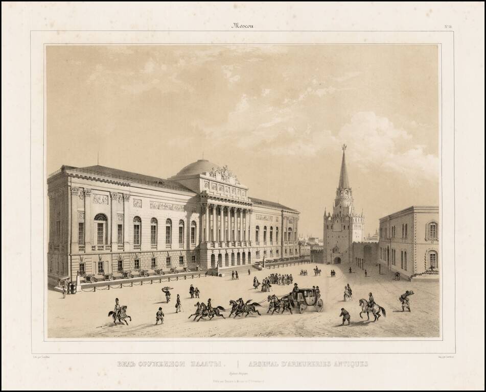
Fine lithographic view of the Kremlin Arsenal Moscow, from a series of views of Moscow and Petersburg, published by Daziaro in Moscow and St. Petersburg. The Kremlin Arsenal was previously used as an armory, which was built within the grounds of the...
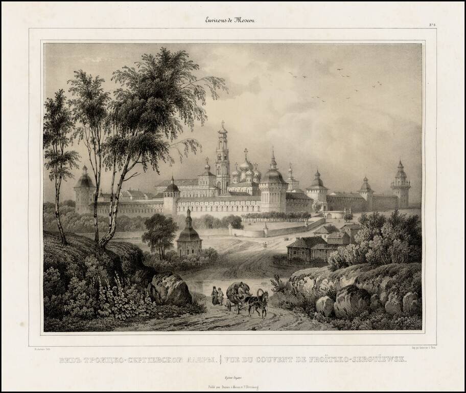
Fine lithographic view of the Convent of Froitzko-Serguiewsk, from a series of views of Moscow and Petersburg, published by Daziaro in Moscow and St. Petersburg.
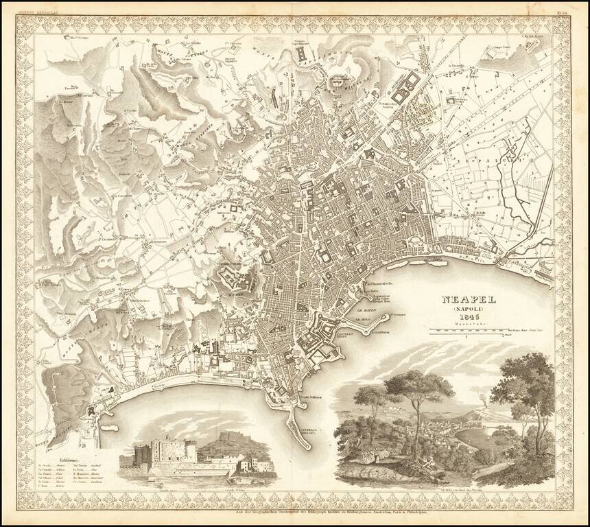
Decorative plan of Naples, published by Meyer. Includes two large vignettes, showing the Castello St. Elmo and a view of Naples and the Harbor from a neighboring hillside, with a volcano erupting in the background.
![South Eastern Asia Birmah - China - Japan [and Philippines]](/map/small/69678.jpg)
Interesting regional map of Southeast Asia and the Philippines. Hong Kong Island is noted, as is Singapore and a separate Malacca. Nice detail in the Philippines.
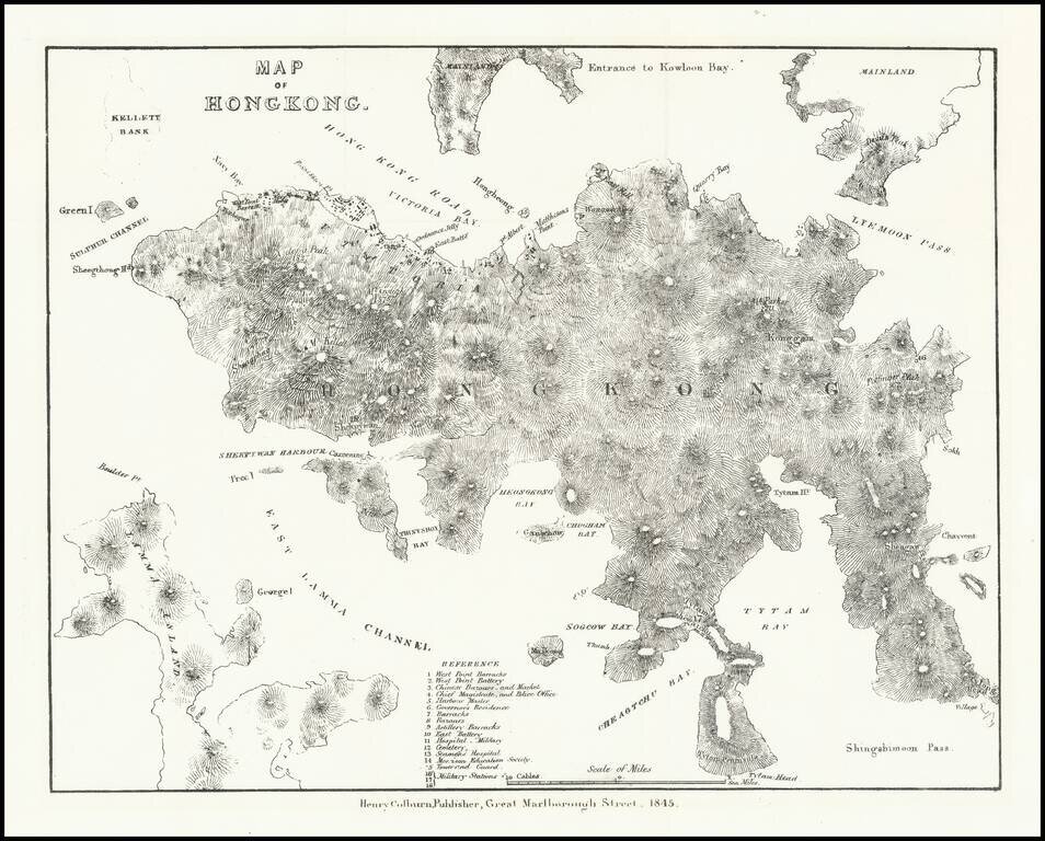
Very early lithographed map focusing specifically on Hong Kong, published in London in 1845. The map is one of the earliest obtainable mappings of Hong Kong after it was ceded to Great Britain in the Treaty of Nanking in 1842. The map derives in large...
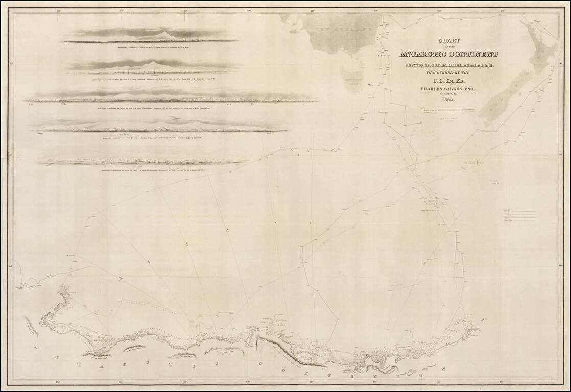
A good example of the Wilkes map of the Antarctic Regions, which accompanied the official account of Wilkes Expedition. The map includes the tracks of Wilkes' expedition, 5 profile views and an outline map of New Zealand and the Southern Tip of...

Scarce map of the South Pole, showing the most recent discoveries and some conjectural regions. Includes annotations with dates of discoveries from 1820 to about 1840 (Charles Wilkes), with some earlier notes regarding Cook's contact with the region...