Map size in jpg-format: 26.9505MiB
Click to open in high resolution (open in new tab).
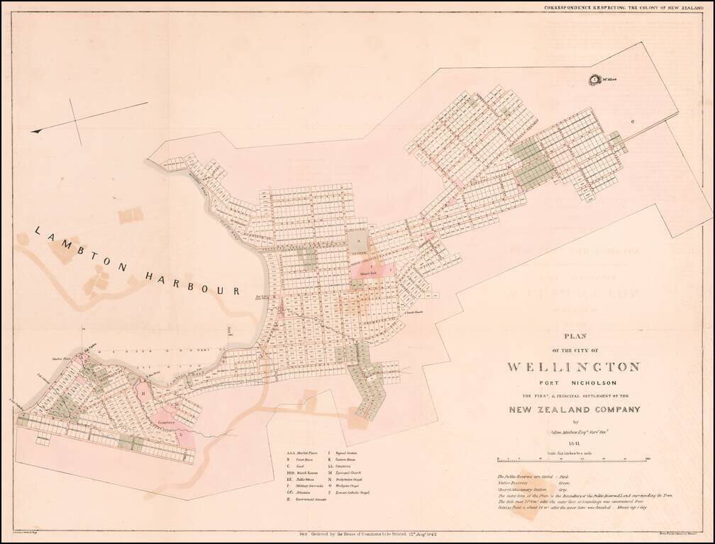
The Earliest Obtainable Map of Wellington, New Zealand
Early plan of Wellington, the Capital of Museum, based upon the manuscript survey map drafted in 1840, under the direction of Felton Mathew, the first Surveyor General of New Zealand.
The map is oriented with East at the top, covering Wellington and Lambton Harbor and Oriental Bay
The map identifies the lots for sale to potential colonists, including the lands reserved for the indigenous Maori peoples.
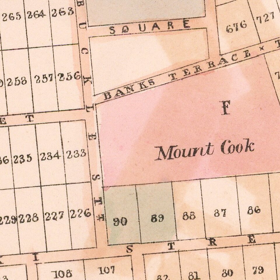
It also identifies locations set aside for markets, a court house, a prison or 'gaol', public offices, cemeteries, military offices, a signal stations, a customs house, various churches, and more. Color coding defines public reserves (pink), properties set aside of the indigenous Maori peoples (green), and lands reserved for religious edifices (grey).
This map is based upon a surviving 1840 - 1841 manuscript survey by Felton Mathew, which was lithographed in London by John Arrowsmith, and printed by James and Luke Graves Hansard (1777-1851).
Rarity
The map appeared in British Parliamentary Papers, 1842, no. 569. Correspondence respecting the colony of New Zealand.
OCLC locates only the examples of the map (National Library of Australia and the British Library) and a photocopy in the Auckland Museum.
If you are a student, write to us in telegram: @antiquemaps and indicate what material you need and for what work you need a map in high detail. We are ready to provide material on special terms. For students only!

![Pascaart vertoonende de zeecusten van Chili, Peru, Hispania Nova, Nova Granada, en California…. [Early New Zealand Inset]](/map/small/65168.jpg)