
Finely colored chart of the World's mountains and rivers, featuring numerous erupting volcanoes. A fine thematic chart illustrating the relative sizes of the world's tallest mountains and longest rivers. The chart also illustrates the relative...
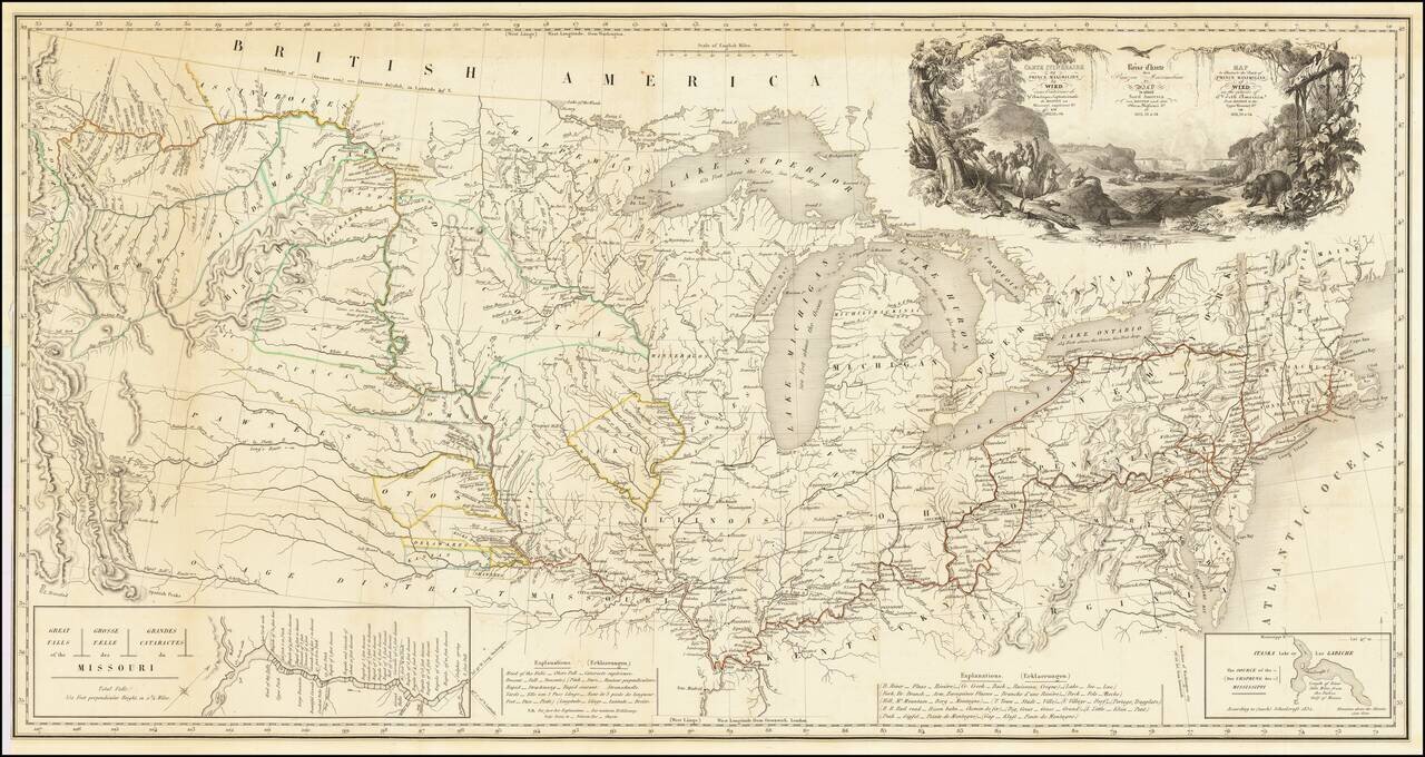
One of the Finest Early Maps of The Missouri Valley & American Plains Nice example of this remarkable map illustrating the account of the travels of Prince Alexander Phillip Maximilian, of Wied's, in the Plains and Rocky Mountain regions, in the...
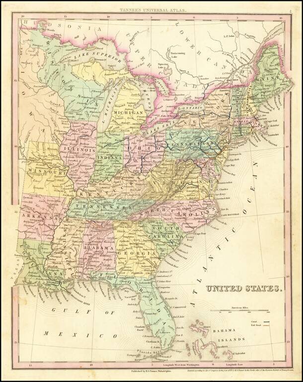
Tanner's scarce map of the United States, including massive unnamed region west of Lake Michigan and oddly shaped Michigan. Shows towns, roads, rivers, lakes, forts, etc.
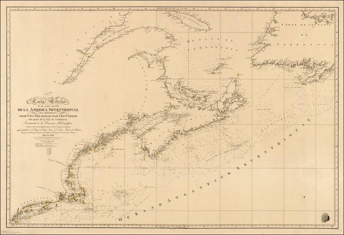
Scarce coastal chart of the region from Long Island to Newfoundland and the St. Lawrence. Extremely detailed. Spanish Sea Charts of this region in the mid-19th Century are quite scarce on the market.
![[Indian Stream Republic Report and Map] Plan of the Sources of Connecticut River](/map/small/56627.jpg)
Map of the Indian Stream Republic with US Congressional Committee on Foreign Affairs Report Complete example of the 12 page Claim of New Hampshire, Report No. 176 of the House of Representatives, 25th Congress, 3d Session, with the map illustrating...
Attractive view, which appeared in an early edition of American Scenery.
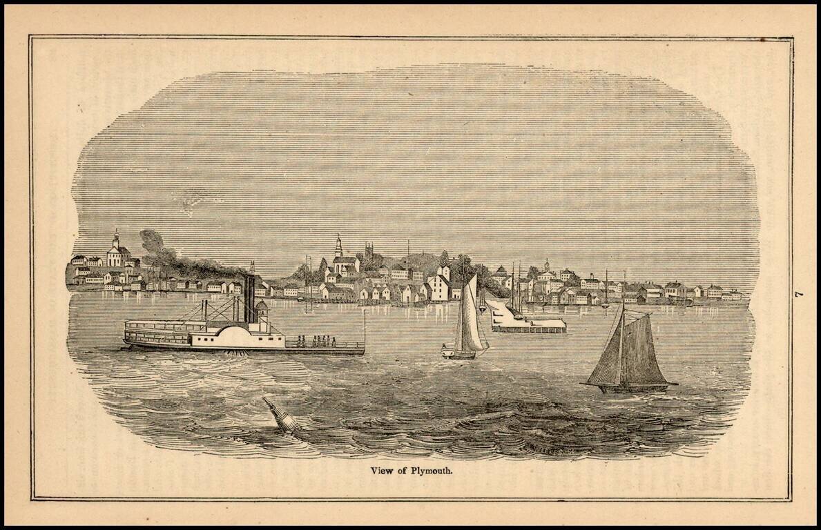
Early view of Plymouth, from the Historical Collection of the State of Massachusetts. John Warner Barber (1798-1885), was an American engraver whose books of state, national, and local history featured his vivid illustrations, said[ to have caught the...
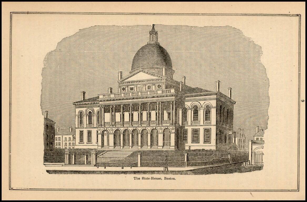
Early view of The State-House, Boston, from the Historical Collection of the State of Massachusetts. John Warner Barber (1798-1885), was an American engraver whose books of state, national, and local history featured his vivid illustrations, said[ to...
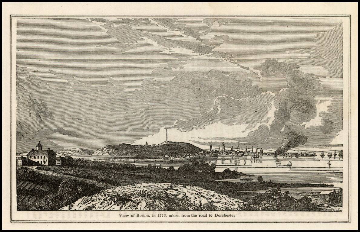
Early view of Boston, from the Historical Collection of the State of Massachusetts. John Warner Barber (1798-1885), was an American engraver whose books of state, national, and local history featured his vivid illustrations, said to have caught the...
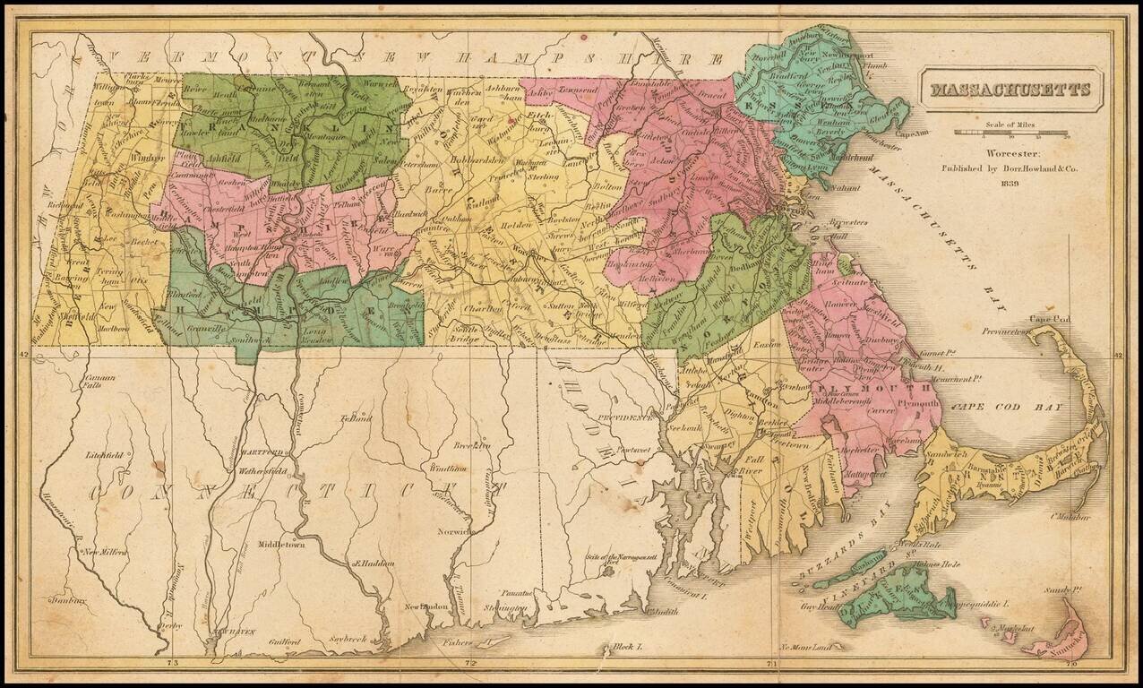
Rare map of Massachusetts, hand-colored by counties and showing towns, roads, railroads, townships, rivers, islands, and other details.
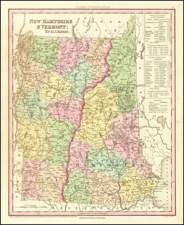
Nice example of Tanner's map of New Hampshire and Vermont, hand colored by counties, and showing towns, roads with distances, railroads, and a host of other details. The key shows counties and towns in each state, with populations, and populations on...
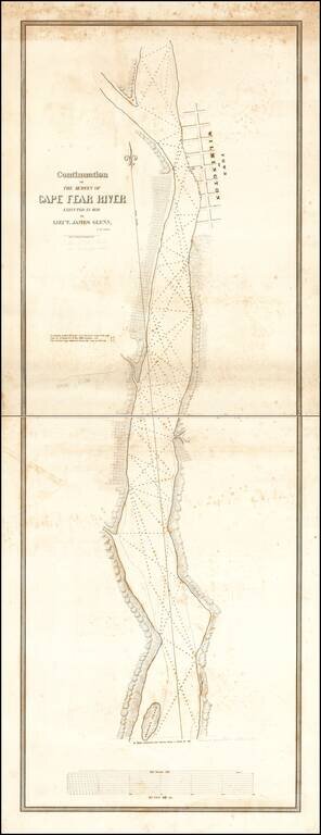
Rare 2-sheet map of a section of the Cape Fear River, prepared under the direction of James Glynn in 1839, as part of the US Navy's search for a suitable port for the establishment of a Southern Navy Yard and printed by P. Haas, Lithy., Washington...
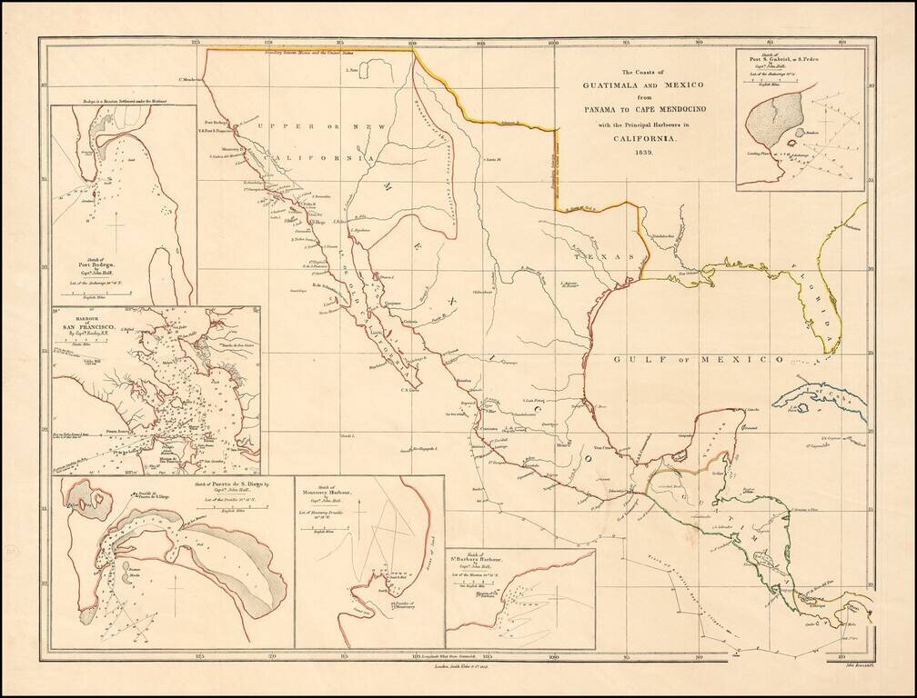
Rare early map of Mexico and Upper California, focusing on the harbors along the California Coast. Includes some of the earliest harbor plans for: Santa Barbara San Gabriel or San Pedro San Diego San Francisco Monterrey Bodega Bay Rumsey...
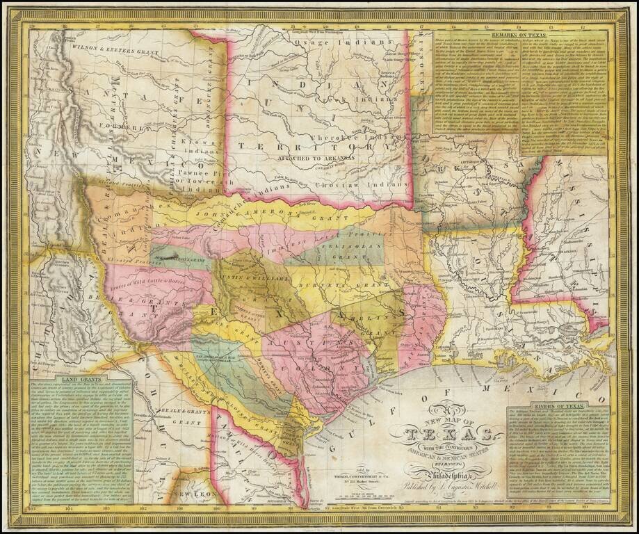
An Important Early Map of The Republic of Texas. Young & Mitchell's A New Map of Texas is one of the great monuments of Texan cartography. This is an essential piece for any serious collection of Texana. This is Streeter's 4th state (of 8, 1178D)...
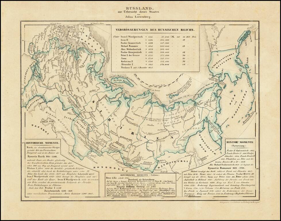
Interesting map of Russia, including Russian America, published in Freiburg in 1839. Includes historical text below the map, covering the history of Russia.
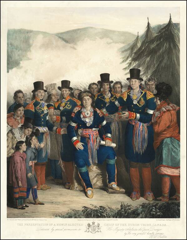
One of the Best Canadian Lithographs. Separately issued hand-colored lithograph of the newly-elected Chief of the Huron Tribe, by H.D. Thielcke. Lithographed by James Henry Lynch, Day & Haghe, Lithographers to the Queen. This superbly composed...