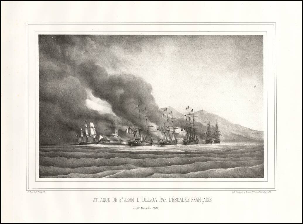
The Decisive Battle of the Pastry War Fine early lithographic view depicting the Battle of Veracruz. Overview During the early years of the new Mexican republic there was widespread civil disorder as factions competed for control of the country....
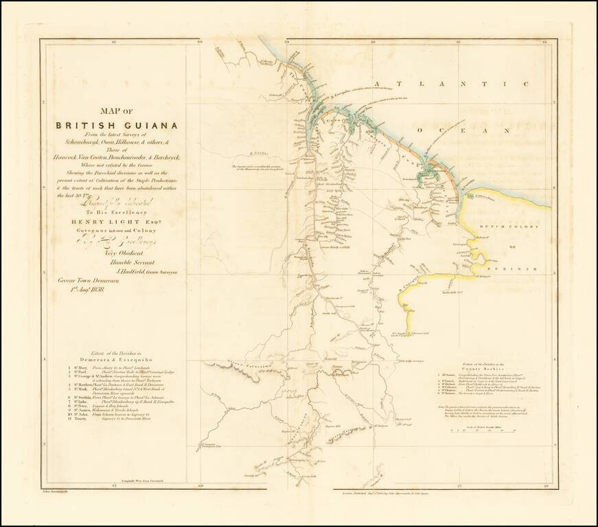
Scarce map of British Guiana, first published in 1838. The English made at least two unsuccessful attempts in the 17th century to colonize the lands that would later be known as British Guiana, at which time the Dutch had established two colonies in...
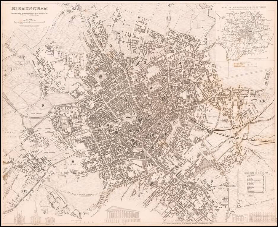
Highly detailed town plan of Birmingham, England. A generally nice example with inset of the environs and boundaries taken from the Reform Act. One of the best examples published in a commercial atlas in the 19th Century.
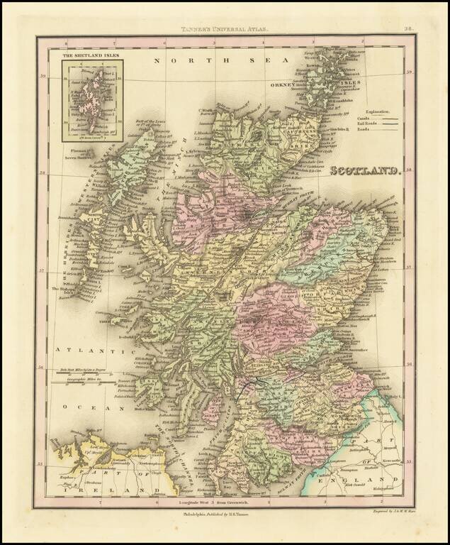
Fine example of Henry Schenk Tanner's map of Scotland, published in Philadelphia. The map is hand colored by counties and showing towns, rivers, lakes, railroads, roads, etc. Tanner was perhaps the single most important American commercial mapmaker...
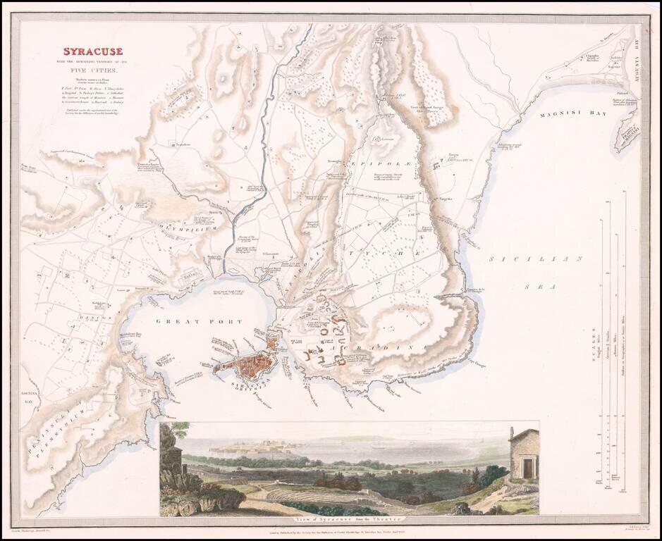
Highly detailed town plan of Syracuse, with a larger view of the City from its Roman Ampitheatre. One of the best published in a commercial atlas in the 19th Century. Plans of Syracuse are quite rare.
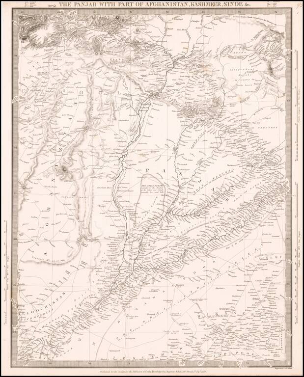
Highly detailed map of Northern India, Afghanistan and neighboring regions, from the Society for the Diffusion of Useful Knowledge. The map extends from north of the Khyber Pass to the northern part of India, focusing on the trade routes and roads in...

Scarce French sea chart of Sumatra, Java, Borneo, Celebes and environs, published by the Depot General de la Marine. The map extends from the Straits of Malacca in the West to Borneo and south to Sandal Wood (Pulau Sumba), southwest of Java and Bali....
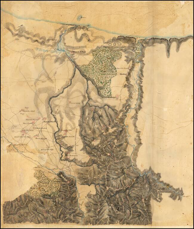
Remarkable Manuscript Collection of the French Invasion of Algeria, From the Collection of the Duke of Orléans Striking collection of 46 manuscript maps, and a few documents, showing northern Algeria. The maps date from the French invasion of Algeria...
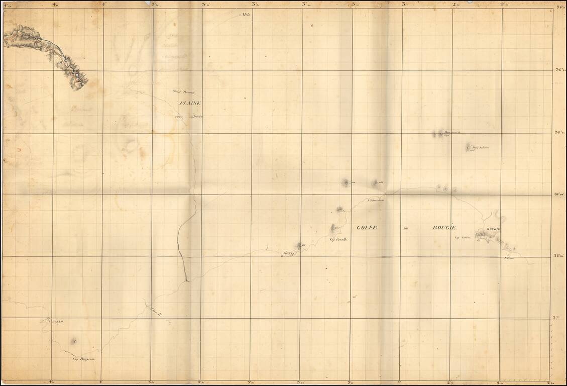
Remarkable Manuscript Collection of the French Invasion of Algeria, From the Collection of the Duke of Orléans Striking collection of 46 manuscript maps, and a few documents, showing northern Algeria. The maps date from the French invasion of Algeria...
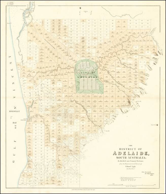
The First Map of Adelaide Rare cadastral map of the area around Adelaide, published by John Arrowsmith. The map illustrates Adelaide and the region surrounding, centered on the 'City of Adelaide', covering an area from Port Adelaide in the north...